
Pond
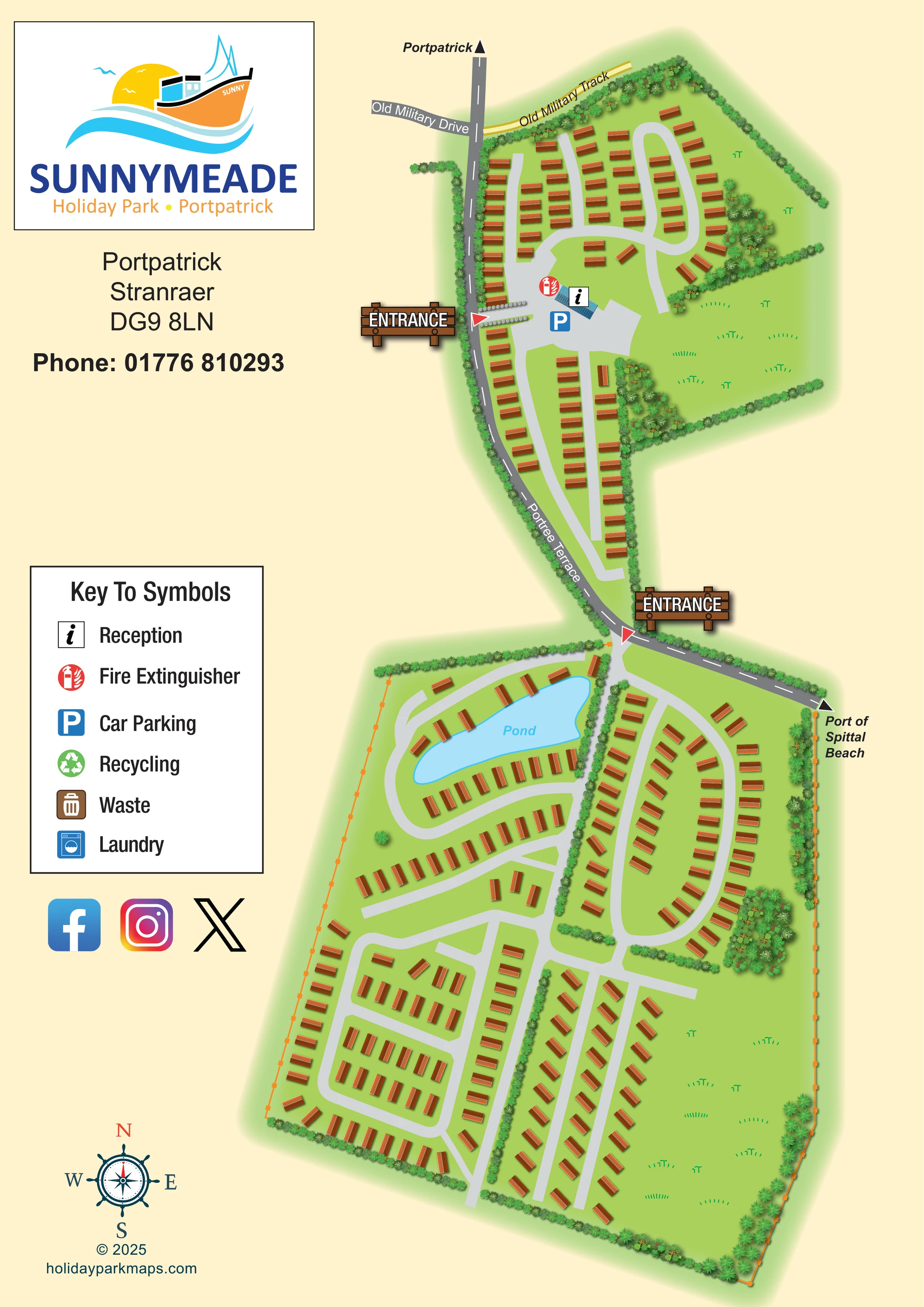
A labelled, irregular blue pond forms the focal point of a curved accommodation loop in the north-western part of the southern section.
ILLUSTRATED PARK MAP · P320
Portpatrick, Stranraer · United Kingdom
 Enlarge the map ↗
A SENSE OF THE PLACE
Sunnymeade Caravan Park overlooks the Irish Sea from a location above Portpatrick in the Rhins of Galloway. Caravan holidays, touring and lodge ownership are offered in this coastal setting.
The park's landscape includes a loch and areas described as attractive to wildlife. Portpatrick and the start of the Southern Upland Way provide context for exploring the surrounding coast and countryside.
LOOK CLOSER
A labelled, irregular blue pond forms the focal point of a curved accommodation loop in the north-western part of the southern section.
Dense illustrated planting traces much of the park perimeter, separates accommodation groups and forms larger clusters beside open grass.
Broad green spaces occupy the eastern side of both main sections. These are not labelled as camping or touring areas.
An information symbol marks the small blue-roofed reception building beside the northern entrance and central arrival area.
A blue parking symbol identifies the broad grey arrival area beside reception.
A red fire-extinguisher symbol is positioned near reception in the northern section.
Wooden-style entrance signs and red triangular pointers mark access near reception and at the junction serving the southern section.
The labelled dark-grey road curves along the western edge of the northern section before reaching the southern entrance junction.
An information symbol marks the small blue-roofed reception building beside the northern entrance and central arrival area.
A blue parking symbol identifies the broad grey arrival area beside reception.
A red fire-extinguisher symbol is positioned near reception in the northern section.
Included in the key as a green recycling symbol; no corresponding location is clearly shown on the plan.
Included in the key as a brown bin symbol; a location is not clearly identified in the mapped accommodation areas.
A blue washing-machine symbol appears in the key, without a clearly positioned equivalent on the plan.
A labelled, irregular blue pond forms the focal point of a curved accommodation loop in the north-western part of the southern section.
Dense illustrated planting traces much of the park perimeter, separates accommodation groups and forms larger clusters beside open grass.
Broad green spaces occupy the eastern side of both main sections. These are not labelled as camping or touring areas.
Wooden-style entrance signs and red triangular pointers mark access near reception and at the junction serving the southern section.
The labelled dark-grey road curves along the western edge of the northern section before reaching the southern entrance junction.
A labelled road connection appears at the northern end of the plan beside the direction towards Portpatrick.
A narrow yellow route runs along the planted northern boundary and is labelled directly on the artwork.
A black arrow at the top of the road indicates Portpatrick beyond the mapped park.
A labelled arrow at the eastern end of the connecting road points towards Port of Spittal Beach; the beach itself is not illustrated.
Pale-grey loops, branches and short spurs organise access through both accommodation sections.
READING THE MAP
This illustrated map of Sunnymeade Holiday Park presents a coastal caravan park at Portpatrick as two connected accommodation areas, with a pond providing a distinctive landmark in the larger southern section. The park’s setting above the Irish Sea is reflected in the boat-and-sun branding and nautical compass, while the plan itself concentrates on entrances, roads, accommodation and planted boundaries rather than depicting the coastline.
The portrait layout gives the park illustration room to follow its long, irregular footprint. A separate information column holds the logo, contact details and symbol key, leaving the roads and accommodation groups relatively uncluttered. Orange-roofed units stand out against light-green grounds, and pale-grey internal roads are clearly separated from the darker connecting road.
For visitors, the most useful anchors are the two entrance signs, reception and parking area, the pond, and directions towards Portpatrick and Port of Spittal Beach. For a map-design portfolio, this is a useful example of presenting a sizeable caravan layout without individual plot labels.
The plan begins with a compact northern accommodation area beside Old Military Drive and Old Military Track. Curving internal roads serve several rows of orange-roofed units, while a longer strip extends south beside Portree Terrace. Near the northern entrance, a blue-roofed reception building, parking symbol and fire-extinguisher marker establish a clear arrival point. A broad grassy area and dense planting occupy the eastern side.
Portree Terrace curves down to the second entrance, where the road continues towards the labelled direction for Port of Spittal Beach. Beyond this junction, the southern section spreads into several distinct groups. At its upper left, accommodation follows a loop around the labelled blue pond. To the right, another elongated loop encloses curved rows of units. Further south, a more rectilinear cluster contrasts with long, angled rows beside branching roads. Open grass remains prominent along the eastern boundary.
Trees and shrubs trace the perimeter and separate parts of the layout. Orange fence-like boundary lines appear along sections of the southern grounds. Repeated roof symbols convey the overall accommodation scale without adding plot numbers, and their changing orientation helps explain how the rows relate to the roads.
The left-hand key identifies reception, fire extinguishers, parking, recycling, waste and laundry. Only reception, parking and a fire-extinguisher location are clearly marked within the plan. Large entrance boards, destination arrows and a nautical compass provide additional orientation. The enlarged detail view repeats part of this same artwork, making the legend and roof treatment easier to read; it is not a separate park section or alternative map.
KEEP EXPLORING
Chosen for shared landscapes, accommodation or facilities.
 Explore the map ↗
United Kingdom
A colour-zoned coastal park map with touring areas, woodland trails, ponds and a leisure club.
 Explore the map ↗
United Kingdom
Colour-coded accommodation, central leisure facilities and coastal paths on an illustrated headland park map.
 Explore the map ↗
United Kingdom
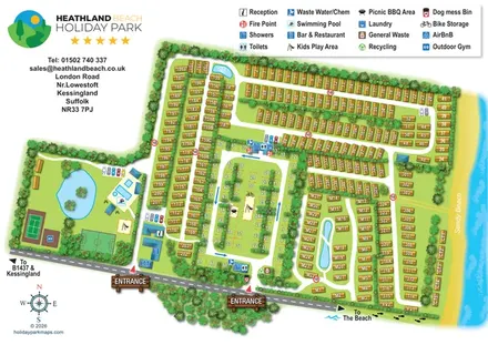
Illustrated Suffolk coastal park map with planted accommodation rows, central pitches, leisure facilities and beach directions.
Features may come from the sample artwork, its key or published park information. Approximate numbers describe the drawing and may cover only part of a park. They are intended to help you compare map examples. Current facilities and booking information should be checked with the park.
LET’S MAP YOUR PARK
For a map quotation, find your park and draw a rough boundary around it. The area you select helps us work out the design time and price.
Draw your park for a quote ↗Or talk to our map designers
01751 473136