
Pond
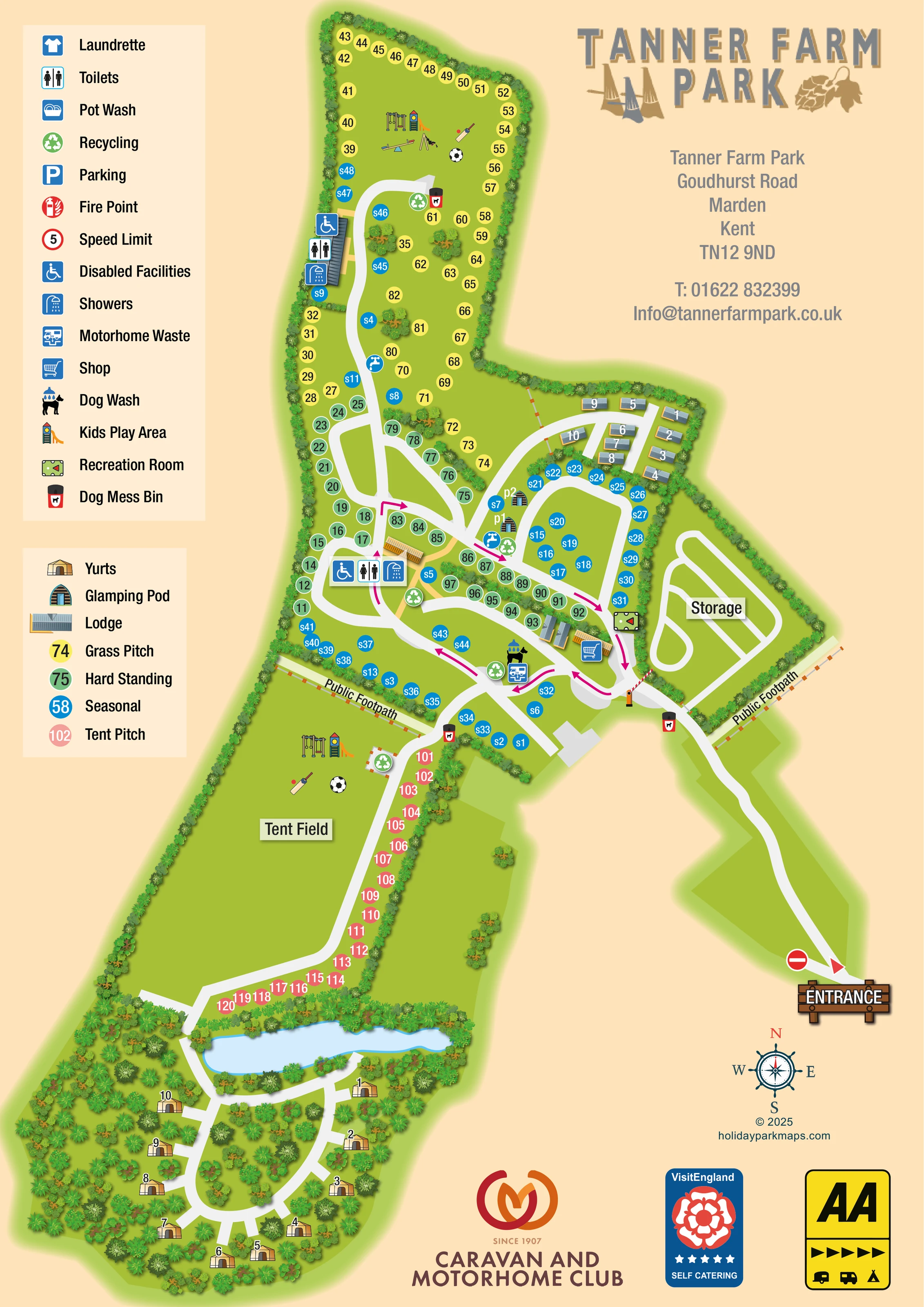
An elongated pale-blue pond separates the Tent Field from the wooded yurt area, with routes passing around its ends and southern bank.
ILLUSTRATED PARK MAP · P326
Tanner Farm Park, Goudhurst Road, Marden, Kent · United Kingdom
 Enlarge the map ↗
A SENSE OF THE PLACE
Tanner Farm Park is a caravan and camping park near Marden in Kent, surrounded by woodland, farmland and apple orchards. Walks lead directly from the grounds into the surrounding countryside.
Spacious pitches accommodate caravans, motorhomes and tents, with open green areas between the camping sections. Washrooms, accessible facilities, a family bathroom and laundry support stays, and the map helps visitors navigate the park.
LOOK CLOSER
An elongated pale-blue pond separates the Tent Field from the wooded yurt area, with routes passing around its ends and southern bank.
Dense illustrated trees enclose the southern yurts, edge the fields and storage area, and break up the central pitch groups.
Two amenity buildings, one beside the northern field and one near the central junction, carry grouped toilet, shower and wheelchair symbols.
A shopping-trolley symbol identifies a building beside the central arrival circulation.
A games-table symbol marks the recreation room next to the seasonal area and storage enclosure.
Play equipment appears in both the northern grass-pitch field and the Tent Field. Football and cricket illustrations communicate informal recreation space.
A dog-under-shower symbol sits beside the motorhome service point near the central arrival loop.
A motorhome waste symbol marks the service area beside the dog wash.
Two amenity buildings, one beside the northern field and one near the central junction, carry grouped toilet, shower and wheelchair symbols.
A shopping-trolley symbol identifies a building beside the central arrival circulation.
A games-table symbol marks the recreation room next to the seasonal area and storage enclosure.
Play equipment appears in both the northern grass-pitch field and the Tent Field. Football and cricket illustrations communicate informal recreation space.
A dog-under-shower symbol sits beside the motorhome service point near the central arrival loop.
A motorhome waste symbol marks the service area beside the dog wash.
Blue tap symbols appear beside the northern route and near the glamping pods.
Green recycling symbols are distributed between the northern field, central amenities and Tent Field.
Red-and-black dog-bin symbols occur near the northern loop, the camping approach and the entrance-side footpath.
A labelled, hedge-bordered storage enclosure lies east of the central accommodation, with its own internal circulation pattern.
Listed in the facilities key; no corresponding position is clearly identifiable on the plan.
Listed in the facilities key without a clearly identifiable plotted symbol.
A parking symbol is explained in the key, but no specific parking position is clearly marked.
The key includes a red fire-point symbol; its placement is not clearly identifiable in the main plan.
The legend contains a circular sign displaying 5; it is not clearly positioned on the road network.
An elongated pale-blue pond separates the Tent Field from the wooded yurt area, with routes passing around its ends and southern bank.
Dense illustrated trees enclose the southern yurts, edge the fields and storage area, and break up the central pitch groups.
Labelled footpath sections cross between the central pitches and Tent Field and run along the entrance-side edge of the storage area.
A long south-eastern approach leads from a timber-style entrance sign to an illustrated barrier at the main park junction.
Magenta arrows trace directional circulation around the central road loops; a red no-entry symbol appears beside the outer approach junction.
READING THE MAP
This illustrated map of Tanner Farm Park brings together touring pitches, camping and glamping within a long, green park layout near Marden in Kent. The portrait design follows the site from its northern grass-pitch field through the central amenities to a wooded yurt area at the southern end. A pale-blue pond creates a memorable landmark between the camping field and the woodland accommodation.
The map uses four colours of numbered pitch markers to separate grass, hard-standing, seasonal and tent provision. Lodges, glamping pods and yurts have their own small illustrations, making the different accommodation areas recognisable without filling the plan with drawn caravans and tents. White roads remain clear against the green grounds, while magenta arrows highlight circulation around the central loops.
Two substantial keys explain accommodation and facilities, including the symbols used for washrooms, the shop, recreation room and service points. Public footpaths, play areas and a prominent entrance sign add useful orientation. The result is a sample suited to a countryside park that needs to explain several accommodation types and a branching layout on one visitor-facing page.
The single portrait plan is organised around a central network of roads, with a long entrance approach extending towards the lower-right corner. An illustrated barrier marks the transition into the main park, and magenta arrows show directional circulation around the central loops. The labelled storage enclosure occupies a separate hedge-bordered area to the east, while public-footpath sections are clearly named beside the entrance-side boundary and between the main pitches and camping field.
In the northern field, yellow grass-pitch markers follow the perimeter and continue into the open interior. Green hard-standing markers line roads closer to the centre, and blue seasonal markers appear in several pockets around the junctions and loops. A compact lodge group occupies the north-eastern corner of the accommodation area. Two illustrated glamping pods sit near the middle of the plan.
Two washroom buildings carry grouped toilet, shower and disabled-facility symbols. The central service area also shows a shop, recreation room, dog wash and motorhome waste point. Tap symbols, recycling points and dog mess bins are distributed through the grounds. Play equipment appears in both the northern field and the large Tent Field, accompanied by football and cricket imagery that communicates open recreation space.
Pink tent-pitch markers run along two edges of the Tent Field. Beyond it, an elongated pond and dense tree planting introduce the southern yurt area, where individual illustrated yurts sit beside a looping route and short access branches.
The two left-hand legends keep facility symbols separate from accommodation types. Large branding and contact details occupy the upper-right space, while a compass and recognition badges balance the lower page. The enlarged views show details of this same artwork rather than additional park sections.
KEEP EXPLORING
Chosen for shared landscapes, accommodation or facilities.
 Explore the map ↗
United Kingdom
Woodland holiday-park map with named accommodation areas, touring loops and illustrated recreation facilities.
 Explore the map ↗
United Kingdom
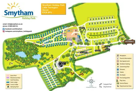
Colour-coded accommodation, woodland ponds and a Tarka Trail footpath on Smytham’s illustrated park map.
 Explore the map ↗
United Kingdom
Woodland-framed Barnsoul map with mixed accommodation, shared facilities and paw-marked walking routes.
Features may come from the sample artwork, its key or published park information. Approximate numbers describe the drawing and may cover only part of a park. They are intended to help you compare map examples. Current facilities and booking information should be checked with the park.
LET’S MAP YOUR PARK
For a map quotation, find your park and draw a rough boundary around it. The area you select helps us work out the design time and price.
Draw your park for a quote ↗Or talk to our map designers
01751 473136