
Wooded grounds and grass clearings
Dense illustrated tree cover frames the site and separates the eastern accommodation, camping field and activity spaces.
ILLUSTRATED PARK MAP · P327
Telford Naturist Club Ltd, The Windings, Redhill, Grange Lane, Telford · United Kingdom
 Enlarge the map ↗
A SENSE OF THE PLACE
Telford Naturist Club occupies a rural location near Telford and the M54. Camping and caravanning are available for visiting naturists by prior arrangement.
The club's facilities include a heated swimming pool, sauna, sports courts, woodland walks and children's recreation areas. Its map brings together the camping, social and activity areas within the grounds.
LOOK CLOSER
Dense illustrated tree cover frames the site and separates the eastern accommodation, camping field and activity spaces.
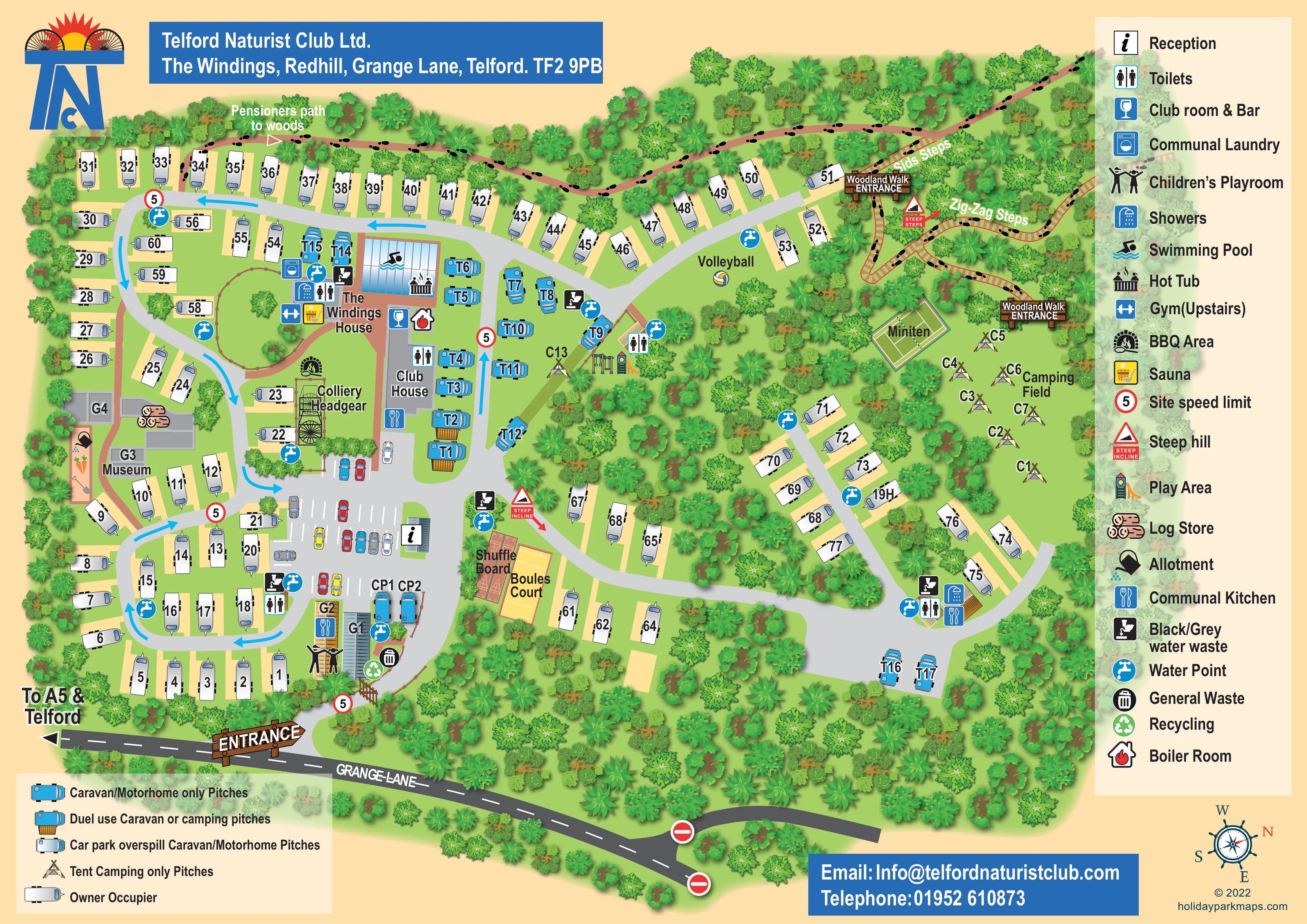
A reception information symbol sits beside the marked parking area reached from the entrance.
The labelled Club House forms part of the central building group, with the club room and bar symbol at its northern end.
Named central building adjoining the illustrated pool and clustered leisure and service symbols.
A prominent blue-panelled pool building beside The Windings House carries a swimmer symbol.
The hot-tub symbol is positioned at the pool building.
Sauna and gym symbols appear beside The Windings House; the legend specifies that the gym is upstairs.
Toilet symbols are distributed around the central and visitor areas, with showers marked at the main leisure building and the eastern service block.
A reception information symbol sits beside the marked parking area reached from the entrance.
The labelled Club House forms part of the central building group, with the club room and bar symbol at its northern end.
Named central building adjoining the illustrated pool and clustered leisure and service symbols.
A prominent blue-panelled pool building beside The Windings House carries a swimmer symbol.
The hot-tub symbol is positioned at the pool building.
Sauna and gym symbols appear beside The Windings House; the legend specifies that the gym is upstairs.
Toilet symbols are distributed around the central and visitor areas, with showers marked at the main leisure building and the eastern service block.
Kitchen symbols mark facilities at the Club House, the entrance-side building group and the eastern service block.
A washing-machine symbol is placed beside the main pool and house complex.
The children's playroom symbol appears on the entrance-side building group; illustrated swings and a slide mark the outdoor play area east of the central pitches.
A barbecue symbol sits on the lawn near the colliery headgear and main buildings.
A named grass activity area with a volleyball illustration lies north-east of the main visitor pitches.
A green, line-marked Miniten court is illustrated beside the camping field and woodland routes.
Adjacent terracotta and yellow courts are individually labelled near the central road junction.
A museum building and a detailed colliery headgear illustration provide distinctive landmarks west of the Club House.
An illustrated growing strip and stacked logs appear beside the western museum and utility buildings.
Repeated tap symbols serve the accommodation areas, with black/grey water disposal symbols at several visitor and service locations.
General waste and recycling symbols are grouped beside the entrance-side buildings.
A house-and-flame symbol marks the boiler room within the main building complex.
Dense illustrated tree cover frames the site and separates the eastern accommodation, camping field and activity spaces.
Footprint-marked paths include 'Pensioners path to woods', 'Sids Steps' and 'Zig-Zag Steps', with two woodland-walk entrance signs.
Red warning signs identify a steep internal road section and steep steps within the woodland routes.
A timber-style entrance sign marks the access from Grange Lane, with an external direction towards the A5 and Telford.
Broad grey roads connect the pitch groups. Blue arrows indicate circulation around the western loops; repeated signs display a site speed limit of 5, and no-entry symbols appear on the external road branches.
READING THE MAP
This illustrated map of Telford Naturist Club brings together caravan pitches, tent camping, shared facilities and woodland recreation within a single landscape plan. Set at The Windings on Grange Lane, near Telford, the club is depicted as a series of grass clearings and curving roads enclosed by dense tree cover. White owner-occupier caravans and blue visitor pitches make the accommodation groups easy to distinguish, while a separate camping field occupies the more wooded eastern side.
The main buildings form a recognisable centre around The Windings House, the Club House and the swimming pool. From there, the map leads visitors towards sports courts, children's recreation spaces and named woodland paths. Unusual local landmarks—the museum and colliery headgear—give this sample an identity beyond a conventional campsite plan.
Two complementary legends explain pitch categories and facilities. Together with numbered positions, directional arrows, woodland entrance signs and terrain warnings, they organise a site that combines visitor stays with an established club community. The result is a useful example of pictorial mapping for a wooded leisure club with varied activities and several accommodation arrangements.
The plan begins at Grange Lane along the lower edge, where an illustrated wooden entrance sign leads into the central parking and reception area. Broad grey roads curve around the western accommodation loops, with blue arrows showing the depicted circulation. Further branches pass the shuffleboard and boules courts before reaching smaller caravan groups and service facilities on the wooded eastern side.
Accommodation is differentiated through both colour and symbol. White caravans represent owner-occupier positions, bright blue units identify visitor caravan or motorhome pitches, and pale blue-grey units denote car-park overspill. Some blue pitches have yellow-brown bases to distinguish dual caravan or camping use. Labelled tent symbols occupy the named camping field, with a further tent position near the central outdoor play area.
The Windings House and Club House anchor a concentrated facility cluster. The map marks the swimming pool, hot tub, sauna, upstairs gym, club room and bar, laundry, toilets, showers and communal kitchen facilities. Repeated water and disposal symbols serve the pitch areas, while general waste and recycling are grouped near the entrance-side buildings. Children's indoor and outdoor recreation, a BBQ area, allotment and log store add further detail.
Beyond the buildings, separately drawn Miniten, volleyball, shuffleboard and boules areas distinguish the club's recreation offer. A museum and colliery headgear form memorable western landmarks. Woodland paths are traced with black footprints, with signs marking entrances and labels identifying Pensioners path to woods, Sids Steps and Zig-Zag Steps. Red symbols highlight steep terrain. The single landscape composition is completed by the facility legend, accommodation key, blue identity and contact panels, and a rotated compass.
KEEP EXPLORING
Chosen for shared landscapes, accommodation or facilities.
 Explore the map ↗
United Kingdom
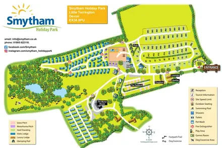
Colour-coded accommodation, woodland ponds and a Tarka Trail footpath on Smytham’s illustrated park map.
 Explore the map ↗
United Kingdom
Woodland park map with mixed pitches, bell tents, lodges and a fishing lake.
 Explore the map ↗
United Kingdom
A colour-zoned coastal park map with touring areas, woodland trails, ponds and a leisure club.
Features may come from the sample artwork, its key or published park information. Approximate numbers describe the drawing and may cover only part of a park. They are intended to help you compare map examples. Current facilities and booking information should be checked with the park.
LET’S MAP YOUR PARK
For a map quotation, find your park and draw a rough boundary around it. The area you select helps us work out the design time and price.
Draw your park for a quote ↗Or talk to our map designers
01751 473136