
Coastal shore and water
Pale blue water and a peach-coloured, stone-dotted shoreline occupy the upper-left side of the artwork.
ILLUSTRATED PARK MAP · P330
The Cove Lodge Park, Cove Road, Silverdale, Carnforth · United Kingdom
 Enlarge the map ↗
A SENSE OF THE PLACE
The Cove is a holiday lodge ownership park on the Silverdale coastline, overlooking Morecambe Bay. Its seafront setting offers views towards Grange-over-Sands and access to the surrounding coastal villages.
Owners have access to leisure facilities at the separate Silverdale Holiday Park across the road, including its swimming complex, sauna and steam room. The Cove's map focuses on the lodge layout and routes within its own grounds.
LOOK CLOSER
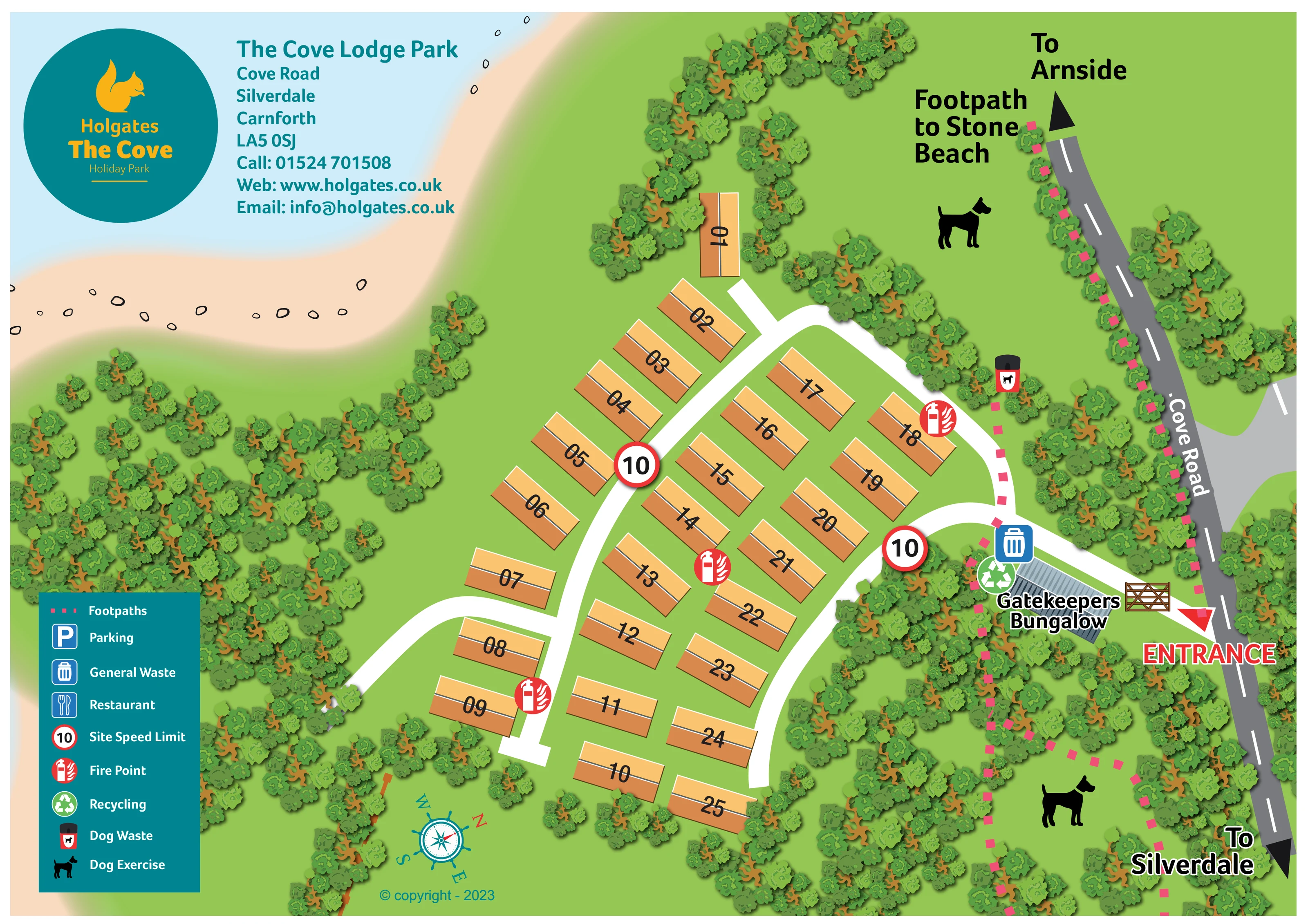
Pale blue water and a peach-coloured, stone-dotted shoreline occupy the upper-left side of the artwork.
Dense illustrated trees surround much of the lodge layout, line Cove Road and separate the dog exercise clearings from the accommodation.
A timber gate, red arrow and large ENTRANCE label identify the access from Cove Road beside the Gatekeepers Bungalow.
A named grey-roofed building forms a prominent landmark just inside the entrance.
The grey external road follows the right side of the plan, with arrows towards Arnside at the top and Silverdale at the bottom.
Broad white roads curve in from the entrance and branch between the lodge rows, with short terminating spurs.
Bright pink square-dashed paths follow the roadside and pass through wooded ground and the lower dog exercise clearing.
A large label identifies the beachward footpath near the upper end of Cove Road; the complete onward walk is not drawn.
Pale blue water and a peach-coloured, stone-dotted shoreline occupy the upper-left side of the artwork.
Dense illustrated trees surround much of the lodge layout, line Cove Road and separate the dog exercise clearings from the accommodation.
A timber gate, red arrow and large ENTRANCE label identify the access from Cove Road beside the Gatekeepers Bungalow.
A named grey-roofed building forms a prominent landmark just inside the entrance.
The grey external road follows the right side of the plan, with arrows towards Arnside at the top and Silverdale at the bottom.
Broad white roads curve in from the entrance and branch between the lodge rows, with short terminating spurs.
Bright pink square-dashed paths follow the roadside and pass through wooded ground and the lower dog exercise clearing.
A large label identifies the beachward footpath near the upper end of Cove Road; the complete onward walk is not drawn.
Black dog silhouettes mark two green clearings on the road-facing side of the park, one above the lodges and one below the entrance.
A dog waste bin symbol is positioned beside the upper section of the internal footpath.
Blue general waste and green recycling symbols are grouped beside the Gatekeepers Bungalow near the entrance.
Red circular fire-point symbols are distributed along the lodge access roads.
Red-rimmed signs bearing ‘10’ appear on the internal roads and are explained as the site speed limit in the key.
Parking is included in the legend, but no corresponding mapped location is identifiable.
A restaurant symbol appears in the legend without an identifiable restaurant location on this plan.
READING THE MAP
The Cove Lodge Park map presents a small coastal lodge development in Silverdale, near Carnforth, with its accommodation framed by trees and the shore of Morecambe Bay. Roughly 25 lodges form the centre of the illustration, their warm two-tone roofs and large numbers standing out against bright green grounds. Curving white access roads make the arrangement easy to follow without competing with the surrounding landscape.
Arrival is a clear focal point: a red entrance arrow and illustrated timber gate lead from Cove Road past the named Gatekeepers Bungalow. Pink-dashed footpaths provide a separate walking layer, including a labelled route towards Stone Beach. Dog exercise clearings, waste and recycling points, fire points and speed-limit symbols add practical detail to the plan.
The page also gives considerable space to park identity. Holgates’ teal-and-gold squirrel branding sits over the pale blue coastal water, alongside the park’s address and contact information. This sample combines a straightforward numbered lodge plan with a distinctive seaside setting and recognisable arrival landmarks.
The single landscape-format map places the lodge development centrally, with coastal water and a stone-dotted shore at upper left and Cove Road running down the right-hand side. Thick belts of illustrated trees enclose much of the accommodation and create smaller green clearings around its edges. The result is a compact plan in which the relationship between road, lodges, woodland and coastline is immediately apparent.
The entrance is marked by a large red label, directional arrow and timber gate. Just inside it, the grey-roofed Gatekeepers Bungalow provides a named landmark, with general waste and recycling symbols grouped nearby. White internal roads curve away from this arrival point and branch between several staggered lodge rows. Each lodge is represented by a simple rectangular, two-colour roof carrying a prominent black number. Their changing angles give the accommodation layout a gentle fan-like rhythm rather than a rigid grid.
Walking routes use bright pink square dashes, visibly distinct from the vehicle roads. These paths extend through the wooded roadside ground and around the lower dog exercise clearing. Two large black dog silhouettes identify exercise areas, and a dog waste symbol sits beside the upper path. A ‘Footpath to Stone Beach’ label adds a coastal walking destination, while arrows on Cove Road point towards Arnside and Silverdale. Fire-point icons and red-rimmed ‘10’ signs are placed along the internal routes.
A teal legend occupies the lower-left corner, and a rotated nautical compass sits near the bottom edge. Parking and restaurant symbols appear in the key without identifiable locations on the plan. The upper-left branding and contact block are integrated into the water backdrop. The enlarged quadrant views are details of this same page, not separate map variants.
KEEP EXPLORING
Chosen for shared landscapes, accommodation or facilities.
 Explore the map ↗
United Kingdom
Trevornick’s colour-coded park map, with mixed accommodation, fishing ponds, golf and wooded trails.
 Explore the map ↗
United Kingdom
A colour-zoned coastal park map with touring areas, woodland trails, ponds and a leisure club.
 Explore the map ↗
United Kingdom
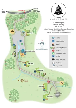
A softly coloured Highland lodge map with named accommodation, hot tubs, a wooded approach and coastal direction markers.
Features may come from the sample artwork, its key or published park information. Approximate numbers describe the drawing and may cover only part of a park. They are intended to help you compare map examples. Current facilities and booking information should be checked with the park.
LET’S MAP YOUR PARK
For a map quotation, find your park and draw a rough boundary around it. The area you select helps us work out the design time and price.
Draw your park for a quote ↗Or talk to our map designers
01751 473136