
Large pond with planted island
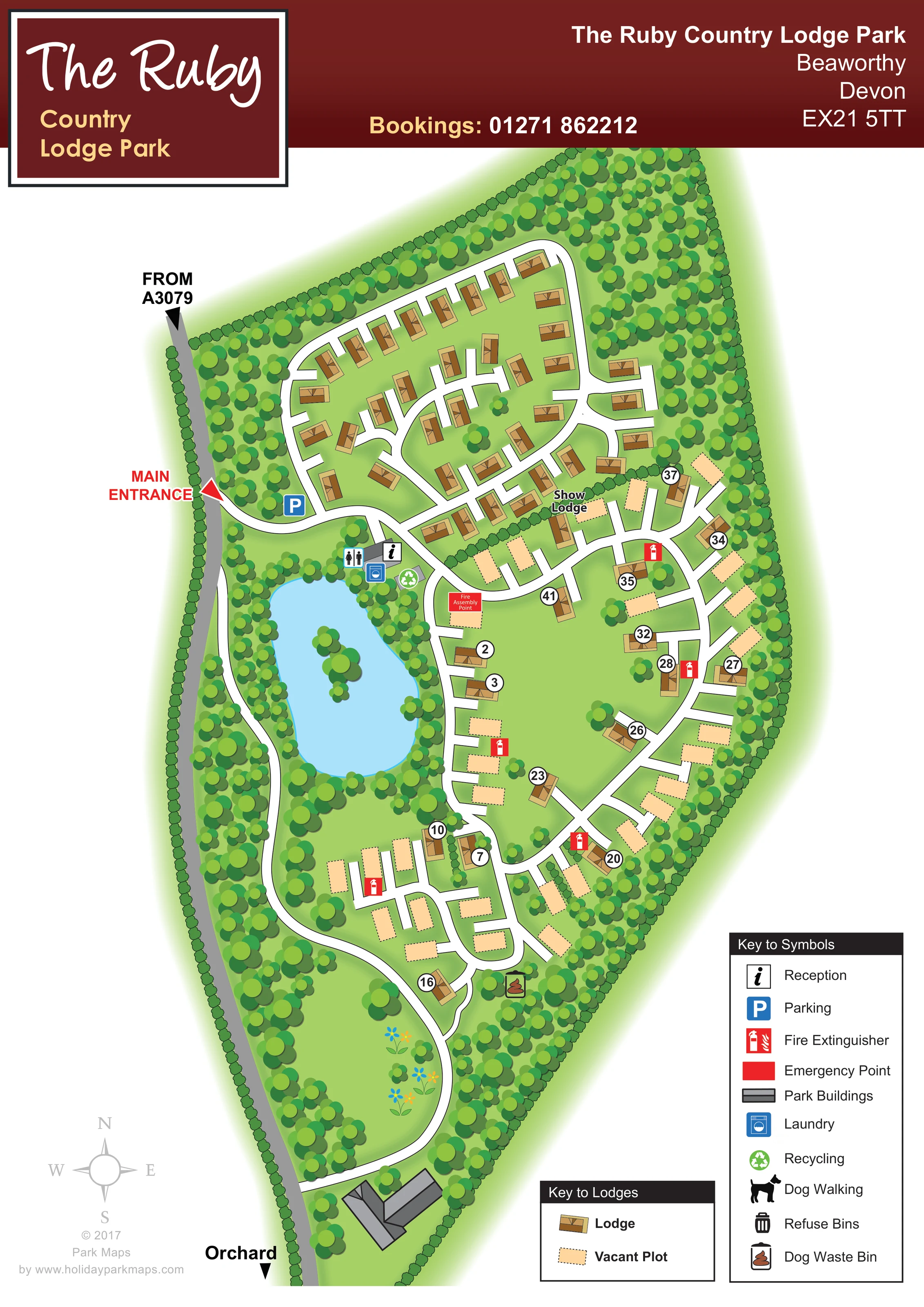
An elongated blue pond occupies the western middle of the park, with a small tree-covered island and a densely planted shoreline.
ILLUSTRATED PARK MAP · P625
Beaworthy, Devon · United Kingdom
 Enlarge the map ↗
A SENSE OF THE PLACE
Ruby Country Lodge Park is a holiday lodge development at Beaworthy in West Devon. Wooded parkland provides the setting for the accommodation.
This map example shows the layout of the lodge plots and the routes between them. It relates to Ruby Country Lodge Park, with its own location and identity, rather than the similarly named Ruby Country Camping business.
LOOK CLOSER
An elongated blue pond occupies the western middle of the park, with a small tree-covered island and a densely planted shoreline.
Dense stylised trees frame the elongated site, with additional trees, hedge-like dividers and open grass between lodge groups.
A grey approach road runs along the western boundary, labelled 'From A3079'; a red arrow identifies the main entrance into the white internal road network.
White roads form an outer circuit, upper lodge loops and branching access spurs through the central and southern plots.
An information symbol marks reception in the small service cluster beside the northern end of the pond.
A blue parking symbol appears just inside the main entrance.
A male-and-female toilet pictogram appears beside reception, although it is not separately explained in the visible symbol key.
A blue washing-machine symbol identifies laundry within the pond-side service cluster.
A grey approach road runs along the western boundary, labelled 'From A3079'; a red arrow identifies the main entrance into the white internal road network.
White roads form an outer circuit, upper lodge loops and branching access spurs through the central and southern plots.
An information symbol marks reception in the small service cluster beside the northern end of the pond.
A blue parking symbol appears just inside the main entrance.
A male-and-female toilet pictogram appears beside reception, although it is not separately explained in the visible symbol key.
A blue washing-machine symbol identifies laundry within the pond-side service cluster.
A green recycling symbol is positioned alongside the reception and laundry area.
A labelled show lodge sits near the transition between the denser northern lodges and the more open southern plot layout.
Repeated red extinguisher symbols are distributed among the central and southern plot roads.
A red 'Fire Assembly Point' label appears beside the road immediately east of the pond's northern end.
The key includes a solid red emergency-point symbol; it does not independently identify a clearly labelled separate location.
Grey roofed buildings are distinguished from the brown lodges, including a prominent angular building near the southern end and a smaller building in the reception area.
A dog waste bin symbol is placed beside the southern internal road near the wooded eastern edge.
Dog walking is included in the symbol key, but no distinct dog-walking route or location is clearly marked on the plan.
A refuse-bin pictogram is explained in the key; its placement is not clearly identifiable in the main plan.
An elongated blue pond occupies the western middle of the park, with a small tree-covered island and a densely planted shoreline.
Dense stylised trees frame the elongated site, with additional trees, hedge-like dividers and open grass between lodge groups.
A downward arrow labelled 'Orchard' points beyond the southern edge of the plan along the western approach road; the orchard itself is not depicted.
READING THE MAP
This illustrated map of The Ruby Country Lodge Park presents a wooded lodge development at Beaworthy in Devon. Its long, tapered layout is framed by dense planting, with a large blue pond providing a recognisable landmark towards the western side. Brown-roofed lodge illustrations and pale, dashed vacant plots make the development pattern easy to distinguish without reducing the site to a technical plot plan.
The map combines arrival information with accommodation wayfinding. An approach from the A3079 leads to a clearly marked main entrance and parking, while white roads connect the northern lodge cluster with the more open central and southern areas. Reception, laundry, recycling and a toilet pictogram form a compact group near the pond, and a show lodge is labelled within the accommodation area.
A burgundy header carries the park's identity above the green landscape illustration. Separate keys explain lodge status and facility symbols, supported by a compass and selected lodge numbers. The result is a useful example for lodge developments needing to show both their landscape setting and the relationship between existing buildings, vacant plots and visitor routes.
The portrait artwork centres on an elongated park enclosed by woodland and hedge-like boundaries. At the top, a burgundy banner contains the park name, Beaworthy address and booking details, with a large framed logo projecting down from the upper-left corner. The illustrated plan fills most of the page beneath it, leaving space for a compass and designer credit at lower left and two boxed keys at lower right.
A grey road follows the western boundary from the direction of the A3079. A red arrow marks the main entrance, where a white internal road curves past a parking symbol. The northern accommodation area is comparatively compact: brown-roofed lodges sit around curved roads and short branching spurs. Further south, a planted divider and the show-lodge label introduce a more open arrangement of lodges and vacant plots. Pale peach rectangles with dashed borders identify the vacant positions, while selected built lodges carry white circular number labels.
The large pond occupies the middle-left of the plan. Its blue water, planted island and tree-lined banks create a strong landscape reference beside the road network. Reception, a toilet pictogram, laundry and recycling are grouped near its northern end. A labelled fire assembly point and repeated extinguisher symbols add practical information among the accommodation roads. A dog waste bin is marked farther south, and grey-roofed park buildings include a substantial angular building near the bottom of the site.
An arrow towards an orchard continues beyond the southern map edge. The facility key also includes dog walking and refuse bins, without clearly locating them in the plan. The accompanying detail images enlarge parts of this same page, including the lodge key, orchard direction and lower symbol key; they are not separate park sections.
KEEP EXPLORING
Chosen for shared landscapes, accommodation or facilities.
 Explore the map ↗
United Kingdom
Woodland camping, lodges, lakes and colour-coded bike trails at Avon Tyrrell Outdoor Centre.
 Explore the map ↗
United Kingdom
Woodland-framed Barnsoul map with mixed accommodation, shared facilities and paw-marked walking routes.
 Explore the map ↗
United Kingdom
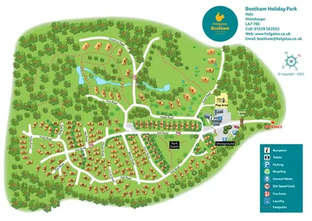
A woodland holiday-park plan with numbered homes, tree-named roads, walking loops and a distinctive entrance totem pole.
Features may come from the sample artwork, its key or published park information. Approximate numbers describe the drawing and may cover only part of a park. They are intended to help you compare map examples. Current facilities and booking information should be checked with the park.
TAKE A CLOSER LOOK
View the illustrated map in detail or choose a file to download. These are sample maps; contact the park for current visitor information.


LET’S MAP YOUR PARK
For a map quotation, find your park and draw a rough boundary around it. The area you select helps us work out the design time and price.
Draw your park for a quote ↗Or talk to our map designers
01751 473136