
Landscaped ponds
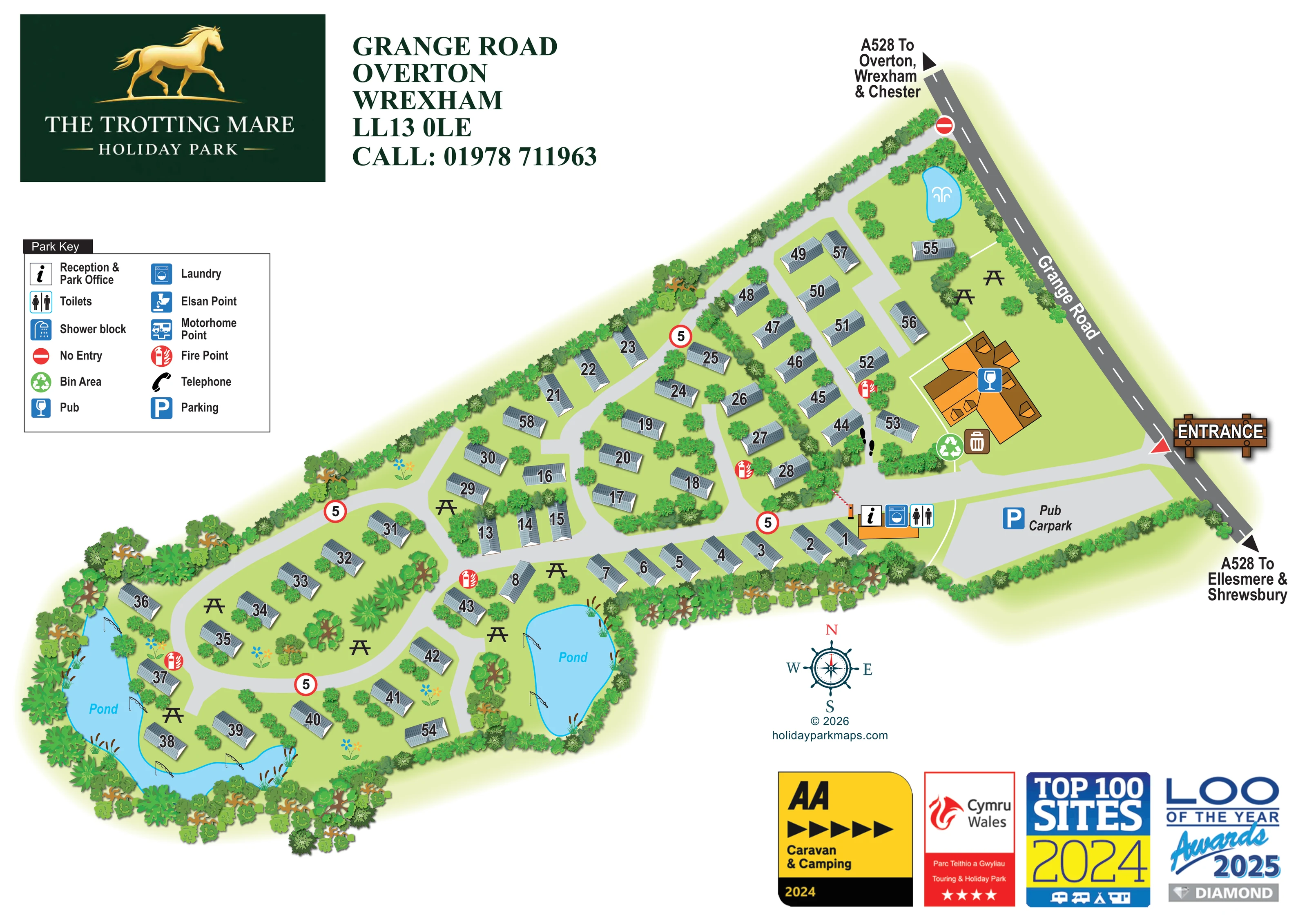
Two large blue ponds shape the lower part of the plan; a smaller pond with a fountain motif sits near the road at the upper end.
ILLUSTRATED PARK MAP · P337
Grange Road, Overton, Wrexham · United Kingdom
 Enlarge the map ↗
A SENSE OF THE PLACE
The Trotting Mare offers holiday accommodation between Overton-on-Dee and the lakes around Ellesmere. Its caravan park setting is complemented by self-contained converted barns designed for adults.
The barns provide a couples' retreat with their own living facilities and shared laundry provision. A pub and bistro form part of the wider site, while the map helps visitors understand the arrangement of the holiday accommodation.
LOOK CLOSER
Two large blue ponds shape the lower part of the plan; a smaller pond with a fountain motif sits near the road at the upper end.
Fishing-rod drawings line the two larger ponds, giving the artwork an angling character without stating fishing arrangements or permissions.
Dense perimeter trees, internal hedges, individual shrubs, ornamental flowers and pond-edge reeds divide and soften the accommodation groups.
An information symbol identifies the small orange-roofed service building beside the main arrival lane and pub car park.
Laundry and toilet symbols sit alongside reception at the front of the accommodation area.
A blue wine-glass symbol marks the large orange-roofed building near the Grange Road entrance.
A substantial grey parking area is explicitly labelled 'Pub Carpark' beside the entrance and reception building.
Recycling and bin symbols identify a waste area beside the pub and the internal arrival junction.
An information symbol identifies the small orange-roofed service building beside the main arrival lane and pub car park.
Laundry and toilet symbols sit alongside reception at the front of the accommodation area.
A blue wine-glass symbol marks the large orange-roofed building near the Grange Road entrance.
A substantial grey parking area is explicitly labelled 'Pub Carpark' beside the entrance and reception building.
Recycling and bin symbols identify a waste area beside the pub and the internal arrival junction.
Repeated red fire-point symbols are distributed through the accommodation layout, including the pond-side section.
Black picnic-table silhouettes appear on green spaces near accommodation, ponds and the pub.
Two large blue ponds shape the lower part of the plan; a smaller pond with a fountain motif sits near the road at the upper end.
Fishing-rod drawings line the two larger ponds, giving the artwork an angling character without stating fishing arrangements or permissions.
Dense perimeter trees, internal hedges, individual shrubs, ornamental flowers and pond-edge reeds divide and soften the accommodation groups.
A prominent entrance board marks arrival from Grange Road, with A528 directions towards Overton, Wrexham and Chester at one end and Ellesmere and Shrewsbury at the other.
Pale grey lanes branch from the entrance, forming a broad lower loop and smaller routes between the central and upper accommodation groups.
Red-bordered signs marked '5' recur along the internal lanes. A no-entry symbol marks the upper connection to Grange Road, and a small barrier is drawn near reception.
Included in the Park Key, but no distinct shower-block position is clearly identified in the plan.
An Elsan point symbol is included in the key; its location is not clearly marked in the illustrated site.
The legend includes a motorhome servicing symbol, without a clearly identifiable position on the plan.
A telephone symbol appears in the key, but its position cannot be confidently established from the artwork.
The park information describes a bistro as part of the wider site; the map labels the hospitality building as a pub.
READING THE MAP
The Trotting Mare Holiday Park map presents a compact, landscaped holiday-home setting on Grange Road in Overton, Wrexham. Its long diagonal composition follows the shape of the grounds, taking visitors from the roadside entrance and pub car park through groups of numbered accommodation to the ponds at the quieter end of the drawing.
Rather than reducing the site to rows of rectangles, the illustration makes trees, hedges and water central to its character. Grey-roofed caravan-style units sit beside gently curving lanes, with picnic tables scattered across the green spaces. Two larger ponds feature reeds and fishing-rod illustrations, while a smaller fountain pond provides another landmark near the road frontage.
The arrival area is especially clear: an orange-roofed pub, a labelled car park and a reception building with laundry and toilet symbols create a recognisable starting point. A boxed key, bold plot numbers and external road directions provide the practical information around this landscape-led plan. Dark green and gold horse branding gives the page a strong identity without competing with the map itself.
The plan is arranged diagonally across a white landscape-format page, with Grange Road defining the right-hand boundary. Direction arrows connect that road with Overton, Wrexham and Chester at the upper end, and Ellesmere and Shrewsbury at the lower end. A timber-style entrance sign marks the main turn into the park.
Immediately inside, the large orange-roofed pub stands beside a grey area labelled 'Pub Carpark'. Reception occupies a smaller building along the internal arrival lane, accompanied by laundry and toilet symbols. A bin area sits near the pub. From this service hub, pale grey roads branch into the accommodation grounds, passing repeated fire-point markers and red-bordered signs displaying '5'. A no-entry symbol distinguishes the upper connection to the external road.
Approximately 50 caravan-style units are illustrated as elongated grey roofs with prominent outlined numbers. Their arrangement changes across the site: a regular row follows the front lane, small groups occupy central planted islands, and a broad loop serves the lower pond-side area. Dense tree borders enclose the grounds, while shrubs, hedges and ornamental planting break up the spaces between units.
The water features are important landmarks. A large curved pond wraps around the lower-left accommodation, a second pond sits nearer the lower centre, and a small fountain pond occupies the upper roadside corner. Fishing-rod drawings, reeds and picnic-table silhouettes add detail to the waterside spaces.
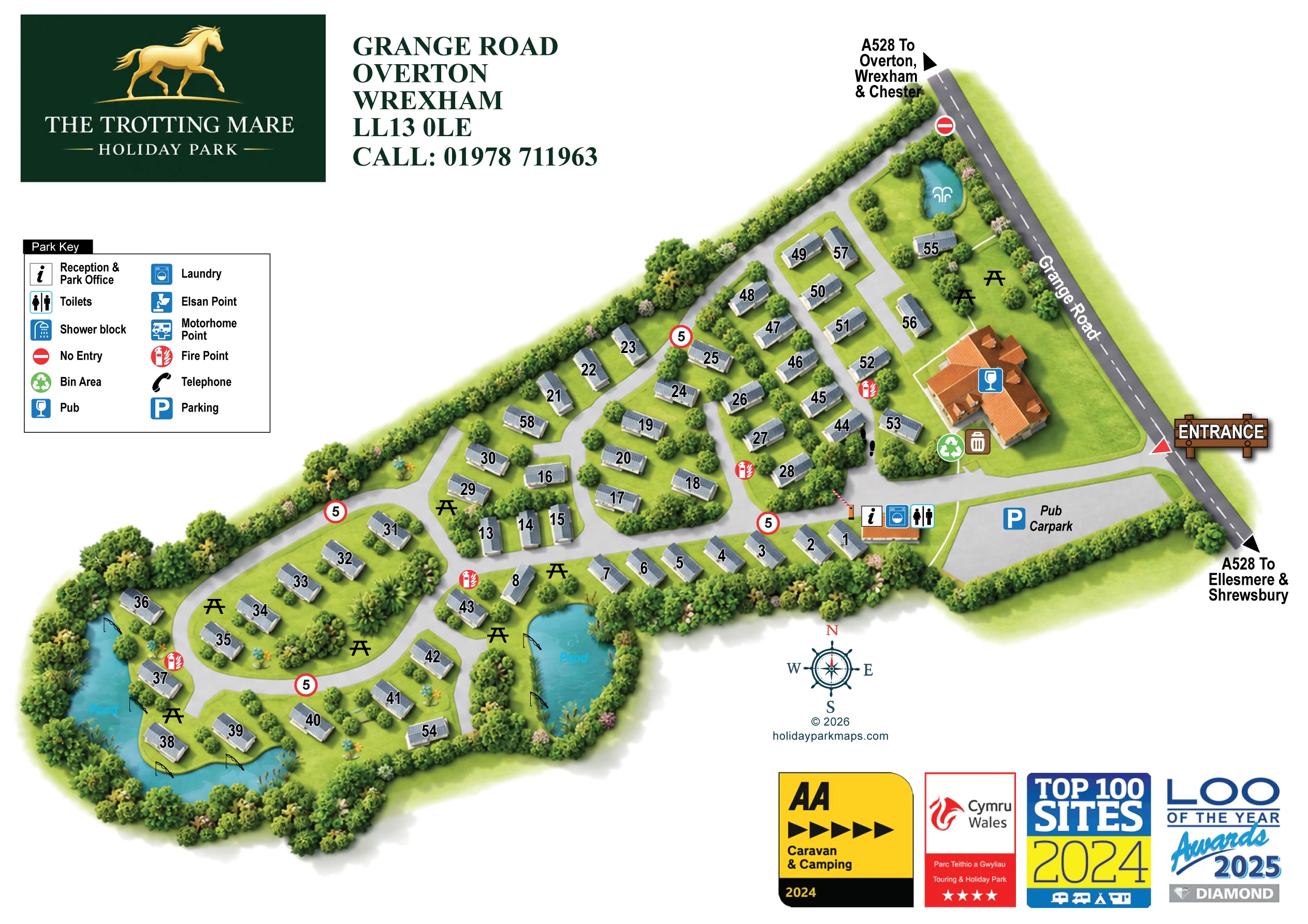
A two-column key sits to the left of the plan, with a compass and designer credit below. Branding, address details and dated award badges complete the page. The accompanying enlarged view reveals the same key and lower landscape details; it is not a separate park section or additional accommodation area.
 Enlarge this map ↗
KEEP EXPLORING
Chosen for shared landscapes, accommodation or facilities.
 Explore the map ↗
United Kingdom
Illustrated lakeside park plan with numbered holiday units, leisure buildings and a looping Woodland Walk.
 Explore the map ↗
United Kingdom
Colour-coded accommodation, central leisure facilities and coastal paths on an illustrated headland park map.
 Explore the map ↗
United Kingdom
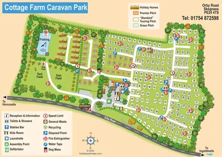
Illustrated touring and camping park map with numbered pitches, a fishing pond and a central farm courtyard.
Features may come from the sample artwork, its key or published park information. Approximate numbers describe the drawing and may cover only part of a park. They are intended to help you compare map examples. Current facilities and booking information should be checked with the park.
LET’S MAP YOUR PARK
For a map quotation, find your park and draw a rough boundary around it. The area you select helps us work out the design time and price.
Draw your park for a quote ↗Or talk to our map designers
01751 473136