
Dog-walking area
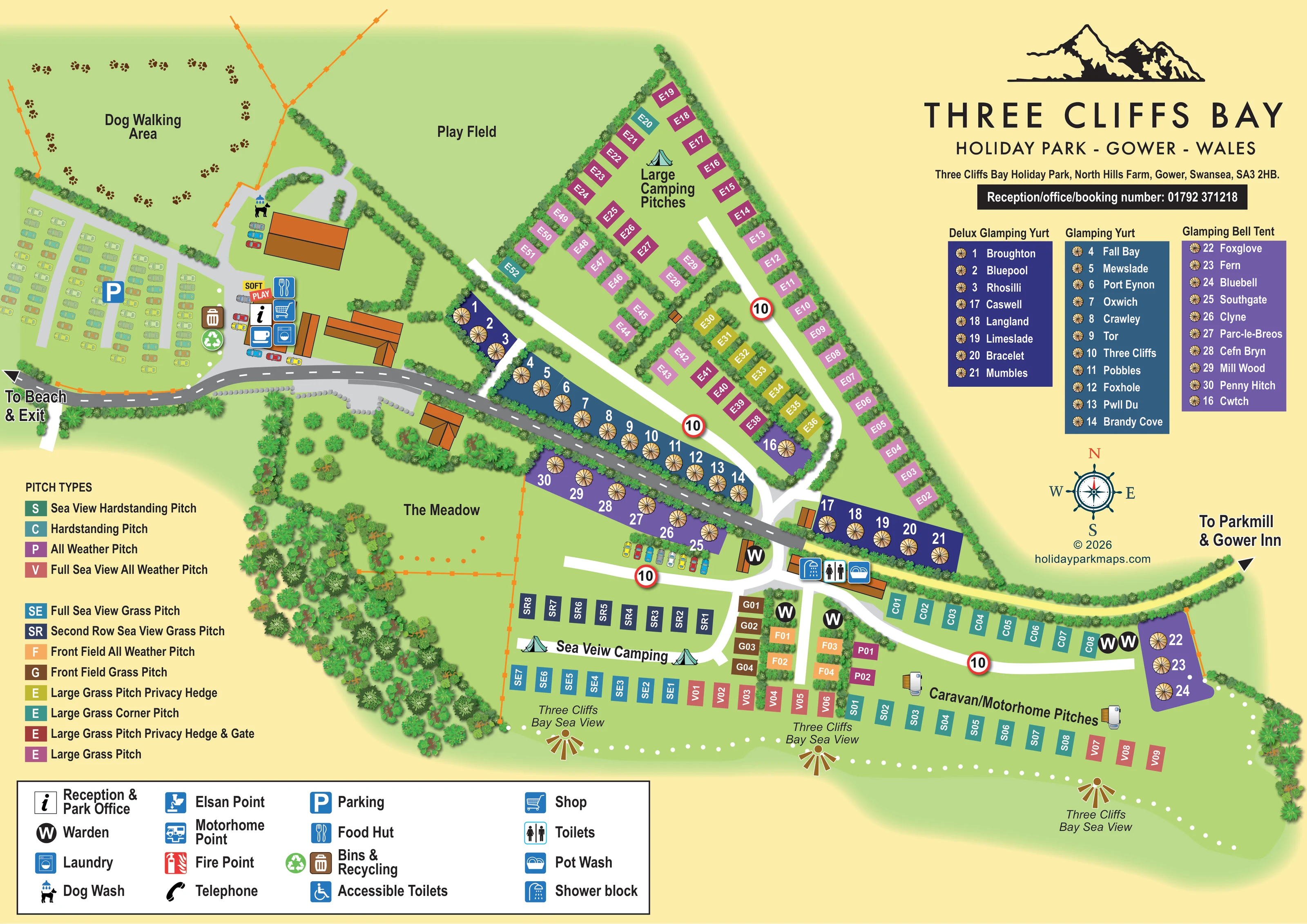
A large north-western open space is labelled Dog Walking Area and ringed with paw-print graphics.
ILLUSTRATED PARK MAP · P340
Three Cliffs Bay Holiday Park, North Hills Farm, Gower, Swansea · United Kingdom
 Enlarge the map ↗
A SENSE OF THE PLACE
Three Cliffs Bay Holiday Park occupies a clifftop position on the Gower Peninsula, with views over the bay. Paths connect the park with the beach and surrounding coastal landscape.
Families and couples are welcomed, and the grounds include space for walking dogs. Nearby bays, woodland and the wider Gower coast provide options for outdoor exploration, while the map helps visitors understand the site's coastal layout.
LOOK CLOSER
A large north-western open space is labelled Dog Walking Area and ringed with paw-print graphics.
Broad open grass area north of the main buildings and west of the large camping pitches.
Named green space south of the main road, bordered by trees and orange boundary markings.
Dense illustrated planting defines the perimeter, screens glamping strips and separates many of the large camping pitches.
Repeated sea-view labels and gold fan-shaped markers emphasise the outlook along the southern pitch frontage; the sea itself is not drawn.
Information symbol within the western service-building cluster beside the main road and car park.
A substantial western car park is illustrated with rows of cars and a parking symbol; smaller vehicle rows appear beside buildings and glamping.
Shopping-trolley symbol at the reception-side facilities cluster.
Information symbol within the western service-building cluster beside the main road and car park.
A substantial western car park is illustrated with rows of cars and a parking symbol; smaller vehicle rows appear beside buildings and glamping.
Shopping-trolley symbol at the reception-side facilities cluster.
Cutlery symbol identifies the food hut beside the western facilities.
A bright two-part Soft Play label appears beside the western buildings.
Washing-machine symbol in the reception-side service cluster.
Dog-and-shower symbol beside the northern building near the dog-walking area.
Paired waste-bin and recycling symbols beside the western car park and facilities.
Three adjacent symbols identify the central-eastern wash building at the junction between glamping and touring areas.
Black circular W markers appear around the central pitch junction and eastern hardstanding/glamping area.
Included in the facilities key; a corresponding position is not clearly identifiable on the plan.
Chemical toilet disposal symbol is explained in the key, without a clearly identifiable mapped position.
A motorhome service symbol appears in the key only.
Red fire-point symbol appears in the facilities legend.
Telephone handset symbol appears in the facilities legend.
A large north-western open space is labelled Dog Walking Area and ringed with paw-print graphics.
Broad open grass area north of the main buildings and west of the large camping pitches.
Named green space south of the main road, bordered by trees and orange boundary markings.
Dense illustrated planting defines the perimeter, screens glamping strips and separates many of the large camping pitches.
Repeated sea-view labels and gold fan-shaped markers emphasise the outlook along the southern pitch frontage; the sea itself is not drawn.
A leftward arrow at the western end of the main road is labelled To Beach & Exit.
A pale-yellow, hedge-lined route runs east from the wash-block area towards an arrow labelled To Parkmill & Gower Inn. The inn is a directional destination, not a depicted on-site facility.
A grey main road with white centre dashes links the western facilities to the central junction. White branches serve the camping and touring areas, with repeated red-ringed 10 signs.
READING THE MAP
This illustrated map of Three Cliffs Bay Holiday Park brings together a varied camping, touring and glamping site on the Gower Peninsula in Wales. Its coastal setting is expressed through repeated bay-view labels along the southern frontage, a cliff-outline logo and a nautical compass, rather than a large scenic illustration of the sea. The result keeps the visitor’s attention on pitches, facilities and routes while retaining a clear sense of place.
The map distinguishes large camping pitches, sea-view camping and caravan/motorhome areas, alongside standard yurts, deluxe yurts and bell tents. Colour-coded pitch rectangles explain differences in surface, outlook and privacy, while a separate glamping directory connects numbered units with their individual names. Reception, parking and the western service buildings form a recognisable hub, with the main road linking them to the rest of the park.
Open spaces are also given prominence: the dog-walking area, play field and meadow balance the more densely organised accommodation. Directional arrows towards the beach and exit, and towards Parkmill and Gower Inn, connect the site plan with its surrounding coastal landscape.
The plan is arranged around a grey road that crosses the park from the western reception and parking area to a central junction. Orange-roofed buildings and a cluster of service symbols establish the western hub, where the map identifies reception, a shop, food hut, laundry, soft play, dog wash, bins and recycling. Farther east, a building at the junction is marked with shower, toilet and pot-wash symbols. Black circular W markers identify warden locations around the adjoining pitch areas.
North of the road, a triangular field contains large camping pitches. Its perimeter rows and smaller interior groups are separated by illustrated hedges, with colours distinguishing ordinary grass pitches from privacy-hedge, corner and hedge-and-gate variants. The play field sits immediately to the west, with the paw-print-decorated dog-walking area beyond it. South of the road, The Meadow provides a named open space framed by dense planting.
Glamping units occupy narrow strips on both sides of the main road and several smaller clusters. Circular tan tent-roof symbols sit on navy, blue and violet backgrounds, corresponding to the three-column directory of deluxe yurts, standard yurts and bell tents. Along the southern side, camping and caravan/motorhome pitches form rows served by white access lanes. The pitch key distinguishes hardstanding, all-weather, front-field and sea-view categories, including front and second-row grass positions.
A pale-yellow route points towards Parkmill and Gower Inn, while the western road is labelled towards the beach and exit. Sea-view labels and gold fan-shaped motifs reinforce the southern outlook. The single landscape composition includes both legends, the glamping directory, branding and compass; the enlarged details show portions of this same artwork rather than additional map variants.
KEEP EXPLORING
Chosen for shared landscapes, accommodation or facilities.
 Explore the map ↗
United Kingdom
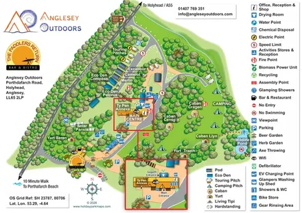
Illustrated camping and glamping map with an activity-centre inset and wildlife pond.
 Explore the map ↗
United Kingdom
Coastal park plan with colour-coded pitches, named neighbourhoods and a Morecambe Bay walking route.
 Explore the map ↗
United Kingdom
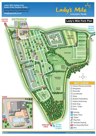
Portrait park plan with named fields, numbered accommodation, beach directions and an enlarged leisure-complex inset.
Features may come from the sample artwork, its key or published park information. Approximate numbers describe the drawing and may cover only part of a park. They are intended to help you compare map examples. Current facilities and booking information should be checked with the park.
LET’S MAP YOUR PARK
For a map quotation, find your park and draw a rough boundary around it. The area you select helps us work out the design time and price.
Draw your park for a quote ↗Or talk to our map designers
01751 473136