
Three fishing lakes
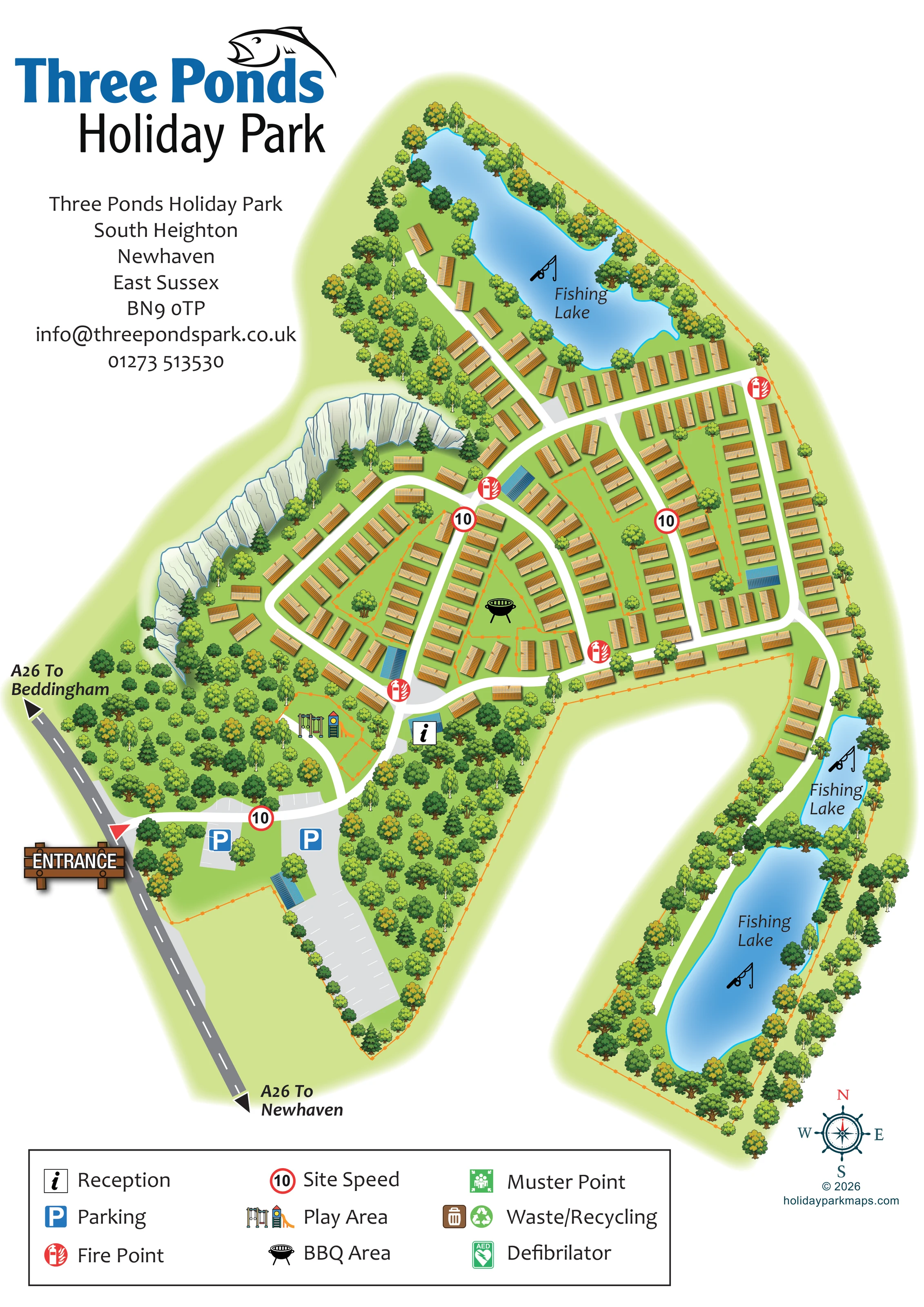
Three separate blue water bodies are each labelled Fishing Lake and marked with a fishing-rod pictogram: one large lake at the northern end and two along the narrow south-eastern extension.
ILLUSTRATED PARK MAP · P341
Three Ponds Holiday Park, South Heighton, Newhaven, East Sussex · United Kingdom
 Enlarge the map ↗
A SENSE OF THE PLACE
Three Ponds Holiday Park is a quiet, family-run site beneath the South Downs at South Heighton near Newhaven. Fishing and the surrounding East Sussex countryside are central to its appeal.
The park listing describes a reception and shop, children's play and ball-game areas, and laundry facilities. Lewes, the coast and the Seven Sisters landscape provide options for excursions beyond the grounds.
LOOK CLOSER
Three separate blue water bodies are each labelled Fishing Lake and marked with a fishing-rod pictogram: one large lake at the northern end and two along the narrow south-eastern extension.
Dense mixed tree illustrations surround the entrance, screen the parking areas, follow the lakeshores and frame much of the site boundary.
A prominent pale, vertically striated rock face curves along the western side of the accommodation area.
The reception information symbol marks a blue-roofed building beside the main approach, just below the accommodation area and near the play area.
Two blue parking symbols identify grey parking areas near the entrance. White bay markings also extend along the approach and into a long southern parking strip.
A swings-and-slide illustration marks an enclosed play area between the entrance approach and the main accommodation, west of reception.
A black barbecue pictogram identifies a small central open space among the accommodation rows.
Repeated red fire-point symbols are positioned at junctions around the main accommodation area.
Three separate blue water bodies are each labelled Fishing Lake and marked with a fishing-rod pictogram: one large lake at the northern end and two along the narrow south-eastern extension.
Dense mixed tree illustrations surround the entrance, screen the parking areas, follow the lakeshores and frame much of the site boundary.
A prominent pale, vertically striated rock face curves along the western side of the accommodation area.
The reception information symbol marks a blue-roofed building beside the main approach, just below the accommodation area and near the play area.
Two blue parking symbols identify grey parking areas near the entrance. White bay markings also extend along the approach and into a long southern parking strip.
A swings-and-slide illustration marks an enclosed play area between the entrance approach and the main accommodation, west of reception.
A black barbecue pictogram identifies a small central open space among the accommodation rows.
Repeated red fire-point symbols are positioned at junctions around the main accommodation area.
Red-ringed signs displaying 10 appear on the entrance approach and internal roads; the legend calls these Site Speed.
A wooden-style ENTRANCE sign and red triangular marker identify the junction from the A26 on the south-western side.
The grey A26 has directional arrows labelled To Beddingham and To Newhaven.
Broad white roads connect the entrance, reception and accommodation loops. A narrower white route continues south beside the two eastern fishing lakes.
A green assembly-point symbol appears in the legend; a corresponding location is not clearly identifiable on the plan.
Bin and recycling symbols are included in the legend, without clearly identifiable placements on the plan.
A green AED symbol appears in the legend, but its location is not clearly marked in the illustrated site.
The park listing describes a shop alongside reception; the artwork labels reception but does not separately identify a shop.
Laundry facilities are described in the park listing, rather than located on this map.
The park listing mentions a ball-game area. No separate ball-game location is labelled in the artwork.
READING THE MAP
Three fishing lakes give this illustrated map of Three Ponds Holiday Park its defining shape. Set at South Heighton near Newhaven in East Sussex, the park is presented as a tree-framed holiday setting, with a compact accommodation area between a northern lake and a striking pale rock face. Two more lakes stretch down a separate, narrow arm on the right, making the fishing landscape immediately recognisable.
The portrait design combines a practical site plan with small-scale landscape illustration. Golden-roofed caravan-style units follow bright white internal roads, while blue-roofed buildings and bold facility symbols provide contrasting landmarks. Arrival from the A26 is clearly introduced with a wooden-style entrance sign, parking symbols and directions towards Beddingham and Newhaven.
Reception, a children's play area, a central BBQ area and repeated fire points are shown within the plan. Large fish-themed branding occupies the upper-left, balanced by a boxed legend at the foot and a compass rose beside the lower lake. This sample is particularly relevant to parks where fishing, woodland and an irregular site layout need to be explained together.
The plan begins at the A26 on the left, where a prominent entrance sign leads visitors onto a white approach road. Grey parking areas with marked bays sit close to this arrival point, including a long strip extending towards the southern boundary. The route then passes the illustrated children's play area and reaches reception, identified by an information symbol over a blue-roofed building.
Beyond reception, the accommodation is arranged along interconnected roads, with parallel rows enclosing small green spaces. A barbecue symbol marks one of these central spaces, and red fire-point icons punctuate key junctions. Red-ringed 10 signs repeat along the approach and internal routes. The golden, ribbed-roof accommodation symbols are deliberately consistent, while changes in their orientation reveal the road pattern without individual plot numbers.
The landscape is unusually prominent. A pale, fissured rock face curves around the western edge of the accommodation, backed and softened by trees. To the north, a large irregular lake has accommodation along its southern and western sides. A road continues down the eastern edge of the main park towards two further fishing lakes: a smaller upper pool and a long lower lake. Each water body carries both a Fishing Lake label and a rod pictogram. Dense tree belts frame this extension, which is separated from the entrance-side grounds by a large white gap.
Orange fence-like lines outline boundaries and several internal spaces. The lower legend explains reception, parking, fire points, site speed, play and BBQ symbols, and also includes muster point, waste/recycling and defibrillator entries. The page is completed by fish-themed branding, an address block and a nautical compass rose. The enlarged views show details of this same portrait artwork, rather than additional park sections.
KEEP EXPLORING
Chosen for shared landscapes, accommodation or facilities.
 Explore the map ↗
United Kingdom
Illustrated lakeside park plan with numbered holiday units, leisure buildings and a looping Woodland Walk.
 Explore the map ↗
United Kingdom
Illustrated caravan park plan with woodland and riverside walks, fishing pools and wildlife panels.
 Explore the map ↗
United Kingdom
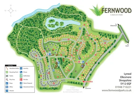
Fernwood's illustrated park plan combines numbered accommodation, woodland walks, a canal-side setting and an island-dotted lake.
Features may come from the sample artwork, its key or published park information. Approximate numbers describe the drawing and may cover only part of a park. They are intended to help you compare map examples. Current facilities and booking information should be checked with the park.
LET’S MAP YOUR PARK
For a map quotation, find your park and draw a rough boundary around it. The area you select helps us work out the design time and price.
Draw your park for a quote ↗Or talk to our map designers
01751 473136