
Tree-lined boundaries
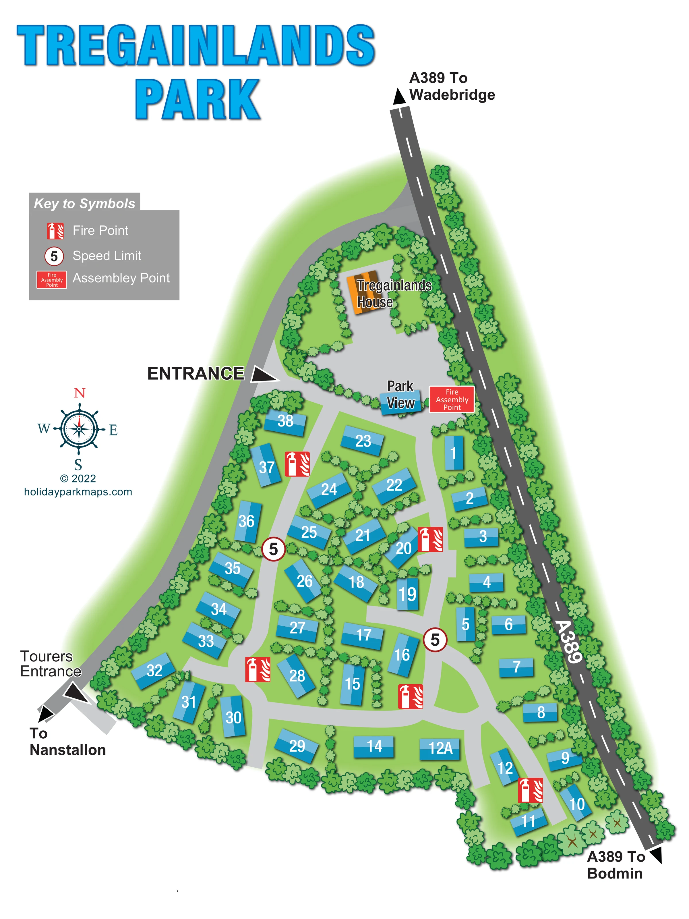
Dense illustrated tree belts enclose much of the park and separate it visually from the A389.
ILLUSTRATED PARK MAP · P626
Washaway, Bodmin, Cornwall · United Kingdom
 Enlarge the map ↗
A SENSE OF THE PLACE
Tregainlands is a privately run touring and caravan storage site near Bodmin in Cornwall. Landscaped pitches occupy a rural setting between the county's north and south coasts.
Its current touring provision is for adult storage customers using self-contained caravans or motorhomes. Serviced grass and hardstanding pitches provide water, electricity and waste connections; tents are not part of the advertised offering.
LOOK CLOSER
Dense illustrated tree belts enclose much of the park and separate it visually from the A389.
Small trees and shrub-like symbols divide individual spaces and central groups within the green park interior.
Repeated red extinguisher-and-flame symbols identify fire points beside internal roads throughout the accommodation area.
A red labelled assembly point is shown beside Park View, near the northern entrance area.
Circular signs displaying 5 appear on internal roads and are explained as speed-limit symbols in the key.
A prominent entrance arrow marks the western approach beside the house grounds and northern accommodation area.
A separately labelled entrance connects the south-western edge of the park with the road towards Nanstallon.
Light-grey curving roads branch around central accommodation groups and connect the western and eastern rows.
Repeated red extinguisher-and-flame symbols identify fire points beside internal roads throughout the accommodation area.
A red labelled assembly point is shown beside Park View, near the northern entrance area.
Circular signs displaying 5 appear on internal roads and are explained as speed-limit symbols in the key.
A prominent entrance arrow marks the western approach beside the house grounds and northern accommodation area.
A separately labelled entrance connects the south-western edge of the park with the road towards Nanstallon.
Light-grey curving roads branch around central accommodation groups and connect the western and eastern rows.
The dark-grey public road follows the eastern boundary, with directional arrows towards Wadebridge at the top and Bodmin at the bottom.
A directional arrow below the Tourers Entrance identifies the route towards Nanstallon.
An orange-roofed building is labelled within landscaped grounds at the northern end. No visitor-service function is stated.
A small blue building or unit is labelled near the northern road junction and assembly point; its function is not specified.
Dense illustrated tree belts enclose much of the park and separate it visually from the A389.
Small trees and shrub-like symbols divide individual spaces and central groups within the green park interior.
Published park information describes water, electricity and waste connections on grass and hardstanding pitches. These services and surface distinctions are not individually mapped.
READING THE MAP
This illustrated map of Tregainlands Touring Park presents a compact, landscaped site at Washaway near Bodmin in Cornwall. Its elongated layout sits beside the A389, with road directions towards Wadebridge and Bodmin and a separate approach towards Nanstallon. A large blue title introduces a green, tree-lined plan in which numbered caravan-style spaces are arranged around a network of pale-grey internal roads.
The map gives particular attention to arrival and everyday orientation. It distinguishes the main Entrance from the Tourers Entrance, names Tregainlands House and Park View, and places fire points and an assembly point directly within the layout. Roughly 40 numbered spaces give the artwork a small-park scale without overwhelming the page.
Rather than relying on detailed vehicle drawings, the design uses consistent blue rectangles, prominent white numbers and planted divisions to explain the site. The portrait composition leaves room for a compact safety key and compass rose, making this a useful example for touring parks seeking a straightforward visitor plan with clear access routes, recognisable landmarks and a strong sense of landscaped enclosure.
The plan follows an irregular, tapering site with the A389 running along its eastern edge. At the northern end, Tregainlands House is drawn with an orange roof inside tree-bordered grounds. Below it, the smaller blue Park View building sits beside the internal road and the labelled fire assembly point. A bold Entrance arrow marks the western approach to this upper part of the park, while the Tourers Entrance appears separately at the south-western edge, beside the direction towards Nanstallon.
Accommodation spaces occupy the middle and lower portions of the plan. Blue numbered rectangles follow the eastern boundary, curve down the western side and form smaller groups between branching internal roads. Their varied angles respond to the road layout rather than a rigid grid. Small planted divisions break up the groups, while larger tree symbols form a near-continuous perimeter and a substantial buffer beside the public road. The green background has a soft edge that fades into the white page.
Light-grey roads remain visually distinct from the darker A389, whose dashed centre line and destination arrows establish the wider approach. Red fire-point symbols are distributed beside the internal routes, and circular signs marked 5 provide additional wayfinding information. The assembly point uses a larger red text panel near Park View.
The upper-left key explains the three safety symbols, with a teal compass rose and designer credit below. Oversized cyan lettering balances the tall site plan. The accompanying enlarged detail shows the same artwork's legend and western entrance area more closely; it is not a separate park section or additional accommodation layout.
KEEP EXPLORING
Chosen for shared landscapes, accommodation or facilities.
 Explore the map ↗
United Kingdom
Illustrated Sanday aire map with a seasonal maze, café barn and motorhome service area.
 Explore the map ↗
United Kingdom
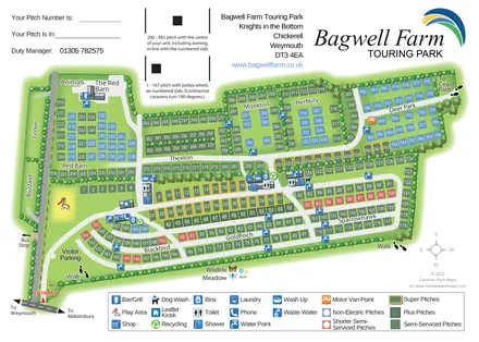
A colour-coded touring park plan with named pitch areas, service symbols and Coast Path links.
 Explore the map ↗
United Kingdom
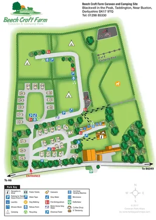
Illustrated touring and camping map with hedge-divided fields, age-labelled play areas and a detailed service key.
Features may come from the sample artwork, its key or published park information. Approximate numbers describe the drawing and may cover only part of a park. They are intended to help you compare map examples. Current facilities and booking information should be checked with the park.
LET’S MAP YOUR PARK
For a map quotation, find your park and draw a rough boundary around it. The area you select helps us work out the design time and price.
Draw your park for a quote ↗Or talk to our map designers
01751 473136