
Tree belts and planted divisions
Dense mixed tree illustrations enclose the grounds and border the public road. Lower hedges divide caravan rows and frame communal spaces.
ILLUSTRATED PARK MAP · P346
Trederwen Caravan Park, Llansantffraid, Powys · United Kingdom
 Enlarge the map ↗
A SENSE OF THE PLACE
Trederwen Caravan Park is a family-run holiday park near Llansantffraid in the Mid Wales countryside. A long-established community atmosphere is a central part of the operator's description of the park.
Facilities include bowls, fishing, snooker, a children's play area and a launderette. A family clubhouse provides social space, with the map helping visitors locate the holiday homes and shared amenities.
LOOK CLOSER
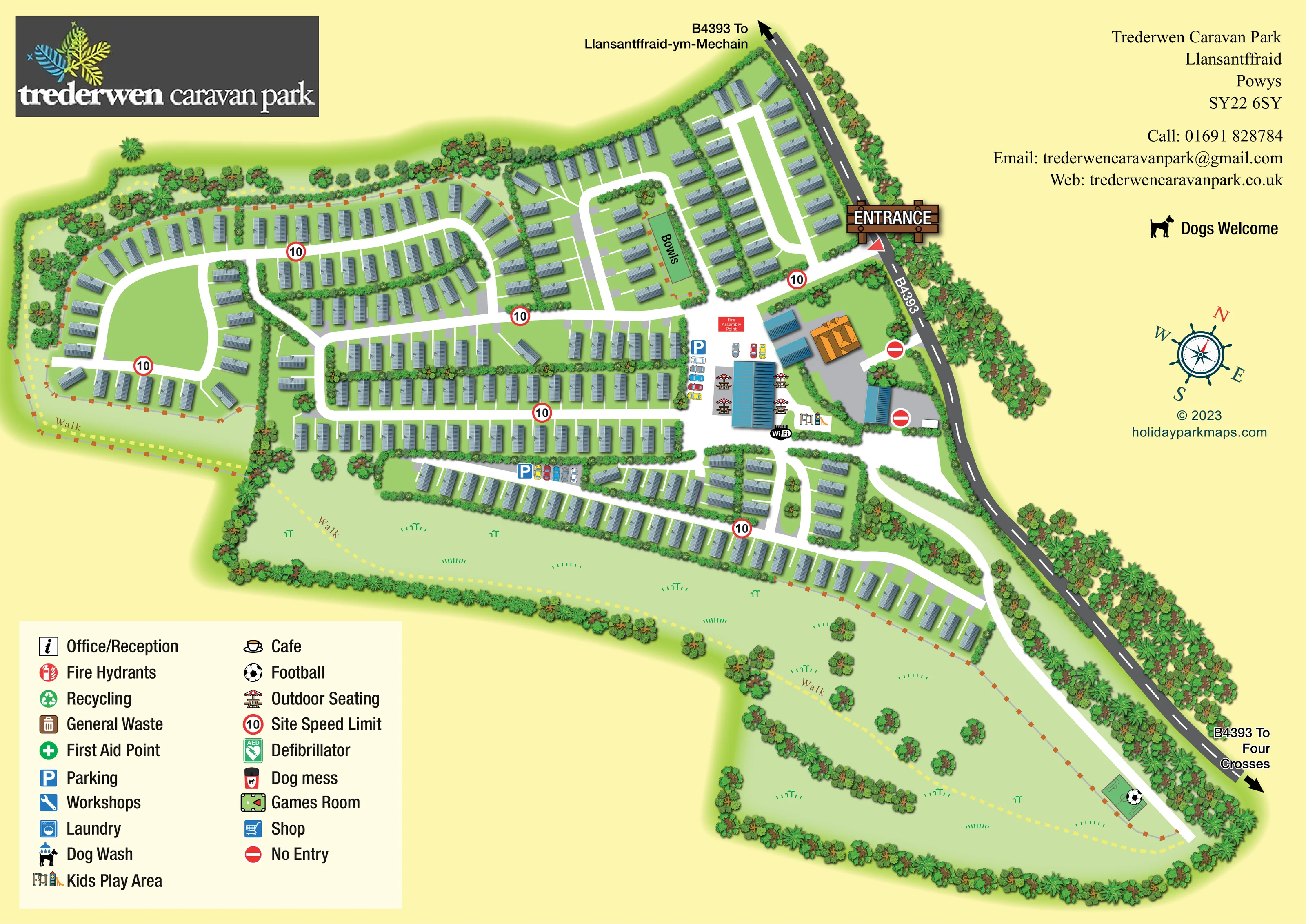
Dense mixed tree illustrations enclose the grounds and border the public road. Lower hedges divide caravan rows and frame communal spaces.
An open green centre occupies the western accommodation loop, while a much broader grassed strip extends below the caravan rows with scattered trees and a walking route.
A narrow rectangular green labelled 'Bowls' sits within a hedge-divided accommodation block above the central cross-park road.
A swing and slide illustration marks the play area beside the main communal building cluster.
A small pitch illustration and football symbol mark an activity area at the far lower-right end of the grounds.
Parasol-covered picnic tables flank the largest blue-roofed communal building.
Blue P symbols and illustrated cars identify parking beside the communal buildings and along a lower accommodation lane.
A 'FREE WiFi' badge appears beside the main communal building and play area.
A narrow rectangular green labelled 'Bowls' sits within a hedge-divided accommodation block above the central cross-park road.
A swing and slide illustration marks the play area beside the main communal building cluster.
A small pitch illustration and football symbol mark an activity area at the far lower-right end of the grounds.
Parasol-covered picnic tables flank the largest blue-roofed communal building.
Blue P symbols and illustrated cars identify parking beside the communal buildings and along a lower accommodation lane.
A 'FREE WiFi' badge appears beside the main communal building and play area.
A red labelled box identifies an assembly point in the open arrival and parking area.
Listed in the key; a corresponding location marker is not clearly visible on the illustrated plan.
All three have individual pictograms in the key, but their building locations are not clearly marked in the visible plan.
Both are named in the key without clearly identifiable location symbols on the plan. A launderette is also mentioned in the park information.
The key includes dog-wash and 'Dog mess' symbols; their positions are not clearly shown.
Separate recycling and general-waste entries appear in the key, without clearly visible mapped positions.
The key names these safety facilities, but does not establish their positions in the visible artwork.
Published park information describes a family clubhouse. The plan illustrates communal buildings near the entrance but does not explicitly label one as the clubhouse.
Mentioned in the park information; no fishing water or explicitly labelled snooker facility is depicted.
A pale-yellow dashed route labelled 'Walk' follows the western perimeter and continues through the broad lower grassed grounds towards the football area.
An oversized timber-style entrance sign marks access from the B4393. Road arrows indicate Llansantffraid-ym-Mechain in one direction and Four Crosses in the other.
Repeated red-ringed 10 signs mark internal roads, while no-entry symbols distinguish two accesses beside the roadside building group.
Dense mixed tree illustrations enclose the grounds and border the public road. Lower hedges divide caravan rows and frame communal spaces.
An open green centre occupies the western accommodation loop, while a much broader grassed strip extends below the caravan rows with scattered trees and a walking route.
A dog silhouette and 'Dogs Welcome' wording appear in the page's information area; the artwork does not specify detailed pet conditions.
READING THE MAP
This illustrated map of Trederwen Caravan Park presents a substantial holiday-home layout in the countryside near Llansantffraid, Powys. The park stretches alongside the B4393, with its entrance picked out by a large timber-style sign and road arrows towards Llansantffraid-ym-Mechain and Four Crosses. Within the grounds, bright white lanes connect rows of grey caravans, planted divisions and a compact group of communal buildings.
The artwork gives particular attention to the relationship between accommodation and outdoor space. A rounded western loop encloses an open green centre, while a broad grassed area runs beneath the longer caravan rows. A dashed walking route follows the perimeter and continues towards a football area at the far end. Bowls, children's play equipment, outdoor seating and parking provide recognisable landmarks closer to the accommodation.
A pale-yellow background, layered greenery and coloured building roofs create a clear distinction between the park, its surroundings and its shared spaces. The finished page also accommodates the park logo, contact details, a compass and a substantial illustrated key, making this a useful sample for caravan parks with dense layouts and generous landscaped grounds.
The plan combines several accommodation patterns within one elongated site. On the left, caravans follow a broad loop around an open green space. Across the centre, longer parallel rows are separated by hedges and connected by intersecting white lanes. Towards the upper-right corner, narrower loops fit the tapering land beside the B4393. A further line of caravans extends along the lower edge, above a wide strip of grassed grounds.
Arrival is made visually prominent by the entrance sign where the public road meets the internal network. Nearby, the communal building group is distinguished by blue roofs and a larger orange-roofed building. Illustrated cars and blue parking signs identify parking areas, while parasol-covered tables, children's play equipment and a Wi-Fi badge give the hub a recognisable social character. A red fire assembly-point label occupies the adjacent open area. The bowls green is labelled within an accommodation block farther up the plan.
The lower landscape has a different rhythm from the closely spaced caravan rows. Scattered trees and small grass marks sit within a continuous planted boundary, crossed by a pale-yellow dashed route labelled 'Walk'. This route also follows the western perimeter. At the far lower-right tip, a football pitch pictogram marks a recreation area beside the extending internal road.
The lower-left key explains both illustrated amenities and standard service symbols, including reception, laundry, waste, first aid and a defibrillator. Some entries are not visibly positioned on the plan. The single-page composition is completed by the logo, contact block, Dogs Welcome notice and decorative compass, with no separate inset or section map.
KEEP EXPLORING
Chosen for shared landscapes, accommodation or facilities.
 Explore the map ↗
United Kingdom
Illustrated lakeside park plan with numbered holiday units, leisure buildings and a looping Woodland Walk.
 Explore the map ↗
United Kingdom
Illustrated caravan park plan with woodland and riverside walks, fishing pools and wildlife panels.
 Explore the map ↗
United Kingdom
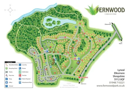
Fernwood's illustrated park plan combines numbered accommodation, woodland walks, a canal-side setting and an island-dotted lake.
Features may come from the sample artwork, its key or published park information. Approximate numbers describe the drawing and may cover only part of a park. They are intended to help you compare map examples. Current facilities and booking information should be checked with the park.
LET’S MAP YOUR PARK
For a map quotation, find your park and draw a rough boundary around it. The area you select helps us work out the design time and price.
Draw your park for a quote ↗Or talk to our map designers
01751 473136