
Tree-lined boundary and planted islands
A near-continuous illustrated belt of trees and shrubs encloses the park, with additional planting between accommodation groups and around the recreation field.
ILLUSTRATED PARK MAP · P355
Village Green Holiday Park, Edmundbyers · United Kingdom
 Enlarge the map ↗
A SENSE OF THE PLACE
Village Green Holiday Park is a holiday home ownership park at Edmundbyers in County Durham. The rolling North Pennines landscape surrounds the site.
Derwent Reservoir and Blanchland provide nearby destinations for outings, while the park itself focuses on a quieter holiday setting. Its map presents the arrangement of static holiday homes and internal routes; the accommodation is for holiday use rather than permanent residence.
LOOK CLOSER
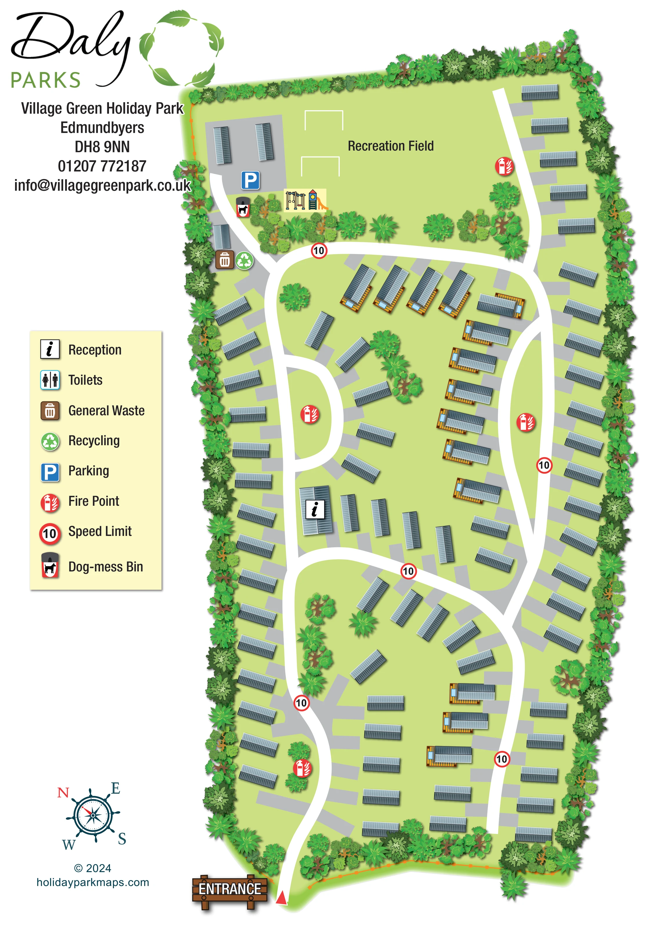
A near-continuous illustrated belt of trees and shrubs encloses the park, with additional planting between accommodation groups and around the recreation field.
An orange line with regularly spaced square marks follows visible portions of the outer edge beneath the planting.
An information symbol identifies a larger roofed building beside the left-hand internal road near the middle of the plan.
A large labelled grass area occupies the upper end of the site, separated from much of the accommodation by planting and a cross-site road.
Two white goal outlines are drawn on the recreation field.
Swings and a colourful slide-and-tower structure are illustrated beside the recreation field, close to the parking area.
A blue parking symbol marks a grey surfaced area at the upper-left end of the plan, beside two unlabelled roofed structures.
Adjacent general-waste and recycling symbols mark a point beside the road below the parking area.
An information symbol identifies a larger roofed building beside the left-hand internal road near the middle of the plan.
A large labelled grass area occupies the upper end of the site, separated from much of the accommodation by planting and a cross-site road.
Two white goal outlines are drawn on the recreation field.
Swings and a colourful slide-and-tower structure are illustrated beside the recreation field, close to the parking area.
A blue parking symbol marks a grey surfaced area at the upper-left end of the plan, beside two unlabelled roofed structures.
Adjacent general-waste and recycling symbols mark a point beside the road below the parking area.
Red circular fire-point symbols appear at several positions around the internal roads and recreation-field edge.
A dog-waste bin symbol is positioned beside the road near the play area and parking.
Toilets are included in the legend, but a corresponding location marker is not clearly visible on the plan.
A timber-style ENTRANCE sign and red triangular marker identify the single illustrated arrival point at the bottom of the page.
Broad white roads form linked curves and loops through the elongated site, with cross-connections and a branch beside the recreation field.
Repeated red-rimmed signs displaying 10 are placed along the roads and explained as Speed Limit in the legend.
A near-continuous illustrated belt of trees and shrubs encloses the park, with additional planting between accommodation groups and around the recreation field.
An orange line with regularly spaced square marks follows visible portions of the outer edge beneath the planting.
READING THE MAP
This illustrated map presents Village Green Holiday Park at Edmundbyers in County Durham, a holiday-home ownership park set within the rolling North Pennines landscape. Its tall, tree-framed plan follows the shape of the site, showing static holiday homes beside a network of curving internal roads and a generous recreation field at the far end.
The entrance is clearly marked at the foot of the page, while reception, parking, waste and recycling points are picked out with simple pictograms. Football goals and a colourful play structure give the recreation area an immediately recognisable role. Selected holiday homes are drawn with timber-coloured decking, adding useful visual variety to the repeated roof shapes.
A large Daly Parks logo, park details and a cream-backed legend occupy the left margin, leaving the main plan relatively uncluttered. Pale-green ground, white roads and blue-grey roofs keep the arrangement easy to read, while layered trees and shrubs convey the enclosed, landscaped character of the park. The result is a visitor-facing overview built around routes, shared spaces and recognisable landmarks rather than individual plot labels.
The single portrait artwork places an elongated park plan to the right of a dedicated information column. Arrival begins at the bottom, where a timber-style ENTRANCE sign and red pointer mark the road into the site. From here, broad white routes wind through the accommodation, forming linked loops and cross-connections before continuing towards the recreation field at the upper end.
Holiday homes line both outer edges and occupy several central groups. Their narrow, shaded roofs are rotated to follow the roads, with grey hardstandings extending towards the carriageways. Some central units have orange-brown decking, providing a visible distinction without introducing a separate accommodation key. Reception is identified by an information symbol on a larger building near the middle-left of the plan.
The upper recreation field is labelled directly and contains two white goal outlines. Swings and a slide-and-tower illustration sit near its lower-left edge. A parking symbol marks the adjoining surfaced area, with general-waste and recycling symbols beside the approach road below it. A dog-mess bin is shown nearby, and red fire-point symbols appear at several locations throughout the park. Repeated signs displaying 10 mark the illustrated speed limit.
Trees and shrubs form a nearly continuous outer belt and create smaller planted islands between the homes. An orange boundary line remains visible along parts of the perimeter. The left-hand legend explains the facility symbols, including a toilets entry without a clearly marked position on the plan. Above it are the Daly Parks logo and park contact details; below it are a decorative compass and the map designer's credit. The enlarged views show details of this same composition, not additional sections or separate maps.
KEEP EXPLORING
Chosen for shared landscapes, accommodation or facilities.
 Explore the map ↗
United Kingdom
Woodland-framed Barnsoul map with mixed accommodation, shared facilities and paw-marked walking routes.
 Explore the map ↗
United Kingdom
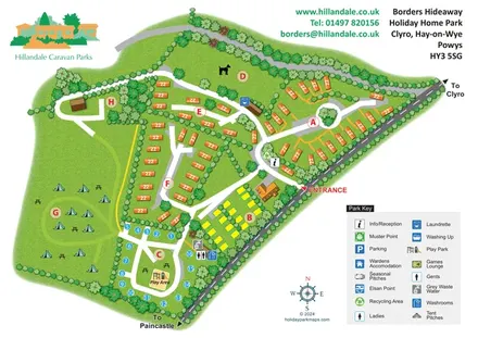
Illustrated Borders Hideaway map with leafy accommodation zones, camping field and a play-area loop.
 Explore the map ↗
United Kingdom
A wooded, streamside park map with a linked farm, café, touring and cottage area.
Features may come from the sample artwork, its key or published park information. Approximate numbers describe the drawing and may cover only part of a park. They are intended to help you compare map examples. Current facilities and booking information should be checked with the park.
LET’S MAP YOUR PARK
For a map quotation, find your park and draw a rough boundary around it. The area you select helps us work out the design time and price.
Draw your park for a quote ↗Or talk to our map designers
01751 473136