
Tree-lined boundaries and internal planting
Dense stylised tree belts enclose the site and divide its sections, with smaller planted clusters among the static pitches.
ILLUSTRATED PARK MAP · P633
Simonscales Lane, Cockermouth, Cumbria · United Kingdom
 Enlarge the map ↗
A SENSE OF THE PLACE
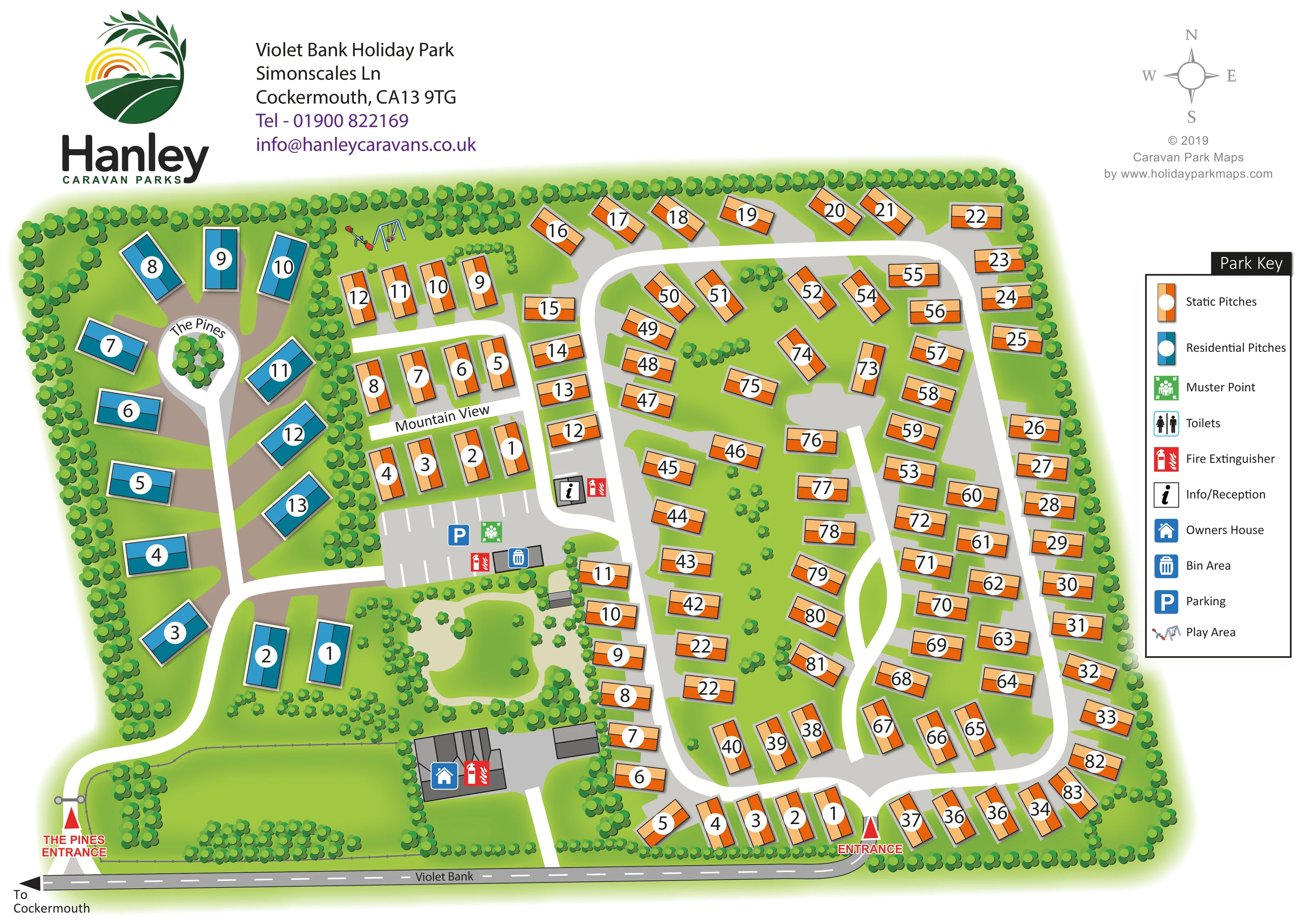
Violet Bank Holiday Park is based at Simonscales Lane, Cockermouth, Cumbria. The park is just outside Cockermouth, on the edge of the Lake District, with views towards the Lorton Valley and Buttermere Fells. Hanley markets static caravans and lodges for sale at Violet Bank.
The operator identifies walking, horse riding, fishing and golf in the surrounding area. Pets are welcomed on site.
LOOK CLOSER
Dense stylised tree belts enclose the site and divide its sections, with smaller planted clusters among the static pitches.
An irregular green area with clustered trees and shrubs lies between the parking court and the owner's house.
A broad green strip with trees and a drawn fence line separates part of the southern frontage from The Pines and the owner's-house area.
An information symbol marks a small building beside the western branch of the main static-pitch road, immediately east of the parking area.
A grey parking court with white bay markings sits below Mountain View, between the residential and main static sections.
Illustrated swings and a seesaw mark a small play area near the northern end of Mountain View, beside the tree belt separating it from The Pines.
A blue house symbol identifies the larger grey building near the southern frontage, west of the main static-pitch section.
A blue bin symbol marks a small service structure at the southern edge of the central parking court.
An information symbol marks a small building beside the western branch of the main static-pitch road, immediately east of the parking area.
A grey parking court with white bay markings sits below Mountain View, between the residential and main static sections.
Illustrated swings and a seesaw mark a small play area near the northern end of Mountain View, beside the tree belt separating it from The Pines.
A blue house symbol identifies the larger grey building near the southern frontage, west of the main static-pitch section.
A blue bin symbol marks a small service structure at the southern edge of the central parking court.
A green assembly symbol appears within the central parking area.
Red symbols identify extinguisher points beside reception, the parking and bin area, and the owner's house.
Toilets are included in the Park Key, but a corresponding position is not clearly identifiable on the plan.
A red entrance marker on the southern edge connects the main static-pitch road system to the road labelled Violet Bank.
A separate labelled entrance at the south-western corner leads to The Pines; a gate is illustrated across this access.
The frontage road is labelled Violet Bank, with a left-pointing arrow towards Cockermouth.
Dense stylised tree belts enclose the site and divide its sections, with smaller planted clusters among the static pitches.
An irregular green area with clustered trees and shrubs lies between the parking court and the owner's house.
A broad green strip with trees and a drawn fence line separates part of the southern frontage from The Pines and the owner's-house area.
READING THE MAP
This illustrated map of Violet Bank Holiday Park in Cockermouth brings together a static-caravan layout and a distinct residential section on one clear, landscape-format page. Set on the edge of the Lake District, the park is presented as a tree-lined site with green spaces woven between its accommodation and access roads.
The design makes the different parts of the park immediately recognisable. Orange symbols identify static pitches across the main eastern area and the smaller Mountain View grouping, while blue symbols distinguish the residential pitches of The Pines to the west. Separate entrance markers, named sections and prominent pitch numbers help visitors understand where they are heading before following the internal road network.
Useful destinations include reception, a central parking court, a play area and the owner's house. A right-hand key explains the accommodation colours and facility symbols, while the Hanley Caravan Parks branding and contact block sit above the plan. The result is a sample particularly relevant to parks that need to show adjoining residential and holiday areas without losing the character of their landscaped setting.
The plan is organised around the road labelled Violet Bank along its southern edge, with an arrow pointing towards Cockermouth. Two red markers distinguish the main entrance from The Pines entrance at the south-western corner. A compass in the upper-right margin establishes orientation without competing with the accommodation labels.
The Pines occupies the western side of the site. Its blue residential units follow a north–south access road that opens into a small circular turning area around a cluster of trees. A substantial planted belt separates this section from Mountain View, where orange static units are arranged in compact rows beside short, straight access branches. Illustrated swings and a seesaw mark the play area near the northern boundary.
Most of the static accommodation lies to the east. White roads curve around perimeter rows and branch between angled groups of units, with grey aprons and green islands making the circulation pattern legible. The map uses large black numbers in white circles on each accommodation symbol, giving the pitch references priority over finer decorative detail.
A parking court below Mountain View forms a central service area. Parking, muster-point, bin and fire-extinguisher symbols appear here, with reception immediately to the east. The owner's house is marked on a larger grey building nearer the southern frontage. Trees and shrubs define an irregular green space between these facilities, while an open lawn and fence line occupy part of the south-western edge.
The right-hand Park Key explains the colour coding and service symbols. Toilets appear in the key, although their location is not clearly marked in the plan. The accompanying enlargement shows part of the eastern accommodation and this same key in greater detail; it is a close view of the artwork, not a separate park section.
KEEP EXPLORING
Chosen for shared landscapes, accommodation or facilities.
 Explore the map ↗
United Kingdom
Illustrated lakeside park plan with numbered holiday units, leisure buildings and a looping Woodland Walk.
 Explore the map ↗
United Kingdom
Colour-coded accommodation, lakeside facilities and woodland routes at Burton Constable Holiday Park & Arboretum.
 Explore the map ↗
United Kingdom
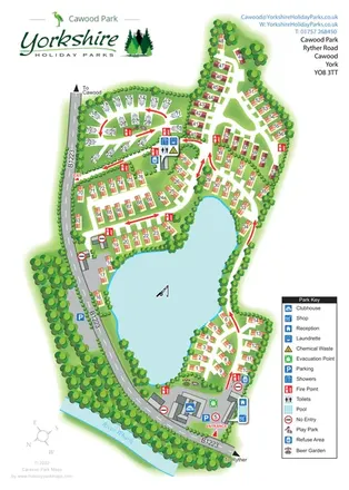
A lake-centred Cawood Park map with touring pitches, tree-lined holiday homes and clear entrance facilities.
Features may come from the sample artwork, its key or published park information. Approximate numbers describe the drawing and may cover only part of a park. They are intended to help you compare map examples. Current facilities and booking information should be checked with the park.
LET’S MAP YOUR PARK
For a map quotation, find your park and draw a rough boundary around it. The area you select helps us work out the design time and price.
Draw your park for a quote ↗Or talk to our map designers
01751 473136