
Tree-lined boundaries and grass plots
Continuous small tree and shrub symbols enclose much of the site. Larger broadleaf trees appear around the perimeter, entrance and spaces between homes.
ILLUSTRATED PARK MAP · P357
Walworth Castle Country Park, Walworth Rd, Darlington · United Kingdom
 Enlarge the map ↗
A SENSE OF THE PLACE
Walworth Retreat is based at Walworth Country Park, Walworth Road, Heighington Village, Darlington. The gated residential estate offers single-storey homes for people over 50.
The published policy permits up to two well-behaved dogs or cats per home. The operator describes a 16-acre countryside setting near Darlington.
LOOK CLOSER
Continuous small tree and shrub symbols enclose much of the site. Larger broadleaf trees appear around the perimeter, entrance and spaces between homes.
A red triangular pointer and prominent ENTRANCE label mark arrival from Walworth Road at the bottom of the plan.
A red-and-white barrier separates the entrance parking area from the internal residential road network.
Blue P symbols identify parking near the entrance and pub. Illustrated cars also occupy short driveways or hardstanding beside several homes.
Named beside the entrance, with terracotta-roofed buildings and beer-glass and cutlery symbols indicating a pub and food.
A white recycling symbol marks a point beside the lower internal road, near the homes closest to the entrance.
Repeated red extinguisher-and-flame symbols are positioned beside internal roads in different parts of the estate.
Dark-grey internal roads form a connected network of curves, short branches and turning ends, with smaller spurs serving individual homes.
A red triangular pointer and prominent ENTRANCE label mark arrival from Walworth Road at the bottom of the plan.
A red-and-white barrier separates the entrance parking area from the internal residential road network.
Blue P symbols identify parking near the entrance and pub. Illustrated cars also occupy short driveways or hardstanding beside several homes.
Named beside the entrance, with terracotta-roofed buildings and beer-glass and cutlery symbols indicating a pub and food.
A white recycling symbol marks a point beside the lower internal road, near the homes closest to the entrance.
Repeated red extinguisher-and-flame symbols are positioned beside internal roads in different parts of the estate.
Dark-grey internal roads form a connected network of curves, short branches and turning ends, with smaller spurs serving individual homes.
Continuous small tree and shrub symbols enclose much of the site. Larger broadleaf trees appear around the perimeter, entrance and spaces between homes.
The adjoining road framework is labelled, with directional arrows towards Darlington, Bishop Aukland, Heighington and Walworth Castle. The castle is a directional reference, not an illustrated on-site attraction.
A small grey compass rose in the lower-left margin indicates orientation, with north pointing towards the upper right of the page.
READING THE MAP
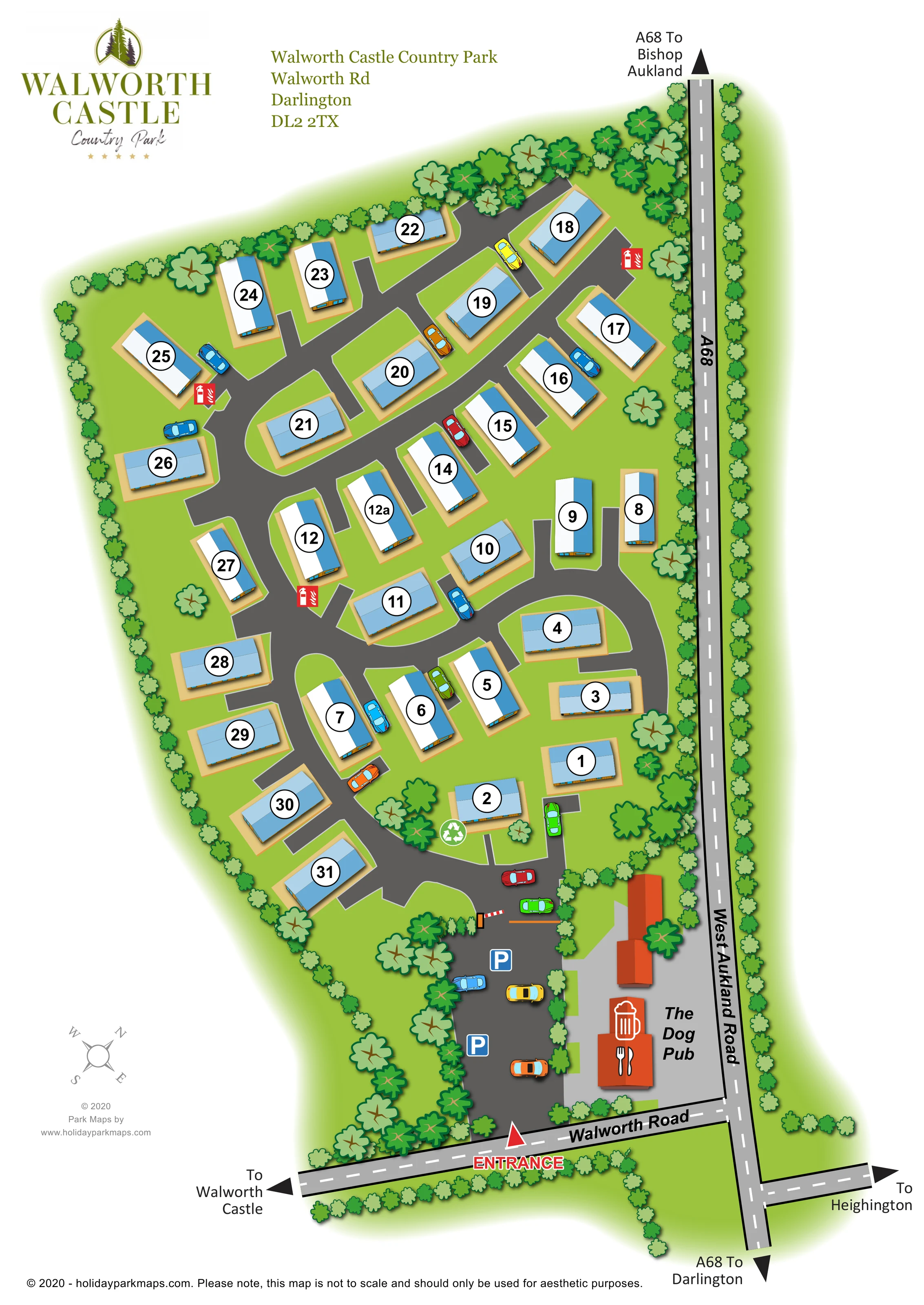
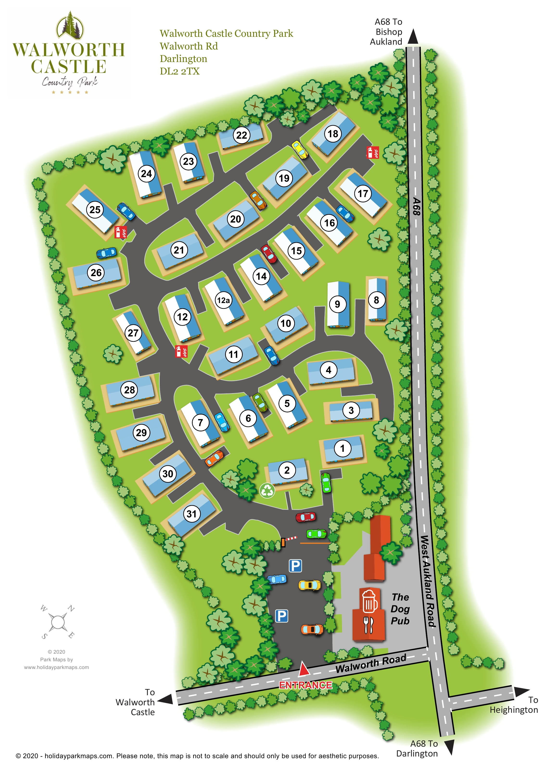
This illustrated map presents a compact park-home estate on Walworth Road near Darlington, branded in the artwork as Walworth Castle Country Park. Approximately 30 detached homes sit within a green, tree-lined boundary, connected by a network of curving estate roads and short driveway spurs. The plan gives each home a prominent numbered circle, making the individual plots easy to distinguish without overwhelming the drawing with text.
The arrival area is a particularly useful part of the composition. An entrance marker leads from Walworth Road into parking beside The Dog Pub, with a barrier showing the transition to the residential roads beyond. Fire-point symbols and a recycling marker add practical detail, while the adjoining A68 and arrows towards nearby destinations place the estate in its wider road setting.
Blue-and-white roofs, terracotta pub buildings and bright green planting create clear visual contrasts. For a residential park operator, this sample demonstrates how a relatively small estate can be presented as one coherent place, with its homes, entrance and surrounding connections all readable on a single portrait page.
The main plan occupies a tapered, irregular green footprint, with the broad residential area towards the top of the page and the entrance at the bottom. The A68 follows the right-hand boundary, labelled as West Aukland Road along its lower section. Walworth Road crosses the foreground, with a junction linking it to the larger road. Directional arrows point towards Darlington, Bishop Aukland, Heighington and Walworth Castle, giving the site a recognisable approach-road context without using a separate inset.
A red entrance triangle directs attention to the parking area beside The Dog Pub. Two blue parking symbols and several illustrated cars distinguish this arrival space from the home plots. Terracotta-roofed buildings, a beer-glass symbol and cutlery icon make the pub a strong landmark. Just beyond the parking area, a red-and-white barrier marks entry to the estate roads.
Within the residential area, charcoal roads curve around grass islands and branch into short access spurs. The homes are rotated to suit the layout rather than placed in a rigid grid. Each sits on a tan rectangular base and carries a large white circular number label; small façade details and shadows give the otherwise overhead view a little depth. Cars beside selected homes help explain the driveway arrangement. Red fire-point symbols are distributed along the roads, and a recycling emblem appears near the lower group of homes.
Rows of small trees and shrubs trace the boundaries, with larger broadleaf symbols filling selected gaps and framing the entrance. A soft green fade blends the site into the white background. The upper margin holds the park logo and address, while a small compass and designer credit sit to the lower left. This is one portrait map; the enlarged details show overlapping portions of the same artwork.
KEEP EXPLORING
Chosen for shared landscapes, accommodation or facilities.
 Explore the map ↗
United Kingdom
Illustrated Sanday aire map with a seasonal maze, café barn and motorhome service area.
 Explore the map ↗
United Kingdom
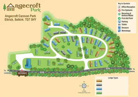
Tree-framed Angecroft Park map with colour-coded roofs, looping roads and a signed B709 entrance.
 Explore the map ↗
United Kingdom
Ashby Park map with seven fishing lakes, colour-coded accommodation and illustrated wooded shorelines.
Features may come from the sample artwork, its key or published park information. Approximate numbers describe the drawing and may cover only part of a park. They are intended to help you compare map examples. Current facilities and booking information should be checked with the park.
TAKE A CLOSER LOOK
View the illustrated map in detail or choose a file to download. These are sample maps; contact the park for current visitor information.


LET’S MAP YOUR PARK
For a map quotation, find your park and draw a rough boundary around it. The area you select helps us work out the design time and price.
Draw your park for a quote ↗Or talk to our map designers
01751 473136
 walworthcastlemap_large.png
 walworthcastlea_large.png
 walworthcastlemap.png