
Lake with a small planted island
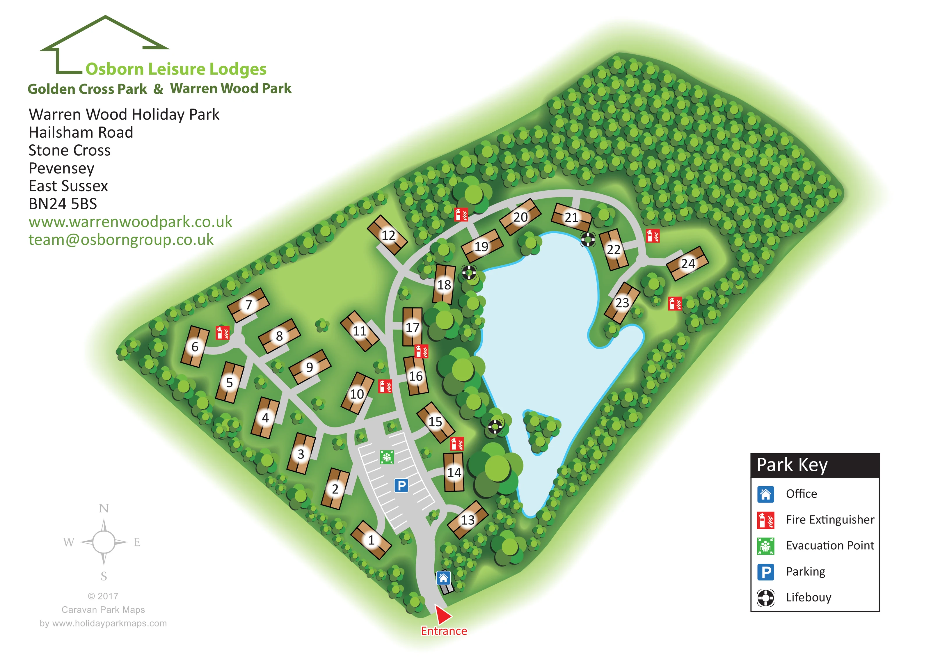
A large irregular lake dominates the right-hand side of the park, with a small tree-covered island in its lower portion.
ILLUSTRATED PARK MAP · P636
Hailsham Road, Stone Cross, Pevensey, East Sussex · United Kingdom
 Enlarge the map ↗
A SENSE OF THE PLACE
Warren Wood Country Park is based at Hailsham Road, Stone Cross, Pevensey, East Sussex. The lodge park is at Stone Cross near Pevensey, with woodland, open land and a lake. The dedicated sales page also advertises residential park homes with a residential licence.
Osborn offers holiday lodges with private hot tubs, including lakeside options at Warren Wood. The operator describes lakeside homes overlooking aquatic life and visiting birds.
LOOK CLOSER
A large irregular lake dominates the right-hand side of the park, with a small tree-covered island in its lower portion.
Dense woodland occupies the upper end of the site, while repeated tree clusters enclose the boundaries and soften the lakeside.
Broad green spaces separate the western lodges, with scattered small trees and larger planted groups.
A red arrow and Entrance label mark the arrival point at the bottom of the plan.
A grey entrance road branches around the central parking area and continues through the lodge groups, including a curved route around the upper end of the lake.
A small building beside the entrance road is identified by the blue office symbol explained in the key.
An elongated parking area near the entrance is drawn with white bay markings and a blue P symbol.
A green evacuation-point symbol is positioned within the central parking area.
A red arrow and Entrance label mark the arrival point at the bottom of the plan.
A grey entrance road branches around the central parking area and continues through the lodge groups, including a curved route around the upper end of the lake.
A small building beside the entrance road is identified by the blue office symbol explained in the key.
An elongated parking area near the entrance is drawn with white bay markings and a blue P symbol.
A green evacuation-point symbol is positioned within the central parking area.
Repeated red extinguisher symbols are distributed beside the lodge access roads.
Black-and-white lifebuoy symbols mark several positions around the lake edge.
A large irregular lake dominates the right-hand side of the park, with a small tree-covered island in its lower portion.
Dense woodland occupies the upper end of the site, while repeated tree clusters enclose the boundaries and soften the lakeside.
Broad green spaces separate the western lodges, with scattered small trees and larger planted groups.
Operator information describes holiday lodges with private hot tubs, including lakeside options; hot tubs are not individually depicted on this map.
READING THE MAP
This illustrated map of Warren Wood Country Park places the lake and woodland at the centre of the visitor’s understanding of the site. The artwork is titled Warren Wood Holiday Park and shows a small lodge development at Stone Cross, near Pevensey in East Sussex. Roughly 25 numbered lodges are arranged across open green grounds and around the water, with dense trees enclosing the upper end of the park.
The arrival sequence is easy to follow: a red entrance arrow leads towards the office, a clearly marked parking area and the branching internal roads. Large lodge numbers remain prominent against the green landscape, while a compact key explains the office, parking and safety symbols. The lake’s irregular outline, small planted island and surrounding tree clusters give the plan a recognisable focal point without overwhelming its practical information.
For a sample gallery, this is a useful example of a landscape-led lodge park map: a compact accommodation layout made legible through restrained building symbols, strong numbering and a clear distinction between roads, water and planting.
The single-page plan presents Warren Wood diagonally across a white landscape sheet. Its entrance sits at the lower tip, where a red arrow directs attention to the grey access road. A small office building stands just inside the entrance, followed by an elongated car park with white bay markings. The blue parking symbol and green evacuation-point marker make this a clear arrival landmark.
Beyond the parking area, the road network branches through two contrasting accommodation settings. On the left, lodges sit within relatively open green space, reached by curved roads and short approaches. On the right, a chain of lodges follows the lake’s western edge and continues around its upper shore. Each unit is drawn as a black-outlined, two-tone brown roof, with a large number placed over a soft white halo. Varied building angles help express the informal arrangement without adding unnecessary architectural detail.
The pale-blue lake is the dominant landscape feature. Its cyan outline defines an irregular shore, and a small wooded island appears towards the lower end. Larger tree clusters frame the water, while dense repeated canopies form a woodland block across the top of the site. Fire extinguisher symbols appear beside the roads, and lifebuoy symbols are positioned around the lake.
A boxed Park Key occupies the lower-right margin. Operator branding and the park address fill the upper-left space, balanced by a compass rose and designer credit below. The accompanying detail views enlarge the entrance and key from this same artwork; they are not separate park sections or additional layouts.
KEEP EXPLORING
Chosen for shared landscapes, accommodation or facilities.
 Explore the map ↗
United Kingdom
Illustrated lakeside park plan with numbered holiday units, leisure buildings and a looping Woodland Walk.
 Explore the map ↗
United Kingdom
Colour-coded accommodation, lakeside facilities and woodland routes at Burton Constable Holiday Park & Arboretum.
 Explore the map ↗
United Kingdom
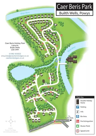
Portrait holiday-home park map with riverside loops, a tree-fringed pond and a separate manor landmark.
Features may come from the sample artwork, its key or published park information. Approximate numbers describe the drawing and may cover only part of a park. They are intended to help you compare map examples. Current facilities and booking information should be checked with the park.
LET’S MAP YOUR PARK
For a map quotation, find your park and draw a rough boundary around it. The area you select helps us work out the design time and price.
Draw your park for a quote ↗Or talk to our map designers
01751 473136