
Tree-rich grounds and wooded side area
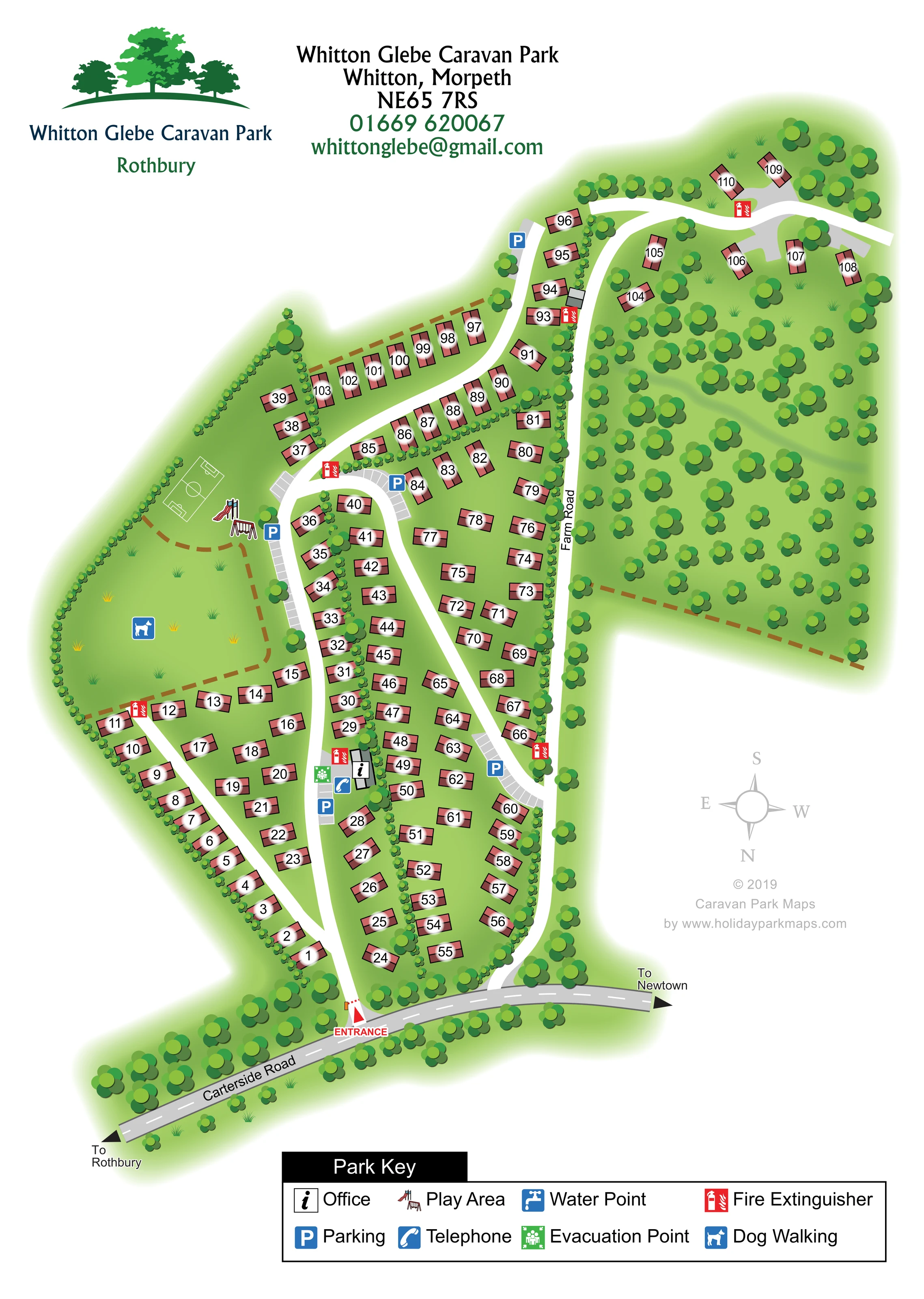
Numerous rounded tree symbols fill the large area to the right of Farm Road, surround the upper caravan group and line the park's edges.
ILLUSTRATED PARK MAP · P646
Whitton Glebe Caravan Park, Rothbury, Northumberland · United Kingdom
 Enlarge the map ↗
A SENSE OF THE PLACE
Whitton Glebe is a family-run static caravan park near Rothbury in Northumberland. Its grounds occupy the south-facing side of the Coquet valley.
Caravans have mains services and park-wide Wi-Fi is advertised. The map shows the arrangement of holiday caravans and access routes; touring caravans and tent camping are not part of the operator's published offering.
LOOK CLOSER
Numerous rounded tree symbols fill the large area to the right of Farm Road, surround the upper caravan group and line the park's edges.
Small repeated shrubs divide some caravan rows and trace the perimeter, while broad green spaces distinguish recreation and wooded areas from accommodation.
A small grey building marked with the office information symbol stands beside the main internal road, partway in from the entrance.
Blue parking symbols and pale grey marked bays appear beside the office, play area and several caravan groups.
Illustrated slide and swing equipment occupy the open recreation space on the left of the plan.
A white-outlined rectangular pitch with a centre circle and goal markings is drawn beside the play equipment; it is not separately named in the key.
A blue dog-walking symbol identifies the broad grassy area below the play equipment on the left of the plan.
A blue telephone symbol is positioned beside the office and nearby parking.
A small grey building marked with the office information symbol stands beside the main internal road, partway in from the entrance.
Blue parking symbols and pale grey marked bays appear beside the office, play area and several caravan groups.
Illustrated slide and swing equipment occupy the open recreation space on the left of the plan.
A white-outlined rectangular pitch with a centre circle and goal markings is drawn beside the play equipment; it is not separately named in the key.
A blue dog-walking symbol identifies the broad grassy area below the play equipment on the left of the plan.
A blue telephone symbol is positioned beside the office and nearby parking.
A green evacuation-point symbol appears beside the office cluster.
Red fire-extinguisher symbols are distributed through the caravan areas, including near the office and in the upper extension.
The key includes a blue tap symbol for a water point; a corresponding position is not clearly identifiable on the plan.
A red ENTRANCE label and triangular marker identify the connection between Carterside Road and the principal internal drive.
The grey external road crosses the foot of the plan, with arrows towards Rothbury to the left and Newtown to the right.
A named route follows the right side of the main caravan area and continues towards the upper wooded extension.
Broad white drives form elongated loops and branches between the caravan rows, connecting the entrance, office, recreation space and upper plots.
Numerous rounded tree symbols fill the large area to the right of Farm Road, surround the upper caravan group and line the park's edges.
Small repeated shrubs divide some caravan rows and trace the perimeter, while broad green spaces distinguish recreation and wooded areas from accommodation.
READING THE MAP
This illustrated map of Whitton Glebe Caravan Park near Rothbury presents a tree-rich static caravan park in Northumberland's Coquet valley. Approximately 110 caravan plots are shown, arranged along curving drives with a smaller, more spacious group extending into the wooded upper part of the plan. Rather than treating the site as a simple grid, the artwork makes its irregular shape, planted boundaries and distinct open spaces easy to recognise.
Arrival is clearly marked from Carterside Road, with onward directions to Rothbury and Newtown. Inside the park, numbered caravan symbols lead visitors through the accommodation areas, while blue parking icons and bright safety symbols stand out against the green grounds. The office, telephone and evacuation point form a recognisable cluster beside the main drive. Elsewhere, illustrated play equipment, a small marked games pitch and a dog-walking area give the open recreation space a clear purpose.
The portrait layout combines a substantial site illustration with tree-themed park branding, contact details and a wide bottom key. It is a useful sample for static caravan parks needing plot-level navigation without losing the character of a leafy rural setting.
The plan begins at Carterside Road, drawn as a grey road across the lower edge with arrows towards Rothbury and Newtown. A red entrance marker leads into a broad white drive. From here, the internal roads curve through elongated groups of numbered caravans, with a small office building, telephone, parking and evacuation-point symbol forming a useful landmark partway into the site.
The main accommodation area is relatively compact, but the rows are staggered and angled rather than rigidly rectangular. Pink caravan symbols follow the changing road alignment, and narrow shrub belts separate several groups. Parking bays are drawn as pale grey strips with white divisions, reinforced by blue P symbols at selected locations. Red fire-extinguisher markers recur across the plan.
On the left, a broad green space contains a dog-walking symbol, illustrated swings and a slide, and a small white-lined games pitch. On the right, Farm Road separates the main caravan rows from a substantial tree-filled area. The upper extension includes both a short roadside row and more widely spaced caravans among trees. Brown dashed lines appear along some landscape divisions, but the key does not assign them a specific function.
The artwork uses an overhead layout with lightly shaded structures, rounded tree canopies and soft green margins. A south-up compass explains its orientation. The bottom key identifies eight amenity and safety symbols, including a water point whose location is not clearly shown in the plan. The legend enlargements reproduce parts of this same single-page artwork rather than separate park sections.
KEEP EXPLORING
Chosen for shared landscapes, accommodation or facilities.
 Explore the map ↗
United Kingdom
Woodland-framed Barnsoul map with mixed accommodation, shared facilities and paw-marked walking routes.
 Explore the map ↗
United Kingdom
A wooded, streamside park map with a linked farm, café, touring and cottage area.
 Explore the map ↗
United Kingdom
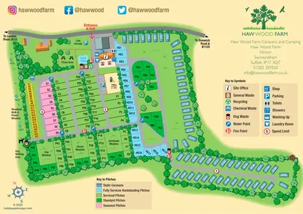
Colour-coded pitches, a leafy facilities hub and a long static-caravan wing at Haw Wood Farm, Suffolk.
Features may come from the sample artwork, its key or published park information. Approximate numbers describe the drawing and may cover only part of a park. They are intended to help you compare map examples. Current facilities and booking information should be checked with the park.
TAKE A CLOSER LOOK
View the illustrated map in detail or choose a file to download. These are sample maps; contact the park for current visitor information.


LET’S MAP YOUR PARK
For a map quotation, find your park and draw a rough boundary around it. The area you select helps us work out the design time and price.
Draw your park for a quote ↗Or talk to our map designers
01751 473136