
Small southern pond
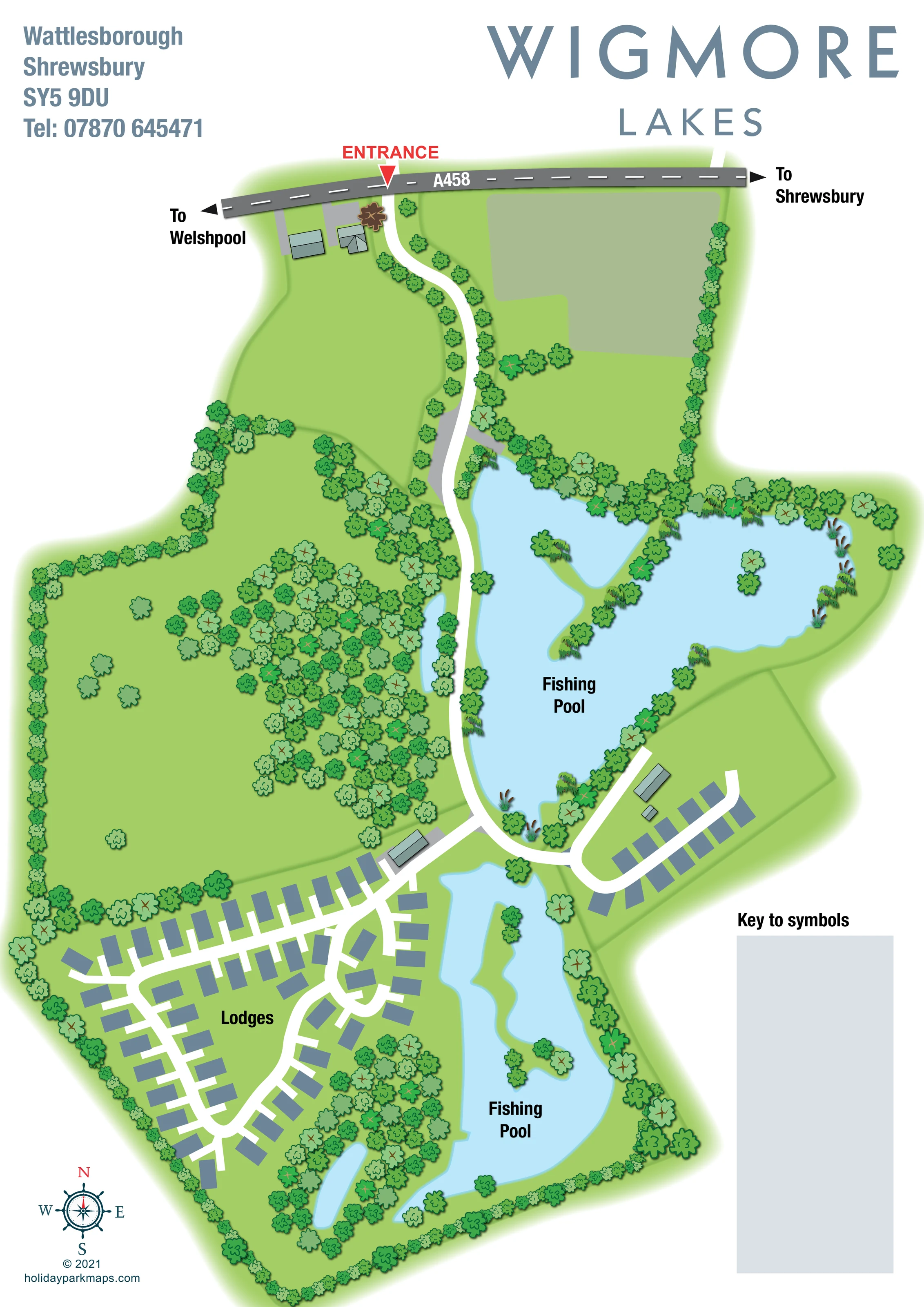
A separate narrow, unlabelled water body sits within trees south of the lodge area and west of the lower fishing pool.
ILLUSTRATED PARK MAP · P647
Wigmore Lakes, Wattlesborough, Halfway House, Shropshire · United Kingdom
 Enlarge the map ↗
A SENSE OF THE PLACE
Wigmore Lakes is based at Wattlesborough, Halfway House, Shropshire. The park overlooks two fishing lakes towards the South Shropshire hills near the Welsh border. The park provides holiday lodges, lodge plots, tent camping and touring caravan pitches. The touring page describes pitches with water, wastewater, electricity and television connections.
Children are accepted, but the touring page explicitly says there is no play area or games provision for them. The lakes contain carp and mixed coarse fish; guest fishing is described as carrying a daily charge. A heated washroom block provides showers and toilets, with kitchen preparation and dining space for campers.
LOOK CLOSER
A separate narrow, unlabelled water body sits within trees south of the lodge area and west of the lower fishing pool.
Dense woodland occupies the central-western area, with further trees around the southern pond, lake margins and much of the site boundary.
Large open green areas lie north and west of the lakes. A muted grey-green polygon occupies part of the north-eastern area, without a stated use.
Irregular banks, narrow projecting landforms, trees and reed-like illustrations give the fishing pools a naturalistic outline.
Two substantial pale-blue water bodies are each labelled 'Fishing Pool', forming the main landscape landmarks through the centre and east of the plan.
A red entrance label and downward triangle identify the site access directly from the A458 at the top of the plan.
Black arrows at either end of the A458 point towards Welshpool on the left and Shrewsbury on the right.
A winding white entrance road follows the western side of the upper fishing pool before dividing towards the main lodge area and the smaller eastern accommodation group.
Two substantial pale-blue water bodies are each labelled 'Fishing Pool', forming the main landscape landmarks through the centre and east of the plan.
A separate narrow, unlabelled water body sits within trees south of the lodge area and west of the lower fishing pool.
Dense woodland occupies the central-western area, with further trees around the southern pond, lake margins and much of the site boundary.
Large open green areas lie north and west of the lakes. A muted grey-green polygon occupies part of the north-eastern area, without a stated use.
Irregular banks, narrow projecting landforms, trees and reed-like illustrations give the fishing pools a naturalistic outline.
A red entrance label and downward triangle identify the site access directly from the A458 at the top of the plan.
Black arrows at either end of the A458 point towards Welshpool on the left and Shrewsbury on the right.
A winding white entrance road follows the western side of the upper fishing pool before dividing towards the main lodge area and the smaller eastern accommodation group.
Several buildings have outlined, shaded roof illustrations near the entrance and accommodation junctions. Their functions are not identified.
A decorative compass in the lower-left margin shows north towards the top of the page.
READING THE MAP
This illustrated map of Wigmore Lakes in Wattlesborough, Shropshire, puts the park’s fishing lakes and wooded setting at the centre of the page. Two large pale-blue pools run through the plan, with the main lodge area arranged to their south-west and a smaller group of accommodation-style footprints beside the upper pool. The result is a landscape-led overview rather than a densely labelled pitch plan.
Arrival is easy to follow visually: the A458 crosses the top of the artwork, with arrows towards Welshpool and Shrewsbury and a red marker identifying the entrance. A winding white drive leads through trees to the lakeside junction, where the accommodation routes divide. Rounded road loops and short access branches explain the lodge layout without individual plot numbers.
The portrait design uses fresh greens, slate blue-grey buildings and a generous white background. Varied tree symbols, irregular shorelines and a small southern pond give the site its particular character, while the large Wigmore Lakes heading establishes a clear branded introduction.
The single portrait plan places the A458 along its northern edge, immediately below the title and address block. A red entrance pointer marks the start of a white access road that curves south through a tree-lined corridor. Open green land occupies much of the northern and western site, while an unlabelled grey-green area appears in the north-east. Several shaded roof illustrations identify buildings, although their functions are not named.
The upper fishing pool has a broad, irregular outline, with tree-covered projecting banks and small reed-like details. The entrance road follows its western side before reaching a junction near the pool’s southern end. From here, one route turns east into a compact curved accommodation spur; another continues into the larger area labelled 'Lodges'. Blue-grey rectangles line the roads, each approached by a short white connection. The main lodge network combines extended rows with branching lanes and rounded turning loops.
A second, more elongated fishing pool lies to the east of the main lodge area. Its narrow upper section opens into a wider southern basin, with planted projections breaking up the shoreline. A separate slim pond is tucked into woodland further south-west. Dense tree clusters and perimeter belts help distinguish the accommodation, water and open land without relying on many labels.
The lower-left corner contains a decorative compass rose and designer credit. At lower right, a pale-grey panel headed 'Key to symbols' has no visible entries. The two detail images enlarge portions of this same artwork, showing the lodge-road treatment, southern landscaping and key panel; they are not separate park sections or additional plans.
KEEP EXPLORING
Chosen for shared landscapes, accommodation or facilities.
 Explore the map ↗
United Kingdom
Woodland camping, lodges, lakes and colour-coded bike trails at Avon Tyrrell Outdoor Centre.
 Explore the map ↗
United Kingdom
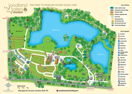
A lakeside holiday-park and fishery map with numbered accommodation, fishing positions and clearly grouped visitor services.
 Explore the map ↗
United Kingdom
Lake-led holiday park map with colour-coded pitches, named lodges and a paw-print woodland route.
Features may come from the sample artwork, its key or published park information. Approximate numbers describe the drawing and may cover only part of a park. They are intended to help you compare map examples. Current facilities and booking information should be checked with the park.
LET’S MAP YOUR PARK
For a map quotation, find your park and draw a rough boundary around it. The area you select helps us work out the design time and price.
Draw your park for a quote ↗Or talk to our map designers
01751 473136