
Central open lawn
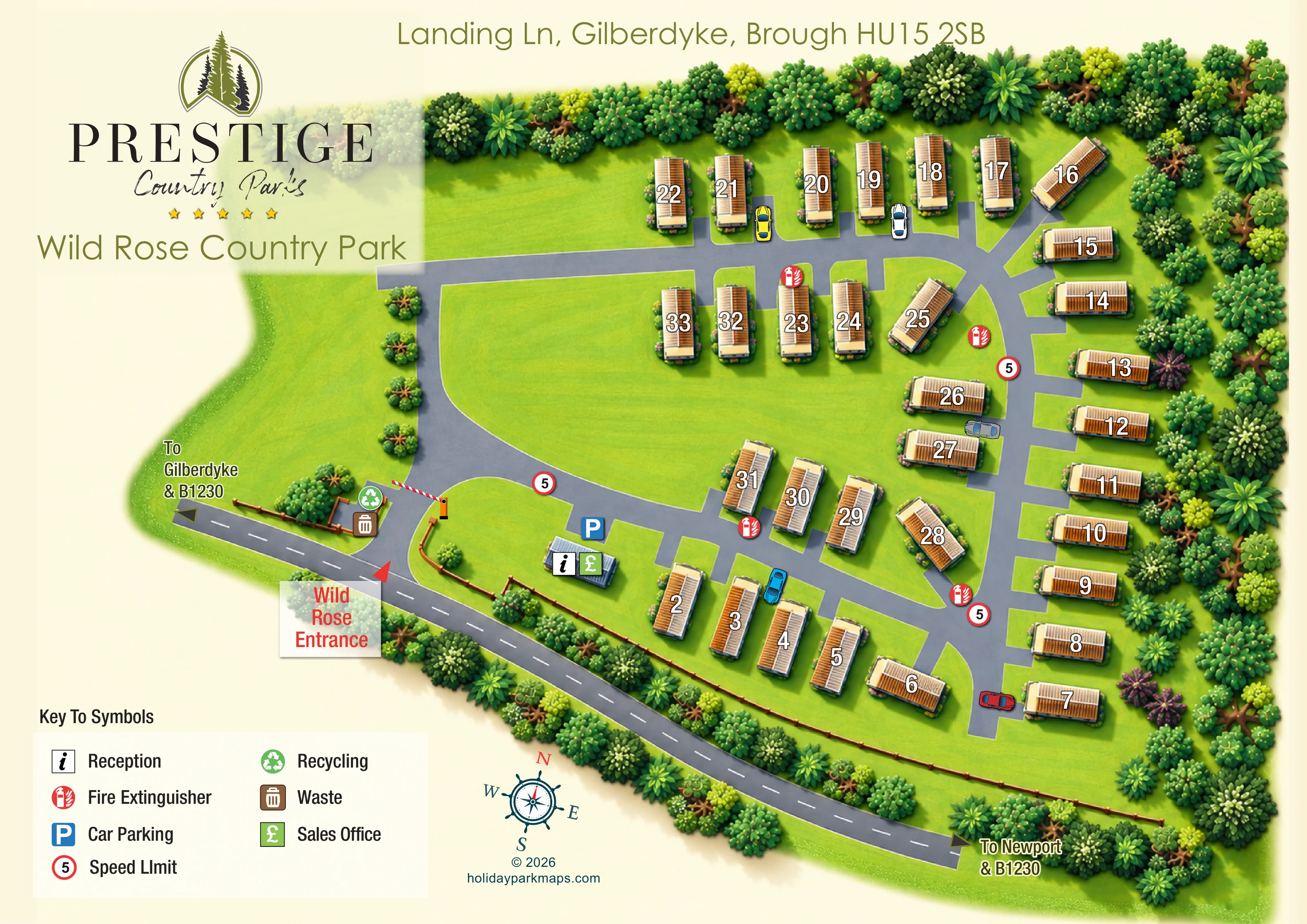
A broad, unbuilt grassy area occupies the centre-left of the layout, enclosed by the internal roads. It is not labelled as a specific recreational facility.
ILLUSTRATED PARK MAP · P367
Wild Rose Country Park, Landing Ln, Gilberdyke, Brough · United Kingdom
 Enlarge the map ↗
A SENSE OF THE PLACE
Wild Rose Country Park is a holiday lodge ownership park near Gilberdyke and Howden in East Yorkshire. Its countryside location is intended as a quieter setting for lodge owners.
The park forms part of the Prestige Country Parks collection. The map shows Wild Rose's own lodge layout and internal routes, helping owners and visitors understand the arrangement of the grounds.
LOOK CLOSER
A broad, unbuilt grassy area occupies the centre-left of the layout, enclosed by the internal roads. It is not labelled as a specific recreational facility.
Dense illustrated trees and shrubs frame the northern and eastern edges and the frontage road. Smaller planting clusters accent lodge plots and the entrance.
A low brown post-and-rail fence separates much of the accommodation grounds from the roadside planting and frontage road.
An information symbol identifies reception in the small building just inside the entrance, beside the southern internal road.
A green pound-sign symbol shares the reception building, identifying the sales office.
A blue parking symbol marks the area beside reception. Several illustrated cars also show how vehicles sit beside lodge plots, without defining a separate parking capacity.
Green recycling and brown waste symbols are grouped in a small paved area immediately beside the entrance barrier.
Repeated red extinguisher symbols identify points around the internal accommodation roads.
An information symbol identifies reception in the small building just inside the entrance, beside the southern internal road.
A green pound-sign symbol shares the reception building, identifying the sales office.
A blue parking symbol marks the area beside reception. Several illustrated cars also show how vehicles sit beside lodge plots, without defining a separate parking capacity.
Green recycling and brown waste symbols are grouped in a small paved area immediately beside the entrance barrier.
Repeated red extinguisher symbols identify points around the internal accommodation roads.
A red entrance callout points to the access from the frontage road. A red-and-white lifting barrier is illustrated across the internal entrance lane.
Grey roads form a circuit around the broad central lawn, with short branches and individual paved approaches serving lodge groups.
Red-ringed signs displaying 5 appear at several internal road locations and are explained in the key.
Arrows at either end of the frontage road point towards Gilberdyke and the B1230 on the left, and Newport and the B1230 on the right.
A broad, unbuilt grassy area occupies the centre-left of the layout, enclosed by the internal roads. It is not labelled as a specific recreational facility.
Dense illustrated trees and shrubs frame the northern and eastern edges and the frontage road. Smaller planting clusters accent lodge plots and the entrance.
A low brown post-and-rail fence separates much of the accommodation grounds from the roadside planting and frontage road.
READING THE MAP
This illustrated map of Wild Rose Country Park presents a compact lodge ownership park at Gilberdyke in East Yorkshire. Around 30 lodge illustrations sit within a green, tree-framed layout, with a broad central lawn giving the plan an open focal point. The elevated view combines the clarity of a site plan with visible roofs, planted borders and shadows that make the individual holiday homes easy to recognise.
Arrival is clearly established from the road along the lower edge. A red entrance callout, lifting barrier and nearby recycling and waste symbols lead the eye towards reception, the sales office and parking. Grey internal roads then connect the perimeter rows and smaller lodge groups, with large plot numbers providing the main accommodation references.
The page also gives substantial space to the Prestige Country Parks identity, the Wild Rose name and the park address. A compact key, compass and directions towards Gilberdyke, Newport and the B1230 complete a design that serves both visitor orientation and the presentation of a countryside lodge development.
The plan is organised around a broad lawn on the centre-left, with a grey road circuit linking the entrance, northern lodge row, eastern accommodation spine and southern plots. Short paved branches reach the smaller internal groups. The lodges change orientation to follow the road geometry: some form straight rows, while others sit diagonally at bends and junctions. Each has a large white plot number outlined in dark grey, laid over a warm-toned pitched roof.
At the lower-left arrival point, a red-and-white barrier spans the access lane. Recycling and waste symbols mark a small paved area beside it. Just inside the grounds, the reception and sales office occupy a single blue-grey-roofed building, with a parking marker adjacent. Red fire-extinguisher symbols and signs displaying a speed limit of 5 appear at intervals along the internal roads. These are practical wayfinding details rather than additional accommodation or leisure buildings.
Dense trees and shrubs wrap around the top and right-hand boundaries. More planting follows the frontage road, where a low brown fence separates the grounds from the roadside edge. Individual shrubs and small flower beds soften the lodge plots, while a few illustrated cars provide scale and visual context. Direction arrows on the frontage road identify routes towards Gilberdyke, Newport and the B1230.
The single landscape-format artwork places the large Prestige Country Parks logo and Wild Rose title above the entrance side of the plan. The full address runs across the top, and the lower-left key explains seven operational symbols. A decorative compass and designer credit sit beneath the map. The enlarged details show portions of this same page, including the legend and southern road direction.
KEEP EXPLORING
Chosen for shared landscapes, accommodation or facilities.
 Explore the map ↗
United Kingdom
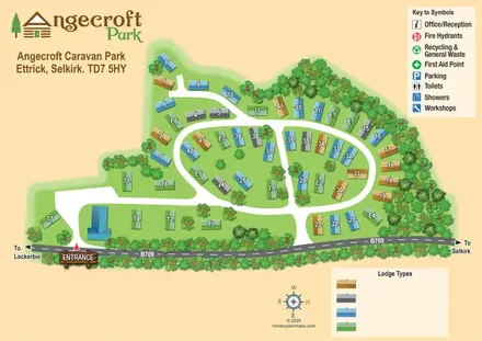
Tree-framed Angecroft Park map with colour-coded roofs, looping roads and a signed B709 entrance.
 Explore the map ↗
United Kingdom
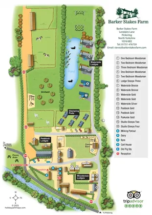
Portrait farm-stay map with pond-side lodges, glamping pods, orchard and illustrated animal paddocks.
 Explore the map ↗
United Kingdom
Woodland-framed Barnsoul map with mixed accommodation, shared facilities and paw-marked walking routes.
Features may come from the sample artwork, its key or published park information. Approximate numbers describe the drawing and may cover only part of a park. They are intended to help you compare map examples. Current facilities and booking information should be checked with the park.
LET’S MAP YOUR PARK
For a map quotation, find your park and draw a rough boundary around it. The area you select helps us work out the design time and price.
Draw your park for a quote ↗Or talk to our map designers
01751 473136