
Enclosed dog walking area
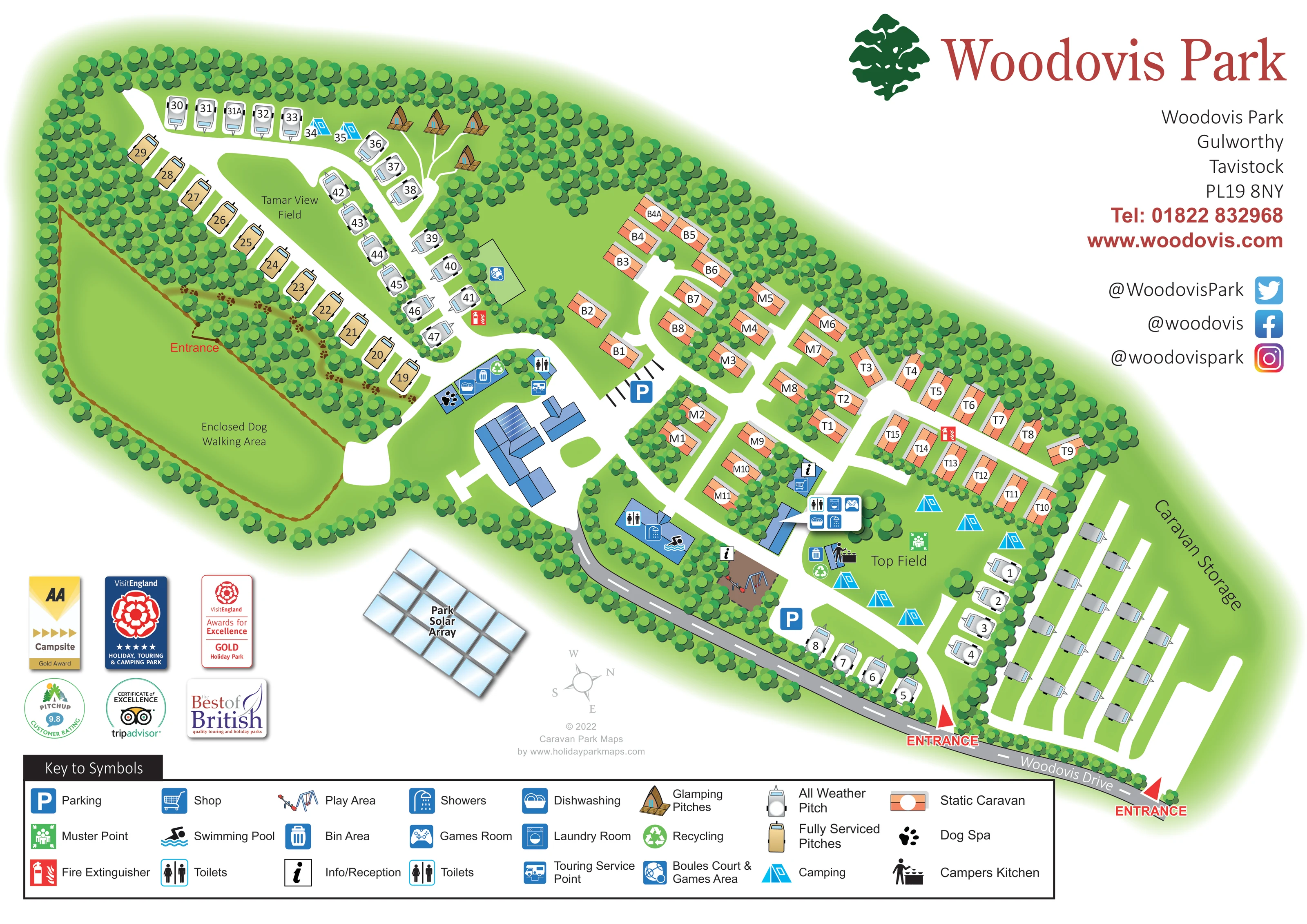
A large fenced grass enclosure occupies the western end of the plan, with its own labelled entrance near Tamar View Field.
ILLUSTRATED PARK MAP · P651
Woodovis Park, Gulworthy, Tavistock · United Kingdom
 Enlarge the map ↗
A SENSE OF THE PLACE
Woodovis Park is a small holiday park near Tavistock on the edge of the Tamar Valley in Devon. Camping, touring, glamping and holiday caravans provide a choice of accommodation.
An indoor heated swimming pool and spa pool are among the shared facilities, alongside a shop, games room and laundry. Dartmoor and the surrounding West Country provide opportunities for outings beyond the park.
LOOK CLOSER
A large fenced grass enclosure occupies the western end of the plan, with its own labelled entrance near Tamar View Field.
Two named grass areas provide the main geographical anchors for the touring and camping accommodation.
Dense illustrated trees wrap the perimeter and separate accommodation rows, facilities and the dog-walking enclosure.
Information symbols identify the main shop/reception building beside Top Field and a further information point near the play area.
A shopping-trolley symbol marks the building between the static-caravan groups and Top Field.
A swimmer symbol identifies the blue-roofed pool building beside the southern internal route.
A games-controller symbol is included in the facility cluster beside Top Field.
Illustrated swings and play equipment sit between the pool building and the southern parking area.
Information symbols identify the main shop/reception building beside Top Field and a further information point near the play area.
A shopping-trolley symbol marks the building between the static-caravan groups and Top Field.
A swimmer symbol identifies the blue-roofed pool building beside the southern internal route.
Published park information describes the swimming pool as indoor and heated and also mentions a spa pool; these details are not separately identified on the map.
A games-controller symbol is included in the facility cluster beside Top Field.
Illustrated swings and play equipment sit between the pool building and the southern parking area.
A rectangular green court with the matching blue symbol lies between Tamar View Field and the western static-caravan group.
A black cooking symbol marks a shared kitchen on the western edge of the Top Field camping lawn.
Grouped sanitary symbols identify shared facilities near Tamar View Field, at the pool building and beside Top Field.
The laundry symbol appears in the shared-facility callout beside Top Field.
Dishwashing symbols appear in the western touring-service cluster and the Top Field facility callout.
A touring-service symbol is placed beside the western shared facilities, close to the route into Tamar View Field.
Blue bin symbols and green recycling symbols mark grouped waste facilities near the western service area and Top Field.
A black paw symbol identifies the dog spa beside the western service buildings.
A large fenced grass enclosure occupies the western end of the plan, with its own labelled entrance near Tamar View Field.
Blue P symbols mark parking beside the western central buildings and near Top Field's southern entrance.
Red triangular arrows identify the main park entrance and a separate entrance to the caravan-storage area from Woodovis Drive.
A separately labelled eastern compound contains rows of grey caravan illustrations and its own access. These are not holiday-accommodation pitches.
A detached illustration of blue solar panels sits below the western half of the park and is labelled Park Solar Array.
A green assembly-point symbol is shown within Top Field.
Red extinguisher symbols appear in the western touring area and among the eastern static caravans.
Two named grass areas provide the main geographical anchors for the touring and camping accommodation.
Dense illustrated trees wrap the perimeter and separate accommodation rows, facilities and the dog-walking enclosure.
READING THE MAP
This illustrated map of Woodovis Park brings together a varied holiday-park layout near Tavistock in Devon. Touring pitches, static caravans, camping lawns and a small glamping cluster are shown within a strong framework of trees, with Tamar View Field and Top Field providing clear reference points. The result is a visitor plan that explains both where guests stay and how the different parts of the park connect.
The artwork gives particular attention to shared facilities. Blue pictograms identify the swimming pool, shop, games room and practical touring amenities, while miniature play equipment and pod illustrations add recognisable landmarks. A large enclosed dog-walking area occupies the western end, and the dog spa, campers kitchen, boules court and solar array give the map a distinctive character.
Woodovis Drive and its entrance arrows establish arrival from the lower edge of the page. The main illustration is paired with prominent park branding, contact information and a broad symbol key, making this a useful sample for a mixed-accommodation park needing one coherent guest-facing map.
The plan follows an elongated, tree-lined site presented diagonally across the page. At the western end, Tamar View Field is surrounded by touring pitches, with gold symbols distinguishing fully serviced pitches from the grey all-weather type. Four illustrated glamping pods sit along the northern tree belt, close to a small camping area. Below this field, a substantial fenced enclosure is labelled as the dog-walking area, with its entrance marked along the upper boundary.
Static caravans occupy the central and eastern sections in short rows and branching lane groups. Orange unit illustrations carry white letter-and-number labels, while trees break up the rows and help distinguish neighbouring accommodation pockets. Top Field forms the main open camping lawn towards the lower right, bordered by touring pitches and shared facilities. Beyond it, the caravan-storage compound is visibly separate and has its own entrance from Woodovis Drive.
The facility symbols are concentrated around recognisable blue-roofed buildings and route junctions. They identify the swimming pool, shop and reception, games room, toilets, showers, laundry and dishwashing facilities. Other mapped amenities include a touring service point, campers kitchen, dog spa, play area and boules court. Parking, bins, recycling, fire extinguishers and a muster point add practical orientation information without requiring lengthy labels beside every feature.
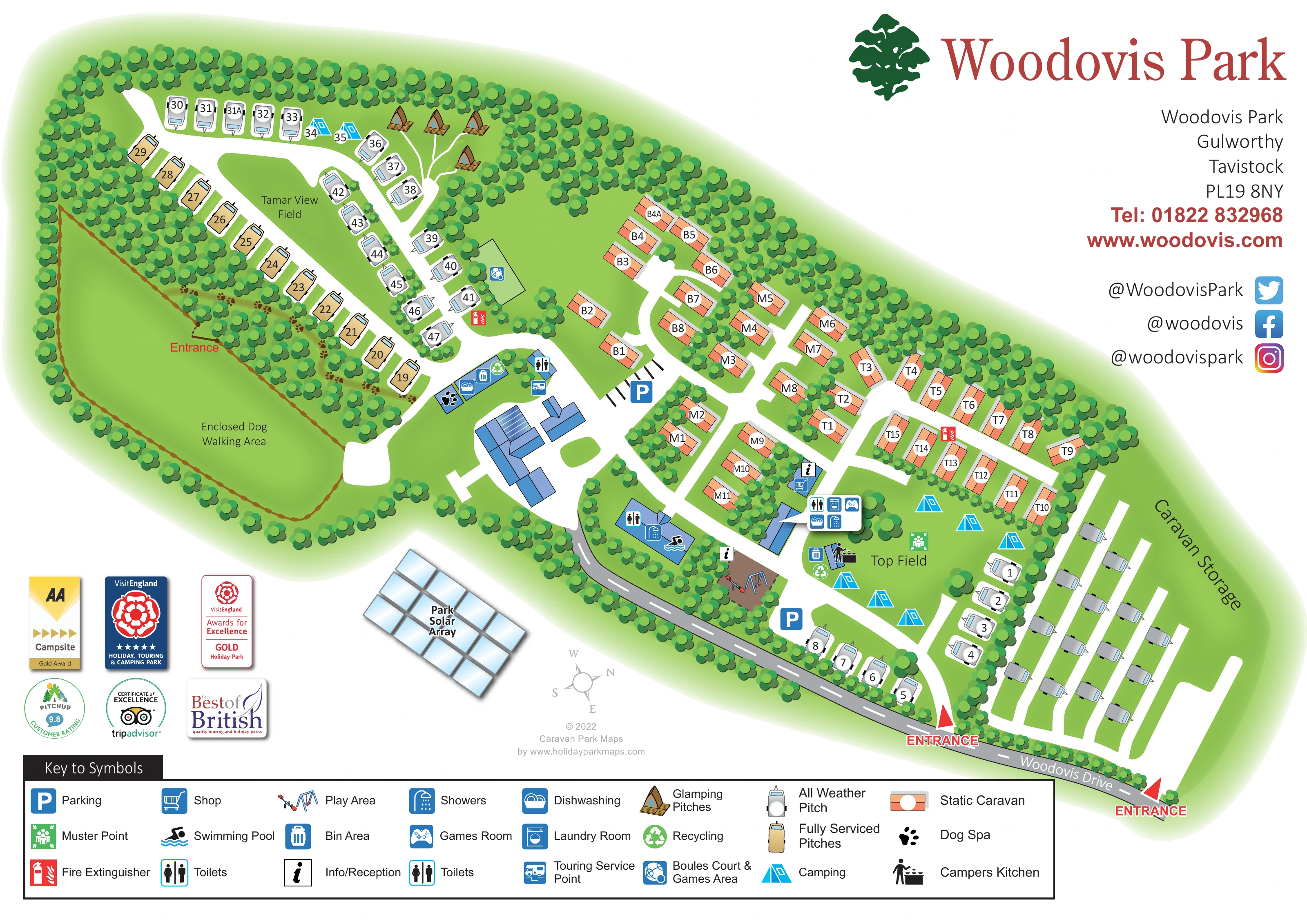
A labelled solar-panel illustration sits below the western part of the park. The right-hand branding panel carries the park name, address and contact details, while award badges occupy the lower-left margin. A full-width key explains the symbols beneath the plan. The two accompanying detail views enlarge this same legend rather than showing additional park sections.
KEEP EXPLORING
Chosen for shared landscapes, accommodation or facilities.
 Explore the map ↗
United Kingdom
Woodland-framed Barnsoul map with mixed accommodation, shared facilities and paw-marked walking routes.
 Explore the map ↗
United Kingdom
A colour-zoned coastal park map with touring areas, woodland trails, ponds and a leisure club.
 Explore the map ↗
United Kingdom
Riverside park map with named pitch fields, illustrated huts and a paw-print dog walk.
Features may come from the sample artwork, its key or published park information. Approximate numbers describe the drawing and may cover only part of a park. They are intended to help you compare map examples. Current facilities and booking information should be checked with the park.
TAKE A CLOSER LOOK
View the illustrated map in detail or choose a file to download. These are sample maps; contact the park for current visitor information.


LET’S MAP YOUR PARK
For a map quotation, find your park and draw a rough boundary around it. The area you select helps us work out the design time and price.
Draw your park for a quote ↗Or talk to our map designers
01751 473136
 woodovisparkmap_large.png