
Pond with wooded islands
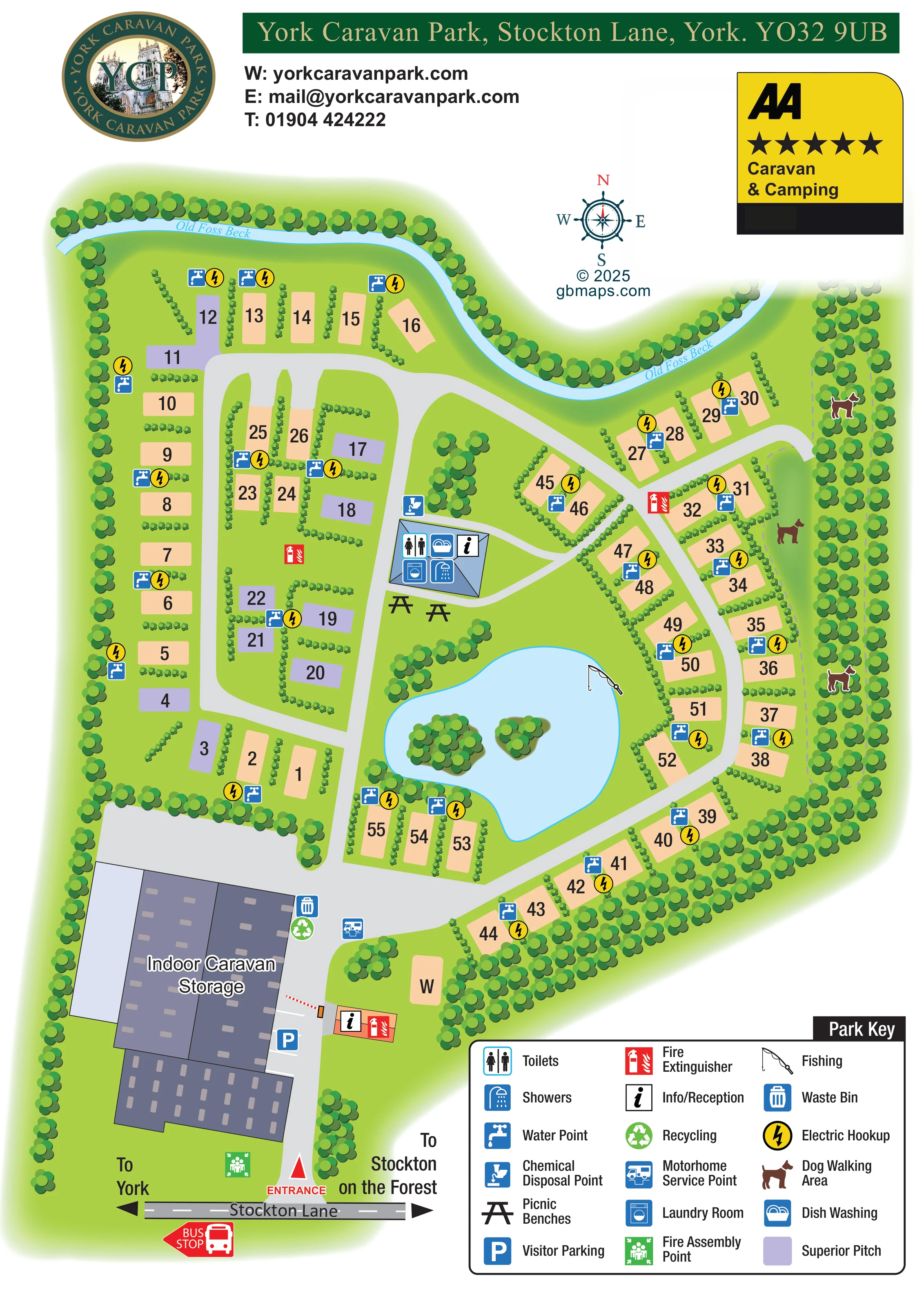
The pale-blue pond contains two small tree-covered islands and is bordered by grass, planting and pitches.
ILLUSTRATED PARK MAP · P384
York Caravan Park, Stockton Lane, York · United Kingdom
 Enlarge the map ↗
A SENSE OF THE PLACE
York Caravan Park offers adults-only touring and camping on Stockton Lane in York. A countryside setting combines with access to the city's historic centre.
The park is designed for a quieter stay for adult visitors bringing their own touring or camping accommodation. Local transport information helps guests plan trips into York, while the map shows the pitch layout and shared facilities.
LOOK CLOSER
The pale-blue pond contains two small tree-covered islands and is bordered by grass, planting and pitches.
A named, tree-lined watercourse curves along the northern boundary of the park.
Dense tree belts frame the site, while short hedge rows separate many pitches and small planted clusters break up the interior.
Information/reception symbols appear on the small entrance-side building and the central facilities building.
A cluster of symbols on the central blue-roofed building identifies toilets, showers, dish washing and a laundry room.
Blue tap symbols and yellow lightning symbols recur throughout the pitch groups.
A chemical disposal symbol is placed beside the central facilities building.
A motorhome service symbol is located on the entrance-side circulation area near the storage building.
Information/reception symbols appear on the small entrance-side building and the central facilities building.
A cluster of symbols on the central blue-roofed building identifies toilets, showers, dish washing and a laundry room.
Blue tap symbols and yellow lightning symbols recur throughout the pitch groups.
A chemical disposal symbol is placed beside the central facilities building.
A motorhome service symbol is located on the entrance-side circulation area near the storage building.
Waste and recycling symbols are grouped beside the indoor caravan storage building.
Two illustrated benches sit immediately south of the central facilities building, between the building and the pond.
A fishing-rod symbol marks the irregular pond in the lower central part of the touring area.
The pale-blue pond contains two small tree-covered islands and is bordered by grass, planting and pitches.
Dog symbols identify a wooded strip along the eastern edge, with a dashed route running beside the eastern pitch rows.
A large, multi-part building complex beside the entrance is explicitly labelled Indoor Caravan Storage.
A parking symbol and drawn bays appear beside the storage building, just inside the entrance.
Red extinguisher symbols are distributed around the site; a green fire assembly symbol appears near the Stockton Lane entrance.
A named, tree-lined watercourse curves along the northern boundary of the park.
Dense tree belts frame the site, while short hedge rows separate many pitches and small planted clusters break up the interior.
The entrance is prominently marked on the southern edge. A barrier is illustrated further inside, and broad grey roads branch into western and eastern touring loops.
A bus stop is marked on Stockton Lane outside the entrance, with road arrows towards York and Stockton on the Forest.
READING THE MAP
This illustrated map of York Caravan Park brings together a touring pitch plan, practical visitor information and the landscape features that give the site its character. Located on Stockton Lane in York, the park is shown within a dense belt of trees, with Old Foss Beck curving around its northern boundary and a fishing pond forming a focal point inside the touring area.
The portrait layout follows the visitor's arrival from the road at the bottom of the page into the wider pitch areas above. Numbered spaces sit beside looping grey roads, with lavender highlighting superior pitches among the peach-coloured plots. Water points and electric hookups are repeated across the plan, while a central facilities building gathers the washroom, laundry and dish-washing symbols in one recognisable location.
The artwork also makes room for details beyond the pitches: indoor caravan storage, visitor parking, a dog walking area, picnic benches and the bus stop outside the entrance. A generous three-column key keeps these services readable without filling the touring layout with long labels.
The plan is organised around a southern entrance from Stockton Lane. Directional arrows point towards York and Stockton on the Forest, and a prominent red bus-stop symbol sits beside the road. Inside the entrance, visitor parking and a small information/reception building flank the approach, with the substantial indoor caravan storage complex occupying the south-western corner. Waste, recycling and motorhome servicing symbols are grouped near this arrival area.
Beyond the storage building, the road divides into linked touring circuits. The western section combines an outer row of pitches with shorter inner rows, including the lavender superior pitches explained in the key. To the east, curving pitch rows wrap around the pond and continue beside the wooded boundary. Short hedge dividers give the numbered spaces a clear rhythm without obscuring the road network. Blue water-point symbols and yellow electric-hookup circles recur throughout both sections.
A blue-roofed facilities building stands near the centre, marked with toilets, showers, laundry, dish washing and information symbols. Chemical disposal is shown beside it, with picnic benches immediately below. The nearby pond contains two tree-covered islands and a fishing symbol on its eastern shore. Along the eastern perimeter, repeated dog symbols and a dashed path identify the dog walking area. Across the top, Old Foss Beck is drawn as a sweeping blue ribbon beneath a continuous tree belt.
The single portrait artwork is completed by green-and-gold park branding, contact details, a compass and a yellow AA Caravan & Camping badge. Its large lower-right key explains the service icons and pitch colour. The accompanying detail views enlarge the same entrance and legend areas rather than introducing additional park sections.
KEEP EXPLORING
Chosen for shared landscapes, accommodation or facilities.
 Explore the map ↗
United Kingdom
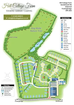
Portrait park map with mixed touring pitches, seasonal rows, ponds and an extensive dog walk.
 Explore the map ↗
United Kingdom
A woodland estate park map combining caravan loops, touring pitches, riverside paths and Bruce’s Cave landmarks.
 Explore the map ↗
United Kingdom
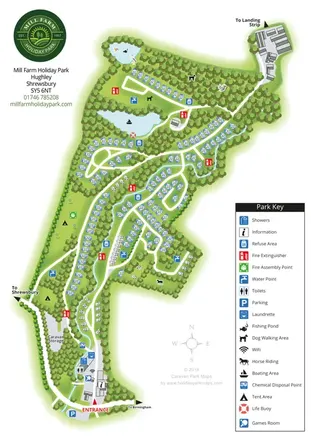
A wooded Shropshire park mapped with curved caravan rows, tent areas, ponds and a winding watercourse.
Features may come from the sample artwork, its key or published park information. Approximate numbers describe the drawing and may cover only part of a park. They are intended to help you compare map examples. Current facilities and booking information should be checked with the park.
TAKE A CLOSER LOOK
View the illustrated map in detail or choose a file to download. These are sample maps; contact the park for current visitor information.


LET’S MAP YOUR PARK
For a map quotation, find your park and draw a rough boundary around it. The area you select helps us work out the design time and price.
Draw your park for a quote ↗Or talk to our map designers
01751 473136