
Dog walking field
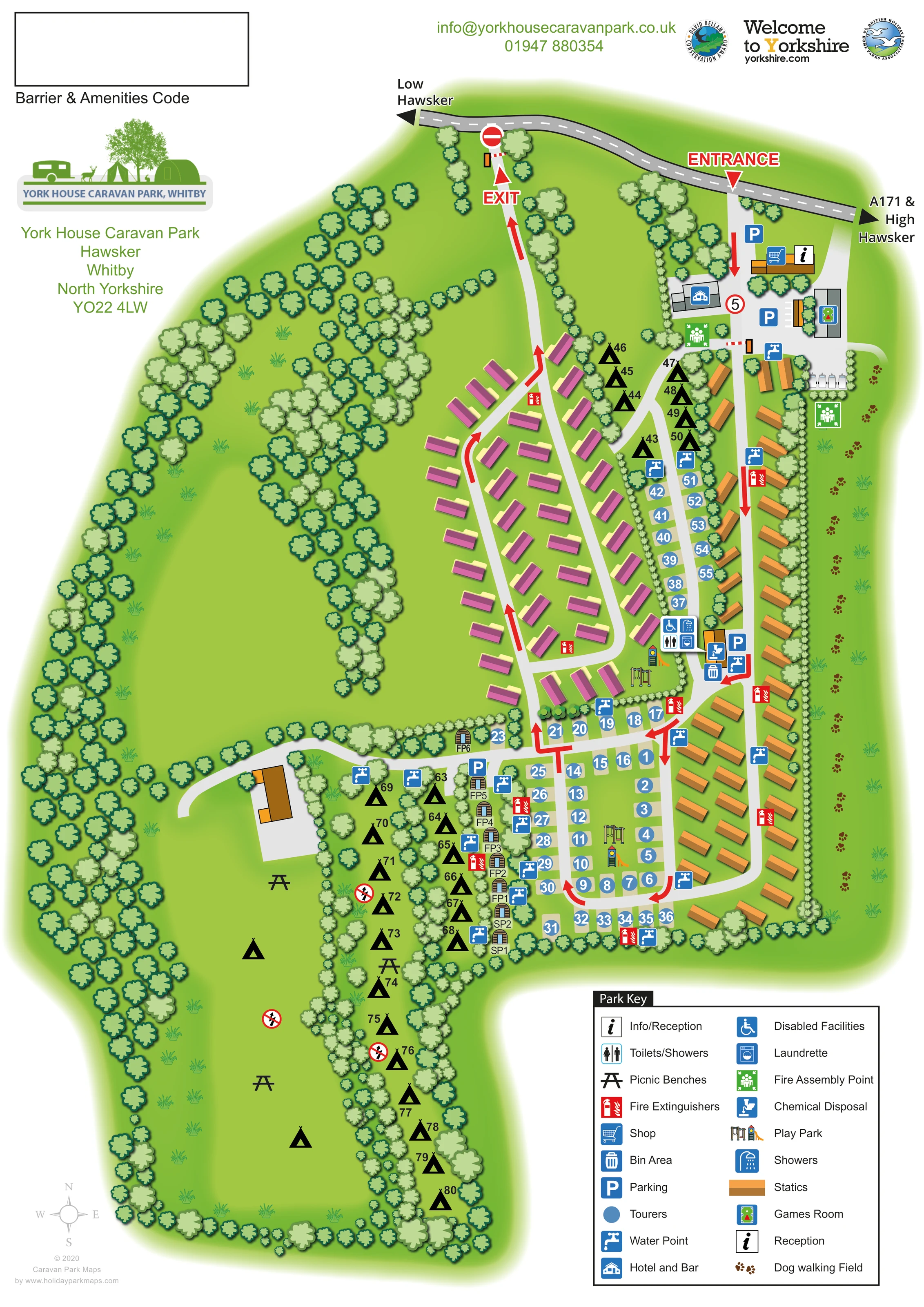
A long grassy strip along the eastern boundary is identified by a trail of brown paw prints.
ILLUSTRATED PARK MAP · P654
York House Caravan Park, Hawsker, Whitby, North Yorkshire · United Kingdom
 Enlarge the map ↗
A SENSE OF THE PLACE
York House Caravan Park is a family-friendly touring and camping site at Hawsker near Whitby. Countryside views and access to walking and cycling routes give the location its character.
Caravan, motorhome and tent pitches sit alongside camping pods. Heated washrooms, a children's play area, barbecue and picnic spaces, dog walking, a bar and shop support stays within the park.
LOOK CLOSER
A long grassy strip along the eastern boundary is identified by a trail of brown paw prints.
Dense illustrated trees enclose the park and separate camping strips, caravan rows and touring areas. A particularly broad wooded belt occupies the north-western side.
A large elongated grassy field occupies the western and south-western side, with sparse tent and picnic-bench symbols.
An information symbol marks the arrival building immediately inside the eastern entrance.
A shopping-trolley symbol shares the reception building near the entrance.
A dedicated hotel-and-bar symbol marks a building west of the entrance road.
A games-room symbol marks a separate building east of the arrival road.
Toilet and shower symbols identify the central amenity block beside the accommodation roads.
An information symbol marks the arrival building immediately inside the eastern entrance.
A shopping-trolley symbol shares the reception building near the entrance.
A dedicated hotel-and-bar symbol marks a building west of the entrance road.
A games-room symbol marks a separate building east of the arrival road.
Toilet and shower symbols identify the central amenity block beside the accommodation roads.
A wheelchair symbol is included in the central amenity cluster; it does not establish the accessibility of the whole park.
A washing-machine symbol appears with the central washroom facilities.
Two illustrated play-equipment groups appear beside the central amenities and within the southern touring area.
Bench symbols are distributed through the open western camping field.
Repeated blue tap symbols mark water points throughout the touring, camping and caravan areas.
A disposal symbol appears in the service cluster beside the central amenities and parking.
A blue bin symbol identifies a waste point near the central facilities.
Parking symbols appear at arrival, beside the central services and near the southern pod area.
Red extinguisher symbols are distributed around the accommodation roads and camping strips.
Green assembly-point symbols are shown near the northern arrival facilities and eastern field.
A long grassy strip along the eastern boundary is identified by a trail of brown paw prints.
Dense illustrated trees enclose the park and separate camping strips, caravan rows and touring areas. A particularly broad wooded belt occupies the north-western side.
A large elongated grassy field occupies the western and south-western side, with sparse tent and picnic-bench symbols.
The entrance is marked at the north-east and the exit farther west on the same external road. Barrier graphics and red route arrows reinforce the arrival and departure arrangement.
Pale grey roads form linked loops and branches through the accommodation, with red arrows showing the depicted direction of circulation.
The external road points towards Low Hawsker to the left and the A171 and High Hawsker to the right.
READING THE MAP
This illustrated map of York House Caravan Park at Hawsker, near Whitby in North Yorkshire, brings together a varied accommodation layout and a strongly green setting. The portrait plan shows caravan rows, numbered touring pitches, tree-lined camping areas and a small group of pod-like units, with a broad open camping field stretching down the western side. Along the opposite boundary, a trail of paw prints identifies the dog-walking field.
Arrival is a prominent part of the design. Separate entrance and exit points sit on the road between Low Hawsker and the A171 towards High Hawsker, while red arrows guide the eye through the internal road network. Reception, the shop, hotel and bar, and games room are grouped near the entrance; washrooms, laundry and other practical services sit farther into the park.
The artwork combines simple pitch symbols with illustrated trees, accommodation blocks and play equipment. Its large lower-right key explains the principal facilities, allowing a detailed mixed-use site to be read as both a welcoming landscape and a practical visitor plan.
The main plan fills most of a tall portrait page, with the park address and branding set into the white space on the left and a substantial Park Key at the bottom right. The road across the northern edge establishes the local approach, naming Low Hawsker in one direction and the A171 and High Hawsker in the other. Separate entrance and exit labels, barrier graphics and red arrows make the circulation pattern a central visual feature.
Inside the park, pale grey roads divide several distinct accommodation zones. Orange statics run along the eastern edge and around the southern bend. Pink caravan-shaped units occupy a branching loop to the west of the main spine. Blue numbered touring circles create a compact southern grid, a linking row across the middle and narrow strips farther north. Black tent symbols mark more sheltered camping positions between tree belts, while the larger western field uses only a few tents and picnic benches to convey its open character. Small timber pod illustrations sit beside the southern touring and camping areas.
Facilities are distributed through the plan rather than confined to the legend. Reception and shop symbols share an arrival building, with the hotel and bar nearby and a games room across the road. The central amenity cluster includes toilets, showers, disabled facilities and a laundrette. Water taps, fire extinguishers, parking, chemical disposal and a bin area provide practical reference points, and two play-equipment illustrations identify recreation areas.
Dense scalloped tree canopies define boundaries and screen neighbouring zones. The eastern dog-walking field is distinguished by repeated brown paw prints. A compass completes the orientation information. The accompanying detail views enlarge the same artwork’s southern edge and legend; they are not separate map variants.
KEEP EXPLORING
Chosen for shared landscapes, accommodation or facilities.
 Explore the map ↗
United Kingdom
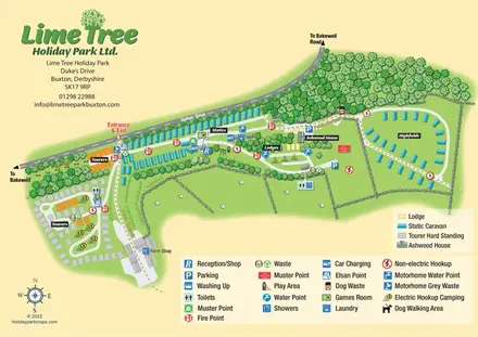
Mixed-accommodation park map with woodland, public footpaths and clearly differentiated service symbols.
 Explore the map ↗
United Kingdom
Woodland-framed Barnsoul map with mixed accommodation, shared facilities and paw-marked walking routes.
 Explore the map ↗
United Kingdom
Riverside park map with named pitch fields, illustrated huts and a paw-print dog walk.
Features may come from the sample artwork, its key or published park information. Approximate numbers describe the drawing and may cover only part of a park. They are intended to help you compare map examples. Current facilities and booking information should be checked with the park.
TAKE A CLOSER LOOK
View the illustrated map in detail or choose a file to download. These are sample maps; contact the park for current visitor information.


LET’S MAP YOUR PARK
For a map quotation, find your park and draw a rough boundary around it. The area you select helps us work out the design time and price.
Draw your park for a quote ↗Or talk to our map designers
01751 473136