
Hogg’s Pond
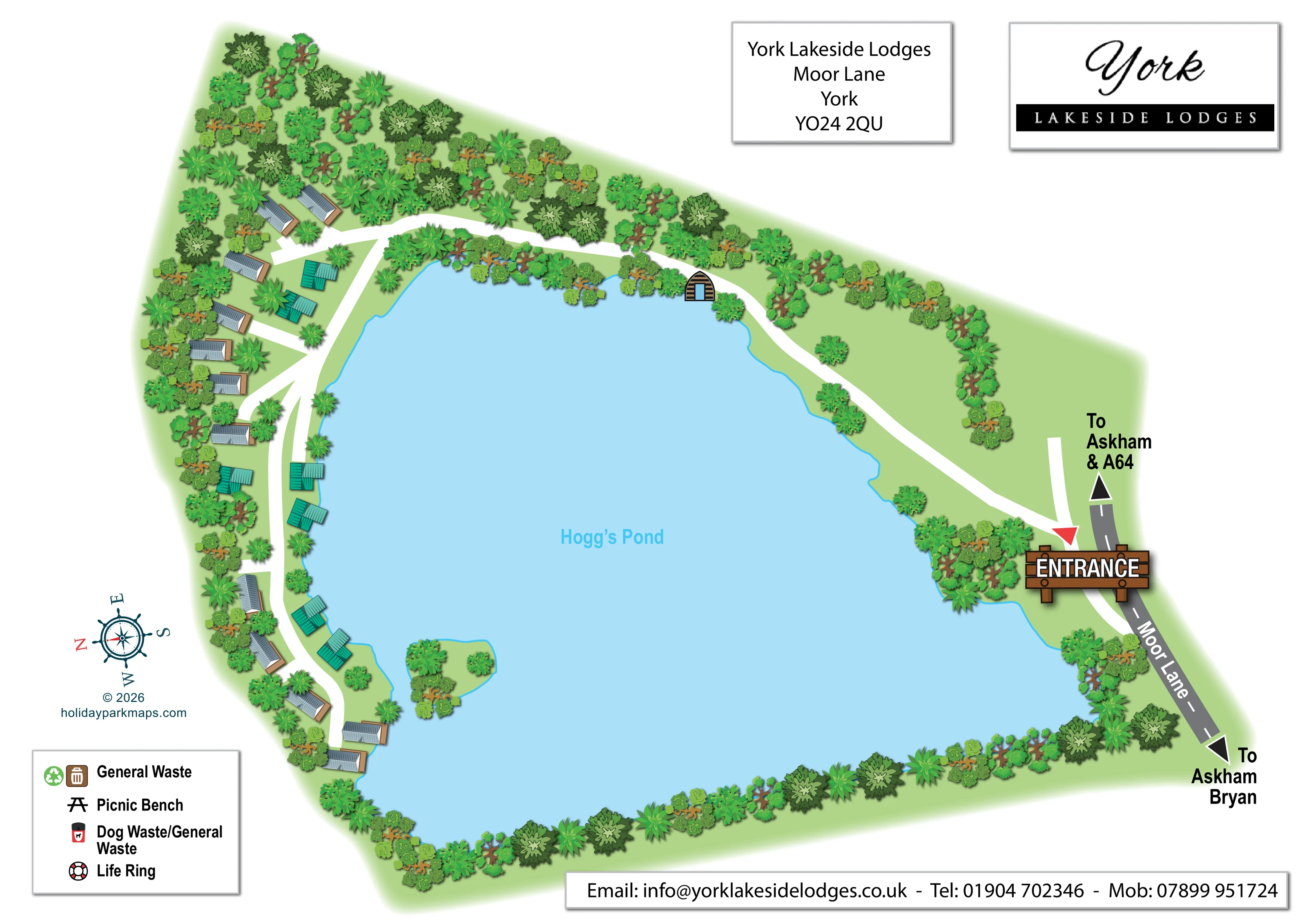
The named pond occupies most of the plan, with an irregular shoreline outlined in bright blue.
ILLUSTRATED PARK MAP · P385
York Lakeside Lodges, Moor Lane, York · United Kingdom
 Enlarge the map ↗
A SENSE OF THE PLACE
York Lakeside Lodges offers self-catering lodge accommodation on Moor Lane in York. Mature woodland provides a sheltered setting within reach of the city centre.
Guests can choose from the lodges offered by the operator for a stay combining their own accommodation space with visits into York. The map shows the arrangement of the lodges and routes through the grounds.
LOOK CLOSER
The named pond occupies most of the plan, with an irregular shoreline outlined in bright blue.
Dense illustrated trees surround the accommodation, line much of the pond edge and form a broad planted boundary across the top of the page.
A small green island with several trees is shown close to the lower part of the accommodation shore.
Pale green ground connects the buildings and planting, with a more open area beside the approach route on the page-right side.
The external approach road is drawn along the page-right edge as a grey strip with a dashed white centre line.
A large timber-style ENTRANCE sign and red arrow mark the access point from Moor Lane.
Broad white routes lead from the entrance around the upper pond edge, then curve through the lodge group with short branches to individual buildings.
Black arrows at the ends of Moor Lane carry the labels ‘To Askham & A64’ and ‘To Askham Bryan’.
The named pond occupies most of the plan, with an irregular shoreline outlined in bright blue.
Dense illustrated trees surround the accommodation, line much of the pond edge and form a broad planted boundary across the top of the page.
A small green island with several trees is shown close to the lower part of the accommodation shore.
Pale green ground connects the buildings and planting, with a more open area beside the approach route on the page-right side.
The external approach road is drawn along the page-right edge as a grey strip with a dashed white centre line.
A large timber-style ENTRANCE sign and red arrow mark the access point from Moor Lane.
Broad white routes lead from the entrance around the upper pond edge, then curve through the lodge group with short branches to individual buildings.
Black arrows at the ends of Moor Lane carry the labels ‘To Askham & A64’ and ‘To Askham Bryan’.
A small arched, timber-striped hut-like symbol stands beside the upper pond edge and internal route. Its function is not identified.
The key pairs a green recycling-style symbol with a brown bin icon under ‘General Waste’; a corresponding location is not evident on the plan.
A black picnic-table symbol appears in the key, without a clearly identifiable placement in the grounds.
A red-and-black bin symbol is included in the key; its position is not established by the illustrated plan.
A red-and-white life-ring symbol appears in the key, but no corresponding shoreline position is clearly shown.
READING THE MAP
Hogg’s Pond is the organising feature of this illustrated map for York Lakeside Lodges on Moor Lane in York. The water fills most of the page, while a small group of detached lodges follows one wooded shore. Rather than presenting accommodation as a grid of plots, the artwork shows how the buildings, access routes and planting fit around the pond’s irregular edge.
The arrival point is immediately recognisable: a timber-style entrance sign and red arrow connect Moor Lane to a broad white route through the grounds. That route follows the upper shoreline before reaching the lodge cluster, where short branches lead between the buildings. Varied tree illustrations give the setting its sheltered character, and a small planted island provides another useful visual landmark.
Grey and teal roofs distinguish building forms without overwhelming the landscape. Framed address and branding panels, a compact symbol key and a nautical compass complete the page. This sample is particularly relevant to small lodge parks whose visitor map needs to communicate a waterside setting and a straightforward arrival route together.
The single landscape-format plan is arranged around the pale blue shape of Hogg’s Pond. Its bright cyan outline traces bays and projecting banks, with a small wooded island near the lower part of the accommodation shore. Dense tree planting frames much of the site, especially behind the lodges and along the upper boundary. More open green ground appears beside the approach route on the opposite side of the water.
Moor Lane runs along the page-right edge. Its grey surface, dashed centre line and angled white road label distinguish it from the broad white routes inside the park. Black arrows indicate directions towards Askham and the A64 at one end, and Askham Bryan at the other. At the entrance, a large brown sign and red arrow create a strong visual starting point. The internal route sweeps around the upper pond edge, then curves through the accommodation with several short connecting spurs.
Roughly 20 lodge-style buildings are illustrated. Long grey-roofed forms have brown edging, while compact teal-roofed forms sit among them, including several close to the water. The buildings have no visible unit names or numbers. A separate arched hut-like illustration beside the upper shoreline is also unlabelled.
The lower-left key lists general waste, picnic bench, dog waste/general waste and life ring symbols, although their positions are not evident on the main plan. Above it sits a rotated nautical compass. Separate shadowed panels hold the park’s address and monochrome logo, and a contact strip spans the lower edge. These supporting elements leave the pond and lodge arrangement as the page’s dominant visual story.
KEEP EXPLORING
Chosen for shared landscapes, accommodation or facilities.
 Explore the map ↗
United Kingdom
Woodland camping, lodges, lakes and colour-coded bike trails at Avon Tyrrell Outdoor Centre.
 Explore the map ↗
United Kingdom
Illustrated lakeside park plan with numbered holiday units, leisure buildings and a looping Woodland Walk.
 Explore the map ↗
United Kingdom
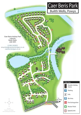
Portrait holiday-home park map with riverside loops, a tree-fringed pond and a separate manor landmark.
Features may come from the sample artwork, its key or published park information. Approximate numbers describe the drawing and may cover only part of a park. They are intended to help you compare map examples. Current facilities and booking information should be checked with the park.
LET’S MAP YOUR PARK
For a map quotation, find your park and draw a rough boundary around it. The area you select helps us work out the design time and price.
Draw your park for a quote ↗Or talk to our map designers
01751 473136