
 Explore the map ↗
Australia
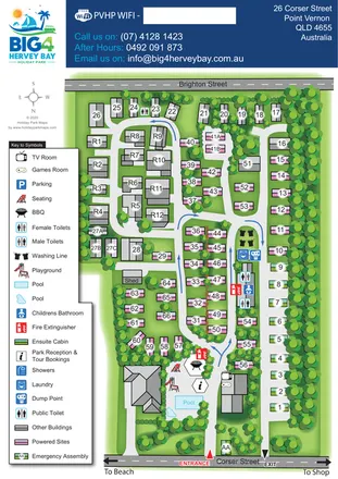
BIG4 Hervey Bay Holiday Park
Tree-lined coastal park plan with colour-coded sites, separate entry and exit routes, and a pool-side visitor hub.
ILLUSTRATED PARK MAP COLLECTION
Explore illustrated maps of BIG4 Hervey Bay Holiday Park, Peachley Leisure, Pen Y Bont Touring Park, Rangeview Caravan and Cabin Park and Riverside Caravan Park. Compare the layouts, landscape and facilities, and discover each park in more detail.
← Browse map collectionsExplore the map ↗Australia
Tree-lined coastal park plan with colour-coded sites, separate entry and exit routes, and a pool-side visitor hub.
 Explore the map ↗
United Kingdom
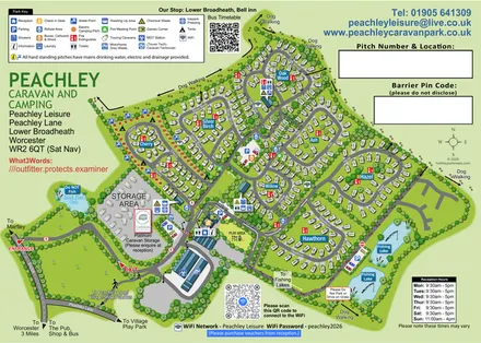
Tree-named touring areas, electric camping pitches and fishing lakes on an illustrated Peachley Leisure visitor map.
 Explore the map ↗
United Kingdom
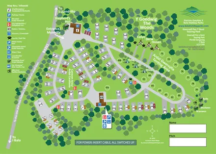
Bilingual touring, camping and glamping map with woodland, numbered pitches and illustrated amenities.
 Explore the map ↗
Australia
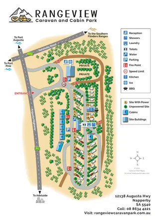
Portrait caravan park map with colour-coded pitches, blue-roofed cabins and regional road directions.
 Explore the map ↗
United Kingdom
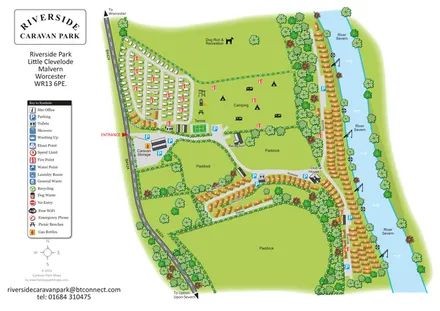
Illustrated riverside park plan with seasonal caravans, camping, paddocks and a long River Severn frontage.
LET’S MAP YOUR PARK
For a map quotation, find your park and draw a rough boundary around it. The area you select helps us work out the design time and price.
Draw your park for a quote ↗Or talk to our map designers
01751 473136