
River Severn
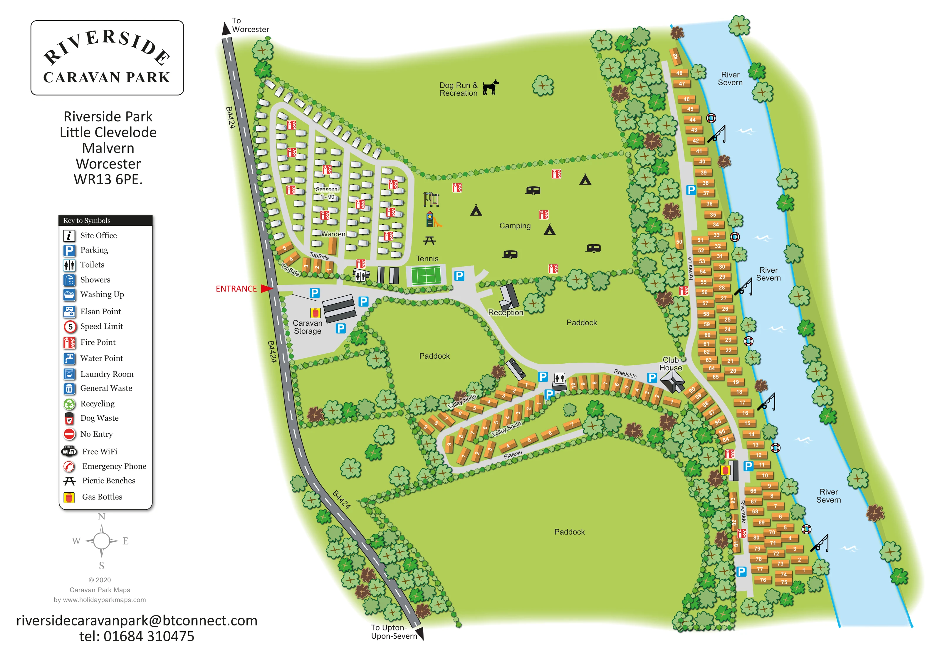
A broad blue river defines the eastern edge of the plan and the setting of the Riverside accommodation.
ILLUSTRATED PARK MAP · P581
Little Clevelode, Malvern, Worcester · United Kingdom
 Enlarge the map ↗
A SENSE OF THE PLACE
Riverside Caravan Park is based at Little Clevelode, Malvern, Worcester. The park is beside the River Severn, with views towards the Malvern Hills. Electric and non-electric grass pitches serve tents and touring vehicles; seasonal pitches and holiday-home sales are also offered.
The park lists a clubhouse serving food, children's play area, laundry and heated washrooms. Dogs are welcomed, with a dedicated exercise field described on the touring page.
LOOK CLOSER
A broad blue river defines the eastern edge of the plan and the setting of the Riverside accommodation.
Three large open green spaces are labelled Paddock, separating the accommodation groups.
Dense trees follow the river corridor and outer boundaries, while clipped hedge symbols divide fields and line internal roads.
A labelled building beside the main internal road, between the camping area and a paddock.
A labelled warden unit within the seasonal caravan section.
A distinctive grey-roofed building at the junction of Roadside and Riverside.
Toilet symbols mark buildings near the seasonal section and beside the Roadside accommodation.
Blue parking symbols appear at the entrance and storage area, by the tennis court, near Roadside and along Riverside.
A labelled building beside the main internal road, between the camping area and a paddock.
A labelled warden unit within the seasonal caravan section.
A distinctive grey-roofed building at the junction of Roadside and Riverside.
Toilet symbols mark buildings near the seasonal section and beside the Roadside accommodation.
Blue parking symbols appear at the entrance and storage area, by the tennis court, near Roadside and along Riverside.
A broad grey forecourt immediately inside the entrance is labelled Caravan Storage.
A green court with white playing lines is labelled Tennis beside the main entrance route.
A swing frame and slide are drawn at the western edge of the camping field.
A large northern grass field is labelled Dog Run & Recreation and identified with a dog silhouette.
A picnic-bench symbol sits beside the play equipment and camping area.
Repeated red fire-point symbols are distributed through the seasonal section, camping field and Riverside accommodation.
Yellow-backed cylinder symbols appear by caravan storage and beside the lower Riverside section.
Several fishing-rod illustrations mark positions along the River Severn frontage; they do not specify fishing rights or arrangements.
Repeated lifebuoy illustrations punctuate the riverbank.
A broad blue river defines the eastern edge of the plan and the setting of the Riverside accommodation.
Three large open green spaces are labelled Paddock, separating the accommodation groups.
Dense trees follow the river corridor and outer boundaries, while clipped hedge symbols divide fields and line internal roads.
A red entrance arrow identifies access from the western road, which has directional arrows towards Worcester and Upton-upon-Severn.
Pale grey roads connect the entrance, seasonal lanes, reception, southern accommodation loops and the long riverside spine.
These services have entries in the key, but their individual positions are not clearly marked on the plan.
The key includes water points, an Elsan point, general waste, recycling and dog waste; the key alone does not establish their locations.
Both appear in the symbol key without clearly identifiable placements on the main plan.
The key includes a site-office symbol, a speed-limit symbol displaying 5 and a no-entry sign; these entries are not evidence of specific mapped positions.
The supplied park information describes food being served at the clubhouse.
Heated washrooms are described in the supplied park information, rather than established by the building illustrations.
The wider park context describes views towards the Malvern Hills; the hills themselves are not illustrated.
READING THE MAP
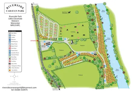
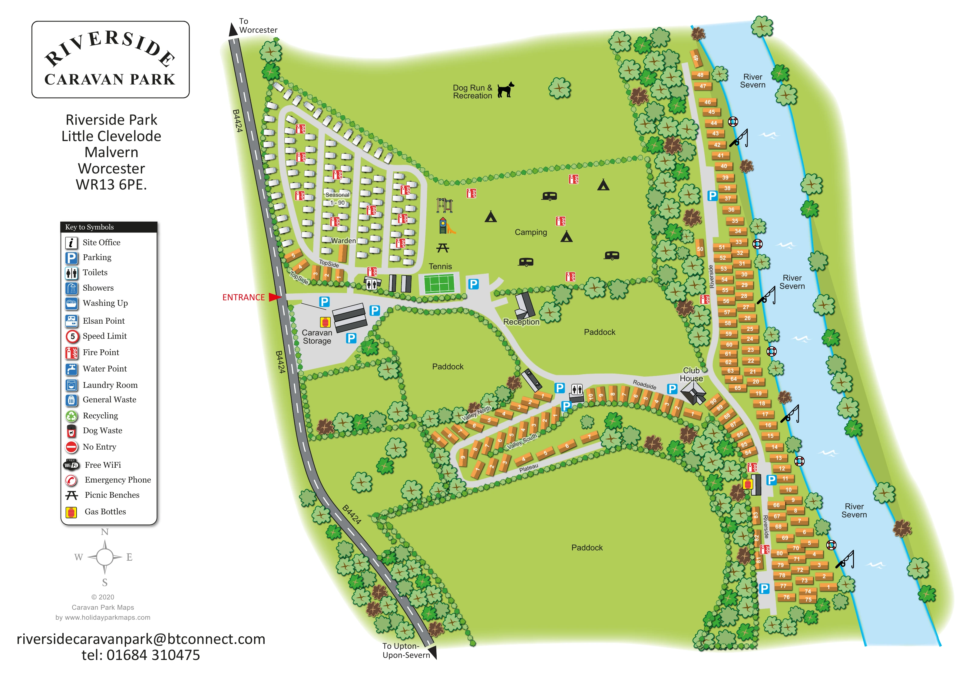
This illustrated map of Riverside Caravan Park at Little Clevelode presents a varied riverside site between the B4424 and the River Severn. Its layout makes the contrast between the compact seasonal caravan area, open camping grass and long riverbank accommodation immediately apparent. Large paddocks and a dedicated dog recreation field remain prominent, giving visitors a useful sense of the spaces between the developed areas.
The map combines a practical overhead plan with recognisable illustrations of caravans, trees, play equipment and buildings. White touring-style caravans distinguish the seasonal section from the ochre units in Riverside, Roadside, TopSide and the smaller valley and plateau groups. Reception, the clubhouse, tennis court, caravan storage and parking provide clear landmarks along the internal roads.
A generous left-hand information column holds the park branding, address, symbol key and compass. Across the plan, numbered units, named sections and coloured facility markers support everyday orientation without obscuring the green setting. This sample is particularly relevant to parks that need to explain several accommodation areas within an irregular, landscape-led site.
The plan is framed by the B4424 down its western side and a broad blue depiction of the River Severn to the east. A conspicuous red entrance arrow leads into the caravan-storage and parking forecourt. From here, pale grey roads connect the seasonal section, tennis court and reception before continuing towards the clubhouse and riverside accommodation. External arrows identify the directions towards Worcester and Upton-upon-Severn.
In the north-western wedge, white caravan illustrations sit in orderly rows along parallel access lanes. The section is labelled Seasonal, with a warden unit towards its southern end. Beside it, the central camping field contains illustrative tents and motorhome-style vehicles, together with play equipment and a picnic-bench symbol. Above this field, a hedge separates the large Dog Run & Recreation area.
Ochre caravan units follow the long Riverside lane, with a tree belt separating much of this accommodation from the park's interior. Fishing-rod and lifebuoy illustrations punctuate the river edge. Inland, TopSide, Roadside, Valley North, Valley South and Plateau form smaller groups around bends and loops. Three labelled paddocks preserve a strong impression of open space between these clusters.
Reception and the clubhouse are identified by text and individual roof drawings. Toilet and parking symbols mark useful stopping points, while red fire-point markers recur throughout the accommodation areas. Gas-cylinder symbols appear at two service locations. The tall left-hand key also explains washroom, utility, waste and communication symbols, although not all have clearly identifiable positions on the plan. A compass completes the orientation aids. The accompanying enlargement shows the same artwork's legend and entrance area in greater detail, rather than a separate park section or additional map variant.
KEEP EXPLORING
Chosen for shared landscapes, accommodation or facilities.
 Explore the map ↗
United Kingdom
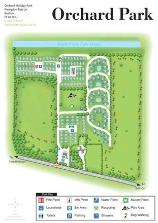
Orchard Holiday Park map with curved accommodation clusters, dog-walking lawns and a named waterside boundary.
 Explore the map ↗
United Kingdom
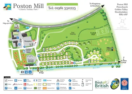
Riverside touring-park map with colour-coded pitches, dog-walking grounds and illustrated visitor facilities.
 Explore the map ↗
United Kingdom
Riverside park map with named pitch fields, illustrated huts and a paw-print dog walk.
Features may come from the sample artwork, its key or published park information. Approximate numbers describe the drawing and may cover only part of a park. They are intended to help you compare map examples. Current facilities and booking information should be checked with the park.
TAKE A CLOSER LOOK
View the illustrated map in detail or choose a file to download. These are sample maps; contact the park for current visitor information.


LET’S MAP YOUR PARK
For a map quotation, find your park and draw a rough boundary around it. The area you select helps us work out the design time and price.
Draw your park for a quote ↗Or talk to our map designers
01751 473136
 riversideplancolour_large.png
 riversideplancolour_large.png
 riversidea_large.png
 riversideplancolour.png
 riversidea_large.webp