
 Explore the map ↗
United Kingdom
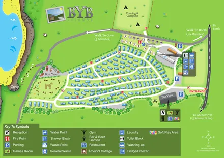
Brynrodyn Caravan Park
Coastal park map with numbered holiday homes, touring and camping areas, The View and walking routes to Borth and the cove.
ILLUSTRATED PARK MAP COLLECTION
Explore illustrated maps of Brynrodyn Caravan Park, Burrowhead Holiday Village, Buttercombe Meadow Campsite & Store, Cakes & Ale Holiday Park, Castlerigg Farm and Upper Carr Holiday Park. Compare the layouts, landscape and facilities, and discover each park in more detail.
← Browse map collectionsExplore the map ↗United Kingdom
Coastal park map with numbered holiday homes, touring and camping areas, The View and walking routes to Borth and the cove.
 Explore the map ↗
United Kingdom
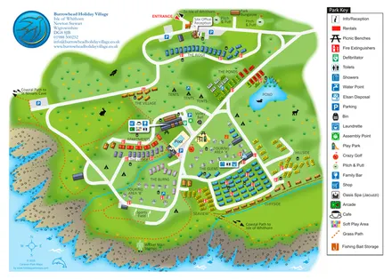
Colour-coded accommodation, central leisure facilities and coastal paths on an illustrated headland park map.
 Explore the map ↗
United Kingdom
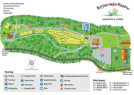
Woodland-framed campsite map with riverside pitches, named plots and an entrance-side beer garden.
 Explore the map ↗
United Kingdom
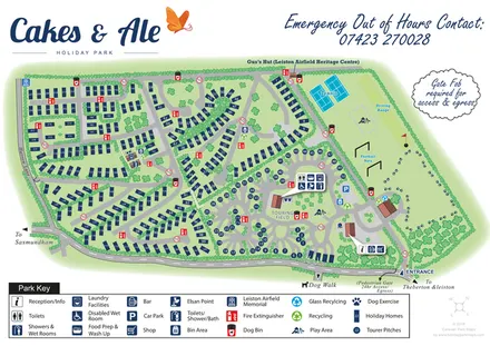
Branded Suffolk park plan with holiday homes, touring loops, recreation grounds and airfield heritage landmarks.
 Explore the map ↗
United Kingdom
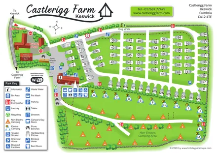
Castlerigg Farm’s bright illustrated plan combines numbered touring rows, lettered electric camping and an open camping field with a detailed amenities key and dog-facility wayfinding.
 Explore the map ↗
United Kingdom
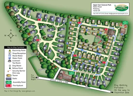
Upper Carr park map with wooded static-caravan areas, touring rows and clearly marked visitor facilities.
LET’S MAP YOUR PARK
For a map quotation, find your park and draw a rough boundary around it. The area you select helps us work out the design time and price.
Draw your park for a quote ↗Or talk to our map designers
01751 473136