
 Explore the map ↗
United Kingdom
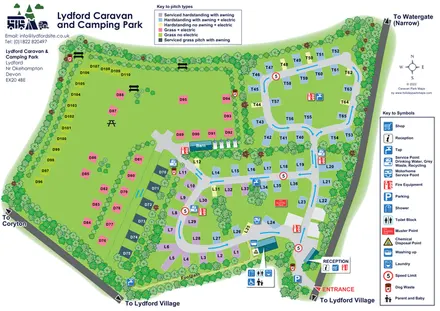
Lydford Caravan and Camping Park
Colour-coded touring and camping pitches, linked road loops and a village footpath at Lydford.
ILLUSTRATED PARK MAP COLLECTION
Explore illustrated maps of Lydford Caravan and Camping Park, Mains Farm Wigwams, Manor Farm Holiday Centre, Mayfield Park and Meadow View Park Homes and Lodges. Compare the layouts, landscape and facilities, and discover each park in more detail.
← Browse map collectionsExplore the map ↗United Kingdom
Colour-coded touring and camping pitches, linked road loops and a village footpath at Lydford.
 Explore the map ↗
United Kingdom
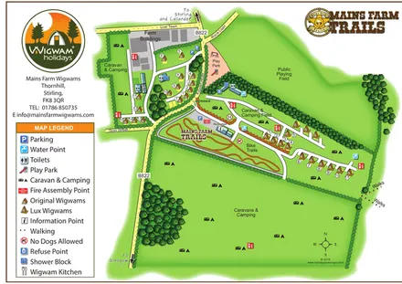
Illustrated farm glamping map with two wigwam styles, camping fields and a branded bike-trail area.
 Explore the map ↗
United Kingdom
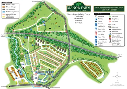
Colour-coded pitches, riverside camping and separate accommodation areas at Manor Farm Holiday Centre, Dorset.
 Explore the map ↗
United Kingdom
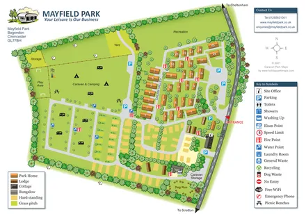
Mayfield Park map with park homes, touring pitches, open camping and tree-lined recreation areas.
 Explore the map ↗
United Kingdom
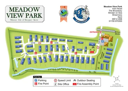
Meadow View Park map with numbered homes, Riverbank Lodges, directional roads and planted waterside boundaries.
LET’S MAP YOUR PARK
For a map quotation, find your park and draw a rough boundary around it. The area you select helps us work out the design time and price.
Draw your park for a quote ↗Or talk to our map designers
01751 473136