
Herb garden
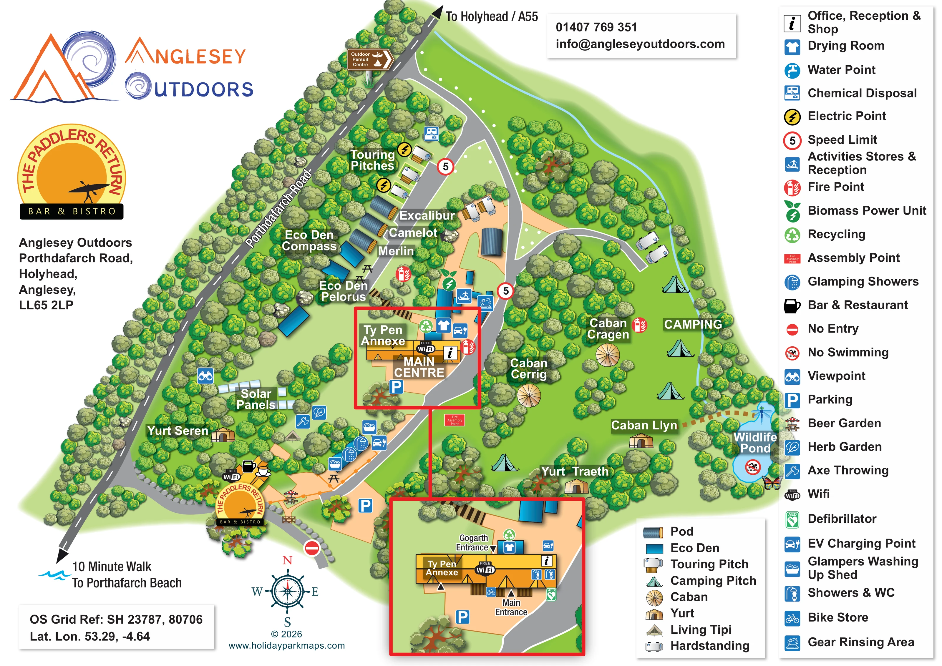
A leaf symbol identifies a garden close to the axe-throwing location.
ILLUSTRATED PARK MAP · P008
Anglesey Outdoors, Porthdafarch Road, Holyhead, Anglesey · United Kingdom
 Enlarge the map ↗
A SENSE OF THE PLACE
Anglesey Outdoors is an activity centre and camping base on Holy Island near Holyhead, with Porth Dafarch and the Wales Coast Path nearby. Accommodation spans rooms, glamping and camping, with space for touring vehicles and smaller motorhomes.
Facilities include showers, washing-up areas, shared cold storage and equipment care areas. The seasonal Paddlers Return bar and bistro complements activities such as sea kayaking and coasteering. Electric pitches have restrictions, and the site does not provide chemical toilet disposal.
LOOK CLOSER
A leaf symbol identifies a garden close to the axe-throwing location.
A labelled blue pond sits at the eastern edge of the camping area, with a no-swimming symbol and decorative dragonfly and butterfly illustrations.
Dense illustrated tree groups frame the road boundary, divide accommodation areas and surround the pond and individual glamping units.
A binocular symbol marks a viewpoint near the solar panels on the western side of the site.
The central yellow building carries the information symbol for office, reception and shop. An enlarged inset identifies its Main Entrance and Gogarth Entrance.
Named alongside the Main Centre and repeated in the linked building-detail inset.
A blue activity symbol locates this function among the outbuildings immediately above the Main Centre.
Prominent branding and a drinks symbol identify the bar and bistro near the lower road entrance.
The central yellow building carries the information symbol for office, reception and shop. An enlarged inset identifies its Main Entrance and Gogarth Entrance.
Named alongside the Main Centre and repeated in the linked building-detail inset.
A blue activity symbol locates this function among the outbuildings immediately above the Main Centre.
Prominent branding and a drinks symbol identify the bar and bistro near the lower road entrance.
A parasol-table symbol marks the beer garden beside the bar; additional picnic-table illustrations appear around the central facilities.
Shower and WC symbols appear on the Main Centre in the enlarged inset.
Repeated shower and washing-up symbols identify the service strip between the bar area and Main Centre.
A shirt symbol marks the drying room immediately behind the Main Centre, also shown in the inset.
A dedicated equipment-rinsing symbol appears beside the activities buildings.
The centre inset places a bicycle symbol near the Main Entrance.
An axe symbol marks an activity location in the planted area above the bar and near the living tipi.
A leaf symbol identifies a garden close to the axe-throwing location.
A labelled blue pond sits at the eastern edge of the camping area, with a no-swimming symbol and decorative dragonfly and butterfly illustrations.
Dense illustrated tree groups frame the road boundary, divide accommodation areas and surround the pond and individual glamping units.
A binocular symbol marks a viewpoint near the solar panels on the western side of the site.
A labelled array of pale rectangular panels is illustrated between the road-side planting and the central lawn.
A green leaf-and-energy symbol locates the biomass unit among the central service buildings.
Yellow lightning symbols identify electrical provision beside the upper touring pitches.
Charging symbols are shown near the Main Centre and the glamping service strip.
Blue P symbols locate parking beside the Main Centre and near the lower entrance and bar area.
Green recycling symbols mark provision around the central buildings; the inset enlarges one of these locations.
Wi-Fi symbols are placed at the Main Centre and bar.
Red fire symbols are distributed around the accommodation and buildings. A labelled assembly point lies below the Main Centre, and the inset shows a defibrillator at the centre frontage.
The diagonal road is labelled, with arrows towards Holyhead/A55 and towards the beach. The artwork labels the beach direction as a ten-minute walk.
A winding grey drive connects the road entrances, centre and upper pitches, with a short eastern spur. Orange dashed pedestrian links connect the bar/service area and the pond-side accommodation.
Red-ringed 5 speed symbols appear along the internal drive, and a no-entry symbol marks the lower branch. These describe the artwork rather than current operating instructions.
The facility key includes a water-point symbol, but a corresponding location is not clearly identifiable in the plan.
The key includes Chemical Disposal and the corresponding blue symbol appears beside the upper touring area. This conflicts with the supplied park information, which states that chemical toilet disposal is not provided.
READING THE MAP
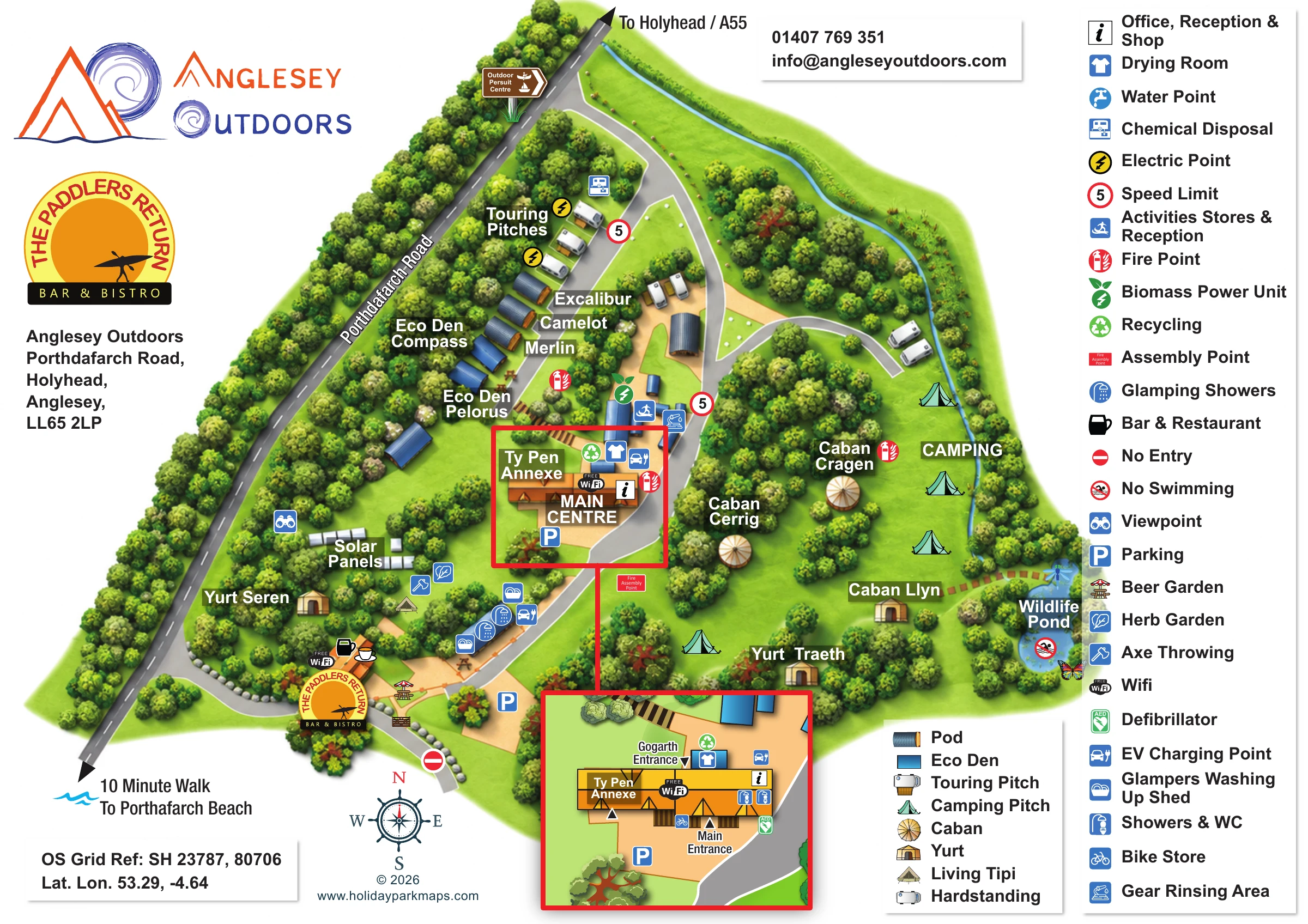
This illustrated map presents Anglesey Outdoors as a compact camping, glamping and activity base on Holy Island near Holyhead. Porthdafarch Road cuts diagonally along one side of the artwork, with directions towards Holyhead and the A55 at one end and a beach-walk reference at the other. Within that frame, tree-lined drives connect the Main Centre, touring spaces, open camping lawns and a varied collection of named glamping units.
The accommodation is an important part of the map’s character: curved-roof pods, blue Eco Dens, cabans, yurts and a living tipi are drawn with different silhouettes rather than reduced to identical markers. The Paddlers Return bar and bistro provides another prominent landmark near the lower entrance, while a wildlife pond anchors the eastern edge.
A tall facility key and a linked enlargement of the Main Centre help visitors move from the overall site arrangement to practical details. Showers, washing-up facilities, equipment care areas and entrances are presented alongside the landscape, making this a useful sample for an outdoor centre with several accommodation types and closely grouped shared facilities.
The artwork uses a bird’s-eye layout with lightly three-dimensional buildings and accommodation. A dark diagonal strip represents Porthdafarch Road, while the lighter internal drive curves through the site past the bar, parking and Main Centre before reaching the upper touring area. A short spur branches towards vehicle spaces on the eastern side. Peach surfaces identify yards and gathering areas, and orange dashed lines distinguish selected pedestrian connections.
West of the central drive, the named pods Excalibur, Camelot and Merlin form a short row, with Eco Den Compass and Eco Den Pelorus nearby. Yurt Seren sits lower down among the trees. To the east, the camping lawn contains scattered tent illustrations and the named cabans Cragen, Cerrig and Llyn, together with Yurt Traeth. These sit within a landscape of planted pockets rather than a rigid grid. A blue wildlife pond marks the far edge, accompanied by a no-swimming symbol and decorative insect drawings.
The service buildings are concentrated around the Main Centre and along the route towards The Paddlers Return. Symbols identify activities stores and reception, gear rinsing, drying, glamping showers, washing-up sheds, recycling and EV charging. The bar area includes outdoor seating, with axe throwing and a herb garden marked nearby. A viewpoint, solar panels and a biomass power unit add further distinctive landmarks.
The single page includes a red-framed enlargement linked directly to the Main Centre on the overview. It clarifies the Main and Gogarth entrances, Ty Pen Annexe, showers and WCs, bike storage and defibrillator. Separate accommodation and facility keys sit on the right, while the park logos, contact panel, compass and external directions occupy the surrounding white space.
 Enlarge this map ↗
KEEP EXPLORING
Chosen for shared landscapes, accommodation or facilities.
 Explore the map ↗
United Kingdom
Illustrated farm campsite map with named pitches, two ponds and a Gothic Pod near New Quay.
 Explore the map ↗
United Kingdom
A colour-zoned coastal park map with touring areas, woodland trails, ponds and a leisure club.
 Explore the map ↗
United Kingdom
Colour-coded accommodation, central leisure facilities and coastal paths on an illustrated headland park map.
Features may come from the sample artwork, its key or published park information. Approximate numbers describe the drawing and may cover only part of a park. They are intended to help you compare map examples. Current facilities and booking information should be checked with the park.
TAKE A CLOSER LOOK
View the illustrated map in detail or choose a file to download. These are sample maps; contact the park for current visitor information.

LET’S MAP YOUR PARK
For a map quotation, find your park and draw a rough boundary around it. The area you select helps us work out the design time and price.
Draw your park for a quote ↗Or talk to our map designers
01751 473136