
Dog walking field
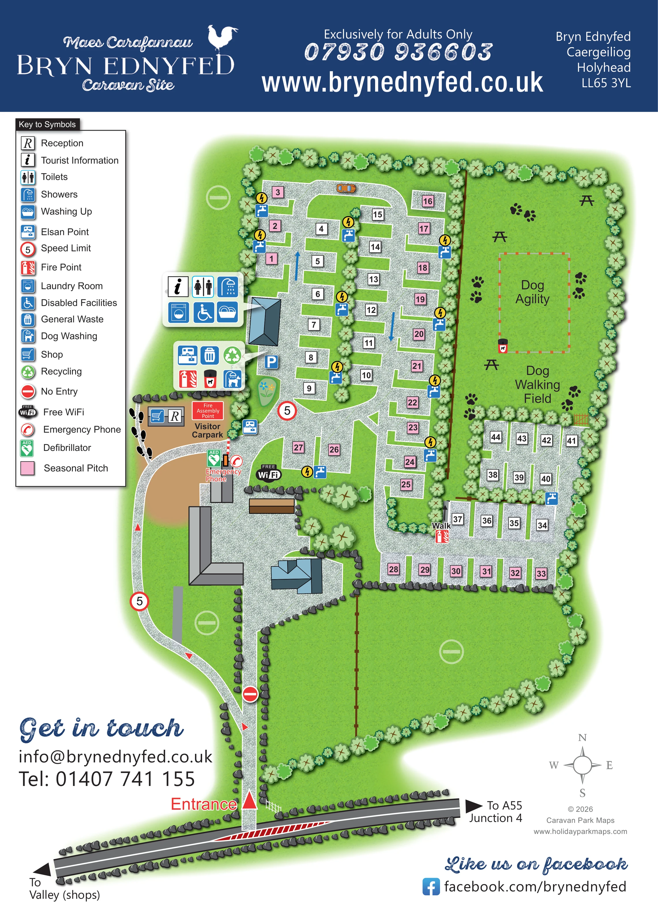
A large enclosed green field occupies the north-eastern side of the site and is labelled for dog walking.
ILLUSTRATED PARK MAP · P043
Bryn Ednyfed, Caergeiliog, Holyhead · United Kingdom
 Enlarge the map ↗
A SENSE OF THE PLACE
Bryn Ednyfed Caravan Site is based at Bryn Ednyfed, Caergeiliog, Holyhead. Bryn Ednyfed is an adults-only caravan and motorhome site in Caergeiliog, Anglesey.
The park provides fully serviced and unserviced pitches, 16A electric hook-ups, laundry, showers, chemical disposal and a covered washing-up area. The homepage names Holyhead Mountain, Breakwater Country Park and an RSPB wetland reserve among local places to explore.
LOOK CLOSER
A large enclosed green field occupies the north-eastern side of the site and is labelled for dog walking.
Stylised trees enclose the site and divide pitch groups. Dark stone edging, fences and broad grass areas define the approach and southern grounds.
Reception and shopping symbols share a small building beside the visitor car park.
An information symbol appears in the facility callout connected to the western amenity building.
A grouped callout locates toilets, showers, a laundry room and washing-up facilities at the blue-roofed amenity building west of the main pitch area.
The wheelchair symbol is included in the amenity-building callout; the map does not specify access arrangements.
Chemical disposal is shown in the service-area callout and by a separate symbol beside the internal arrival lane.
General waste and recycling symbols are grouped in the service area next to the amenity building; dog-waste bin symbols also appear there and in the dog field.
Reception and shopping symbols share a small building beside the visitor car park.
An information symbol appears in the facility callout connected to the western amenity building.
A grouped callout locates toilets, showers, a laundry room and washing-up facilities at the blue-roofed amenity building west of the main pitch area.
The wheelchair symbol is included in the amenity-building callout; the map does not specify access arrangements.
Chemical disposal is shown in the service-area callout and by a separate symbol beside the internal arrival lane.
General waste and recycling symbols are grouped in the service area next to the amenity building; dog-waste bin symbols also appear there and in the dog field.
A dog-washing symbol is located in the service-area callout near the visitor car park.
Blue tap symbols and yellow lightning markers recur beside several pitch groups. Their distribution is shown visually, although they are not explained in the main key.
A free WiFi badge is placed near the centre of the arrival and pitch area.
Emergency phone and AED symbols are grouped near the barrier and buildings just beyond the visitor car park.
Fire-point symbols occur in the western service area and beside the eastern pitch section. A labelled fire assembly point adjoins the visitor car park.
A tan area beside reception is explicitly labelled Visitor Carpark; a separate blue parking symbol appears near the amenity building.
A large enclosed green field occupies the north-eastern side of the site and is labelled for dog walking.
A dashed rectangular area labelled Dog Agility sits within the dog walking field.
Several picnic-table silhouettes are distributed within the dog walking field.
Stylised trees enclose the site and divide pitch groups. Dark stone edging, fences and broad grass areas define the approach and southern grounds.
The entrance is marked on the road along the bottom of the page, with an internal lane leading north towards reception and the barrier.
Opposing arrows on the frontage road point towards Valley shops and A55 Junction 4.
Red arrows mark the approach circulation, blue arrows indicate movement within the pitch lanes, and circular 5 speed markers and no-entry symbols distinguish route restrictions.
A short link labelled Walk connects the central and eastern pitch areas through the planted divider.
The header explicitly identifies the site as exclusively for adults.
READING THE MAP
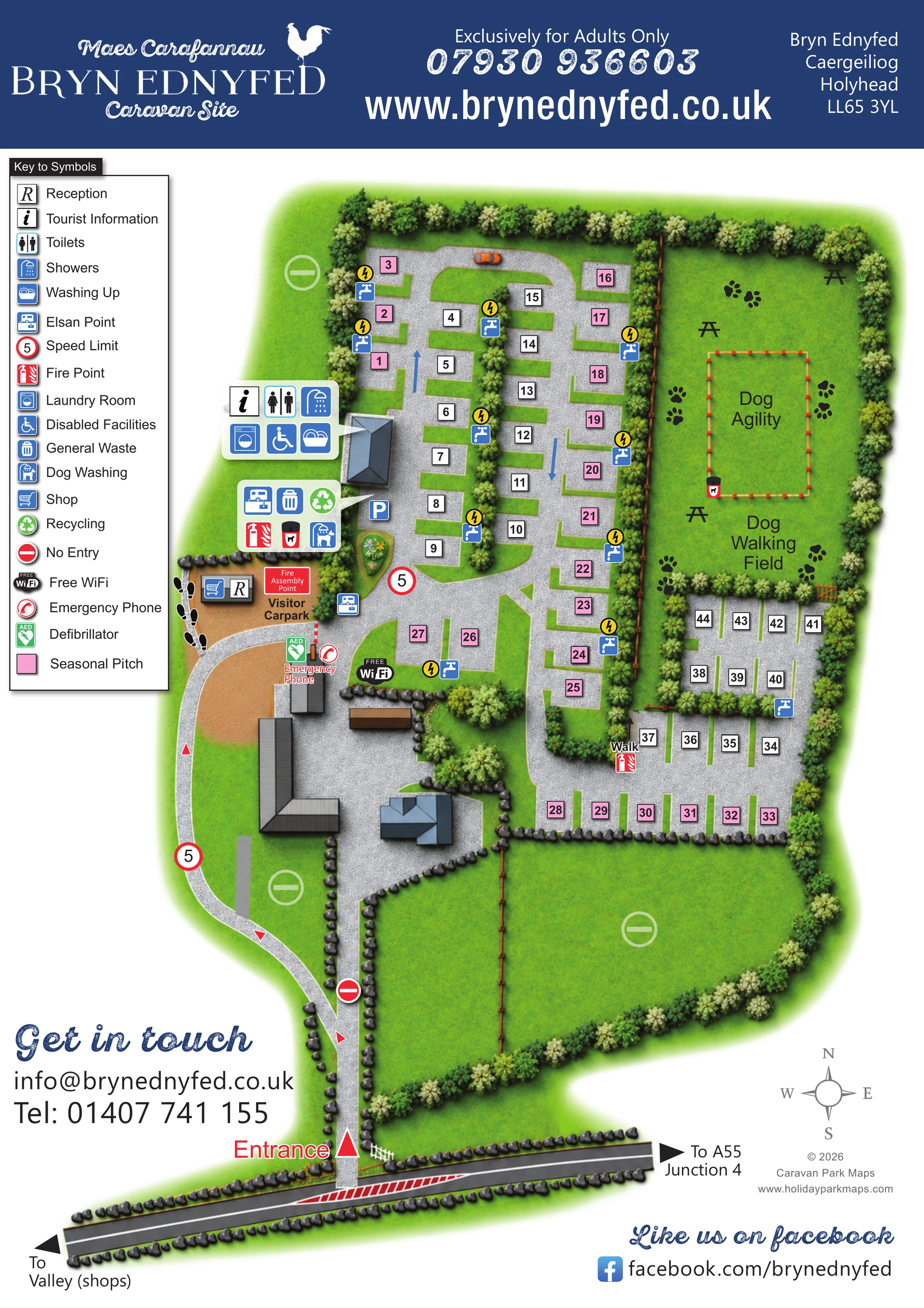
This illustrated map of Bryn Ednyfed Caravan Site presents a compact adults-only caravan and motorhome setting in Caergeiliog, near Holyhead on Anglesey. A navy header carries the park's Welsh and English branding, while the main plan uses bright green grounds, textured gravel lanes and simple numbered pitch markers to explain the site at a glance.
The map shows roughly 45 pitches, with pink markers distinguishing seasonal pitches from the white-marked spaces. Arrival is easy to locate at the bottom of the page: the entrance leads towards reception, visitor parking and the central facilities before the lanes branch into the accommodation areas. The substantial dog walking field gives the eastern side of the plan a distinctive shape, with a separately outlined agility area and picnic tables within it.
A large symbol key and two building-linked facility panels bring together practical information, including showers, laundry, washing up, waste disposal and dog washing. Road arrows towards Valley shops and A55 Junction 4 connect the site plan to its immediate surroundings without turning it into a wider regional map.
The portrait artwork combines a branded header, a large left-hand legend and a landscaped site plan extending down to the entrance road. The plan is read from the south: a clearly labelled entrance feeds a narrow internal approach, with directional arrows leading around the buildings towards reception and the tan visitor car park. A barrier, emergency phone and defibrillator are shown near this arrival area, and the fire assembly point sits beside reception.
Most pitches occupy the northern and central part of the site, arranged as rectangular hardstandings along a curving gravel lane and short side spurs. Tree strips break up the rows. Pink numbered squares identify seasonal pitches, while white squares mark the remaining spaces. Tap symbols and yellow electrical markers appear at intervals beside the pitch groups. A smaller eastern court lies beneath the dog field, with a short connection labelled Walk between the accommodation sections.
The blue-roofed amenity building on the western side has a leader-linked panel showing tourist information, toilets, showers, laundry, disabled facilities and washing up. A second panel groups Elsan disposal, general waste, recycling, fire equipment and dog washing. Additional disposal, parking and WiFi symbols appear nearby.
The north-eastern dog walking field is framed by trees and fencing, with paw-print illustrations, picnic tables and a dashed dog agility rectangle. Broad southern lawns and stone-edged building areas provide visual breathing space. At the foot of the page, the frontage road carries directions towards Valley shops and A55 Junction 4. A compass, contact details and social-media information complete the composition. The enlarged detail view repeats the legend and western facilities from this same artwork rather than showing a separate site section.
 Enlarge this map ↗
KEEP EXPLORING
Chosen for shared landscapes, accommodation or facilities.
 Explore the map ↗
United Kingdom
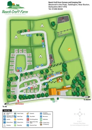
Illustrated touring and camping map with hedge-divided fields, age-labelled play areas and a detailed service key.
 Explore the map ↗
United Kingdom
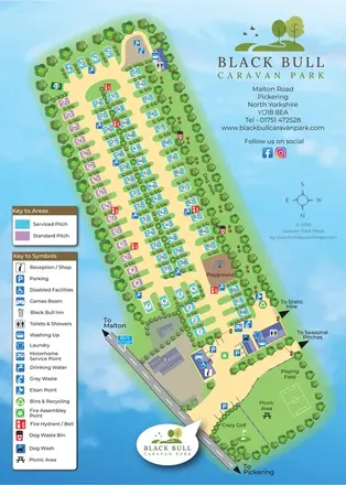
Colour-coded touring-park plan for Black Bull, with numbered pitches, a paw-print dog walk, service icons and entrance recreation areas, paired with a visitor-information reverse.
 Explore the map ↗
United Kingdom
A wooded, streamside park map with a linked farm, café, touring and cottage area.
Features may come from the sample artwork, its key or published park information. Approximate numbers describe the drawing and may cover only part of a park. They are intended to help you compare map examples. Current facilities and booking information should be checked with the park.
LET’S MAP YOUR PARK
For a map quotation, find your park and draw a rough boundary around it. The area you select helps us work out the design time and price.
Draw your park for a quote ↗Or talk to our map designers
01751 473136