
River Spean
A broad blue river forms the lower edge of the illustrated park.
ILLUSTRATED PARK MAP · P049
Roy Bridge, Fort William, Scotland · United Kingdom
 Enlarge the map ↗
A SENSE OF THE PLACE
Bunroy Park is a family-run holiday site in Roy Bridge in the Scottish Highlands, with views towards Aonach Mòr. It offers self-catering lodges, log pods, touring hardstandings and tent camping.
Electric connections are available on touring pitches and selected camping spaces, with showers and other washroom facilities on site. Roy Bridge's location near Spean Bridge and Fort William makes it a base for exploring Highland scenery and outdoor activities.
LOOK CLOSER
A broad blue river forms the lower edge of the illustrated park.
Labelled at the lower-left river junction, providing a second named landscape reference.
Dense stylised trees frame the riverside boundary, divide accommodation groups and follow the narrow internal watercourse.
An unlabelled blue watercourse runs down the western part of the park towards the rivers, with white-edged crossings at access routes.
An information symbol marks the small central building where the lodge approach meets the touring area.
A callout points to the blue-roofed building on the eastern side of the touring loop and groups toilet and shower symbols with other camper facilities.
Shown in the shared facilities callout beside the eastern building.
The combined kitchen/laundry category is identified in the key and repeated in the facilities-building callout.
An information symbol marks the small central building where the lodge approach meets the touring area.
A callout points to the blue-roofed building on the eastern side of the touring loop and groups toilet and shower symbols with other camper facilities.
Shown in the shared facilities callout beside the eastern building.
The combined kitchen/laundry category is identified in the key and repeated in the facilities-building callout.
Tap symbols appear by the hardstanding row and within the facilities-building callout.
Yellow lightning-bolt circles identify hook-up locations beside touring pitches and an electric tent symbol.
A green waste-bin symbol marks a point near the entrance.
A green disposal symbol is positioned beside the inner touring-pitch row.
Identified in the eastern facilities-building callout.
Repeated red extinguisher symbols are distributed around the camping, pod and touring areas.
A red cross symbol appears beside reception.
A green assembly symbol is shown on the approach immediately above reception.
A red telephone-handset icon appears beside reception, although its meaning is not explained in the Park Key.
A broad blue river forms the lower edge of the illustrated park.
Labelled at the lower-left river junction, providing a second named landscape reference.
Dense stylised trees frame the riverside boundary, divide accommodation groups and follow the narrow internal watercourse.
An unlabelled blue watercourse runs down the western part of the park towards the rivers, with white-edged crossings at access routes.
A brown dashed walking route is labelled along the opposite bank of the River Spean.
The entrance is highlighted at the top of the plan, with an outward direction towards Roy Bridge and the A86.
Broad grey roads branch through the lodge area and continue into a rounded loop serving hardstandings and open camping lawns.
READING THE MAP
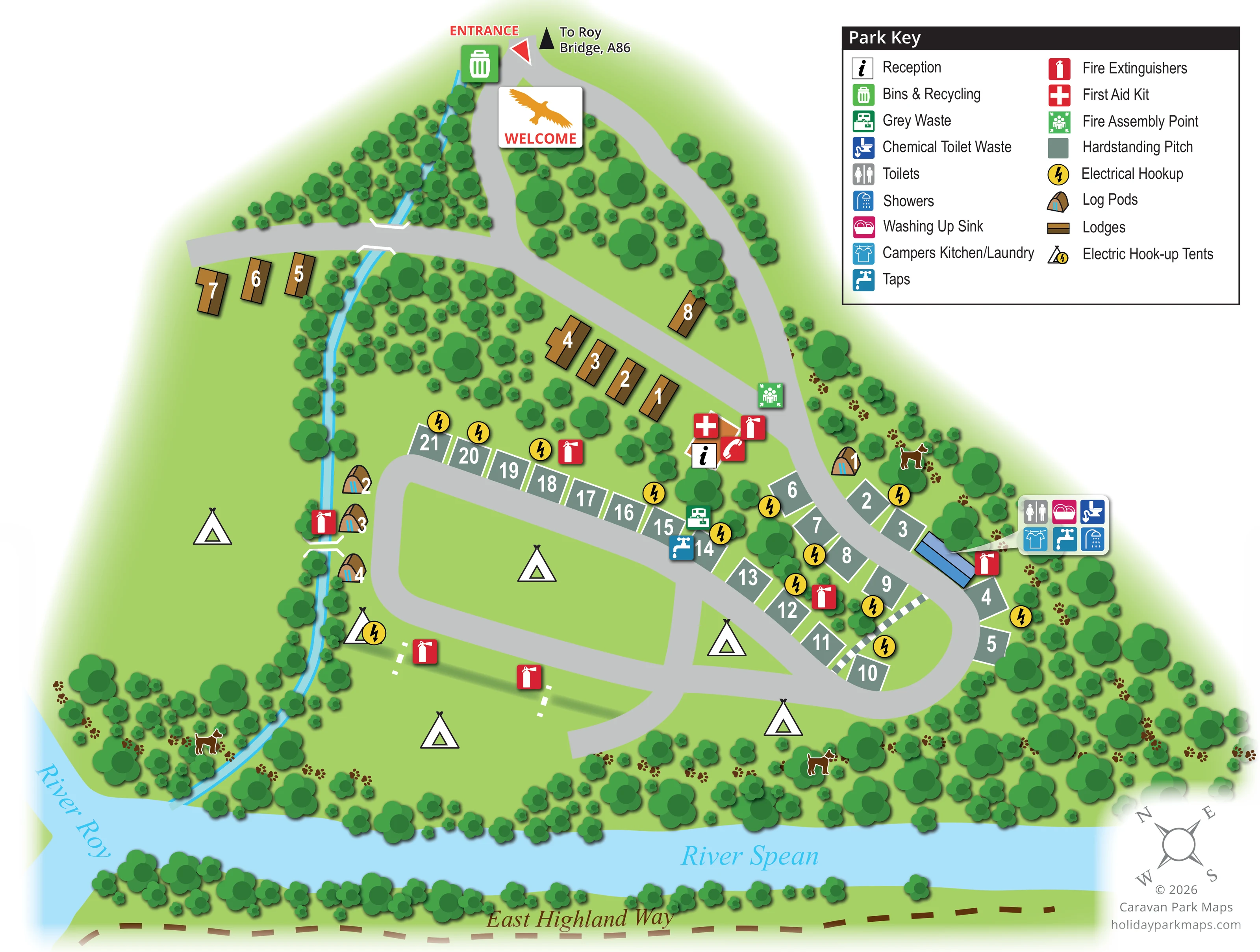
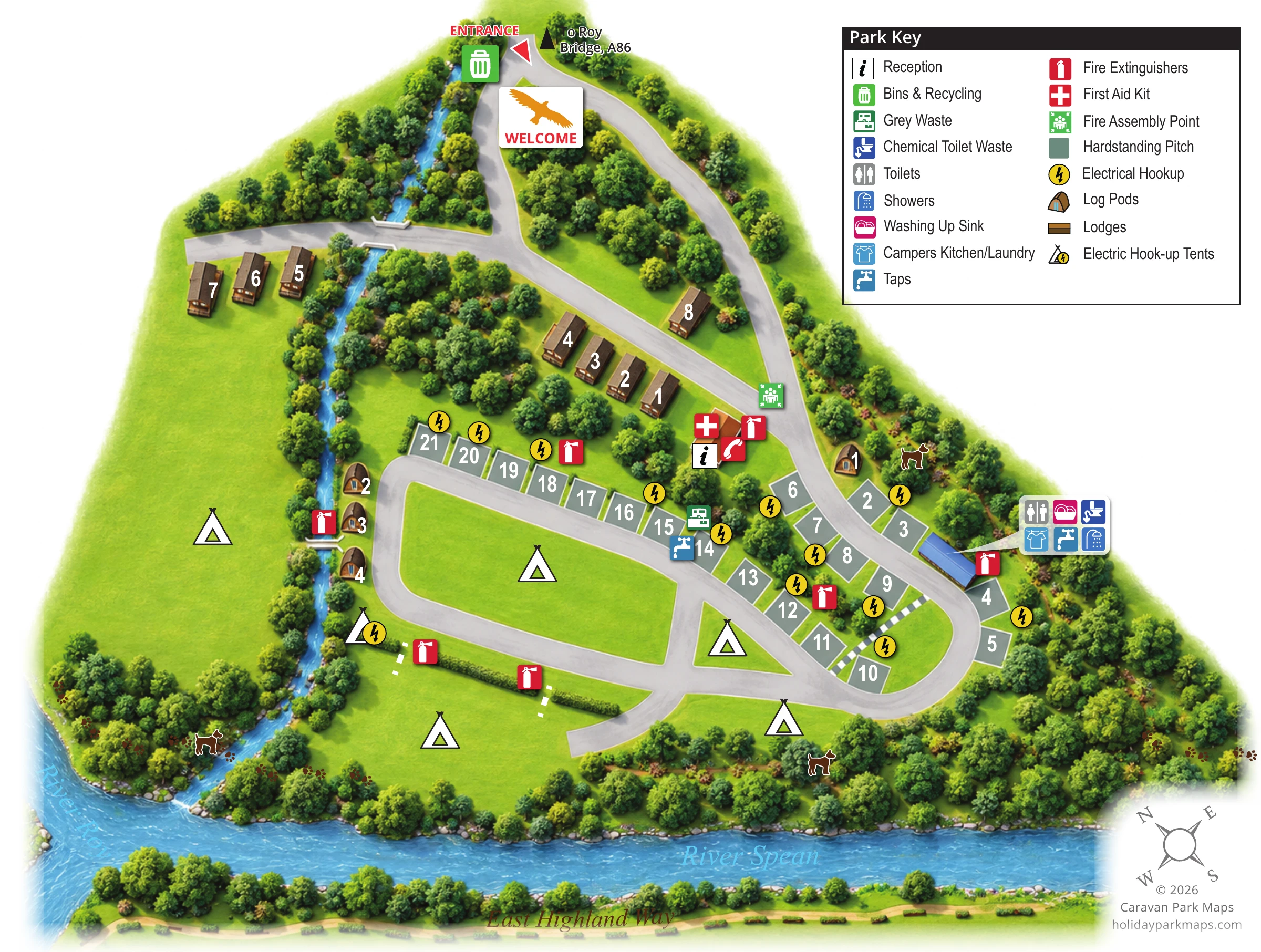
This illustrated map of Bunroy Park brings together a wooded Highland setting and the practical detail needed to navigate a mixed lodge, pod, touring and camping site. Based in Roy Bridge near Fort William, the park is presented as a compact network of access roads and grassy spaces beside the River Spean, with the River Roy named at the lower-left river junction. The East Highland Way adds a useful landscape reference along the opposite bank.
The design makes the different accommodation areas immediately recognisable. Brown lodge illustrations follow the upper roads, curved-roof log pods sit close to the trees and narrow watercourse, and numbered hardstandings line the touring loop. Tent symbols identify the more open camping lawns without making them look like rows of fixed units.
A generous Park Key explains the colour-coded facilities and safety symbols, while a separate callout gathers the services associated with the main facilities building. Bright electrical markers, large white accommodation numbers and a clearly highlighted entrance give the map a practical wayfinding structure within its softer green-and-blue landscape.
The plan begins at a red-labelled entrance at the top of the page, beside a direction towards Roy Bridge and the A86. A welcome panel with an orange bird silhouette introduces the site. The grey access road branches around a wooded island, with one route crossing the narrow blue watercourse to a small western lodge group and another continuing past further lodges towards reception.
Below this arrival area, the road opens into a rounded touring loop. Grey-green hardstandings with white borders follow its northern and eastern edges, with large white numbers and yellow electrical hook-up markers. Open grass occupies the loop interior and the broader western and riverside spaces. Tent symbols distinguish these camping areas, including an electric hook-up tent symbol. Curved-roof log pods are placed mainly along the western watercourse, with another near the eastern approach.
Reception is marked by an information icon, with first aid, a telephone symbol and a fire extinguisher nearby. A fire assembly point is shown just above it. The blue-roofed eastern facilities building has a pointer-linked callout for toilets, showers, washing up, campers kitchen/laundry, taps and chemical toilet waste. Further symbols locate grey waste, water, bins and recycling, and extinguishers across the site.
Dense rounded tree canopies frame the accommodation and riverbanks. The River Spean spans the bottom of the artwork, the River Roy is labelled at the left, and a dashed brown East Highland Way runs along the far bank. Dog silhouettes and paw prints add small illustrative details among the trees. A compass rose completes the lower-right corner. The enlarged key view repeats part of this same artwork, making its two-column legend and facilities callout easier to read.
 Enlarge this map ↗
KEEP EXPLORING
Chosen for shared landscapes, accommodation or facilities.
 Explore the map ↗
United Kingdom
Woodland park map with mixed pitches, bell tents, lodges and a fishing lake.
 Explore the map ↗
United Kingdom
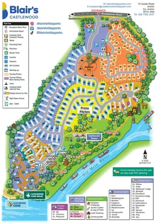
A colourful riverside park map combining touring pitches, holiday accommodation and treetop adventures.
 Explore the map ↗
United Kingdom
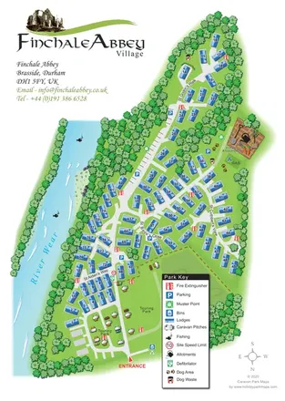
Finchale Abbey park map with numbered lodges, touring areas, River Wear frontage and village allotments.
Features may come from the sample artwork, its key or published park information. Approximate numbers describe the drawing and may cover only part of a park. They are intended to help you compare map examples. Current facilities and booking information should be checked with the park.
TAKE A CLOSER LOOK
View the illustrated map in detail or choose a file to download. These are sample maps; contact the park for current visitor information.


LET’S MAP YOUR PARK
For a map quotation, find your park and draw a rough boundary around it. The area you select helps us work out the design time and price.
Draw your park for a quote ↗Or talk to our map designers
01751 473136