
Meadow, hedges, trees and stone boundaries
Textured green grounds, repeated hedgerows, broadleaf trees and a stone boundary around the southern pads establish the rural setting. Sheep illustrations reinforce the farm character.
ILLUSTRATED PARK MAP · P077
Church House Farm, Church Road, Llangain, Carmarthenshire · United Kingdom
 Enlarge the map ↗
A SENSE OF THE PLACE
Church House Farm Getaways is represented here by a map of its rural site near Llangain in Carmarthenshire. The operator's published description places the accommodation among Welsh meadows.
Its holiday offering included camping, caravan pitches and glamping pods. The map remains a useful record of that layout; it is presented as an artwork example while the operator's website carries a temporary-closure notice.
LOOK CLOSER
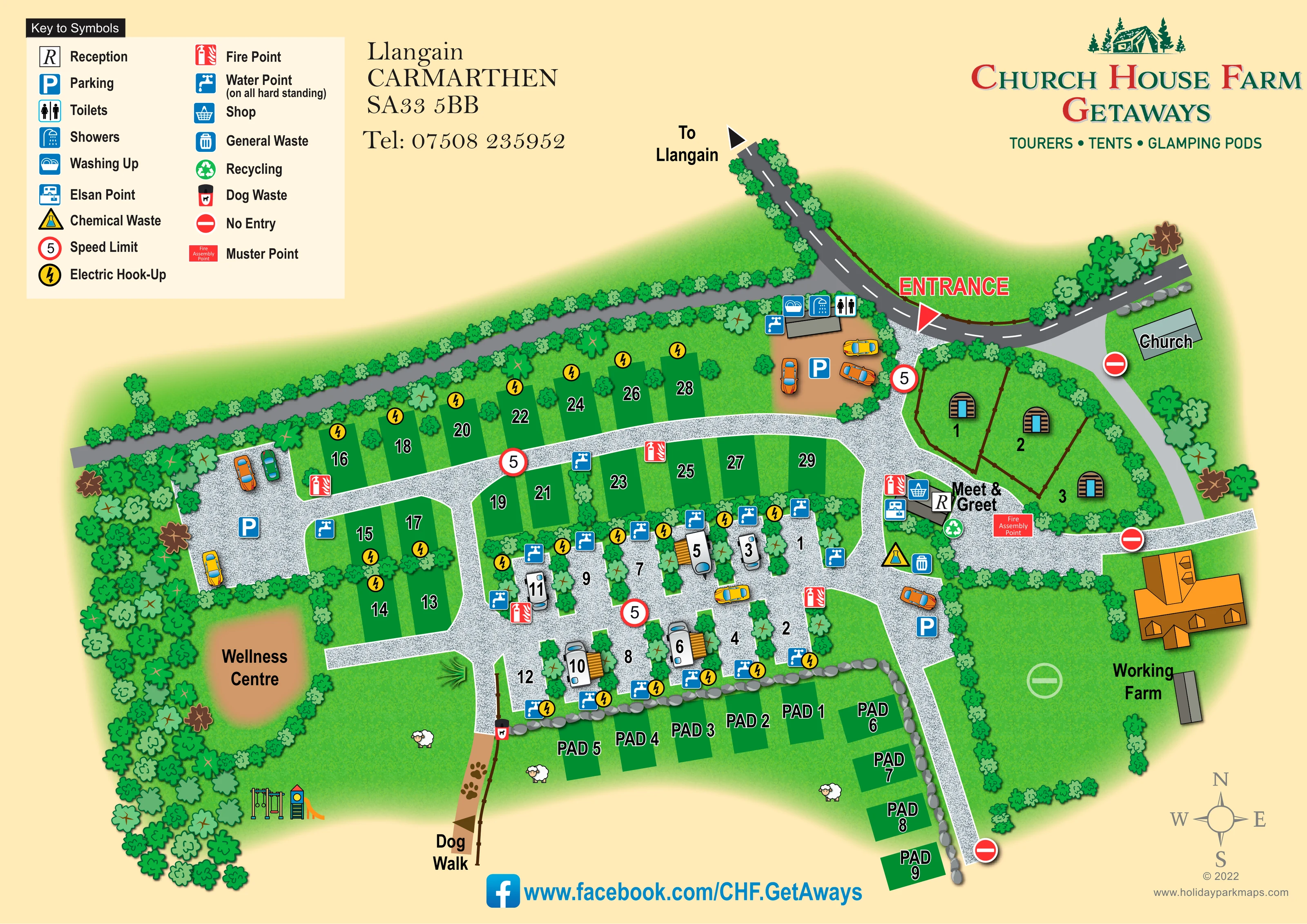
Textured green grounds, repeated hedgerows, broadleaf trees and a stone boundary around the southern pads establish the rural setting. Sheep illustrations reinforce the farm character.
The eastern grounds are labelled Working Farm and illustrated with a large orange-roofed building and a smaller outbuilding.
A small building beside the road east of the entrance is labelled Church, providing a useful local landmark.
A small building beside the eastern internal junction is labelled Meet & Greet and marked with reception and shop symbols.
The building just inside the entrance, beside the northern parking area, carries toilets, showers and washing-up symbols.
Blue parking symbols identify areas near the entrance amenities, at the western end of the pitch road and south of reception.
Yellow lightning symbols appear beside many grass and hardstanding pitches.
Blue tap symbols are distributed through the pitch area. The key states that water points are provided on all hardstandings.
A small building beside the eastern internal junction is labelled Meet & Greet and marked with reception and shop symbols.
The building just inside the entrance, beside the northern parking area, carries toilets, showers and washing-up symbols.
Blue parking symbols identify areas near the entrance amenities, at the western end of the pitch road and south of reception.
Yellow lightning symbols appear beside many grass and hardstanding pitches.
Blue tap symbols are distributed through the pitch area. The key states that water points are provided on all hardstandings.
Disposal and recycling symbols form a service cluster around and below the Meet & Greet building.
Red fire-point symbols are distributed around the accommodation roads, with a labelled Fire Assembly Point beside reception.
A rounded tan area within the tree-lined western grounds is labelled Wellness Centre; the artwork does not describe its services.
A small illustration of swings and a slide marks a play area on the south-western lawn.
A brown, paw-print-marked path runs south from the pitch area towards the Dog Walk label. A dog-waste symbol marks its northern end.
A large red ENTRANCE label and arrow identify access from the curving public road. A separate directional arrow points towards Llangain.
Pale, textured internal roads connect the pitch groups and parking areas. The drawing includes 5 speed-limit signs and no-entry markers at selected peripheral routes.
Textured green grounds, repeated hedgerows, broadleaf trees and a stone boundary around the southern pads establish the rural setting. Sheep illustrations reinforce the farm character.
The eastern grounds are labelled Working Farm and illustrated with a large orange-roofed building and a smaller outbuilding.
A small building beside the road east of the entrance is labelled Church, providing a useful local landmark.
READING THE MAP
This illustrated map of Church House Farm Getaways presents a small rural holiday site at Llangain in Carmarthenshire. Touring pitches, tent accommodation and glamping pods share a meadow setting framed by hedges, trees and working-farm grounds. Rather than treating the site as a uniform grid, the artwork makes its different areas easy to recognise: grass pitches along the upper lane, gravel hardstandings in the centre, a separate strip of labelled pads and three fenced pod plots near the entrance.
The arrival sequence is particularly clear. A red entrance arrow leads from the curving road to parking and the amenities building, while the Meet & Greet reception sits at the next internal junction. Blue facility symbols, yellow hook-up markers and red fire-point signs sit directly within the plan and are explained in a generous two-column key.
Details such as the neighbouring church, a paw-print dog-walk path, children's play equipment and the labelled Wellness Centre give this sample its individual character. The warm cream background and bright green landscape keep the practical information within a distinctly countryside-focused design.
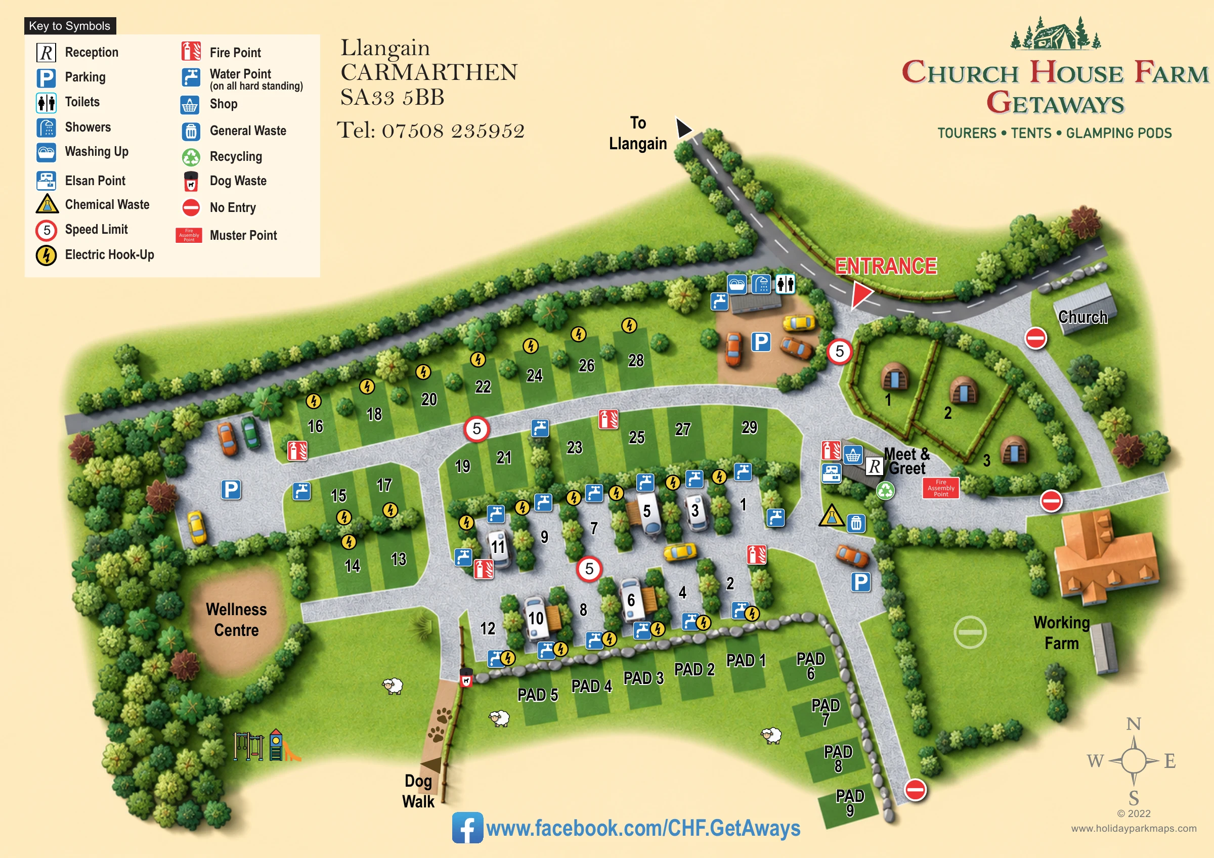
The single-page plan is arranged around a road entering from the north, with an arrow indicating the direction to Llangain. The public road curves past the church and the clearly marked site entrance. Immediately inside, a parking court adjoins a building marked for toilets, showers and washing up. From here, pale gravel roads branch west through the main pitches and south towards reception and the farm-side boundary.
Accommodation is drawn in several recognisable groups. Dark-green grass pitches line the northern lane and extend into the western part of the site. The central hardstandings form short rows divided by planting, with selected caravan illustrations helping visitors understand their use. Water and electric hook-up symbols are especially prominent around this central area. Along the lower edge, a separate run of PAD-labelled spaces follows a stone boundary before turning south. Three timber-style glamping pods occupy fenced grassy compartments east of the entrance junction.
The Meet & Greet building carries reception and shop symbols. Nearby are Elsan, chemical-waste, general-waste and recycling markers, together with the labelled fire assembly point. Further parking areas and repeated fire-point symbols support navigation through the compact site. To the west, the Wellness Centre sits within a leafy pocket; below it, a small play-equipment illustration marks the lawn. A brown path with paw prints leads towards the dog walk.
The surrounding church, working-farm buildings, hedges, trees and sheep illustrations supply local context. A large legend occupies the upper-left corner, park branding balances it at the upper right, and a compass anchors the lower-right margin. The accompanying enlargement shows the same artwork's legend and western pitches in greater detail, rather than a separate site section or additional accommodation.
 Enlarge this map ↗
KEEP EXPLORING
Chosen for shared landscapes, accommodation or facilities.
 Explore the map ↗
United Kingdom
Woodland-framed Barnsoul map with mixed accommodation, shared facilities and paw-marked walking routes.
 Explore the map ↗
United Kingdom
Riverside park map with named pitch fields, illustrated huts and a paw-print dog walk.
 Explore the map ↗
United Kingdom
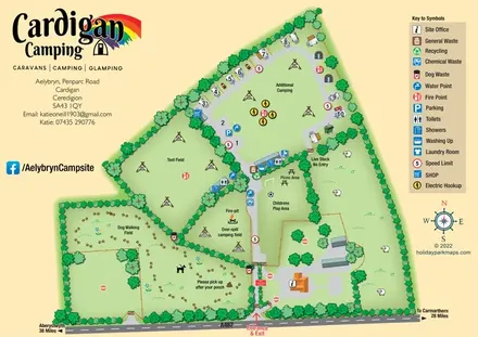
Illustrated farm-campsite map with mixed accommodation, named camping fields and a dedicated dog-walking area.
Features may come from the sample artwork, its key or published park information. Approximate numbers describe the drawing and may cover only part of a park. They are intended to help you compare map examples. Current facilities and booking information should be checked with the park.
LET’S MAP YOUR PARK
For a map quotation, find your park and draw a rough boundary around it. The area you select helps us work out the design time and price.
Draw your park for a quote ↗Or talk to our map designers
01751 473136