
Quiet gardens
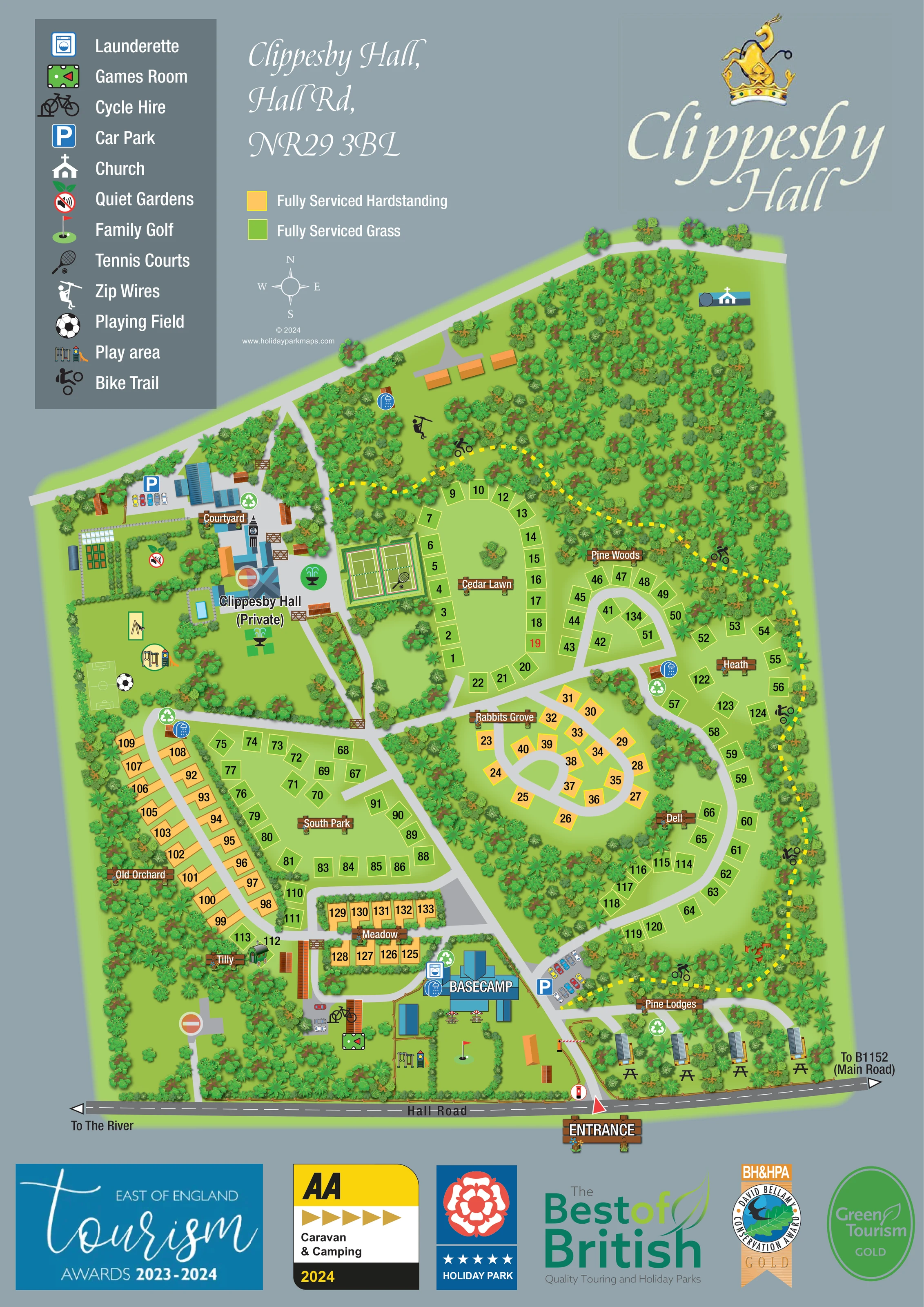
A quiet-gardens symbol marks the formal enclosed garden beside the private hall and Courtyard.
ILLUSTRATED PARK MAP · P080
Clippesby Hall, Hall Road · United Kingdom
 Enlarge the map ↗
A SENSE OF THE PLACE
Clippesby Hall offers camping, touring and self-catering accommodation in woodland grounds and gardens in the Norfolk Broads area. Pitch settings range from more secluded woodland spaces to open family lawns.
Electric connections are available, while cottages and other holiday accommodation provide alternatives to camping. The park's information centre supports visitors planning outings to the Broads, Norfolk coast, Norwich and Great Yarmouth.
LOOK CLOSER
A quiet-gardens symbol marks the formal enclosed garden beside the private hall and Courtyard.
Dense illustrated trees enclose the park, divide its pitch neighbourhoods and form a substantial northern woodland area.
The hall is explicitly labelled Private, with a distinctive roof, tower, formal garden details and fountain motifs.
Prominent blue-roofed building complex close to the entrance, with nearby parking, picnic seating and visitor-facility symbols.
The washing-machine symbol is located at BASECAMP and explained in the main legend.
Repeated blue shower symbols mark service locations around the pitch areas and at BASECAMP.
Green recycling symbols are distributed near buildings, pitch areas and Pine Lodges.
A snooker-table pictogram places the games room just west of the BASECAMP complex.
Prominent blue-roofed building complex close to the entrance, with nearby parking, picnic seating and visitor-facility symbols.
The washing-machine symbol is located at BASECAMP and explained in the main legend.
Repeated blue shower symbols mark service locations around the pitch areas and at BASECAMP.
Green recycling symbols are distributed near buildings, pitch areas and Pine Lodges.
A snooker-table pictogram places the games room just west of the BASECAMP complex.
The cycle-hire symbol appears beside the building group west of BASECAMP.
Blue parking signs and illustrated cars identify parking near BASECAMP and the Courtyard.
A church pictogram marks a building in the wooded north-eastern part of the depiction.
A quiet-gardens symbol marks the formal enclosed garden beside the private hall and Courtyard.
A golf-flag symbol identifies the lawn south of BASECAMP.
Two clearly drawn courts sit between the private hall grounds and Cedar Lawn.
A zip-wire pictogram marks a clearing in the northern woodland.
A football symbol and pitch markings identify the playing field west of the hall.
Play-equipment illustrations mark recreation spaces near the playing field and south-west of BASECAMP.
A bright yellow dashed route with cyclist pictograms runs through the northern and eastern woodland, continuing towards the parking area near Pine Lodges.
Dense illustrated trees enclose the park, divide its pitch neighbourhoods and form a substantial northern woodland area.
The hall is explicitly labelled Private, with a distinctive roof, tower, formal garden details and fountain motifs.
Named building group beside the private hall, reached by an internal drive and accompanied by parking.
A small green bow-top caravan illustration labelled Tilly appears near the southern end of Old Orchard; its accommodation category is not specified.
Parasol picnic tables appear beside BASECAMP, with separate picnic-table illustrations outside the Pine Lodges.
A large timber-style entrance label and red pointer mark arrival from Hall Road, with a barrier illustrated just inside.
Hall Road has outward arrows labelled To The River and To B1152 (Main Road); the river itself is not depicted.
No-entry symbols appear at the private hall and on the western access spur.
A red fire-extinguisher pictogram appears beside the entrance.
READING THE MAP
This illustrated map of Clippesby Hall presents a woodland camping, touring and self-catering park in the Norfolk Broads area. Rather than treating the grounds as one continuous field of pitches, the design brings out a series of named neighbourhoods, each framed by trees, gardens or open lawn. Cedar Lawn, South Park, Old Orchard and the smaller woodland clearings give visitors memorable reference points as they move around the estate.
Arrival is anchored by Hall Road along the bottom of the page, with a prominent entrance sign leading towards BASECAMP and the nearby Pine Lodges. Gold and green pitch colours distinguish fully serviced hardstanding from fully serviced grass, while a bright yellow dashed bike trail creates a separate recreational route through the woodland.
The map also gives considerable space to the park's activity areas, including tennis courts, family golf, play areas, a playing field and zip wires. The private hall and its formal grounds provide a distinctive landmark. Script branding, timber-style area signs and a structured pictogram legend complete a visitor map that combines practical navigation with the character of a wooded country estate.
The portrait artwork uses an overhead plan with pictorial buildings and shaded tree canopies. Hall Road runs across the southern edge, carrying arrows towards the river and the B1152 main road. A red pointer and large wooden entrance sign mark the approach into the park, where a barrier, parking area, BASECAMP and Pine Lodges establish the principal arrival landmarks.
Pale-grey internal roads branch into several contrasting accommodation layouts. Rabbits Grove is arranged around a compact loop of gold-coloured hardstanding pitches, while Old Orchard follows a longer linear drive. Meadow uses short rows close to BASECAMP. Green grass pitches surround the open spaces of Cedar Lawn and South Park, with Pine Woods, Heath and Dell following more curved, tree-lined routes. Brown signboard labels make these areas easy to distinguish without relying solely on pitch numbers.
The western part of the plan contains the Courtyard and Clippesby Hall, explicitly marked Private. Formal garden details, fountain motifs and the hall's tower contrast with the surrounding woodland. Nearby are two drawn tennis courts, a playing field and play equipment. Further north, a zip-wire symbol marks a woodland clearing. The yellow dashed bike trail runs through the northern trees and down the eastern side, using repeated cyclist symbols to distinguish it from vehicle access.
Around BASECAMP, the map locates the launderette, showers, games room, cycle hire, picnic seating, play space and family golf. Shower and recycling symbols recur elsewhere across the grounds. The upper page holds the facility legend, pitch-surface key, address, compass and park branding, while award and membership graphics occupy the footer. The close-up views enlarge this same single-page composition rather than introducing additional map variants.
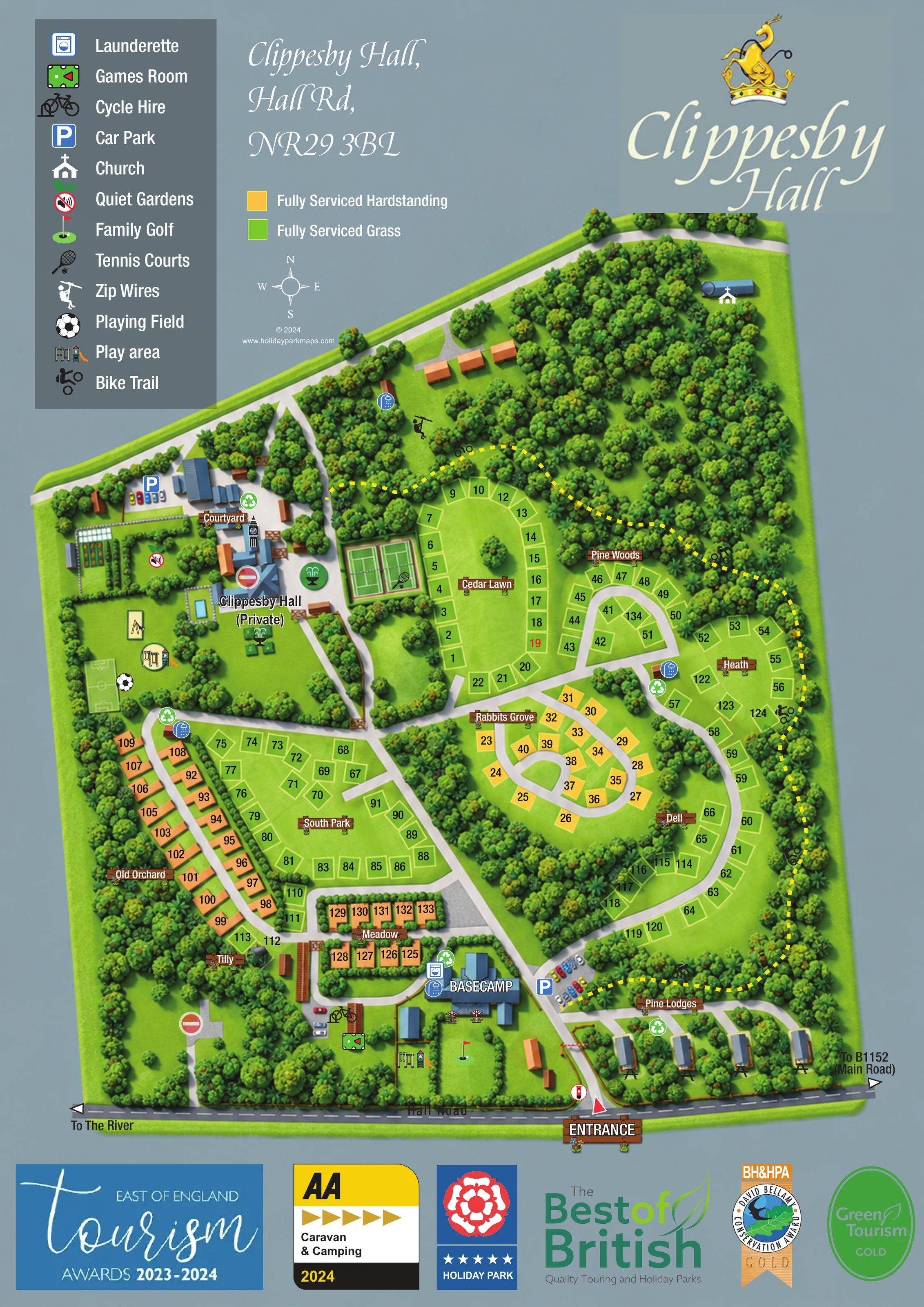 Enlarge this map ↗
KEEP EXPLORING
Chosen for shared landscapes, accommodation or facilities.
 Explore the map ↗
United Kingdom
Woodland camping, lodges, lakes and colour-coded bike trails at Avon Tyrrell Outdoor Centre.
 Explore the map ↗
United Kingdom
Woodland park map with mixed pitches, bell tents, lodges and a fishing lake.
 Explore the map ↗
United Kingdom
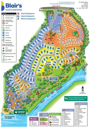
A colourful riverside park map combining touring pitches, holiday accommodation and treetop adventures.
Features may come from the sample artwork, its key or published park information. Approximate numbers describe the drawing and may cover only part of a park. They are intended to help you compare map examples. Current facilities and booking information should be checked with the park.
LET’S MAP YOUR PARK
For a map quotation, find your park and draw a rough boundary around it. The area you select helps us work out the design time and price.
Draw your park for a quote ↗Or talk to our map designers
01751 473136