
Open grass areas
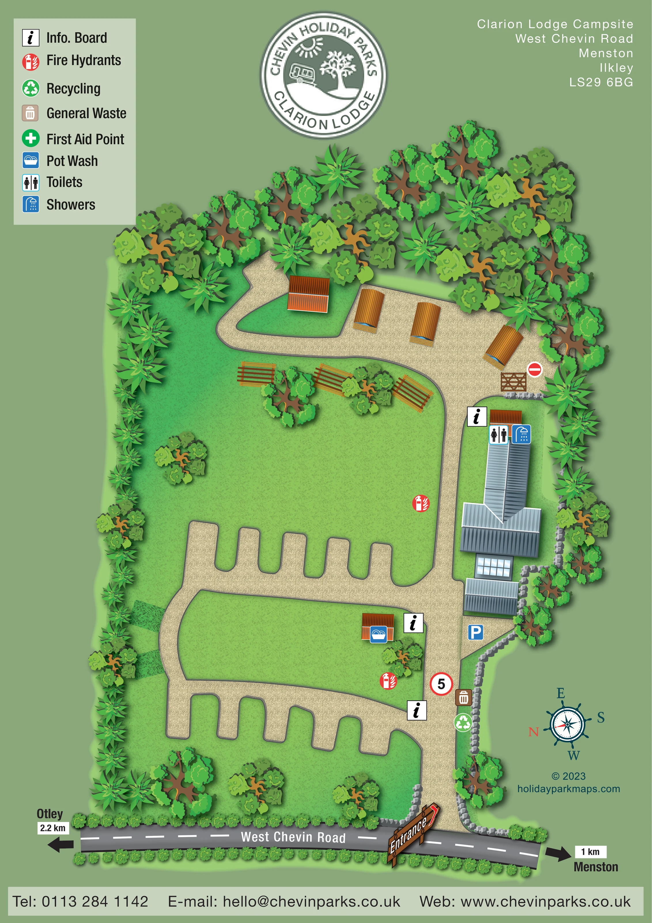
Broad textured lawns fill the spaces between the gravel lanes, with scattered trees and no individually marked tent plots.
ILLUSTRATED PARK MAP · P079
Clarion Lodge Campsite, West Chevin Road, Menston, Ilkley · United Kingdom
 Enlarge the map ↗
A SENSE OF THE PLACE
Clarion Lodge Campsite at Menston welcomes tents, caravans, campervans and motorhomes. Hardstanding pitches and separate tent areas provide a choice of accommodation space, with optional electric connections.
Toilets and showers serve the site, and washing-up facilities are housed in a communal wooden cabin. The map helps visitors find these shared facilities and understand the arrangement of pitches at this Chevin Holiday Parks site.
LOOK CLOSER
Broad textured lawns fill the spaces between the gravel lanes, with scattered trees and no individually marked tent plots.
Dense illustrated trees frame the upper boundary, with repeated planting along the sides and a low hedge beside West Chevin Road.
Grey stone walls edge the entrance and much of the right-hand side, providing a recognisable boundary beside the access lane.
Toilet and shower symbols identify facilities at the upper end of the elongated building group beside the right-hand access lane.
A blue washing-up symbol marks a small orange-roofed cabin on the central grass area, close to the main lane.
Repeated black information symbols appear beside the facilities and at junctions along the entrance lane.
Red symbols, identified in the legend as fire hydrants, mark two points beside the grass areas and internal routes.
General waste and recycling symbols are grouped beside the boundary wall on the lower part of the entrance lane.
Toilet and shower symbols identify facilities at the upper end of the elongated building group beside the right-hand access lane.
A blue washing-up symbol marks a small orange-roofed cabin on the central grass area, close to the main lane.
Repeated black information symbols appear beside the facilities and at junctions along the entrance lane.
Red symbols, identified in the legend as fire hydrants, mark two points beside the grass areas and internal routes.
General waste and recycling symbols are grouped beside the boundary wall on the lower part of the entrance lane.
A blue P marks a small surfaced area beside the main building group.
Three timber picnic tables are illustrated around small tree groups below the upper accommodation area.
A green first aid symbol is included in the legend, but no corresponding position is clearly marked on the plan.
Broad textured lawns fill the spaces between the gravel lanes, with scattered trees and no individually marked tent plots.
Dense illustrated trees frame the upper boundary, with repeated planting along the sides and a low hedge beside West Chevin Road.
Grey stone walls edge the entrance and much of the right-hand side, providing a recognisable boundary beside the access lane.
A large illustrated entrance sign identifies the access from West Chevin Road at the bottom of the page.
The right-hand entrance lane connects two cross-site pitch lanes, a curved left-hand link and the upper pod area.
A timber gate and no-entry symbol appear near the upper facilities; a red-bordered 5 sign is drawn on the entrance lane.
Roadside arrows label Otley to the left and Menston to the right, with distances printed on the artwork.
READING THE MAP
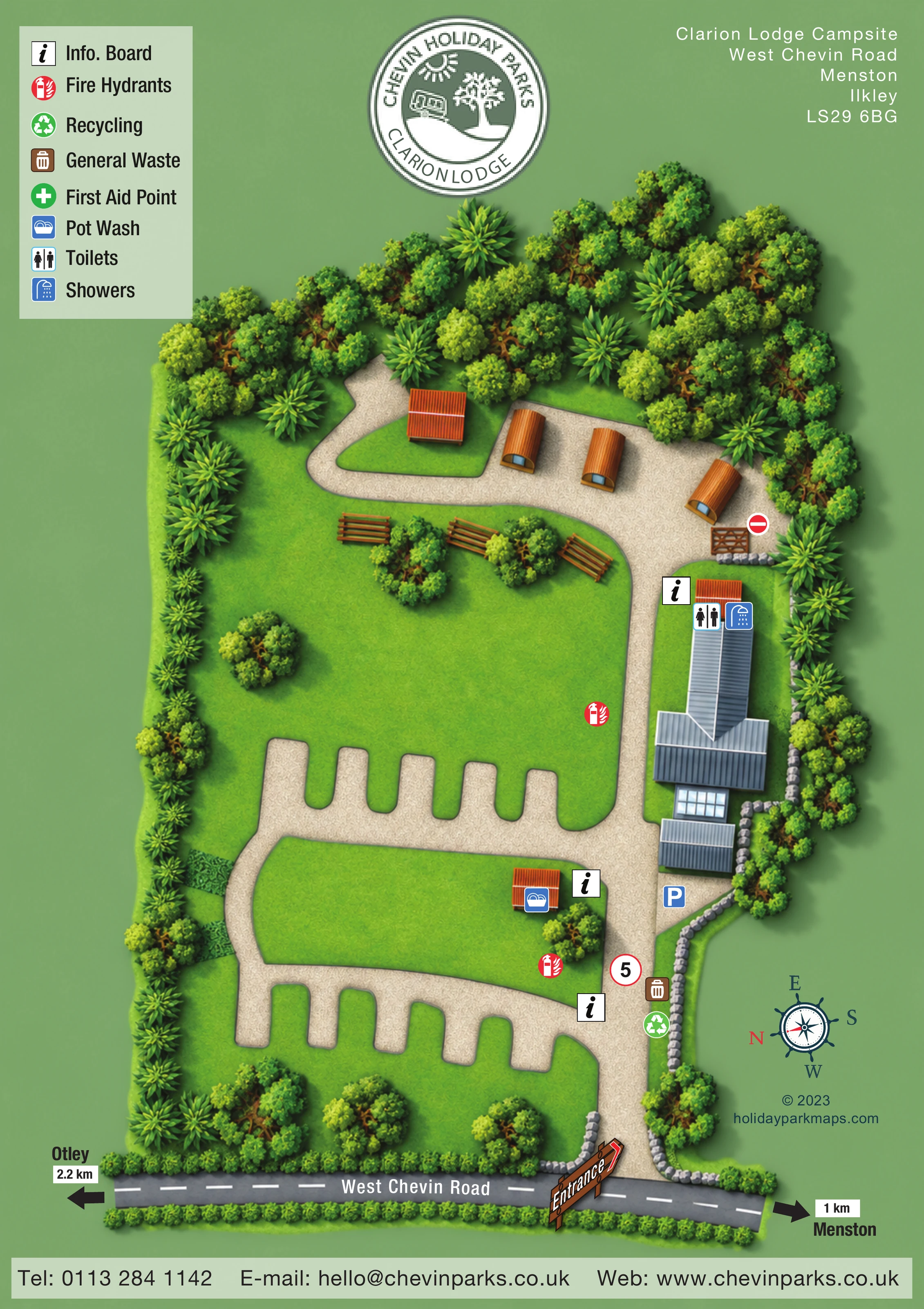
This illustrated map of Clarion Lodge Campsite on West Chevin Road, Menston, presents a compact touring and camping site through its lanes, lawns and shared facilities. The portrait layout follows the visitor’s arrival from the roadside entrance at the bottom of the page into an enclosed, tree-lined site. Pale gravel routes stand out against textured green grass, making the two rows of hardstanding bays easy to recognise without filling the drawing with vehicles or pitch numbers.
At the top of the plan, three timber pod-like units form a small accommodation group beside dense planting. Picnic tables, small cabins and a larger blue-grey-roofed building group provide useful visual landmarks. Clear symbols identify toilets, showers, washing-up facilities, information boards, waste points and parking.
The circular Clarion Lodge branding, address block and compact legend sit above the main drawing, while West Chevin Road and arrows towards Otley and Menston give the entrance a local context. The result is a sample suited to smaller campsites that need visitors to understand the site’s organisation and find everyday facilities, rather than navigate a densely numbered accommodation estate.
The plan is organised around a gravel entrance lane running up the right-hand side from West Chevin Road. Two cross-site lanes extend left from it, with short projecting hardstanding bays forming a distinctive comb-like pattern. A curved link joins the lanes on the left, enclosing a broad central lawn. Further open grass lies above and below these routes, with scattered tree groups breaking up the space. The bays are empty and unnumbered, so the emphasis is on recognising the campsite’s structure rather than locating a particular labelled pitch.
Near the top of the page, the gravel route widens around three orange timber pod-like units. A separate pitched-roof cabin sits inside the curve of this upper route. Picnic tables are drawn on the adjoining lawn, backed by a dense band of varied trees. A gate and no-entry symbol provide another recognisable landmark near the upper end of the main access lane.
Shared facilities occupy the right-hand side. Toilet and shower symbols sit at the upper end of the elongated building group, while a parking symbol identifies the surfaced space below it. A small orange-roofed cabin on the central lawn carries the pot wash symbol. Information boards are marked at several points along the lane, with red fire-hydrant symbols nearby. General waste and recycling are grouped beside the stone boundary wall closer to the entrance.
The single portrait composition combines an overhead route plan with shaded roofs, layered tree crowns and textured ground surfaces. Its upper legend explains the service symbols, including a first aid entry without a clearly shown location. The road frontage, large entrance sign, local direction arrows and rotated compass complete the wayfinding framework. The enlarged views show details of this same composition, rather than separate map variants.
 Enlarge this map ↗
KEEP EXPLORING
Chosen for shared landscapes, accommodation or facilities.
 Explore the map ↗
United Kingdom
Colour-coded campsite map with riverside pitches, bell tents, a swimming pool and fishing lake.
 Explore the map ↗
United Kingdom
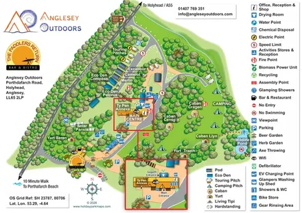
Illustrated camping and glamping map with an activity-centre inset and wildlife pond.
 Explore the map ↗
United Kingdom
Woodland park map with mixed pitches, bell tents, lodges and a fishing lake.
Features may come from the sample artwork, its key or published park information. Approximate numbers describe the drawing and may cover only part of a park. They are intended to help you compare map examples. Current facilities and booking information should be checked with the park.
TAKE A CLOSER LOOK
View the illustrated map in detail or choose a file to download. These are sample maps; contact the park for current visitor information.

LET’S MAP YOUR PARK
For a map quotation, find your park and draw a rough boundary around it. The area you select helps us work out the design time and price.
Draw your park for a quote ↗Or talk to our map designers
01751 473136