
Woodland and planted boundaries
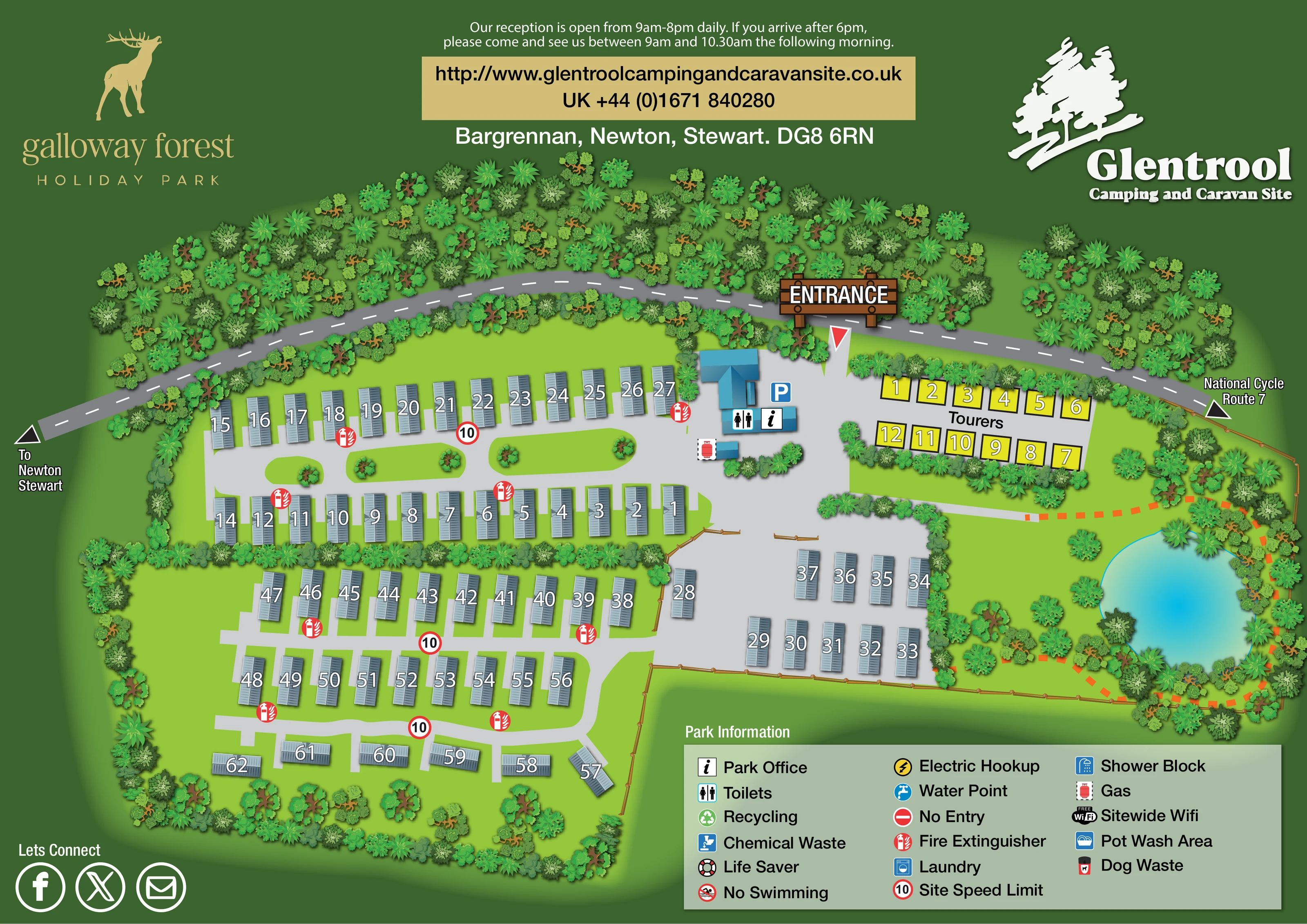
Dense bands of varied tree crowns frame the road and park perimeter, separate accommodation groups and surround the pond.
ILLUSTRATED PARK MAP · P136
Bargrennan, Newton Stewart · United Kingdom
 Enlarge the map ↗
A SENSE OF THE PLACE
Glentrool Camping and Caravan Site is located in the Galloway Forest Dark Sky Park near Newton Stewart. It welcomes tents, caravans and motorhomes, and offers static holiday accommodation for hire or ownership.
Forest landscapes and wildlife give the site an outdoor focus, with the dark-sky setting adding another reason to spend time outside. The map helps guests locate the different accommodation areas and shared spaces.
LOOK CLOSER
Dense bands of varied tree crowns frame the road and park perimeter, separate accommodation groups and surround the pond.
A rounded turquoise pond occupies the eastern side of the plan, with trees around much of its edge.
Brown post-and-rail lines outline parts of the eastern and lower boundaries, with openings between accommodation areas.
A large timber-style ENTRANCE sign and red triangular pointer mark the approach from the road across the top of the plan.
An information symbol locates the park office within the blue-roofed building group immediately inside the entrance.
A toilet pictogram is placed on the entrance building group beside the office symbol.
A blue P symbol identifies parking beside the entrance buildings.
A red gas-cylinder symbol marks a small blue-roofed structure below the main entrance buildings.
A large timber-style ENTRANCE sign and red triangular pointer mark the approach from the road across the top of the plan.
An information symbol locates the park office within the blue-roofed building group immediately inside the entrance.
A toilet pictogram is placed on the entrance building group beside the office symbol.
A blue P symbol identifies parking beside the entrance buildings.
A red gas-cylinder symbol marks a small blue-roofed structure below the main entrance buildings.
Repeated red extinguisher symbols are distributed along the accommodation roads.
Red-ringed signs displaying 10 appear on several internal road sections.
Dense bands of varied tree crowns frame the road and park perimeter, separate accommodation groups and surround the pond.
A rounded turquoise pond occupies the eastern side of the plan, with trees around much of its edge.
An orange dashed line continues from a grey link near the touring area and loops through the planted ground around the pond. Its purpose is not defined in the legend.
Broad pale-grey roads connect the entrance forecourt, parallel accommodation rows, lower curved lane and smaller eastern accommodation group.
Brown post-and-rail lines outline parts of the eastern and lower boundaries, with openings between accommodation areas.
The road leaving the left side of the artwork is labelled To Newton Stewart.
A directional label at the right-hand end of the roadside corridor identifies National Cycle Route 7.
These three waste-related services are listed in the Park Information key; their symbols are not visibly located on the plan.
Electric hookup and water-point symbols appear in the key without identifiable placements on the illustrated pitches.
The legend lists these washing facilities, but does not establish their individual positions on the plan.
Sitewide Wi-Fi is named in the key rather than shown as a located feature.
The key includes these safety and restriction symbols; no specific placements are established by the visible artwork.
The park context places Glentrool within the Galloway Forest Dark Sky Park near Newton Stewart; this is wider setting information rather than a mapped stargazing facility.
READING THE MAP
This illustrated map of Glentrool Camping and Caravan Site presents a compact holiday park framed by woodland at Bargrennan, near Newton Stewart. A deep forest-green background and dense bands of stylised trees establish the outdoor setting, while bright lawns, pale-grey roads and blue-grey caravan roofs keep the accommodation layout easy to distinguish. The turquoise pond on the right adds a recognisable landscape landmark beyond the numbered rows.
The map brings arrival information into the same composition as the site plan. A large timber-style entrance sign points towards the office, toilets and parking, with the yellow touring pitches immediately alongside. Static caravans occupy the larger western and southern sections, organised around connected lanes and planted strips. Directional labels link the roadside setting to Newton Stewart and National Cycle Route 7.
For a sample gallery, this design demonstrates how a woodland park can combine numbered accommodation, a clear arrival point and a substantial information key without losing its landscape character. Prominent branding across the header and a three-column legend complete the visitor-facing page.
The artwork is a single landscape-format site plan, viewed almost directly from above. A curving road crosses the upper edge between dense tree belts, with a direction to Newton Stewart at the left and a National Cycle Route 7 reference at the right. The entrance is deliberately conspicuous: a dimensional wooden sign and red pointer lead into a broad forecourt beside the blue-roofed office and toilet buildings. Parking and gas symbols are also placed in this arrival cluster.
Most static caravans lie to the left and below the forecourt. Their repeated blue-grey roofs carry large white numbers, and the pale-grey lanes run between orderly rows, green verges and planted islands. The lower lane curves around a final row of units near the woodland boundary. A smaller accommodation group occupies a grey surfaced area towards the pond, partly outlined by brown fencing. To the right of the entrance, two short rows of yellow rectangles form the explicitly labelled Tourers section.
The pond is rendered in turquoise, with a fine blue edge and overlapping tree crowns. An orange dashed route runs from the vicinity of the touring area around the water through the planted ground; the key does not define this line. Red fire-extinguisher icons and circular speed markers recur along the accommodation lanes.
The lower-right Park Information panel lists service and safety symbols in three columns, including washing facilities, waste services, water, electric hookup and Wi-Fi. Several of these are legend entries rather than located symbols. Two logos, central contact information and lower-left social icons frame the plan. The enlarged views show portions of this same artwork, not additional park sections or separate map variants.
KEEP EXPLORING
Chosen for shared landscapes, accommodation or facilities.
 Explore the map ↗
United Kingdom
Woodland holiday-park map with named accommodation areas, touring loops and illustrated recreation facilities.
 Explore the map ↗
United Kingdom
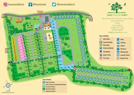
Colour-coded pitches, a leafy facilities hub and a long static-caravan wing at Haw Wood Farm, Suffolk.
 Explore the map ↗
United Kingdom
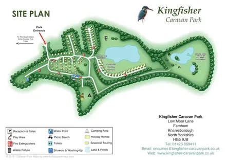
Tree-framed accommodation, lakeside homes and a woodland trail on Kingfisher Caravan Park's illustrated site plan.
Features may come from the sample artwork, its key or published park information. Approximate numbers describe the drawing and may cover only part of a park. They are intended to help you compare map examples. Current facilities and booking information should be checked with the park.
LET’S MAP YOUR PARK
For a map quotation, find your park and draw a rough boundary around it. The area you select helps us work out the design time and price.
Draw your park for a quote ↗Or talk to our map designers
01751 473136