
Ponds and lakes
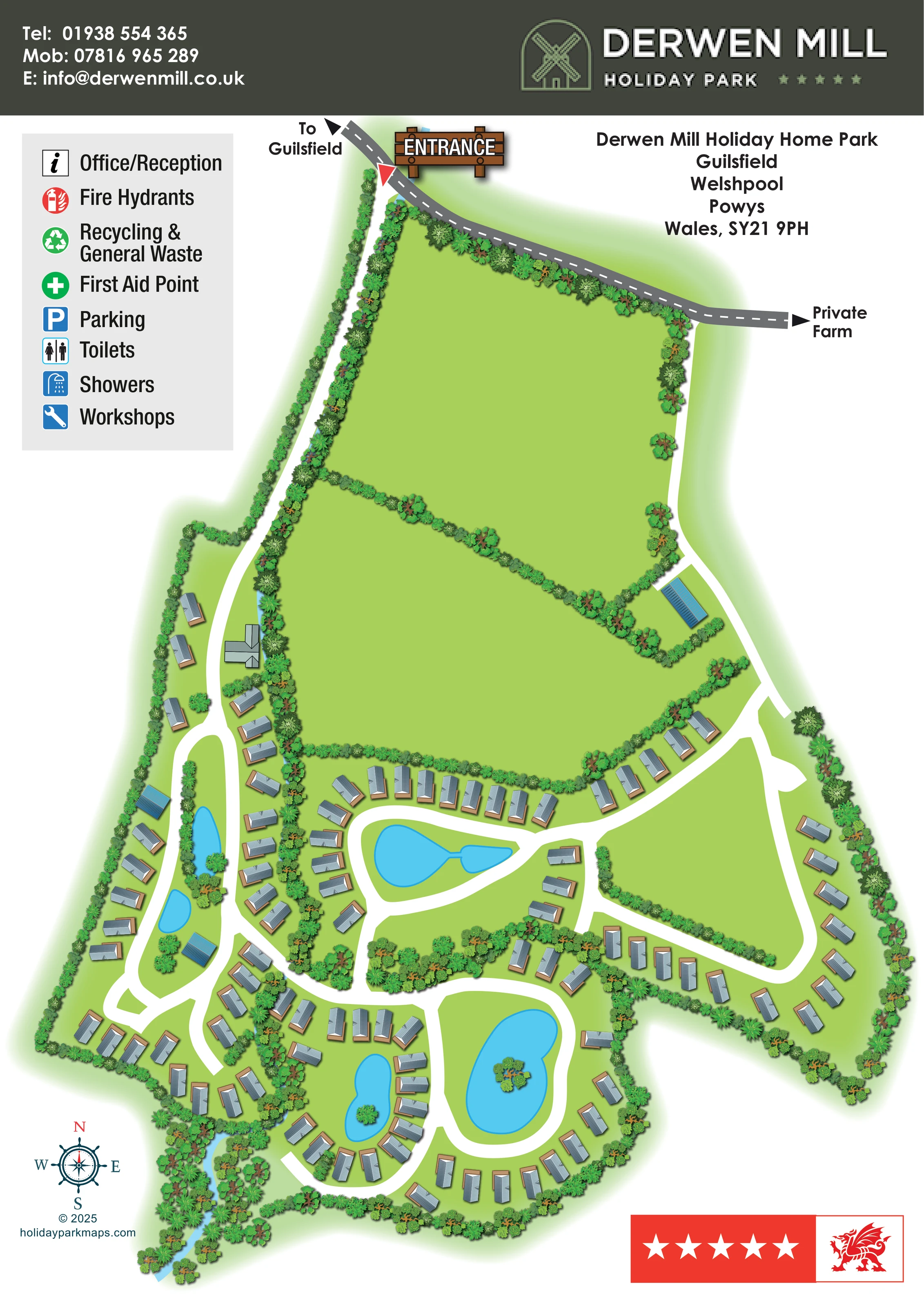
Bright blue water features include two small western ponds, a central linked pair of basins and two southern ponds or lakes with planted islands.
ILLUSTRATED PARK MAP · P100
Derwen Mill Holiday Home Park, Guilsfield, Welshpool, Powys, Wales · United Kingdom
 Enlarge the map ↗
A SENSE OF THE PLACE
Derwen Mill Holiday Home Park is based at Guilsfield, Welshpool, Powys, Wales. Gardens, lakes and lawns lie within walking distance of Guilsfield, under three miles from Welshpool.
The map brings the site layout and its access routes together in one view, providing a reference for understanding the arrangement of the grounds.
LOOK CLOSER
Bright blue water features include two small western ponds, a central linked pair of basins and two southern ponds or lakes with planted islands.
A narrow pale-blue watercourse is visible beside planting on the western side and emerges through dense trees at the south-western edge.
Large green enclosures dominate the northern half, with further open lawn areas between the accommodation loops.
Dense illustrated planting encloses the site, divides the northern green areas and separates clusters of holiday homes.
A large illustrated timber entrance sign and red triangular marker identify arrival from the road along the northern edge.
A black arrow at the north-western end of the external road is labelled 'To Guilsfield'.
The external road continues eastwards to an arrow labelled 'Private Farm'; this is a directional reference rather than a visitor facility.
Broad white routes descend along both sides of the northern grounds, connect through the accommodation areas and form several loops around water features and lawns.
A large illustrated timber entrance sign and red triangular marker identify arrival from the road along the northern edge.
A black arrow at the north-western end of the external road is labelled 'To Guilsfield'.
The external road continues eastwards to an arrow labelled 'Private Farm'; this is a directional reference rather than a visitor facility.
Broad white routes descend along both sides of the northern grounds, connect through the accommodation areas and form several loops around water features and lawns.
Bright blue water features include two small western ponds, a central linked pair of basins and two southern ponds or lakes with planted islands.
A narrow pale-blue watercourse is visible beside planting on the western side and emerges through dense trees at the south-western edge.
Large green enclosures dominate the northern half, with further open lawn areas between the accommodation loops.
Dense illustrated planting encloses the site, divides the northern green areas and separates clusters of holiday homes.
An irregular grey-roofed building sits beside the western approach, and several blue-roofed rectangular buildings appear elsewhere. Their functions are not identified by positioned labels or symbols.
Listed in the legend with an information symbol; no corresponding location is clearly marked on the plan.
A red fire-safety symbol appears in the legend, without clearly positioned instances on the plan.
Named in the legend with a green recycling symbol; its location is not shown clearly.
Included in the legend as a green cross, without a clearly located marker in the park illustration.
A blue parking symbol is included in the key; no specific parking area is identified by that symbol on the plan.
Separate toilet and shower symbols appear in the legend, but their positions are not clearly marked.
Named in the legend beside a blue spanner symbol; the illustrated ancillary buildings are not explicitly assigned this function.
Operator information places the park's gardens, lakes and lawns within walking distance of Guilsfield and under three miles from Welshpool.
READING THE MAP
This illustrated map of Derwen Mill Holiday Home Park presents a landscape-led holiday-home site in Guilsfield, near Welshpool in Powys. Rather than treating the grounds as a simple grid of plots, the design makes their defining features immediately visible: broad lawns, thick planted boundaries, several blue ponds and lakes, and winding lanes lined with holiday homes.
The portrait layout follows the park from its northern entrance into the more developed central and southern grounds. Grey-roofed homes turn with the roads, while white route ribbons stand out against the green landscape. Water features provide particularly useful landmarks, from small ponds along the western side to the larger southern lakes with planted islands.
A dark branded header, a prominent entrance sign and clear arrows towards Guilsfield and a private farm establish the arrival context. The generous legend and ornamental compass complete the page. As a gallery example, it shows how an illustrated overview can communicate both the arrangement of a holiday-home park and the garden-like character of its setting.
The map is arranged as one continuous portrait plan, beginning with a grey road across the northern boundary. Direction arrows point towards Guilsfield on the left and a private farm on the right. A timber-style entrance sign and red marker highlight the park access, from which white internal lanes descend beside the planted edges of the grounds.
Much of the upper half is occupied by large green enclosures divided by hedges and trees. Holiday homes become more frequent along the western approach and across the lower half, where the routes branch into linked loops. The accommodation follows these curves in short rows and perimeter groups, with a separate eastern section enclosing a broad open lawn. The homes use a consistent grey-roofed symbol on a tan base, but their changing orientation keeps the layout closely tied to the illustrated lanes.
Water is a strong organising element. Two small western ponds sit within a narrow loop, a linked pair of basins occupies a central green island, and two southern lakes sit inside rounded circuits of accommodation. Planted islands add detail to the southern water features. A narrow watercourse is partly screened by trees before emerging at the south-western edge.
An irregular grey-roofed building and several blue-roofed structures provide additional landmarks, although their uses are not labelled. The upper-left key names office/reception, fire hydrants, recycling and general waste, first aid, parking, toilets, showers and workshops; corresponding positions are not clearly marked on the plan. Branding, the address block, compass and Welsh dragon graphic frame the illustration without introducing a separate inset or secondary map.
KEEP EXPLORING
Chosen for shared landscapes, accommodation or facilities.
 Explore the map ↗
United Kingdom
Illustrated lakeside park plan with numbered holiday units, leisure buildings and a looping Woodland Walk.
 Explore the map ↗
United Kingdom
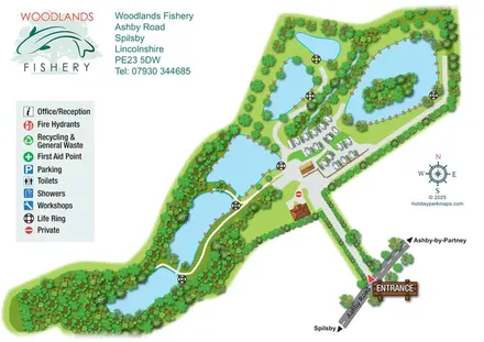
Illustrated fishery map with lakeside routes, wooded waters and a compact touring area.
 Explore the map ↗
United Kingdom
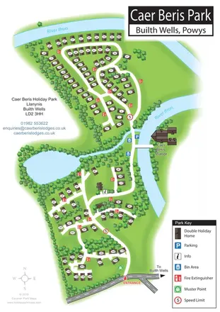
Portrait holiday-home park map with riverside loops, a tree-fringed pond and a separate manor landmark.
Features may come from the sample artwork, its key or published park information. Approximate numbers describe the drawing and may cover only part of a park. They are intended to help you compare map examples. Current facilities and booking information should be checked with the park.
LET’S MAP YOUR PARK
For a map quotation, find your park and draw a rough boundary around it. The area you select helps us work out the design time and price.
Draw your park for a quote ↗Or talk to our map designers
01751 473136