
Tree-lined grassy grounds
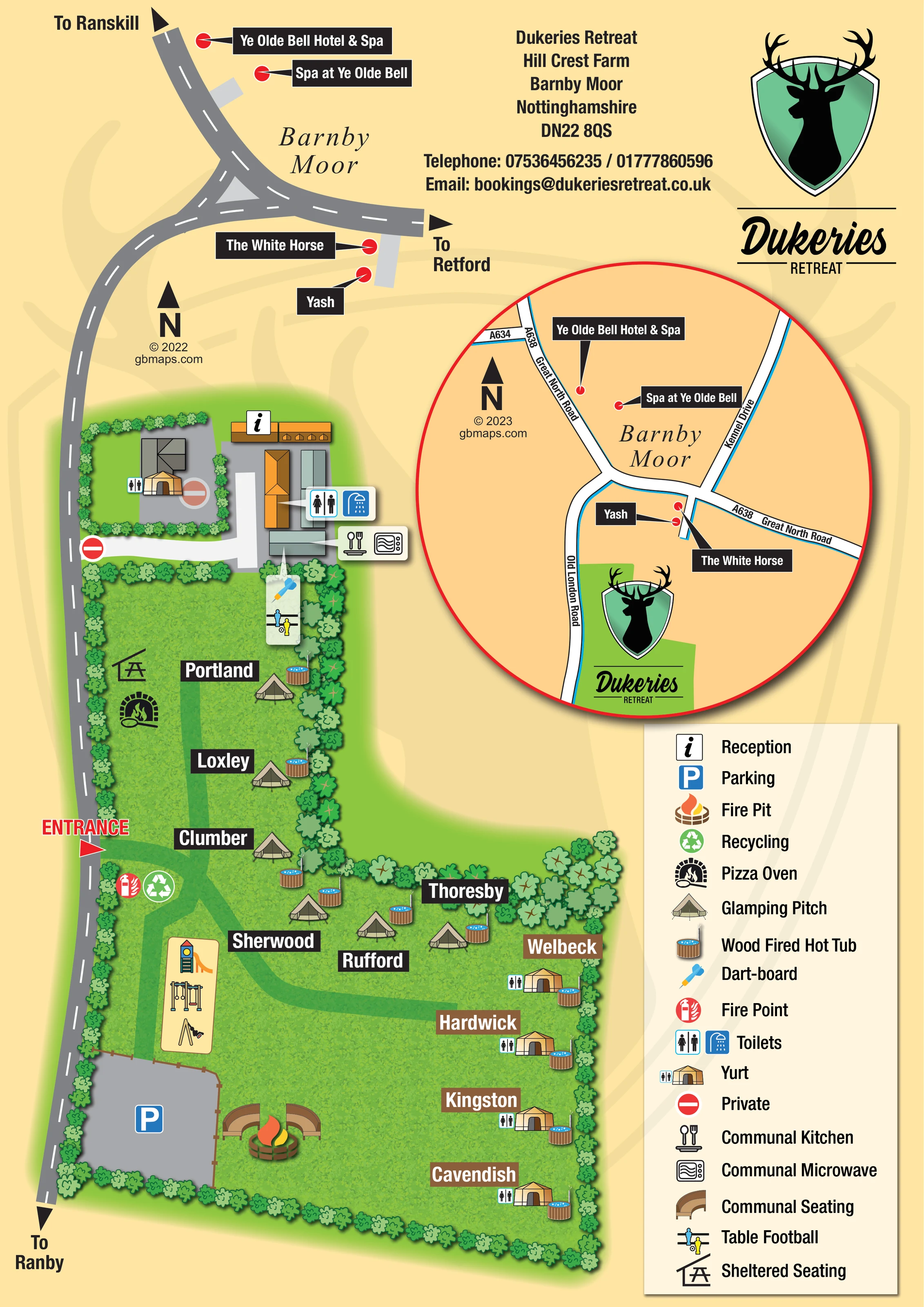
Textured lawns are enclosed by continuous rows of stylised trees and shrubs, with denser planting around the eastern bend.
ILLUSTRATED PARK MAP · P103
Dukeries Retreat, Hill Crest Farm, Barnby Moor, Nottinghamshire · United Kingdom
 Enlarge the map ↗
A SENSE OF THE PLACE
Dukeries Retreat offers glamping at Hill Crest Farm in Barnby Moor, near Retford. Developed from former pastureland, the site provides accommodation for countryside breaks and group stays.
Yurts and designated dog-friendly options form part of the offering, with fire pits and hot tubs associated with selected stays. Its village location provides access to nearby places to eat, while the map explains the arrangement of accommodation within the grounds.
LOOK CLOSER
Textured lawns are enclosed by continuous rows of stylised trees and shrubs, with denser planting around the eastern bend.
An information symbol marks the long building at the northern end of the site.
A grey parking area with a blue P symbol occupies the south-western corner.
Toilet and shower symbols point to the northern service buildings. Small toilet symbols also accompany the yurt illustrations.
A cutlery symbol and microwave symbol share a callout pointing to a northern service building.
Timber-sided tubs with blue water and small flues are drawn beside the named tent pitches and yurts.
A prominent black oven-and-flame symbol appears in the north-western glamping lawn.
A roofed picnic-table symbol is positioned near the pizza oven.
An information symbol marks the long building at the northern end of the site.
A grey parking area with a blue P symbol occupies the south-western corner.
Toilet and shower symbols point to the northern service buildings. Small toilet symbols also accompany the yurt illustrations.
A cutlery symbol and microwave symbol share a callout pointing to a northern service building.
Timber-sided tubs with blue water and small flues are drawn beside the named tent pitches and yurts.
A prominent black oven-and-flame symbol appears in the north-western glamping lawn.
A roofed picnic-table symbol is positioned near the pizza oven.
A large illustrated fire pit and curved timber benches form a gathering point beside the southern parking area.
A paired games callout points to the southern end of the northern building cluster.
An elongated pale-yellow play area contains illustrations of a slide, climbing equipment and a swing, immediately north of the parking area.
Green recycling and red fire-point symbols sit just inside the marked entrance.
A red arrow and large ENTRANCE label mark access from the road along the western boundary.
Broad darker-green routes branch from the entrance towards the northern pitches, southern parking and eastern accommodation.
Red restriction symbols, explained as Private in the legend, distinguish the northern access and enclosed compound from the guest grounds.
Textured lawns are enclosed by continuous rows of stylised trees and shrubs, with denser planting around the eastern bend.
A circular inset locates the retreat beside Old London Road and labels the A638 Great North Road, A634 and Kennel Drive.
The main road diagram includes arrows towards Ranskill, Retford and Ranby.
Off-site callouts identify Ye Olde Bell Hotel & Spa, Spa at Ye Olde Bell, The White Horse and Yash in both the surrounding road diagram and location inset.
READING THE MAP
This illustrated map presents Dukeries Retreat, a small glamping site at Hill Crest Farm in Barnby Moor, Nottinghamshire. The design brings together two useful scales: the arrangement of accommodation and shared spaces within the grounds, and the retreat's position within the village road network. A tree-lined lawn forms the main plan, with named tent-style pitches curving towards a separate row of yurts on the eastern side. Small timber hot-tub illustrations give the accommodation a recognisable visual character.
The map also gives communal spaces a clear presence. Reception and service buildings occupy the northern end, while a play area, parking and a fire pit with curved seating anchor the southern lawn. A pizza oven, sheltered seating and games symbols add detail without requiring long explanatory labels. On the right, a circular locator names surrounding roads and nearby businesses, beneath the retreat's distinctive stag-and-shield branding. The result is a visitor-facing map that explains both where to arrive and how the small site is organised.
The main plan follows an irregular strip of landscaped grounds beside the road on the western boundary. A red ENTRANCE arrow marks the guest access, from which darker-green routes branch through the lawn. One route leads south towards a grey parking area; others connect the northern glamping pitches with accommodation around the eastern bend. Trees and shrubs outline the site, separating the green guest grounds from the pale-yellow page background.
The tent-style pitches are labelled Portland, Loxley, Clumber, Sherwood, Rufford and Thoresby in white lettering on black panels. Farther east, Welbeck, Hardwick, Kingston and Cavendish identify the yurts using brown panels. Distinct canvas illustrations differentiate the groups, and timber-sided hot tubs appear beside the named accommodation. Small toilet symbols accompany the yurts. A separate northern compound is marked private rather than presented as part of the guest accommodation sequence.
Reception is identified on the long northern building. Nearby callouts locate toilets and showers, a communal kitchen and microwave, plus a dartboard and table football. A pizza oven and sheltered seating sit near the northern lawn. Recycling and a fire point are marked close to the entrance. In the south, illustrated play equipment stands beside parking, with a communal fire pit and curved benches on the adjacent grass.
The same portrait artwork includes a circular Barnby Moor locator, not a second accommodation plan. It labels Old London Road, A638 Great North Road, A634 and Kennel Drive, together with nearby businesses. The broader road diagram supplies arrows towards Ranskill, Retford and Ranby. A tall pictorial legend completes the lower-right portion of the page.
KEEP EXPLORING
Chosen for shared landscapes, accommodation or facilities.
 Explore the map ↗
United Kingdom
Woodland-framed Barnsoul map with mixed accommodation, shared facilities and paw-marked walking routes.
 Explore the map ↗
United Kingdom
Woodland park map with mixed pitches, bell tents, lodges and a fishing lake.
 Explore the map ↗
United Kingdom
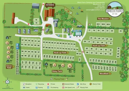
A field-based farm campsite map with numbered pitches, bell tents, huts and a wooded boundary.
Features may come from the sample artwork, its key or published park information. Approximate numbers describe the drawing and may cover only part of a park. They are intended to help you compare map examples. Current facilities and booking information should be checked with the park.
LET’S MAP YOUR PARK
For a map quotation, find your park and draw a rough boundary around it. The area you select helps us work out the design time and price.
Draw your park for a quote ↗Or talk to our map designers
01751 473136