
Wildlife lake
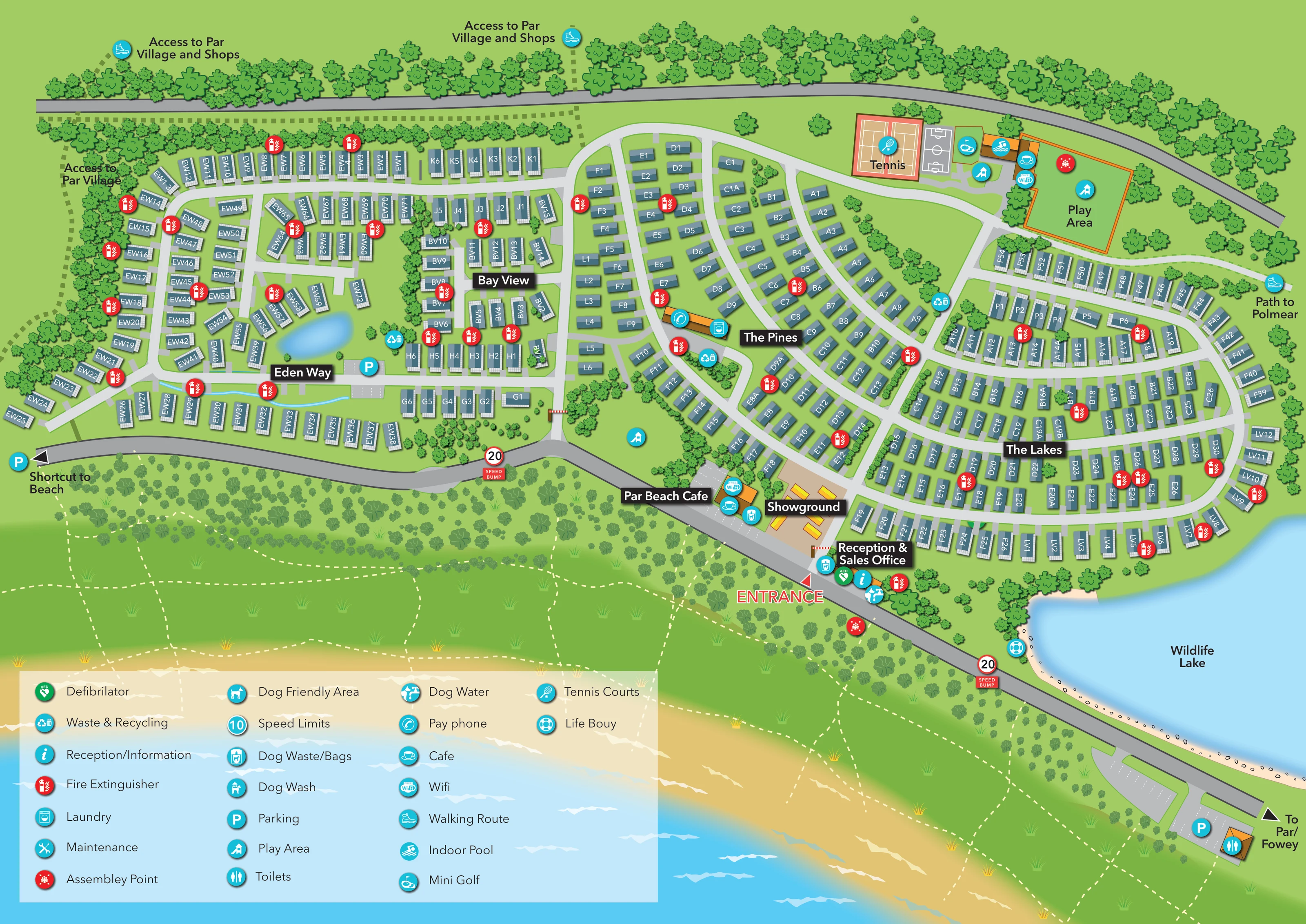
A large blue lake occupies the lower-right edge, with a pale bank and tree-lined separation from The Lakes accommodation area.
ILLUSTRATED PARK MAP · P563
Par, Cornwall · United Kingdom
 Enlarge the map ↗
A SENSE OF THE PLACE
Par Sands Coastal Holiday Park is based at Par, Cornwall. The park lies behind Par Beach's dunes and has direct beach access. Caravan holidays are advertised, with the park season shown as January to December.
Indoor pool, steam room, café, play area and sports courts are listed. The wildlife lake is explicitly designated as a no-fishing lake.
LOOK CLOSER
A large blue lake occupies the lower-right edge, with a pale bank and tree-lined separation from The Lakes accommodation area.
A small blue pond lies within Eden Way, with a narrow blue watercourse drawn along its southern accommodation row.
A broad dune belt, golden sand and blue sea form the foreground, with grass tufts, scrub and stylised white surf.
Dense trees edge the upper boundary and western side; planted strips and open greens break up the accommodation rows.
Labelled beside the main entrance on the beach-facing road, next to the showground.
A separate tan display area containing bright yellow-orange units beside reception.
Par Beach Cafe is labelled near the entrance and showground; a second café symbol appears beside the northern leisure facilities.
A swimming symbol identifies the pool building in the leisure cluster along the upper edge.
Labelled beside the main entrance on the beach-facing road, next to the showground.
A separate tan display area containing bright yellow-orange units beside reception.
Par Beach Cafe is labelled near the entrance and showground; a second café symbol appears beside the northern leisure facilities.
A swimming symbol identifies the pool building in the leisure cluster along the upper edge.
A pair of drawn tennis courts is labelled Tennis beside the pool and other recreation facilities.
A grey rectangular court with white pitch markings sits immediately beside the tennis courts.
A flag-and-green symbol marks a small recreation space between the sports court and pool.
A large outlined Play Area occupies the upper-right leisure cluster, with further play symbols beside the pool and on the central beach-facing green.
A washing-machine symbol marks the long orange-roofed service building in The Pines.
A telephone symbol appears on the same service building as the laundry.
Wi-Fi symbols are placed at Par Beach Cafe and the northern café/leisure cluster.
Parking symbols and marked bays appear near Eden Way, the beach shortcut and the lower-right approach road; additional bays are drawn beside Par Beach Cafe.
A toilet symbol identifies a small building beside the lower-right parking area.
Repeated waste-and-recycling symbols mark collection points within and between accommodation neighbourhoods.
Dog-friendly-area and dog-water symbols appear at reception, with dog-waste/bag symbols around reception and Par Beach Cafe. These are mapped facilities rather than a statement of park-wide pet policy.
Included in the key, but no corresponding location is clearly identifiable on the plan.
The key includes a maintenance symbol without a clearly identifiable placement in the mapped park.
An AED symbol is placed at reception, red fire-extinguisher symbols recur throughout the accommodation areas, assembly-point symbols appear near the entrance and large play area, and a lifebuoy symbol sits beside the wildlife lake.
A large blue lake occupies the lower-right edge, with a pale bank and tree-lined separation from The Lakes accommodation area.
A small blue pond lies within Eden Way, with a narrow blue watercourse drawn along its southern accommodation row.
A broad dune belt, golden sand and blue sea form the foreground, with grass tufts, scrub and stylised white surf.
Dense trees edge the upper boundary and western side; planted strips and open greens break up the accommodation rows.
The entrance is prominently marked beside reception. Pale internal roads branch through the accommodation areas, with barrier graphics at access points.
Several routes along the upper and left edges are labelled for access to Par Village, including two references to village shops.
A labelled Shortcut to Beach appears at the left end of the beach-facing road; dashed white paths cross the dune belt towards the shore.
A labelled walking connection leaves the upper-right side beside the recreation area.
The lower-right road carries a directional arrow labelled To Par/Fowey.
Circular 20 markers and red SPEED BUMP labels are drawn on the beach-facing approach road.
Listed in the park information, but not separately identified in the artwork.
READING THE MAP
This illustrated map of Par Sands Coastal Holiday Park places a large caravan-style holiday-home layout within its distinctive Cornish coastal setting. The beach is not reduced to a small edge label: dunes, crossing footpaths, golden sand and blue sea stretch across the foreground, while a separate wildlife lake shapes the right-hand side of the plan. Together, these landscape features help explain the park’s position behind Par Beach.
The accommodation is divided into named neighbourhoods, including Eden Way, Bay View, The Pines and The Lakes. Individual roof labels support close-up navigation, while prominent black destination panels make the broader layout easier to scan. Reception, the sales showground and Par Beach Cafe form a recognisable arrival cluster beside the beach-facing road.
Elsewhere, the map brings together the pool, tennis courts, mini golf and play areas, alongside practical symbols for parking, laundry, recycling and dog facilities. Walking connections towards Par Village, its shops and Polmear extend the map’s usefulness beyond finding a holiday home. The result is a sample focused on the relationship between a substantial accommodation layout, everyday visitor destinations and the surrounding coast.
The single landscape-format plan shows the park from an overhead viewpoint, with blue-grey accommodation roofs arranged along a network of pale internal roads. Eden Way and Bay View fill the left-hand portion, where straighter rows bend around a small pond and planted spaces. The Pines occupies the centre, using curved roads and branching rows, while The Lakes spreads across the right in broad parallel arcs beside the wildlife lake. White alphanumeric labels are placed directly on individual roofs, and larger black-backed panels identify the neighbourhoods.
The main entrance is marked in red beside Reception & Sales Office on the lower road. A tan showground with yellow-orange display units sits immediately alongside, with Par Beach Cafe and parking nearby. In The Pines, a long orange-roofed building carries laundry and pay-phone symbols. Repeated recycling and fire-extinguisher markers serve the accommodation areas, while reception also carries information, AED and dog-related symbols.
Along the upper edge, the recreation cluster includes two illustrated tennis courts, an additional marked sports court, mini golf, an indoor-pool building, a café and a large outlined play area. Further play symbols appear nearby and on the central green. At the lower right, parking and toilets sit on the approach towards Par and Fowey, and a lifebuoy marker appears beside the lake.
Dense tree belts define the inland boundaries. Across the foreground, white dashed paths thread through green dunes towards the sand and sea, including a labelled beach shortcut at the left. Olive dotted routes and walking symbols indicate village connections, with a separate path towards Polmear. A large translucent four-column legend overlays the lower-left shoreline. The enlarged views reveal details of this same plan rather than additional mapped sections.
KEEP EXPLORING
Chosen for shared landscapes, accommodation or facilities.
 Explore the map ↗
United Kingdom
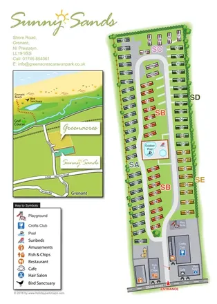
Colour-coded caravan park plan with an entrance leisure hub and a coastal location inset.
 Explore the map ↗
United Kingdom
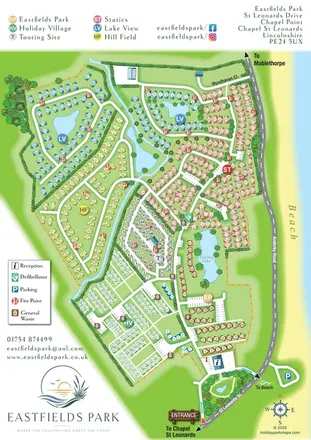
Six colour-coded neighbourhoods, lakeside layouts and coastal access on the Eastfields Park map.
 Explore the map ↗
United Kingdom
Illustrated lakeside park plan with numbered holiday units, leisure buildings and a looping Woodland Walk.
Features may come from the sample artwork, its key or published park information. Approximate numbers describe the drawing and may cover only part of a park. They are intended to help you compare map examples. Current facilities and booking information should be checked with the park.
LET’S MAP YOUR PARK
For a map quotation, find your park and draw a rough boundary around it. The area you select helps us work out the design time and price.
Draw your park for a quote ↗Or talk to our map designers
01751 473136