
Fire breaks
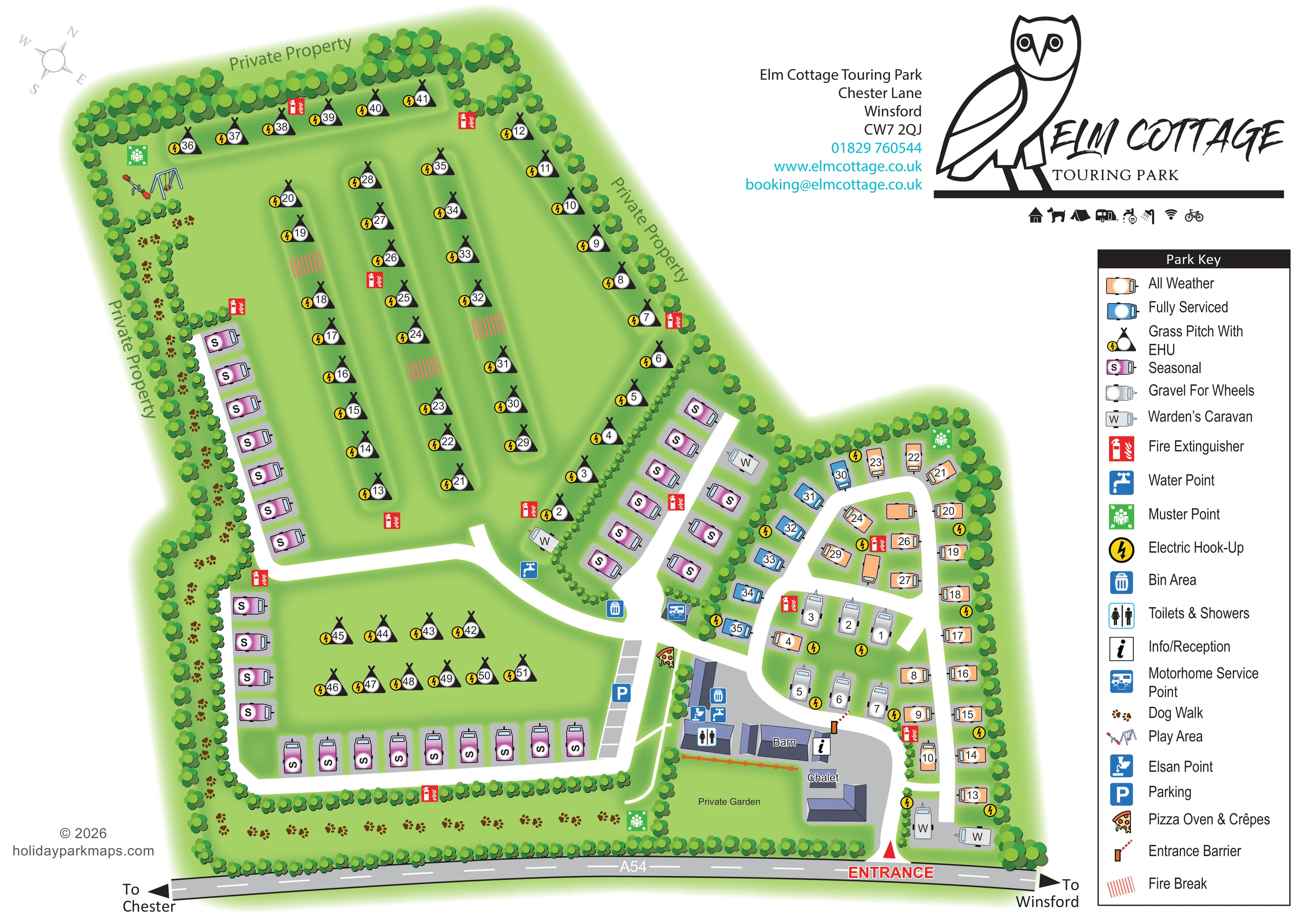
Short bands of red diagonal hatching mark gaps between rows in the upper grass-pitch field.
ILLUSTRATED PARK MAP · P111
Elm Cottage Touring Park, Chester Lane, Winsford · United Kingdom
 Enlarge the map ↗
A SENSE OF THE PLACE
Elm Cottage Touring Park is a family-owned touring site near Winsford in Cheshire. Its location in the Vale Royal countryside provides a rural base for caravan and motorhome holidays.
The park map offers a practical overview of the pitches and shared areas, helping guests orient themselves on arrival. The surrounding Cheshire landscape and nearby towns provide options for exploring beyond the site.
LOOK CLOSER
Short bands of red diagonal hatching mark gaps between rows in the upper grass-pitch field.
Dense stylised planting encloses the park, separates some accommodation sections and frames the dog walk.
Private Property labels follow the upper and western boundaries; a Private Garden label identifies the lawn beside the chalet.
An information symbol marks a small building beside the barn and entrance barrier.
The shared facilities symbol appears on the building group beside the barn, close to the arrival area.
A blue motorhome service symbol sits beside the central road junction between the pitch areas.
An Elsan disposal symbol is grouped with other service symbols beside the toilet and shower building.
Blue tap symbols identify water provision near the central route and the main facilities.
An information symbol marks a small building beside the barn and entrance barrier.
The shared facilities symbol appears on the building group beside the barn, close to the arrival area.
A blue motorhome service symbol sits beside the central road junction between the pitch areas.
An Elsan disposal symbol is grouped with other service symbols beside the toilet and shower building.
Blue tap symbols identify water provision near the central route and the main facilities.
Bin symbols are shown at the central pitch junction and beside the shared facilities.
Yellow lightning circles identify electric hook-up beside grass pitches and throughout the touring area.
A distinctive pizza-slice icon marks the food amenity beside the parking strip and approach to the facilities.
Illustrated swings and a seesaw mark a play area in the north-western corner of the grass-pitch field.
Repeated brown pawprints trace a tree-lined walking corridor along the western boundary and across the southern edge.
A blue P identifies a strip of marked parking bays beside the lower seasonal area and facilities approach.
A red entrance label and triangular marker identify access from the A54; an orange barrier symbol marks the internal approach beside reception.
The road runs across the foot of the map, with arrows towards Chester on the left and Winsford on the right.
Broad white roads connect the entrance, compact eastern touring loop, central seasonal rows and lower perimeter loop.
Repeated red extinguisher symbols are distributed around the accommodation areas.
Green assembly symbols appear near the play area, at the top of the eastern touring section and on the southern dog-walk corridor.
Short bands of red diagonal hatching mark gaps between rows in the upper grass-pitch field.
Dense stylised planting encloses the park, separates some accommodation sections and frames the dog walk.
Private Property labels follow the upper and western boundaries; a Private Garden label identifies the lawn beside the chalet.
Named buildings form part of the entrance-side cluster. The chalet is not identified as bookable visitor accommodation.
Grey caravan symbols marked W identify staff caravans beside the central accommodation division and near the entrance.
READING THE MAP
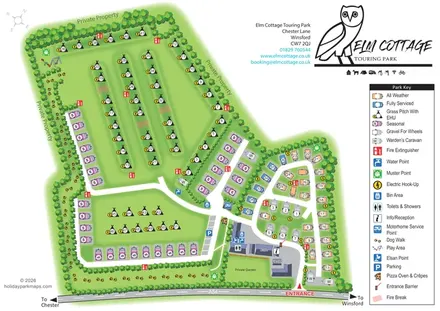
This illustrated map of Elm Cottage Touring Park near Winsford presents a tree-lined Cheshire touring site with several distinct pitch areas. A large grass-pitch field occupies the upper part of the plan, while seasonal caravan rows frame the western and southern sections. A more compact touring area sits beside the entrance, with different colours identifying all-weather, fully serviced and gravel-for-wheels pitches.
The map combines pitch finding with a clear introduction to the park’s shared spaces. Reception, toilets and showers, parking and service points cluster around the barn near the A54 entrance. Further into the site, a small illustrated play area and a pawprint-marked dog walk provide memorable landmarks. Private boundaries and the garden beside the chalet are also labelled, helping distinguish guest routes from neighbouring or private spaces.
The page gives generous space to the park’s owl branding and a comprehensive pictorial key. Soft green landscaping, white access roads and brightly coloured facility symbols make this a useful example of a touring-park map that explains pitch choice, arrival and everyday orientation on one sheet.
The plan is arranged around three accommodation zones. In the upper field, numbered tent symbols represent grass pitches with electric hook-up, organised in long rows with gently shaded green corridors between them. Red hatched strips identify fire breaks. The north-western corner contains illustrated swings and a seesaw, while a dense belt of rounded tree canopies encloses the field.
Pink seasonal caravan symbols follow the western boundary, continue around the lower grass area and form additional rows beside the central road. The lower field contains a smaller group of grass pitches. A dog walk, drawn as repeated brown pawprints, runs between planting along the western side and across the bottom of the site. Its separation from the white vehicle roads is visually clear.
On the eastern side, a compact road loop serves peach all-weather pitches, blue fully serviced pitches and grey gravel-for-wheels positions. Yellow hook-up symbols, red fire extinguishers and green muster points punctuate the plan. Wardens’ caravans are distinguished by W markers rather than guest pitch numbers.
The entrance connects directly to the A54, with directions towards Chester and Winsford. Nearby, the barn, reception symbol and toilet-and-shower block form the main facilities cluster. Water, Elsan and bin symbols sit beside this group, while a motorhome service point occupies the central junction. A parking strip and pizza oven and crêpes icon sit on the western approach. The chalet and its private garden complete the entrance-side building group.
A large owl logo and contact block balance the plan at the top right, above a tall Park Key explaining the pitch colours and service symbols. The accompanying detail image enlarges this same key and eastern pitch area; it is not a separate section map.
KEEP EXPLORING
Chosen for shared landscapes, accommodation or facilities.
 Explore the map ↗
United Kingdom
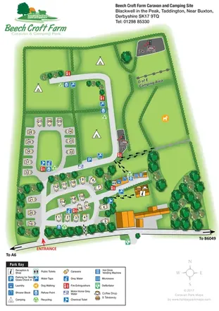
Illustrated touring and camping map with hedge-divided fields, age-labelled play areas and a detailed service key.
 Explore the map ↗
United Kingdom
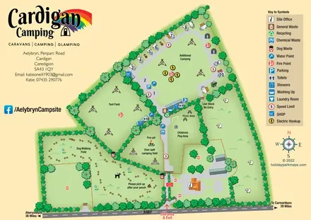
Illustrated farm-campsite map with mixed accommodation, named camping fields and a dedicated dog-walking area.
 Explore the map ↗
United Kingdom
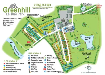
Illustrated camping and touring map with fishing lakes, dog areas and colour-coded pitches.
Features may come from the sample artwork, its key or published park information. Approximate numbers describe the drawing and may cover only part of a park. They are intended to help you compare map examples. Current facilities and booking information should be checked with the park.
TAKE A CLOSER LOOK
View the illustrated map in detail or choose a file to download. These are sample maps; contact the park for current visitor information.

LET’S MAP YOUR PARK
For a map quotation, find your park and draw a rough boundary around it. The area you select helps us work out the design time and price.
Draw your park for a quote ↗Or talk to our map designers
01751 473136