
Tree-lined boundary and central planting
Repeated stylised trees enclose most of the park, line the central divider and punctuate a few interior lawns.
ILLUSTRATED PARK MAP · P114
The Fairway, Sandown, Isle Of Wight · United Kingdom
 Enlarge the map ↗
A SENSE OF THE PLACE
Fairway Holiday Park is a caravan holiday site at Sandown on the Isle of Wight. Its location gives visitors a base for exploring the town, Sandown Bay and other parts of the island.
Published park information describes an outdoor pool and a clubhouse with entertainment. The map sets out the accommodation areas and shared spaces, helping families understand the layout of the park.
LOOK CLOSER
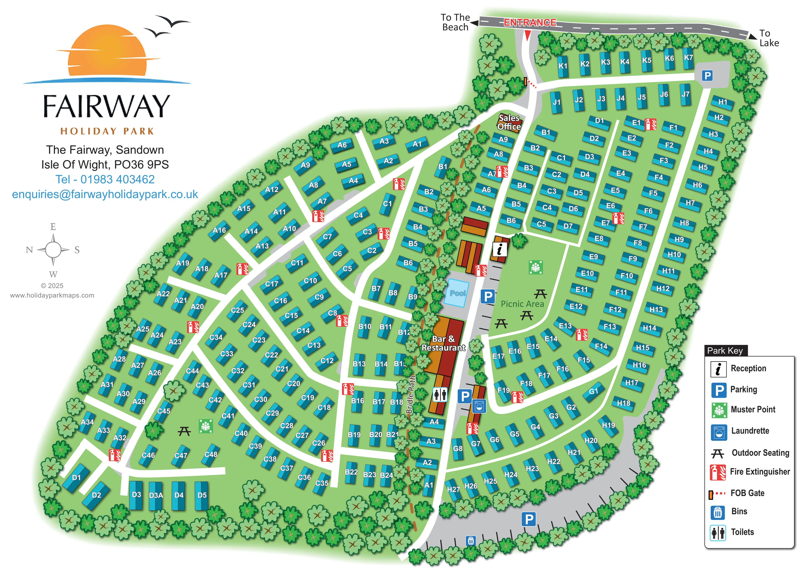
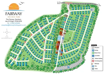
Repeated stylised trees enclose most of the park, line the central divider and punctuate a few interior lawns.
Green ground unifies the accommodation areas, with larger clear spaces reserved for the picnic area and western outdoor seating.
An information symbol marks a building beside the central access spine, immediately above the pool and opposite the picnic lawn.
A labelled building stands near the upper junction of the entrance route and the western accommodation lanes.
A long red-and-orange building occupies the central shared-facilities strip, below the pool.
A light-blue rectangular pool is labelled beside reception and the central parking strip.
A named picnic lawn with table symbols lies east of the central facilities; another outdoor-seating symbol appears on an open lawn in the lower western area.
A blue washing-machine symbol identifies a small building on the lower central access spine.
An information symbol marks a building beside the central access spine, immediately above the pool and opposite the picnic lawn.
A labelled building stands near the upper junction of the entrance route and the western accommodation lanes.
A long red-and-orange building occupies the central shared-facilities strip, below the pool.
A light-blue rectangular pool is labelled beside reception and the central parking strip.
A named picnic lawn with table symbols lies east of the central facilities; another outdoor-seating symbol appears on an open lawn in the lower western area.
A blue washing-machine symbol identifies a small building on the lower central access spine.
A toilet symbol is positioned at the lower end of the bar-and-restaurant building.
Blue parking symbols mark an upper-right parking area, bays beside the central facilities and a broad parking strip along the lower-right edge.
A bin symbol marks a point on the lower perimeter parking strip.
Red fire-extinguisher symbols are distributed throughout the accommodation areas and around the central facilities.
Green muster-point symbols appear on the central picnic lawn and on an open lawn in the western accommodation area.
A red entrance label and arrow identify access from the road along the top edge; a gate symbol appears just inside this route.
A narrow labelled bridle path follows the tree-lined central divider beside the shared facilities.
Arrows on the external road point left towards the beach and right towards Lake. Neither destination is illustrated within the park boundary.
Repeated stylised trees enclose most of the park, line the central divider and punctuate a few interior lawns.
Green ground unifies the accommodation areas, with larger clear spaces reserved for the picnic area and western outdoor seating.
Published park information mentions a clubhouse with entertainment; entertainment is not separately labelled on this artwork.
READING THE MAP
This illustrated map of Fairway Holiday Park in Sandown presents a substantial caravan site as two clearly organised accommodation areas, linked by a central route and shared facilities. Set on the Isle of Wight, the park is given a seaside identity through its prominent sun-and-horizon logo and the road arrow pointing towards the beach. A second arrow indicates the direction of Lake.
The plan uses cyan caravan symbols, white internal lanes and a continuous green landscape to make its many lettered accommodation groups easy to distinguish. Reception, the pool, bar and restaurant, sales office and laundrette form a recognisable central cluster, with a picnic lawn directly alongside. Tree belts define the boundary and the central divider, where a bridle path is also labelled.
A separate Park Key explains the service and safety symbols, while parking areas and the entrance are highlighted directly on the plan. The result is a useful sample for caravan parks needing to combine individual-unit wayfinding with a clear overview of communal spaces.
The single landscape-format artwork places the park logo and contact block in the open upper-left corner, leaving most of the page for an irregular, tree-bordered site plan. A compass beneath the branding shows that east is at the top. The external road runs across the upper edge, with a red entrance arrow and directions towards the beach and Lake.
Inside the boundary, accommodation is split into two broad areas. On the left, diagonal lanes branch through staggered rows of caravans and meet several cross-routes. On the right, straighter upper rows give way to curved lanes following the lower boundary. Each caravan is a cyan, roof-striped rectangle with a white letter-number label. The overall depiction suggests roughly 225 units, giving the design a substantial amount of individual-unit information to organise.
The central strip provides the main visual anchor. Reception stands above a light-blue pool, with the bar and restaurant below and the laundrette farther down the route. The sales office is positioned nearer the entrance. Parking bays sit beside these buildings, with additional parking at the upper right and along the lower-right perimeter. A tree-lined bridle path is labelled beside the central buildings.
Across from reception, the named picnic area contains outdoor-seating symbols and a muster point. Further seating and another muster point appear on a western lawn. Fire-extinguisher markers are distributed around the park, while toilet and bin symbols identify supporting facilities. The lower-right Park Key explains these pictograms and the FOB gate marker. The accompanying enlargement is a closer view of this same artwork, showing the key and adjacent accommodation rather than a separate map variant.
KEEP EXPLORING
Chosen for shared landscapes, accommodation or facilities.
 Explore the map ↗
United Kingdom
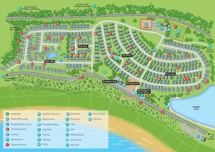
Coastal holiday-park plan with named caravan neighbourhoods, dune paths, leisure facilities and a wildlife lake.
 Explore the map ↗
United Kingdom
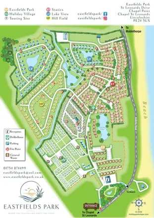
Six colour-coded neighbourhoods, lakeside layouts and coastal access on the Eastfields Park map.
 Explore the map ↗
United Kingdom
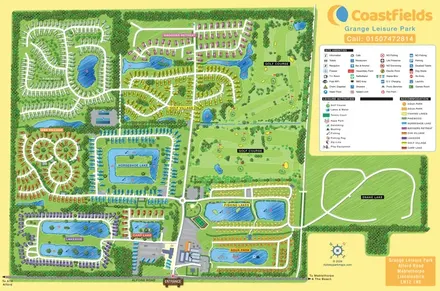
Colour-coded accommodation villages, fishing lakes, golf grounds and an Aqua Park at Grange Leisure Park.
Features may come from the sample artwork, its key or published park information. Approximate numbers describe the drawing and may cover only part of a park. They are intended to help you compare map examples. Current facilities and booking information should be checked with the park.
TAKE A CLOSER LOOK
View the illustrated map in detail or choose a file to download. These are sample maps; contact the park for current visitor information.


LET’S MAP YOUR PARK
For a map quotation, find your park and draw a rough boundary around it. The area you select helps us work out the design time and price.
Draw your park for a quote ↗Or talk to our map designers
01751 473136