
River Wear
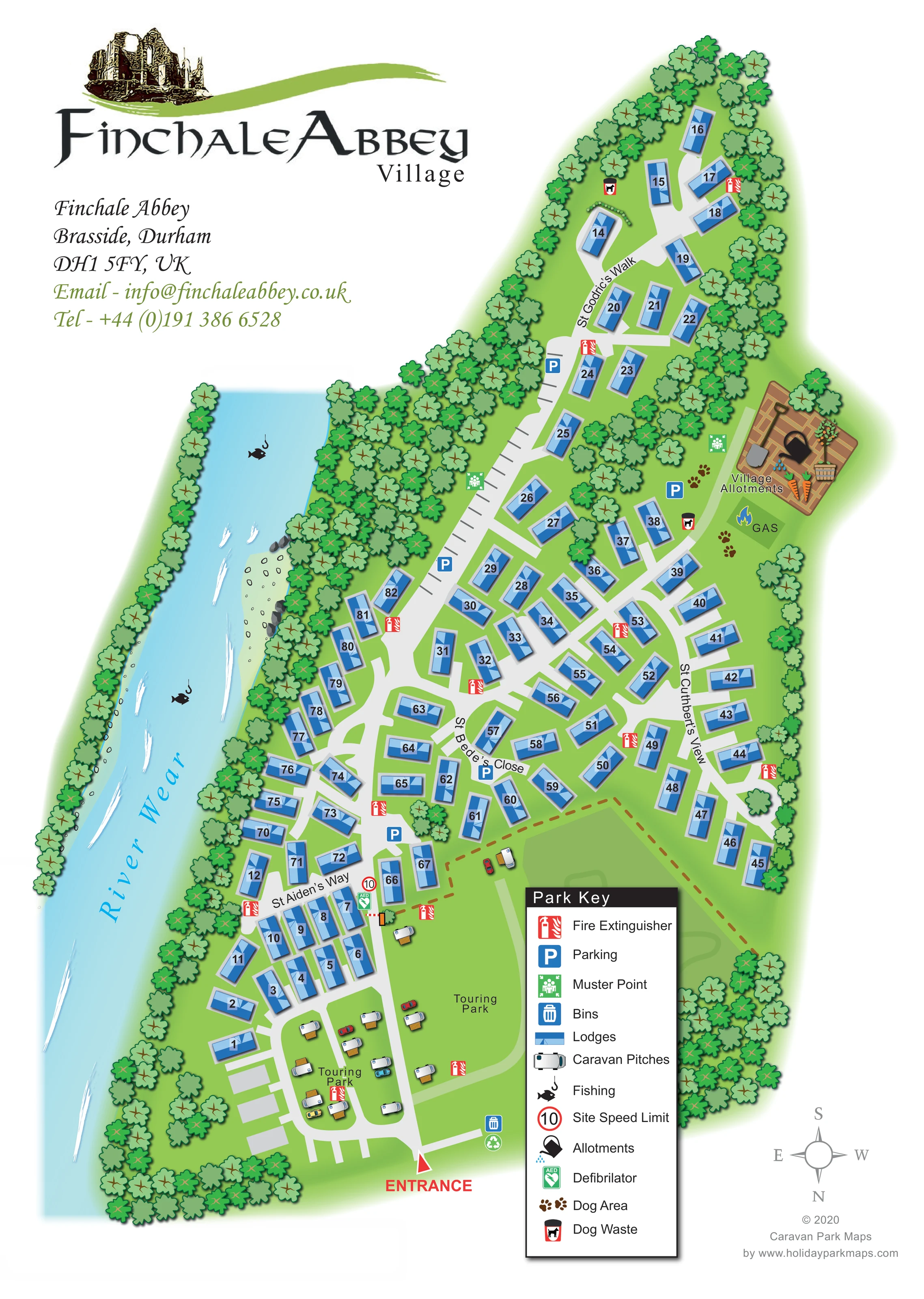
A broad blue river runs along the left edge, with its name following the watercourse.
ILLUSTRATED PARK MAP · P460
Finchale Abbey, Brasside, Durham · United Kingdom
 Enlarge the map ↗
A SENSE OF THE PLACE
Finchale Abbey Touring Park is an adults-only caravan and camping site at Brasside near Durham. Its grounds overlook the priory ruins, woodland and the River Wear.
Grass and hardstanding pitches offer electric connections, with some fully serviced options. Glamping pods provide another way to stay, supported by washrooms, accessible facilities and washing-up and waste-disposal points.
LOOK CLOSER
A broad blue river runs along the left edge, with its name following the watercourse.
Dense illustrated trees line the riverbank, enclose the park boundary and separate several accommodation groups.
An irregular pale bank with stones interrupts the tree belt beside the central riverside lodges.
Fish-and-hook symbols mark two places along the River Wear.
A red entrance arrow marks access at the foot of the plan. A red-and-white barrier is drawn farther along the internal route near the touring-to-lodge transition.
St Godric’s Walk, St Cuthbert’s View, St Bede’s Close and St Aiden’s Way provide named reference points within the lodge road network.
Blue P symbols identify several parking locations, including a long marked strip beside the central road.
A labelled allotment illustration on the right includes rectangular beds, gardening objects and vegetables.
A broad blue river runs along the left edge, with its name following the watercourse.
Dense illustrated trees line the riverbank, enclose the park boundary and separate several accommodation groups.
An irregular pale bank with stones interrupts the tree belt beside the central riverside lodges.
Fish-and-hook symbols mark two places along the River Wear.
A red entrance arrow marks access at the foot of the plan. A red-and-white barrier is drawn farther along the internal route near the touring-to-lodge transition.
St Godric’s Walk, St Cuthbert’s View, St Bede’s Close and St Aiden’s Way provide named reference points within the lodge road network.
Blue P symbols identify several parking locations, including a long marked strip beside the central road.
A labelled allotment illustration on the right includes rectangular beds, gardening objects and vegetables.
A green patch marked GAS with a flame symbol sits below the village allotments; its precise operational function is not specified.
Paw-print symbols identify a dog area beside the allotments and gas-labelled patch.
Dog-waste bin symbols appear near the upper lodge area and beside the dog-area facilities.
Repeated red fire-extinguisher symbols are distributed through the lodge and touring areas.
Green assembly-point symbols appear beside the central parking strip and near the allotments.
A green AED symbol is shown beside the internal barrier near St Aiden’s Way.
Bin and recycling symbols are grouped near the entrance.
A circular sign marked 10 appears near the barrier and is explained as the site speed limit in the key.
A brown dashed line crosses the open area between the touring pitches and right-hand lodge rows, but the key does not define its purpose.
The park context describes grounds overlooking the priory ruins. A ruin illustration also forms part of the map’s branding, rather than a plotted landmark within the plan.
READING THE MAP
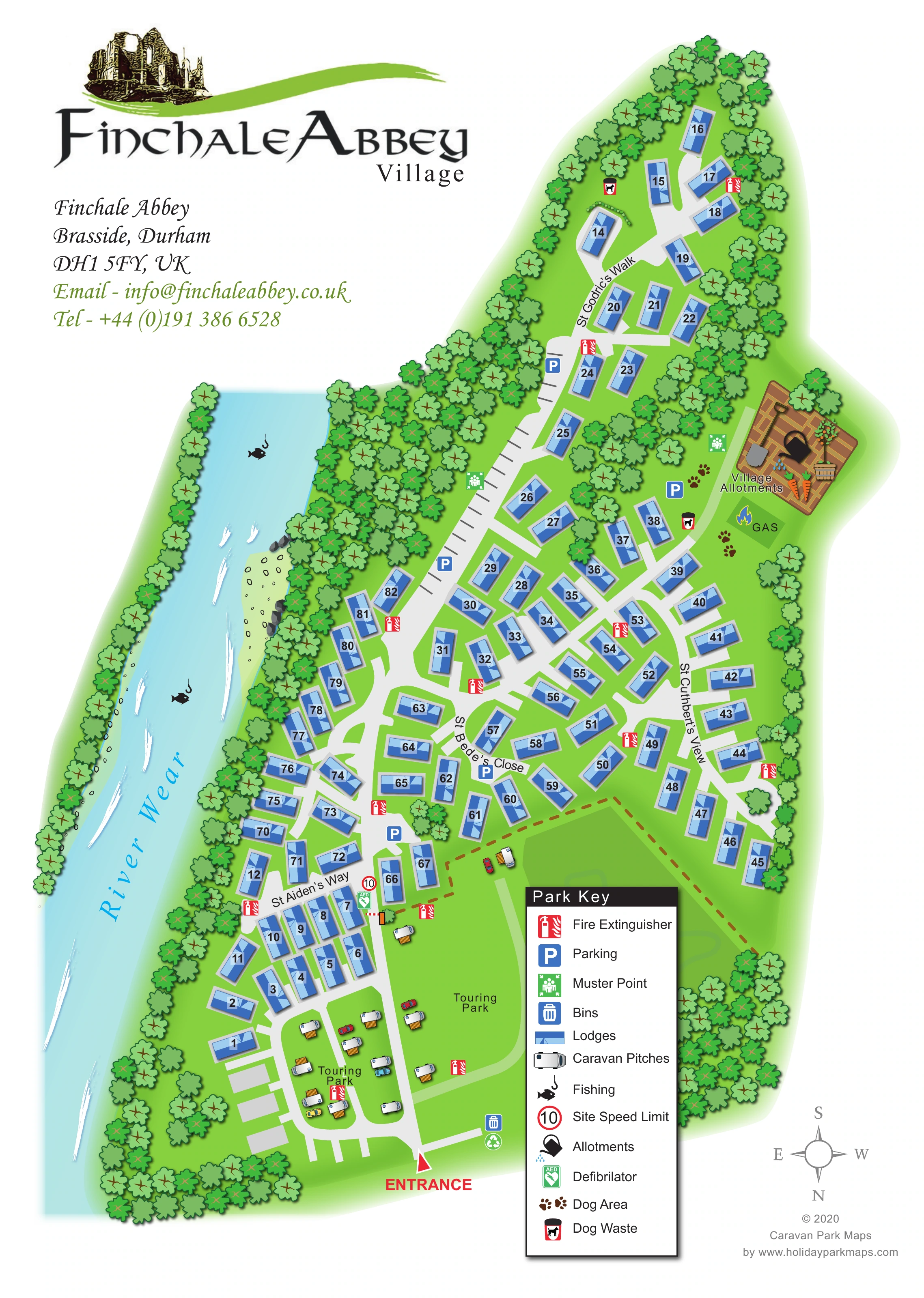
This illustrated map presents Finchale Abbey’s riverside accommodation at Brasside, Durham, under the Finchale Abbey Village branding. The River Wear runs down the left-hand side of the portrait plan, while dense tree belts frame an elongated site of numbered lodges and two touring areas near the entrance. A ruin illustration above the title connects the park’s identity with its historic setting without competing with the practical site information.
The accommodation is easy to distinguish: blue-roofed lodges follow a branching network of named roads, while white caravan illustrations occupy the more open touring ground. Parking, fishing locations, village allotments, dog facilities and safety points add useful detail beyond the accommodation layout. A large boxed key explains the symbols, and a red entrance arrow gives the visitor a clear starting point.
For the sample gallery, this is a useful example of a mixed lodge-and-touring map shaped around a strong natural boundary. Its design combines a compact numbered plan with recognisable landscape illustration, giving a wooded riverside site a clear visual structure.
The plan begins at a red entrance marker near the bottom of the page. Pale-grey access roads lead into two areas labelled Touring Park, where white caravans, small cars and timber-coloured platforms sit within open grass. An illustrated barrier, a defibrillator symbol and a circular speed-limit sign mark the transition towards the numbered lodge roads.
Blue lodges occupy most of the remaining site. Their roofs are drawn with contrasting facets and shadows, and each carries a large black number. St Aiden’s Way serves the lower group, St Bede’s Close crosses the middle, St Cuthbert’s View follows the right-hand rows, and St Godric’s Walk reaches into the narrow upper extension. Blue parking symbols and a long strip of marked bays provide additional reference points. Dense trees separate clusters and enclose much of the boundary.
The River Wear forms the left edge of the composition. White streaks suggest moving water, while a pale, stony bank interrupts the riverside woodland. Fish-and-hook symbols identify fishing locations. On the opposite side, the village allotments receive unusually detailed treatment, with beds, vegetables and gardening objects. Nearby are a gas-labelled area, dog-area paw prints and dog-waste symbols.
Red fire-extinguisher icons recur throughout the accommodation areas; green muster-point symbols sit beside the central parking and allotments. Bins and recycling are shown near the entrance. A tall black-headed key explains the main symbols, while the compass indicates north towards the bottom of the sheet. The overlapping detail views enlarge this same artwork, not separate park sections. A brown dashed line across the open ground remains undefined by the key.
KEEP EXPLORING
Chosen for shared landscapes, accommodation or facilities.
 Explore the map ↗
United Kingdom
Woodland park map with mixed pitches, bell tents, lodges and a fishing lake.
 Explore the map ↗
United Kingdom
A woodland estate park map combining caravan loops, touring pitches, riverside paths and Bruce’s Cave landmarks.
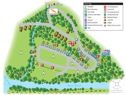 Explore the map ↗
United Kingdom
A wooded riverside map combining lodges, log pods, touring hardstandings and open camping at Bunroy Park.
Features may come from the sample artwork, its key or published park information. Approximate numbers describe the drawing and may cover only part of a park. They are intended to help you compare map examples. Current facilities and booking information should be checked with the park.
TAKE A CLOSER LOOK
View the illustrated map in detail or choose a file to download. These are sample maps; contact the park for current visitor information.


LET’S MAP YOUR PARK
For a map quotation, find your park and draw a rough boundary around it. The area you select helps us work out the design time and price.
Draw your park for a quote ↗Or talk to our map designers
01751 473136
 finchaleas.png
 finchalemapscombined_Page_1.png
 finchalemapscombined_Page_2.png
 finchaleas_large.png
 finchaleabbey_large.png