
Trees and planted areas
Dense small tree clusters divide caravan pitches and surround the quarters, while larger trees line the more open right-hand and lower areas.
ILLUSTRATED PARK MAP · P463
Eyre Highway, Norseman, Western Australia · Australia
 Enlarge the map ↗
A SENSE OF THE PLACE
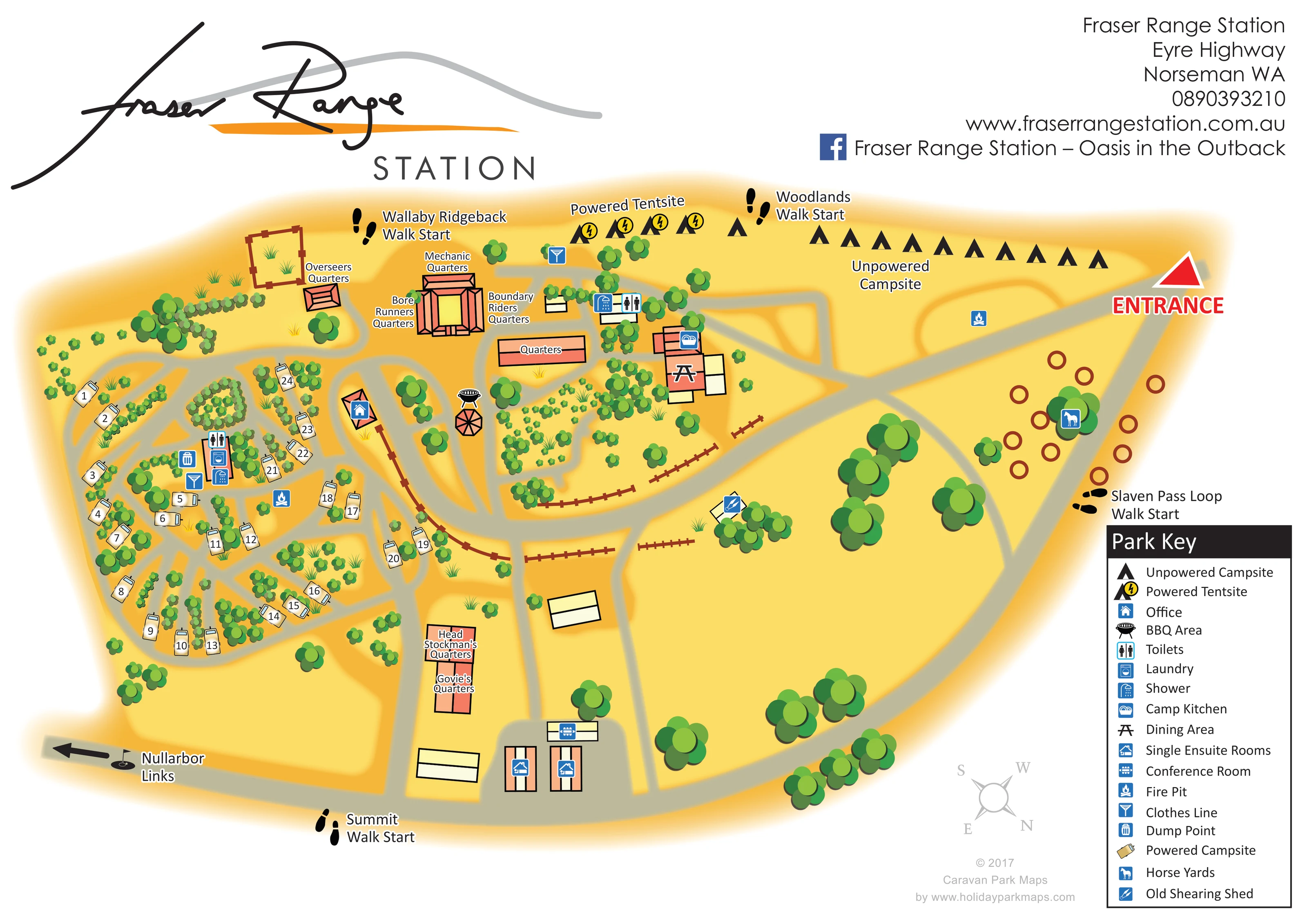
Fraser Range Station is based at Eyre Highway, Norseman, Western Australia. The site is located between Norseman and Balladonia amid the Great Western Woodlands. The park offers powered/unpowered campsites plus rooms, cottages and quarters.
Hot showers, laundry, camp kitchen and barbecue areas are provided. Nullarbar is the onsite licensed bar and restaurant.
LOOK CLOSER
Dense small tree clusters divide caravan pitches and surround the quarters, while larger trees line the more open right-hand and lower areas.
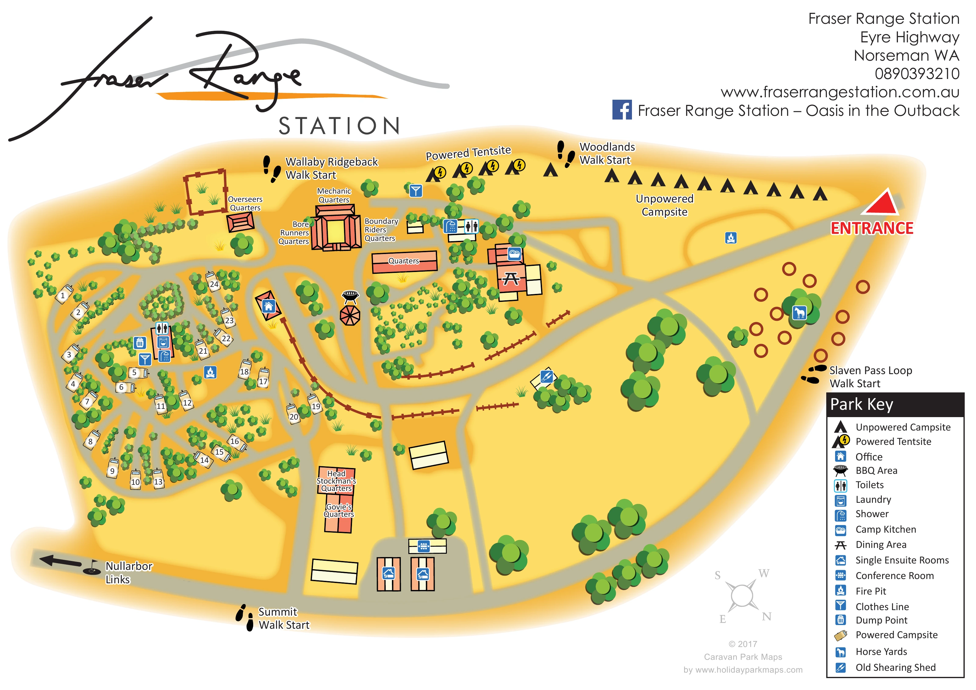
Rust-brown post-and-rail lines cross the central grounds, with a small enclosed area above Overseers Quarters.
A large red triangular marker and ENTRANCE label identify the arrival point at the upper-right edge.
Broad grey-beige roads connect the entrance, central station buildings, caravan loops and lower accommodation cluster.
Blue house symbols identify an office beside the caravan area and two buildings in the lower cluster.
A freestanding black barbecue symbol marks an area near the centre, beside the office-side road.
Grouped toilet and shower symbols appear within the caravan area and beside the upper central quarters.
A washing-machine symbol is grouped with the amenities in the caravan area.
A large red triangular marker and ENTRANCE label identify the arrival point at the upper-right edge.
Broad grey-beige roads connect the entrance, central station buildings, caravan loops and lower accommodation cluster.
Blue house symbols identify an office beside the caravan area and two buildings in the lower cluster.
A freestanding black barbecue symbol marks an area near the centre, beside the office-side road.
Grouped toilet and shower symbols appear within the caravan area and beside the upper central quarters.
A washing-machine symbol is grouped with the amenities in the caravan area.
Clothes-line symbols appear near the caravan amenities and the upper quarters.
The keyed dump-point symbol appears beside the caravan-area amenity cluster.
A blue kitchen symbol marks a salmon-coloured building in the upper central facilities group.
A picnic-table symbol marks the building immediately beside the camp kitchen.
A meeting-table symbol identifies a building in the lower accommodation and office cluster.
Fire-pit symbols are shown within the caravan area and near the upper-right unpowered camping area.
A horse symbol identifies the right-hand area, illustrated with a group of brown circular outlines.
A shearing symbol marks a small building beside trees, just right of the central road junction.
Footprints mark the walk start near the upper-left quarters area.
A footprint marker identifies the walk start beside the powered tent area along the top edge.
The walk start is labelled on the right-hand perimeter beside the horse-yard area.
Footprints and a label identify the walk start at the lower edge of the plan.
A black arrow and golf flag point off the lower-left edge towards Nullarbor Links; the course itself is not drawn.
Dense small tree clusters divide caravan pitches and surround the quarters, while larger trees line the more open right-hand and lower areas.
Rust-brown post-and-rail lines cross the central grounds, with a small enclosed area above Overseers Quarters.
The park lies between Norseman and Balladonia amid the Great Western Woodlands.
The wider park information identifies Nullarbar as the onsite licensed bar and restaurant; it is not named on this artwork.
READING THE MAP
This illustrated map of Fraser Range Station brings together a caravan and camping area, named station quarters and visitor facilities in an outback setting on Western Australia's Eyre Highway. Warm yellow ground, clusters of green trees and salmon-coloured buildings give the plan a recognisable station character without obscuring its practical purpose.
The map shows roughly 25 powered caravan pitches in a compact network of lanes on the left, with powered tent and unpowered camping areas along the upper edge. Quarters and communal buildings sit between these accommodation areas, while horse yards and more open grounds occupy the right-hand side. A prominent red entrance marker provides a clear starting point for reading the road network.
Details such as the old shearing shed, four named walk starts and a direction towards Nullarbor Links make this more than a pitch-location plan. The large Park Key supports everyday navigation to showers, laundry, the camp kitchen and other facilities. For a station-based campsite, the design demonstrates how a visitor map can explain varied accommodation and preserve the distinctive identity of the place.
The plan is organised around a broad road entering from the upper right and branching through the station grounds. On the left, numbered caravan illustrations follow curved lanes and short spurs, with trees and shrubs separating groups of powered pitches. A nearby amenities cluster is marked with toilet, shower, laundry, clothes-line and dump-point symbols. An office building and barbecue area sit closer to the central roads.
Across the upper edge, black tent symbols distinguish camping from the caravan pitches. Yellow lightning badges identify the powered tentsite area, while the longer unpowered campsite strip extends towards the entrance. A fire-pit marker appears nearby, with another in the caravan area. The tent illustrations communicate the accommodation zones rather than a fixed number of pitches.
The station buildings provide a second layer of wayfinding. Overseers, Mechanic, Bore Runners and Boundary Riders Quarters are labelled around the upper central area; Head Stockman's and Govie's Quarters appear farther down the plan. Other buildings carry symbols for single ensuite rooms, a conference room and offices. The camp kitchen and dining area form a clearly marked facilities group beside the upper quarters.
The more open right-hand grounds contain large tree symbols, horse yards and the old shearing shed. Brown fence lines add structure through the central grounds. Footprints identify the starts of Wallaby Ridgeback, Woodlands, Slaven Pass Loop and Summit walks, while a golf flag and arrow indicate the direction of Nullarbor Links.
A single illustrated plan is framed by the station logo, contact block and tall Park Key. The accompanying enlargement shows the same key and adjoining grounds in greater detail, rather than a separate site or map variant.
KEEP EXPLORING
Chosen for shared landscapes, accommodation or facilities.
 Explore the map ↗
Australia
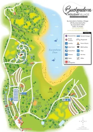
A landscape-led map of Buckenderra Holiday Village, with colour-coded accommodation, lakeside roads and illustrated recreation facilities.
 Explore the map ↗
Australia
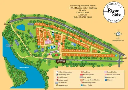
Numbered cabin rows, central amenities and wooded Ovens River frontage at Bundalong Riverside Resort.
 Explore the map ↗
Australia
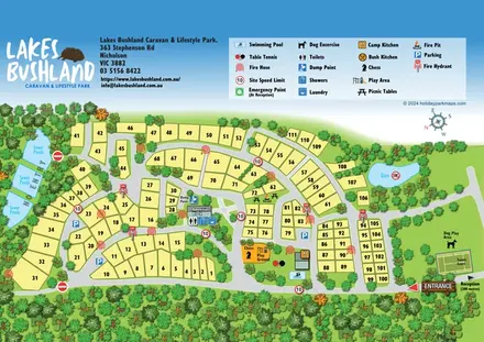
A tree-framed numbered site plan with curving roads, shared leisure facilities and a prominent pictorial legend.
Features may come from the sample artwork, its key or published park information. Approximate numbers describe the drawing and may cover only part of a park. They are intended to help you compare map examples. Current facilities and booking information should be checked with the park.
TAKE A CLOSER LOOK
View the illustrated map in detail or choose a file to download. These are sample maps; contact the park for current visitor information.


LET’S MAP YOUR PARK
For a map quotation, find your park and draw a rough boundary around it. The area you select helps us work out the design time and price.
Draw your park for a quote ↗Or talk to our map designers
01751 473136
 fraserrange_large.png