
Bushland and planted screening
Dense illustrated tree canopies surround the site, with smaller clusters separating plot groups, lining roads and enclosing facilities.
ILLUSTRATED PARK MAP · P183
363 Stephenson Road, Nicholson, Victoria · Australia
 Enlarge the map ↗
A SENSE OF THE PLACE
Lakes Bushland Caravan and Lifestyle Park is located at Nicholson in Victoria's Gippsland region. Powered and unpowered sites cater for tents, caravans, motorhomes and larger rigs in a bush setting.
The park also offers residential living for people over 55 and annual-use cabin options. These uses sit alongside holiday camping, with the map showing the arrangement of the different areas within the grounds.
LOOK CLOSER
Dense illustrated tree canopies surround the site, with smaller clusters separating plot groups, lining roads and enclosing facilities.
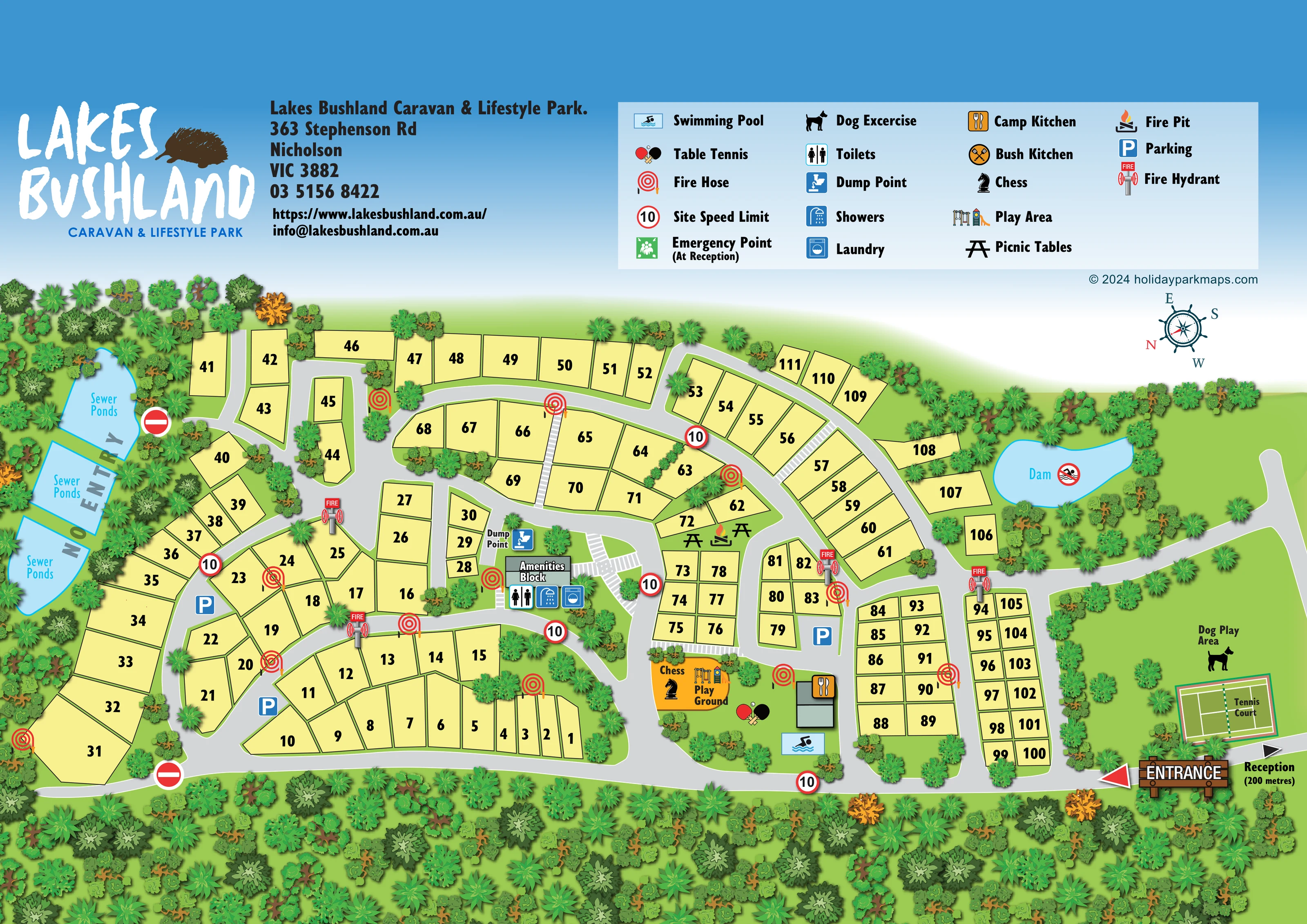
A blue, irregularly shaped dam appears in the upper-right part of the plan, edged with trees and bearing a no-swimming symbol.
Three blue ponds are labelled along the left edge, separated from the accommodation plots by trees and accompanied by NO ENTRY wording.
A labelled building near the centre-left carries toilet, shower and laundry symbols, with striped pedestrian connections around it.
Labelled and symbolised immediately above the amenities block, beside an internal road.
The orange cutlery symbol identifies a grey-green building in the lower central leisure area.
A blue swimming symbol locates the pool beside the camp-kitchen and recreation cluster.
Crossed red and black bat illustrations mark table tennis between the playground and camp-kitchen building.
A labelled building near the centre-left carries toilet, shower and laundry symbols, with striped pedestrian connections around it.
Labelled and symbolised immediately above the amenities block, beside an internal road.
The orange cutlery symbol identifies a grey-green building in the lower central leisure area.
A separate bush-kitchen symbol is explained in the legend, but no corresponding location is clearly identifiable in the plan.
A blue swimming symbol locates the pool beside the camp-kitchen and recreation cluster.
Crossed red and black bat illustrations mark table tennis between the playground and camp-kitchen building.
An orange play area with an illustrated climbing frame and slide sits in the lower central part of the plan.
A labelled chess-knight symbol shares the orange playground area.
Two picnic-table symbols flank a fire-pit symbol on a small green space above the central leisure area.
A labelled, line-marked tennis court is illustrated beside the entrance, separate from the main recreation cluster.
A broad green space above the tennis court is labelled Dog Play Area and marked with a dog silhouette.
Blue P symbols mark parking at several locations within the accommodation road network.
Repeated red hose-reel and hydrant symbols are positioned along roads and between plot groups.
The legend states that the emergency point is at reception; its location is not plotted within the illustrated accommodation area.
A black arrow beside the entrance points beyond the drawing to Reception, with the artwork's distance annotation of 200 metres.
A timber-style entrance sign and red directional arrow mark arrival at the lower-right edge of the plan.
Wide grey roads form connected loops and branches around the plot groups. Narrow white-and-grey striped links cut between plots and connect shared facilities.
Repeated red-ringed 10 signs mark the mapped site speed limit. No-entry symbols appear on the left-side routes, alongside prominent NO ENTRY wording at the sewer ponds.
Dense illustrated tree canopies surround the site, with smaller clusters separating plot groups, lining roads and enclosing facilities.
A blue, irregularly shaped dam appears in the upper-right part of the plan, edged with trees and bearing a no-swimming symbol.
Three blue ponds are labelled along the left edge, separated from the accommodation plots by trees and accompanied by NO ENTRY wording.
READING THE MAP
This illustrated map of Lakes Bushland Caravan & Lifestyle Park in Nicholson, Victoria, combines a clear numbered site plan with a distinctive bushland setting. Pale-yellow plots sit within a network of grey roads, while layered tree canopies frame the grounds and separate smaller groups of sites. The accommodation area shown is on the scale of roughly 110 plots, presented without separate visual categories for camping, cabins or residential use.
The map gives shared facilities a prominent role. An amenities block and dump point occupy a central position, while a separate recreation cluster brings together the swimming pool, camp kitchen, playground, chess and table tennis. Near the entrance, a tennis court and dog play area create another recognisable destination. A tree-lined dam and the clearly labelled sewer ponds add useful landscape and service landmarks.
The generous header combines the park's brush-lettered logo, contact details and a large pictorial legend. This sample is particularly relevant to parks that need straightforward plot navigation without losing the character of a wooded setting.
The single landscape plan places the entrance at the lower-right edge, marked by a timber-style sign and a red arrow. A separate black arrow points towards reception beyond the drawing. From the arrival edge, a broad grey road extends across the lower side of the park and connects to curving loops and shorter branches through the accommodation area.
Plot shapes follow that road structure. The left and upper portions contain larger, irregular polygons arranged around sweeping bends, while the lower-right portion uses compact paired rows of rectangular plots. Every plot shares a pale-yellow fill, dark outline and bold black number. Narrow striped pedestrian links provide connections between selected rows and around the central amenities block, where toilet, shower and laundry symbols are grouped together. The dump point is labelled nearby, and blue parking symbols appear at several points along the roads.
Leisure facilities form two useful landmarks. In the lower centre, an orange playground and chess area sits beside table tennis, a camp-kitchen building and the swimming-pool symbol. A small green space above this cluster contains picnic tables and a fire pit. Near the entrance, the line-marked tennis court lies below a labelled dog play area.
Trees provide both atmosphere and structure, enclosing facilities and following the boundaries of the plot groups. The upper-right dam carries a no-swimming symbol; the three sewer ponds at the left are labelled and accompanied by no-entry markings. Repeated fire hoses, hydrants and speed-limit signs add operational information. Above the plan, the broad legend explains the pictograms, while a rotated compass rose clarifies orientation. The enlarged detail views show portions of this same artwork rather than additional park sections.
KEEP EXPLORING
Chosen for shared landscapes, accommodation or facilities.
 Explore the map ↗
United States
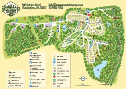
Woodland RV campground map with mixed camping, three water landmarks and a central recreation hub.
 Explore the map ↗
United Kingdom
A colour-zoned coastal park map with touring areas, woodland trails, ponds and a leisure club.
 Explore the map ↗
United Kingdom
Woodland holiday-park map with named accommodation areas, touring loops and illustrated recreation facilities.
Features may come from the sample artwork, its key or published park information. Approximate numbers describe the drawing and may cover only part of a park. They are intended to help you compare map examples. Current facilities and booking information should be checked with the park.
LET’S MAP YOUR PARK
For a map quotation, find your park and draw a rough boundary around it. The area you select helps us work out the design time and price.
Draw your park for a quote ↗Or talk to our map designers
01751 473136