
Nature Reserve
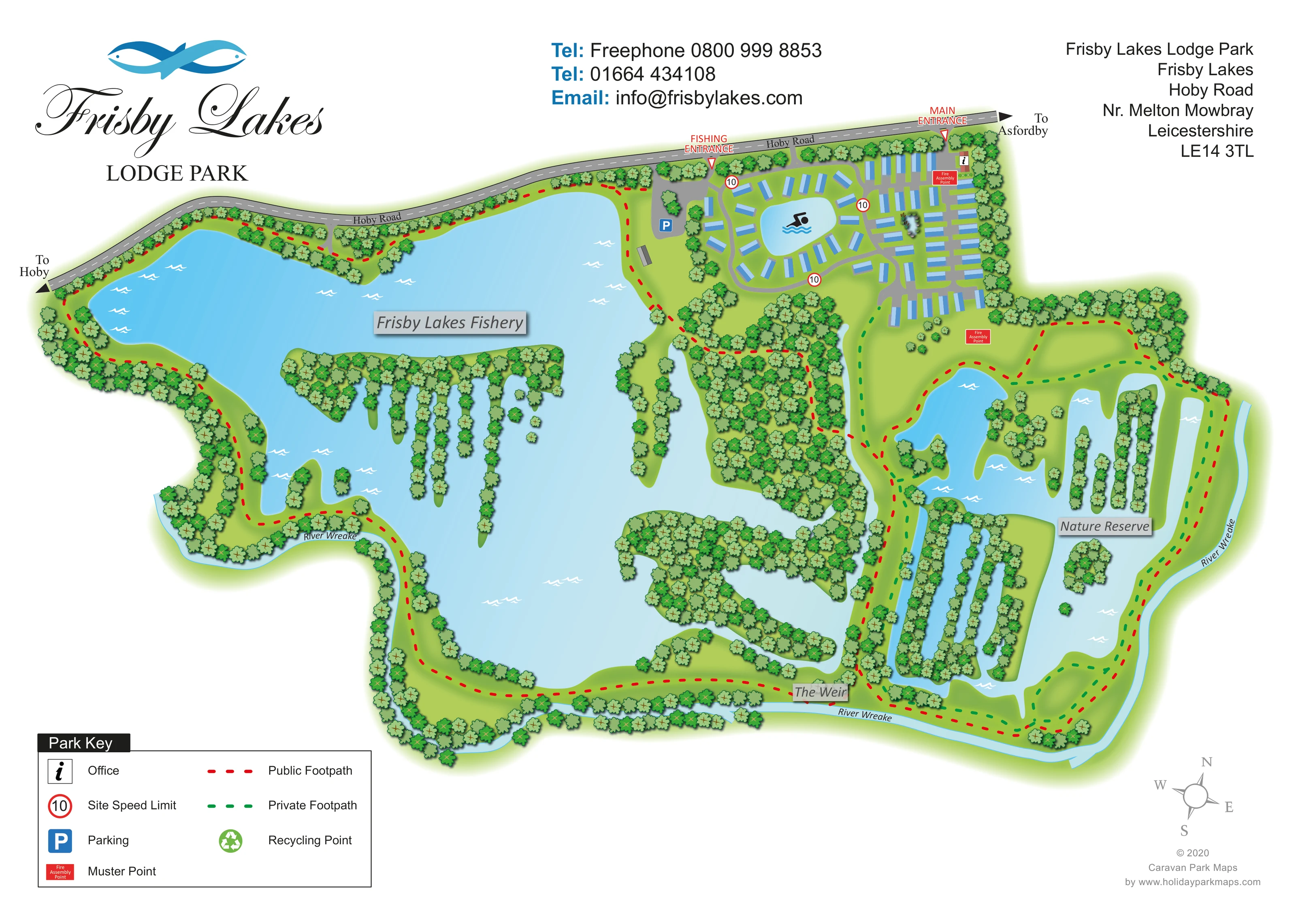
The eastern wetland area is labelled Nature Reserve and contains irregular pools, wooded islands and narrow strips of land.
ILLUSTRATED PARK MAP · P464
Frisby Lakes Lodge Park, Frisby Lakes, Hoby Road, Nr. Melton Mowbray, Leicestershire · United Kingdom
 Enlarge the map ↗
A SENSE OF THE PLACE
Frisby Lakes Lodge Park is a lakeside holiday lodge development near Melton Mowbray in rural Leicestershire. Water and open countryside are central to its setting.
Published park information describes fishing, open-water swimming, paddlesports, saunas and a café. The map explains the relationship between lodge areas, access routes and the lakes, helping prospective owners and visitors understand the site.
LOOK CLOSER
The eastern wetland area is labelled Nature Reserve and contains irregular pools, wooded islands and narrow strips of land.
A narrow blue river follows much of the southern and eastern perimeter, with repeated labels following its course.
Named near the southern meeting point of the fishery, reserve and river corridor.
Dense tree groups define the lake margins, long finger-like islands and central wooded separation between the fishery and nature reserve.
The large western lake is explicitly labelled as the fishery, with a separate fishing entrance from Hoby Road.
A swimmer pictogram marks the small lake encircled by lodges.
A red arrow identifies the lodge-park entrance from Hoby Road at the upper-right edge.
A separate labelled entrance leads from Hoby Road towards the fishery-side parking area.
The large western lake is explicitly labelled as the fishery, with a separate fishing entrance from Hoby Road.
A swimmer pictogram marks the small lake encircled by lodges.
The eastern wetland area is labelled Nature Reserve and contains irregular pools, wooded islands and narrow strips of land.
A narrow blue river follows much of the southern and eastern perimeter, with repeated labels following its course.
Named near the southern meeting point of the fishery, reserve and river corridor.
Dense tree groups define the lake margins, long finger-like islands and central wooded separation between the fishery and nature reserve.
A red arrow identifies the lodge-park entrance from Hoby Road at the upper-right edge.
A separate labelled entrance leads from Hoby Road towards the fishery-side parking area.
The grey boundary road carries directional arrows towards Hoby and Asfordby.
Red dashed routes follow extensive sections of the lake shores and reserve perimeter; the key identifies them as public footpaths.
Green dashed routes run through and around the eastern reserve and connect towards the lodge area.
An information-style office symbol appears beside the main entrance.
A blue parking symbol marks a grey parking area near the fishing entrance.
Red Fire Assembly Point boxes are placed near the main entrance and on open ground south of the lodge rows.
Circular red-bordered 10 markers appear on internal roads and are explained by the key.
A green recycling symbol is included in the key; its position within the plan is not clearly identifiable.
Published park context describes these activities and amenities, but they are not individually labelled or clearly located in this artwork.
READING THE MAP
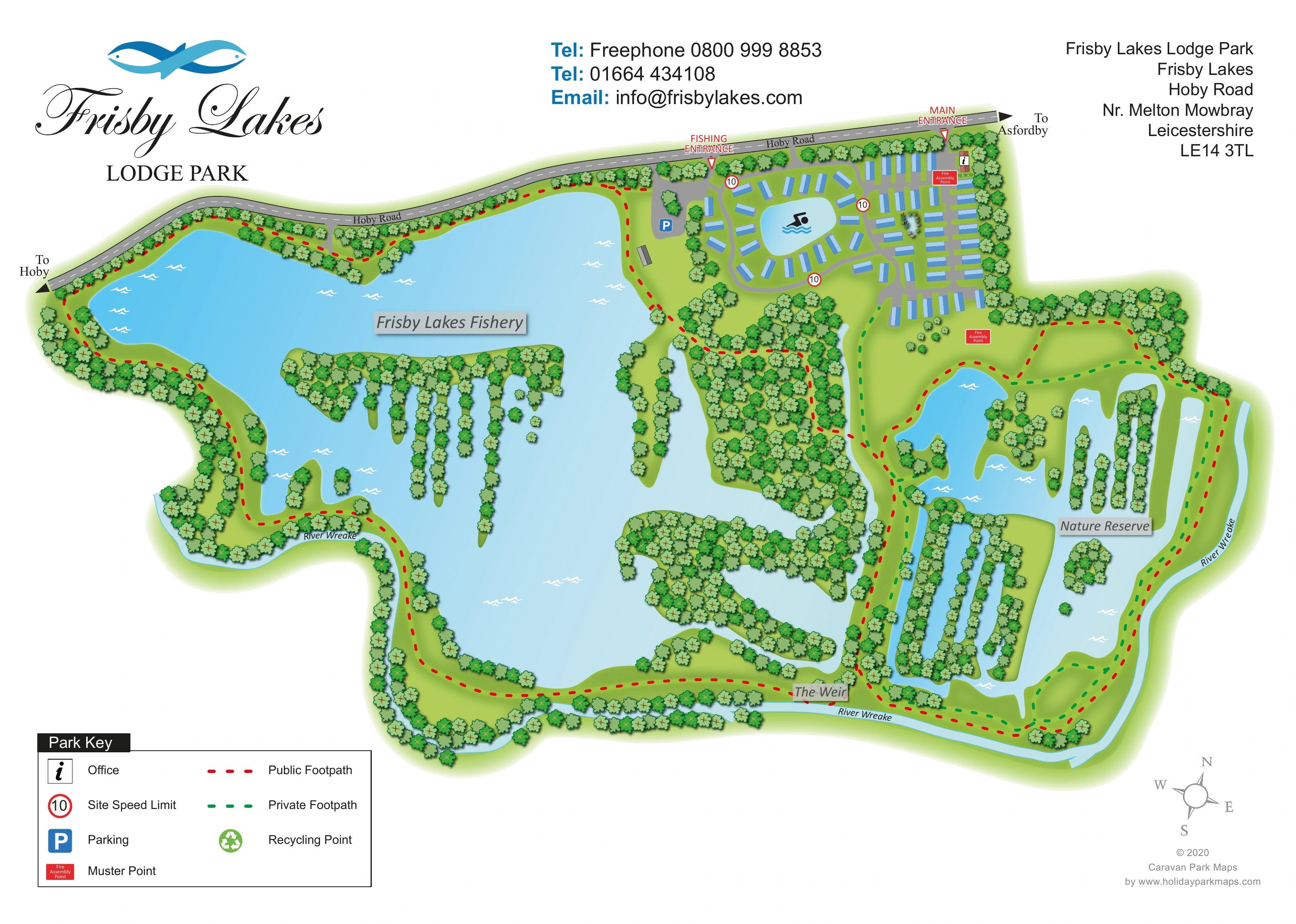
Water shapes almost every part of this illustrated map of Frisby Lakes Lodge Park near Melton Mowbray in Leicestershire. A broad fishing lake fills the western side of the plan, while a network of pools, wooded islands and narrow land strips forms the nature reserve to the east. The lodge development sits above these larger water landscapes, with one group arranged around a small lake marked by a swimming symbol.
The map brings accommodation, arrival routes and countryside paths into a single view. Hoby Road runs along the upper boundary, with separate arrows for the main entrance and fishing entrance. Within the site, grey roads serve the lodges, while red and green dashed lines distinguish public and private footpaths around the lakes and reserve.
Blue water, layered green planting and simple lodge symbols keep the extensive landscape readable without turning it into a technical site plan. The prominent Frisby Lakes branding, compact key and clearly named natural features make this a useful sample for lodge parks where the relationship between accommodation and outdoor recreation is central to the visitor experience.
The composition places the lodge area at the upper right, leaving most of the page for the lakes and wooded landscape. Blue rectangular units circle a small swimmer-marked lake, then extend into parallel rows along branching grey roads. This contrast between a curved waterside cluster and more regular accommodation groups makes the development easy to recognise within the much larger site.
Hoby Road follows the upper edge of the plan, with arrows pointing towards Hoby and Asfordby. Two red entrance markers distinguish the lodge-park arrival from access to the fishery. A parking symbol sits beside the fishing approach, while an office symbol appears near the main entrance. Speed-limit signs and red fire assembly point boxes add practical references within and beside the accommodation area.
The main water body is labelled Frisby Lakes Fishery. Its irregular shoreline encloses long, tree-covered fingers of land and smaller islands. To the east, the Nature Reserve has a more fragmented pattern of pools, channels and wooded strips. The River Wreake traces the lower and right-hand boundaries, and The Weir is named near the southern junction of these landscapes.
Red dashed public footpaths follow much of the waterside perimeter; green dashed private paths provide a contrasting network through the reserve. The lower-left key explains both route types alongside the principal facility symbols. Large script branding occupies the upper-left white space, with contact and address blocks across the top and a compass at the lower right. The accompanying detail views enlarge the key and compass area of this same artwork rather than presenting additional park sections.
KEEP EXPLORING
Chosen for shared landscapes, accommodation or facilities.
 Explore the map ↗
United Kingdom
Woodland park map with mixed pitches, bell tents, lodges and a fishing lake.
 Explore the map ↗
United Kingdom
Illustrated lakeside park plan with numbered holiday units, leisure buildings and a looping Woodland Walk.
 Explore the map ↗
United Kingdom
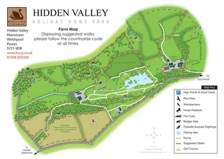
Hidden Valley farm map with suggested walks, wildlife landmarks, viewpoints and a fishing lake.
Features may come from the sample artwork, its key or published park information. Approximate numbers describe the drawing and may cover only part of a park. They are intended to help you compare map examples. Current facilities and booking information should be checked with the park.
TAKE A CLOSER LOOK
View the illustrated map in detail or choose a file to download. These are sample maps; contact the park for current visitor information.


LET’S MAP YOUR PARK
For a map quotation, find your park and draw a rough boundary around it. The area you select helps us work out the design time and price.
Draw your park for a quote ↗Or talk to our map designers
01751 473136
 frisbylakeswide_large.png