
South Forty Foot Drain
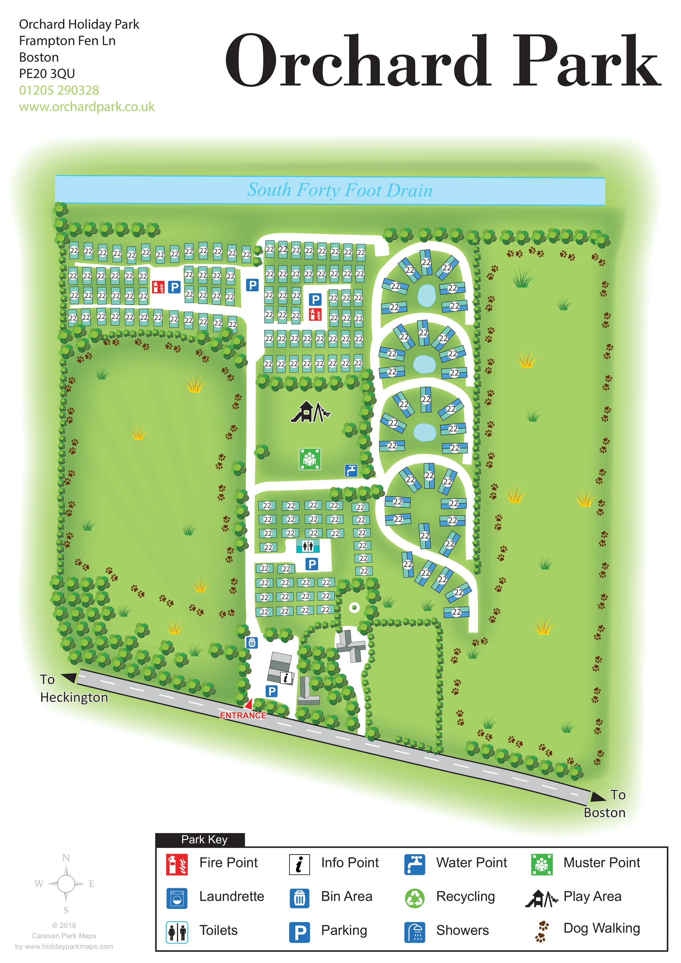
A long pale-blue watercourse forms the northern backdrop and is explicitly named.
ILLUSTRATED PARK MAP · P560
Frampton Lane, Hubberts Bridge, Boston, Lincolnshire · United Kingdom
 Enlarge the map ↗
A SENSE OF THE PLACE
Orchard Holiday Park is based at Frampton Lane, Hubberts Bridge, Boston, Lincolnshire. Touring, motorhome and tent pitches are offered alongside holiday homes. Holiday homes can be hired; the location page describes its luxury cabins as sale-only.
On-site facilities include a café, licensed bar, laundry and shower/toilet block. The operator describes a five-acre fishing lake containing coarse fish.
LOOK CLOSER
A long pale-blue watercourse forms the northern backdrop and is explicitly named.
Rows of stylised trees define boundaries and divide accommodation blocks, with extensive lawns on both sides of the developed core.
Several radial accommodation groups surround pale-blue oval features. These are unlabelled and should not be identified as the park's fishing lake.
A red entrance label and triangular marker identify the access from the road along the southern edge.
The diagonal frontage road has arrows towards Heckington on the left and Boston on the right.
White routes lead north from the entrance, serve the rectangular accommodation blocks and curve between the eastern radial clusters.
An information symbol is placed on a grey-roofed building near the entrance.
Blue parking symbols appear near the entrance and within several accommodation groups.
A red entrance label and triangular marker identify the access from the road along the southern edge.
The diagonal frontage road has arrows towards Heckington on the left and Boston on the right.
White routes lead north from the entrance, serve the rectangular accommodation blocks and curve between the eastern radial clusters.
An information symbol is placed on a grey-roofed building near the entrance.
Blue parking symbols appear near the entrance and within several accommodation groups.
A toilet symbol marks a facility within the lower central accommodation block.
A prominent black play-equipment pictogram occupies the central green between accommodation groups.
A green muster-point symbol sits on the central green, below the play area.
A blue tap symbol appears beside the route at the south-eastern corner of the central green.
Red fire-point symbols are shown within the upper accommodation blocks.
A blue bin symbol is positioned beside the main internal route north of the entrance buildings.
Brown paw-print trails trace routes around the broad western and eastern green areas.
A long pale-blue watercourse forms the northern backdrop and is explicitly named.
Rows of stylised trees define boundaries and divide accommodation blocks, with extensive lawns on both sides of the developed core.
Several radial accommodation groups surround pale-blue oval features. These are unlabelled and should not be identified as the park's fishing lake.
A washing-machine symbol is included in the key, without a clearly identifiable position on the main plan.
A shower symbol is included in the key, but no separate shower location is clearly identifiable on the plan.
The key includes a green recycling symbol; its location in the main artwork is not sufficiently clear to assign.
Operator information identifies a café and licensed bar. Neither is explicitly labelled in the map.
Operator information describes a coarse-fishing lake, but the artwork does not explicitly label or locate it.
READING THE MAP
This illustrated map of Orchard Holiday Park near Boston, Lincolnshire, brings together a compact accommodation layout, generous green margins and a distinctive waterside boundary. The South Forty Foot Drain stretches across the top of the plan, while the road towards Heckington and Boston anchors the entrance along its lower edge. Between them, turquoise caravan-style symbols form a mixture of orderly rows and curved groups, giving the park a recognisable visual structure.
The map focuses on everyday orientation: arriving at the information point, finding parking, locating toilets and recognising the central play area. Brown paw-print trails make the dog-walking areas especially easy to spot, tracing the broad lawns on either side of the accommodation. Trees provide both a perimeter frame and clear divisions between sections.
Its portrait page combines a large ‘Orchard Park’ heading with a spacious illustrated plan and a boxed facility key. The result is a useful sample for parks that need to explain several different accommodation layouts within one coherent visitor map, while keeping green space and walking routes visually prominent.
The plan is read from the entrance near the lower centre of the page. A red marker identifies the turn from the diagonal frontage road, whose arrows point towards Heckington and Boston. Just inside are grey-roofed buildings, an information symbol and parking. A broad white internal route continues north through the developed part of the park.
Accommodation is organised in three principal rectangular blocks: one towards the upper left, another above the central green and a third below it. Their turquoise symbols sit in closely spaced rows, with parking and selected service markers placed within the blocks. Along the eastern side, a separate sequence of curved groups follows a winding route. Units rotate around rounded islands, several of which contain small, unlabelled pale-blue oval features. This change in geometry gives the eastern section a markedly different character from the straight rows.
The central green carries a large play-area pictogram, a green muster-point marker and a nearby blue water-point symbol. Toilets are marked in the lower accommodation block, fire points in the upper blocks and a bin area beside the main approach. The bottom key also includes laundrette, shower and recycling symbols, without clearly established positions for those facilities in the main plan.
Open green areas extend along both sides of the accommodation. Brown paw prints trace dog-walking routes around these lawns, while repeated tree symbols frame the boundaries and separate sections. The named South Forty Foot Drain closes the northern edge. A compass, contact block and large three-row key complete the single-page design; the accompanying detail views enlarge that same key rather than showing additional park sections.
KEEP EXPLORING
Chosen for shared landscapes, accommodation or facilities.
 Explore the map ↗
United Kingdom
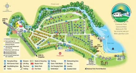
Colour-coded touring and camping map beside Afon Llafar and Bala Lake, with bilingual Glanllyn branding.
 Explore the map ↗
United Kingdom
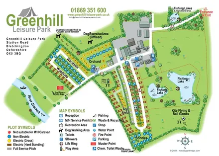
Illustrated camping and touring map with fishing lakes, dog areas and colour-coded pitches.
 Explore the map ↗
United Kingdom
A lakeside holiday-park and fishery map with numbered accommodation, fishing positions and clearly grouped visitor services.
Features may come from the sample artwork, its key or published park information. Approximate numbers describe the drawing and may cover only part of a park. They are intended to help you compare map examples. Current facilities and booking information should be checked with the park.
TAKE A CLOSER LOOK
View the illustrated map in detail or choose a file to download. These are sample maps; contact the park for current visitor information.

LET’S MAP YOUR PARK
For a map quotation, find your park and draw a rough boundary around it. The area you select helps us work out the design time and price.
Draw your park for a quote ↗Or talk to our map designers
01751 473136
 orchardholidaypark_Page_2.png