
Afon Miwl / River Mule
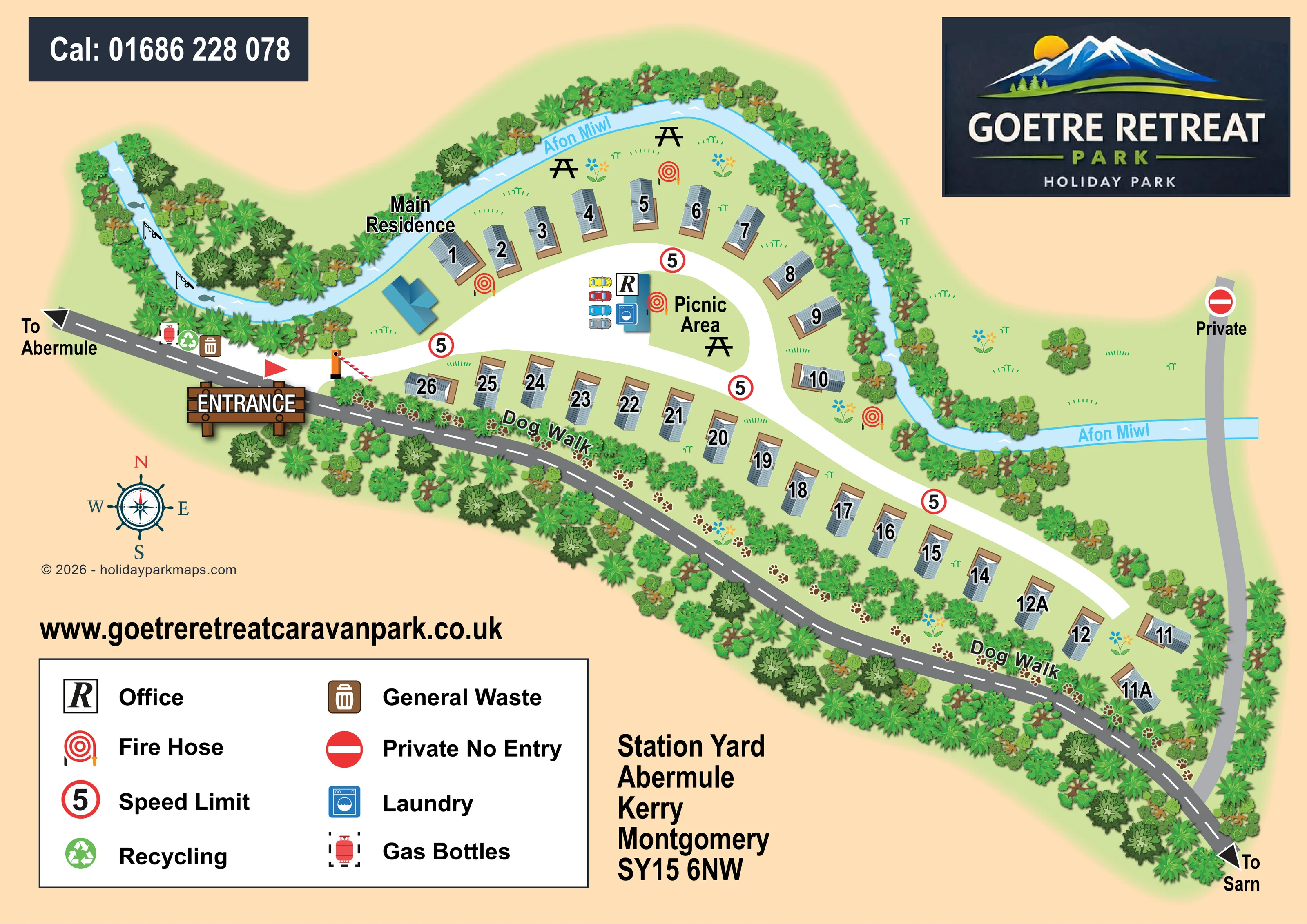
A pale-blue river curves around the upper accommodation row and continues eastwards. It is labelled Afon Miwl on the artwork.
ILLUSTRATED PARK MAP · P137
Station Yard, Abermule, Kerry, Montgomery · United Kingdom
 Enlarge the map ↗
A SENSE OF THE PLACE
Goetre Retreat is an owners-only holiday park beside the River Mule between Abermule and Kerry. Its Mid Wales valley setting provides a quieter base for people with their own holiday home.
Dogs are welcomed and a dedicated dog trail is available on the park. The surrounding area offers countryside excursions towards Newtown, Welshpool and the Shropshire border. The park does not currently advertise holiday caravan letting.
LOOK CLOSER
A pale-blue river curves around the upper accommodation row and continues eastwards. It is labelled Afon Miwl on the artwork.
Dense illustrated trees and shrubs frame the river, roadside edge and eastern boundary, with lighter planting between accommodation and routes.
Fish silhouettes and fishing-rod motifs decorate the western river bend; they are not accompanied by a named fishing facility or access information.
A labelled picnic area occupies the green island inside the entrance loop, with further picnic-table symbols on the riverside grass.
A labelled dog walk follows the planted strip beside the Abermule–Sarn road, marked with repeated brown paw prints.
The legend's boxed R office symbol is placed at the central service building within the internal road loop.
A blue washing-machine symbol identifies laundry at the same central service building.
A small group of coloured car illustrations indicates parking immediately beside the office and laundry building.
A pale-blue river curves around the upper accommodation row and continues eastwards. It is labelled Afon Miwl on the artwork.
Dense illustrated trees and shrubs frame the river, roadside edge and eastern boundary, with lighter planting between accommodation and routes.
A labelled picnic area occupies the green island inside the entrance loop, with further picnic-table symbols on the riverside grass.
A labelled dog walk follows the planted strip beside the Abermule–Sarn road, marked with repeated brown paw prints.
The legend's boxed R office symbol is placed at the central service building within the internal road loop.
A blue washing-machine symbol identifies laundry at the same central service building.
A small group of coloured car illustrations indicates parking immediately beside the office and laundry building.
General-waste and recycling symbols are grouped near the entrance on the Abermule side of the park.
A gas-bottle symbol is shown alongside the entrance-side waste and recycling points.
Repeated red hose-reel symbols mark points around the internal drive, central facilities and riverside accommodation.
A large timber-style entrance sign, red flag and striped barrier mark the western access from the adjoining road.
A dark-grey road runs diagonally along the lower park boundary, with arrows labelled 'To Abermule' and 'To Sarn'.
A separate grey route on the eastern side crosses the river and is labelled Private with a no-entry symbol.
Red-ringed 5 symbols are repeated along the white internal road and explained as speed-limit symbols in the legend.
A separate blue-roofed building near the entrance and river is labelled Main Residence.
Fish silhouettes and fishing-rod motifs decorate the western river bend; they are not accompanied by a named fishing facility or access information.
READING THE MAP
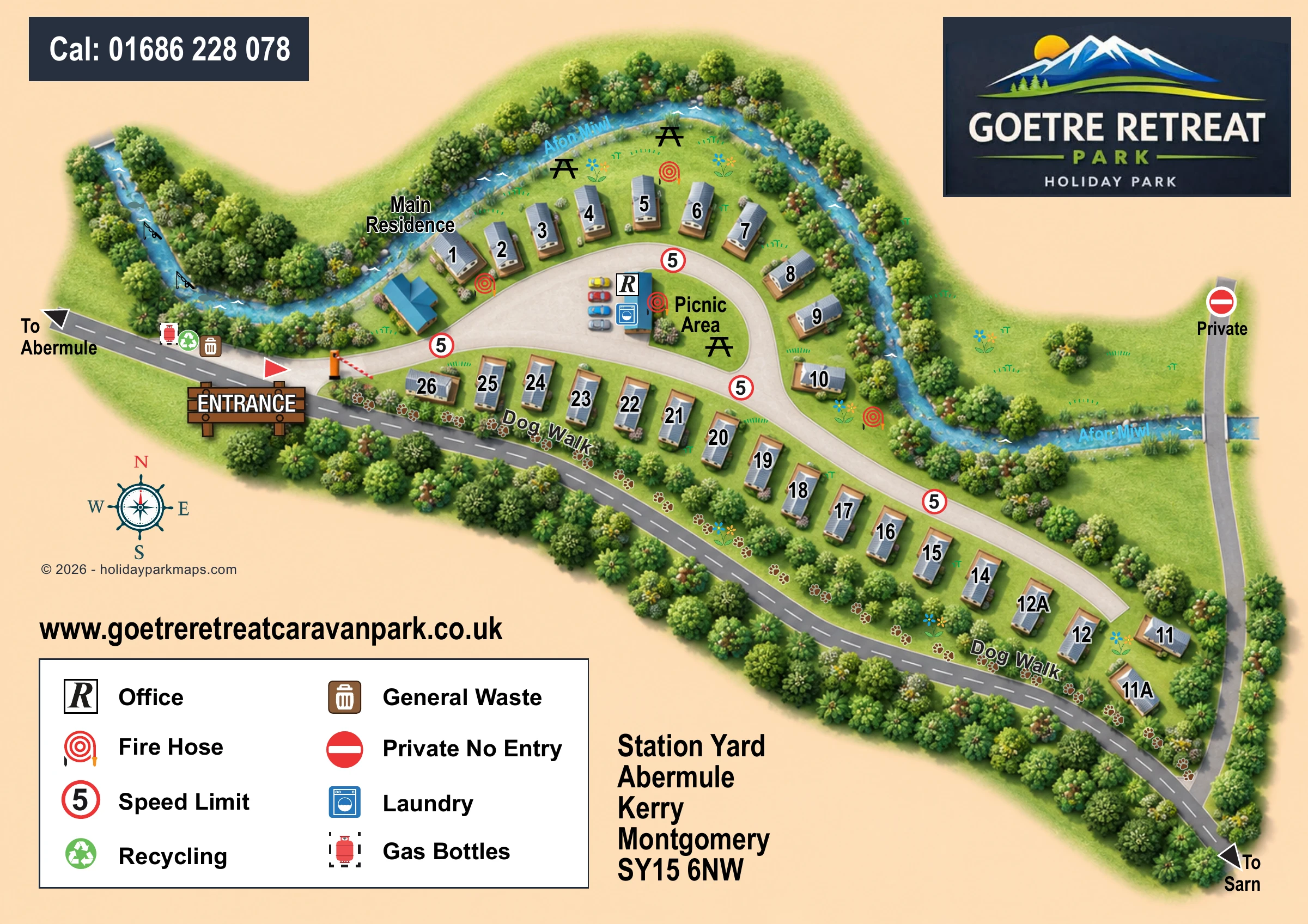
This illustrated map of Goetre Retreat Caravan Park presents a small riverside holiday-home park in Mid Wales, with the Afon Miwl forming a prominent curved boundary. Roughly 30 caravan illustrations occupy a broad arc near the entrance and a longer row extending towards the park’s eastern end. The layout is easy to grasp because the river, internal drive and adjoining road each have a distinct visual treatment.
The map gives particular attention to everyday orientation: a timber-style entrance sign and barrier establish the arrival point, while the office, laundry and picnic area sit together inside the main road loop. Along the lower boundary, a dog walk is traced with paw prints through a planted strip beside the road towards Abermule and Sarn.
Grey caravan roofs, blue service buildings and richly layered green planting sit against a warm peach background. A large park logo, clear facility key and prominent contact details complete a sample suited to compact owner-focused parks where landscape character and straightforward wayfinding matter more than a complex network of leisure facilities.
The single landscape-format plan places Goetre Retreat between the winding Afon Miwl and the road linking the directions of Abermule and Sarn. At the wider western end, the entrance is marked by a timber-style sign, a red flag and a striped barrier. From here, a broad white drive curves around a central island before continuing towards the narrow eastern end of the park.
Numbered caravan holiday homes follow two principal lines: an upper arc beside the river and a longer lower row between the internal drive and roadside planting. The grey roof illustrations rotate to follow these curves, with tan bases or decking giving each unit a recognisable footprint. A blue-roofed main residence stands near the entrance. Within the road loop, a second blue building carries office and laundry symbols, with coloured cars alongside it and a labelled picnic area on the neighbouring lawn. Additional picnic-table symbols appear beside the river.
Practical points are integrated into the plan rather than confined to the key. Recycling, general waste and gas bottles are grouped near the entrance, while red fire-hose and speed-limit symbols recur around the drive. A separate eastern route crosses the river and is marked private. The dog walk is especially distinctive, using repeated paw prints and curved text along the planted roadside strip.
Dense tree illustrations frame the site, while flowers, grass marks, river ripples and fish motifs soften the diagram. The lower-left legend explains eight service and access symbols; a compass, address and website occupy the remaining lower space. The enlarged views show overlapping portions of this same artwork, not separate park sections.
 Enlarge this map ↗
KEEP EXPLORING
Chosen for shared landscapes, accommodation or facilities.
 Explore the map ↗
United Kingdom
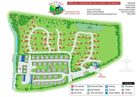
Tree-framed park plan combining touring rows, holiday homes, a brook and a wildlife enclosure.
 Explore the map ↗
United Kingdom
Riverside park map with named pitch fields, illustrated huts and a paw-print dog walk.
 Explore the map ↗
United Kingdom
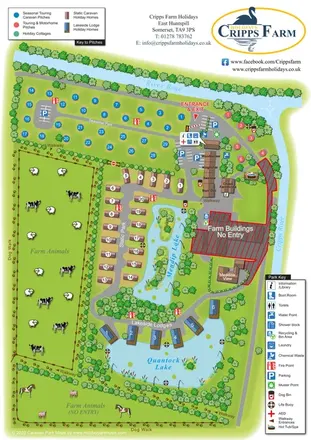
Illustrated farm holiday park plan combining riverside pitches, lakeside accommodation, animal fields and paw-print walking routes, with separate accommodation and facilities keys.
Features may come from the sample artwork, its key or published park information. Approximate numbers describe the drawing and may cover only part of a park. They are intended to help you compare map examples. Current facilities and booking information should be checked with the park.
LET’S MAP YOUR PARK
For a map quotation, find your park and draw a rough boundary around it. The area you select helps us work out the design time and price.
Draw your park for a quote ↗Or talk to our map designers
01751 473136