
Lake
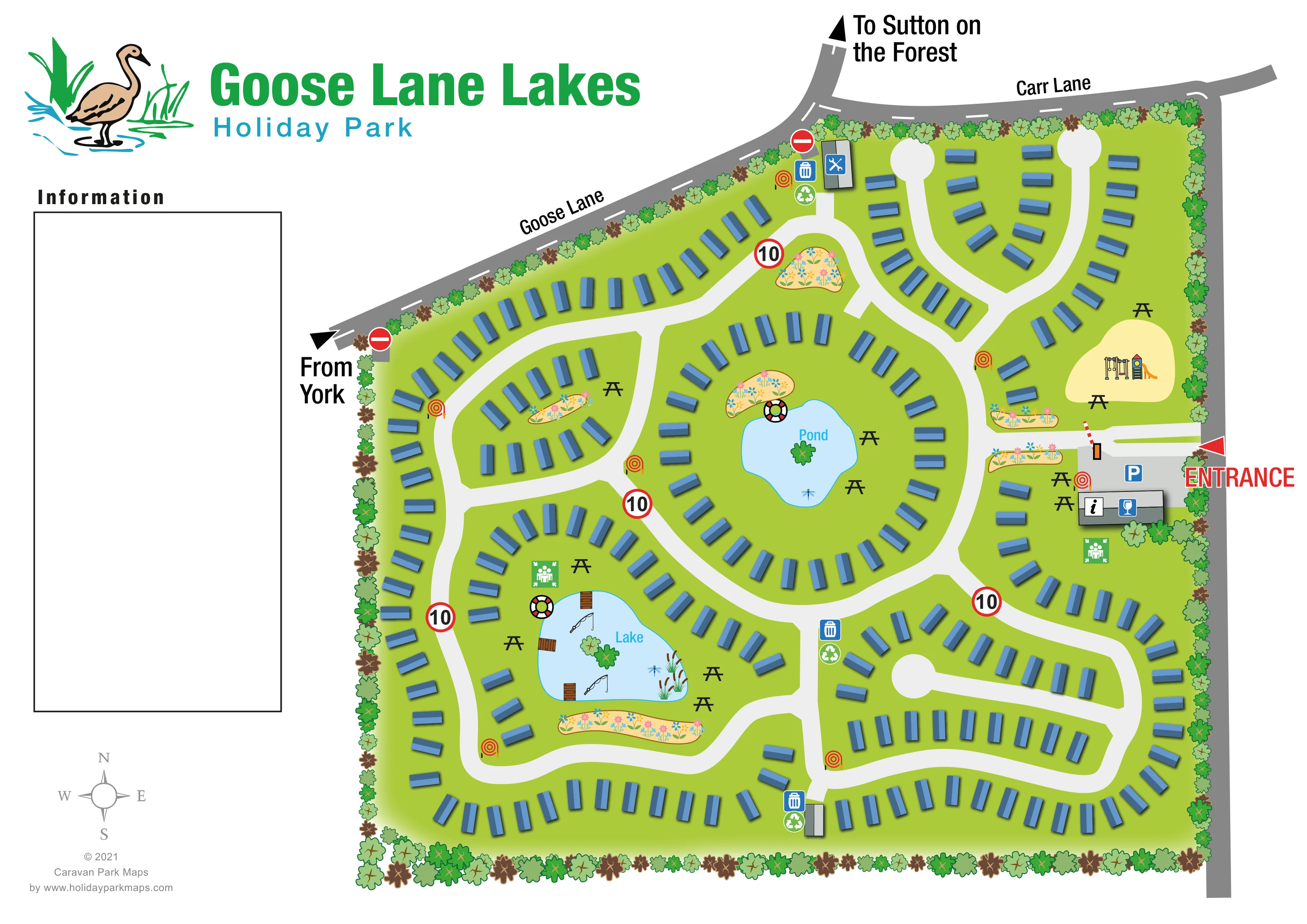
The larger irregular water feature occupies a south-western internal green and is explicitly labelled Lake.
ILLUSTRATED PARK MAP · P475
Goose Lane / Carr Lane, near Sutton on the Forest, York · United Kingdom
 Enlarge the map ↗
A SENSE OF THE PLACE
The Goose Lane Lakes Holiday Park artwork depicts a landscaped caravan layout near Sutton-on-the-Forest, with Carr Lane and Goose Lane marked along its boundaries. A lake and a smaller pond form focal points within the design.
The map shows internal roads, picnic areas, a play space and a reception area. It is presented as an artwork example, without assuming that every facility or plot shown represents a currently operating park.
LOOK CLOSER
The larger irregular water feature occupies a south-western internal green and is explicitly labelled Lake.
A smaller, rounded central water feature is labelled Pond and sits within a ring of accommodation.
A nearly continuous belt of stylised trees encloses the park, while colourful flower beds accent the entrance, road junctions and waterside greens.
A grey building beside the eastern entrance carries an information symbol and forms the arrival focus.
A blue wine-glass symbol appears on the entrance-side information building. Its precise facility name is not given.
A blue parking symbol marks the grey forecourt immediately inside the entrance.
Swings and a slide are illustrated on a pale-yellow play space north of the entrance, with picnic tables nearby.
Repeated black picnic-table symbols appear beside both water features, around the play area, near reception and within western landscaped spaces.
A grey building beside the eastern entrance carries an information symbol and forms the arrival focus.
A blue wine-glass symbol appears on the entrance-side information building. Its precise facility name is not given.
A blue parking symbol marks the grey forecourt immediately inside the entrance.
Swings and a slide are illustrated on a pale-yellow play space north of the entrance, with picnic tables nearby.
Repeated black picnic-table symbols appear beside both water features, around the play area, near reception and within western landscaped spaces.
Fishing-rod illustrations and several small timber platforms identify the larger lake as a fishing-related focal point.
A grey building near the northern boundary carries a crossed-tools symbol.
Grouped bin and recycling symbols appear at several internal locations, including the northern service area and southern road junctions.
Red coiled-hose symbols are distributed beside roads and near the entrance building.
A lifebuoy is drawn beside each of the two water features.
Green assembly-point symbols appear near reception and on the northern side of the larger lake.
The larger irregular water feature occupies a south-western internal green and is explicitly labelled Lake.
A smaller, rounded central water feature is labelled Pond and sits within a ring of accommodation.
A nearly continuous belt of stylised trees encloses the park, while colourful flower beds accent the entrance, road junctions and waterside greens.
A large red ENTRANCE label and arrow identify the eastern arrival point, with a red-and-white barrier illustrated across the access.
Goose Lane follows the sloping north-western boundary and meets Carr Lane along the northern edge. A grey road continues down the eastern side.
External arrows are labelled From York and To Sutton on the Forest.
Broad off-white roads form linked loops, curved branches and short spurs ending in circular turning heads.
Red-ringed signs marked 10 appear along internal roads, while no-entry symbols mark two boundary-side connections.
READING THE MAP
This illustrated map of Goose Lane Lakes Holiday Park presents a landscaped caravan setting near Sutton on the Forest, York. Goose Lane and Carr Lane frame the northern side of the plan, while a clearly marked entrance on the eastern edge leads to parking and an information building. Inside the tree-lined boundary, curving roads organise rows of blue caravan-style units around two distinctive water features.
The central pond and the larger lake to the south-west give the layout recognisable landmarks. Picnic tables, colourful flower beds and a small children's play area add detail to the shared spaces, while fishing rods and timber platforms distinguish the lake. Service and safety symbols are distributed through the site rather than gathered into a single facilities cluster.
The design combines an overhead plan with lightly shaded buildings, pictorial landscaping and bold arrival cues. A goose-and-reeds logo reinforces the waterside identity, and the generous left-hand Information panel gives the page a different rhythm from a tightly packed plot-number map. This sample is particularly relevant to caravan parks seeking to explain a winding road layout through landscape landmarks and simple facility symbols.
The single-page plan shows an irregular site enclosed by a dense illustrated tree belt. Goose Lane follows its sloping north-western edge before meeting Carr Lane across the top. Direction arrows connect the drawing to York and Sutton on the Forest, and a compass sits in the open left-hand margin. The detail views enlarge this same artwork rather than showing additional park sections.
The main entrance is on the eastern side, highlighted by a red arrow, large lettering and a striped barrier. A grey forecourt carries a parking symbol beside the information building, which also displays a wine-glass pictogram. Immediately north is a pale-yellow play area with swings and a slide; picnic tables and flower beds surround this arrival-side space.
Broad off-white roads divide the grounds into connected loops and short spurs. Blue caravan-style units follow their curves, with circular turning heads serving the northern branches and one southern internal spur. The central pond occupies a green enclosed by an almost continuous accommodation ring. The larger lake lies farther south-west, surrounded by another curved road and accommodation group. Fishing rods, small timber platforms, reeds and a lifebuoy add specific detail to this waterside area. Both water features have nearby picnic seating.
A crossed-tools icon identifies a northern service building. Bin and recycling symbols recur at several junctions, red hose-reel symbols line the roads, and green assembly-point icons appear near reception and the lake. Red-ringed signs marked 10 and boundary no-entry signs add traffic information. Accommodation symbols are unnumbered, and the large Information box on the left contains no explanatory key, so the map relies on recognisable pictograms and landscape landmarks.
KEEP EXPLORING
Chosen for shared landscapes, accommodation or facilities.
 Explore the map ↗
United Kingdom
Illustrated lakeside park plan with numbered holiday units, leisure buildings and a looping Woodland Walk.
 Explore the map ↗
United Kingdom
A lakeside holiday-park and fishery map with numbered accommodation, fishing positions and clearly grouped visitor services.
 Explore the map ↗
United Kingdom
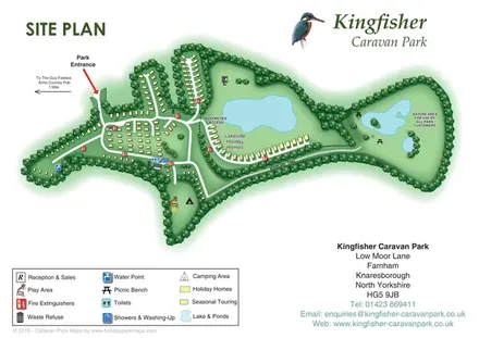
Tree-framed accommodation, lakeside homes and a woodland trail on Kingfisher Caravan Park's illustrated site plan.
Features may come from the sample artwork, its key or published park information. Approximate numbers describe the drawing and may cover only part of a park. They are intended to help you compare map examples. Current facilities and booking information should be checked with the park.
LET’S MAP YOUR PARK
For a map quotation, find your park and draw a rough boundary around it. The area you select helps us work out the design time and price.
Draw your park for a quote ↗Or talk to our map designers
01751 473136