
Great Stour river
Named blue watercourse forming the right-hand boundary, with a curving watercourse also following part of the upper edge.
ILLUSTRATED PARK MAP · P477
Canterbury Road, Ashford · United Kingdom
 Enlarge the map ↗
A SENSE OF THE PLACE
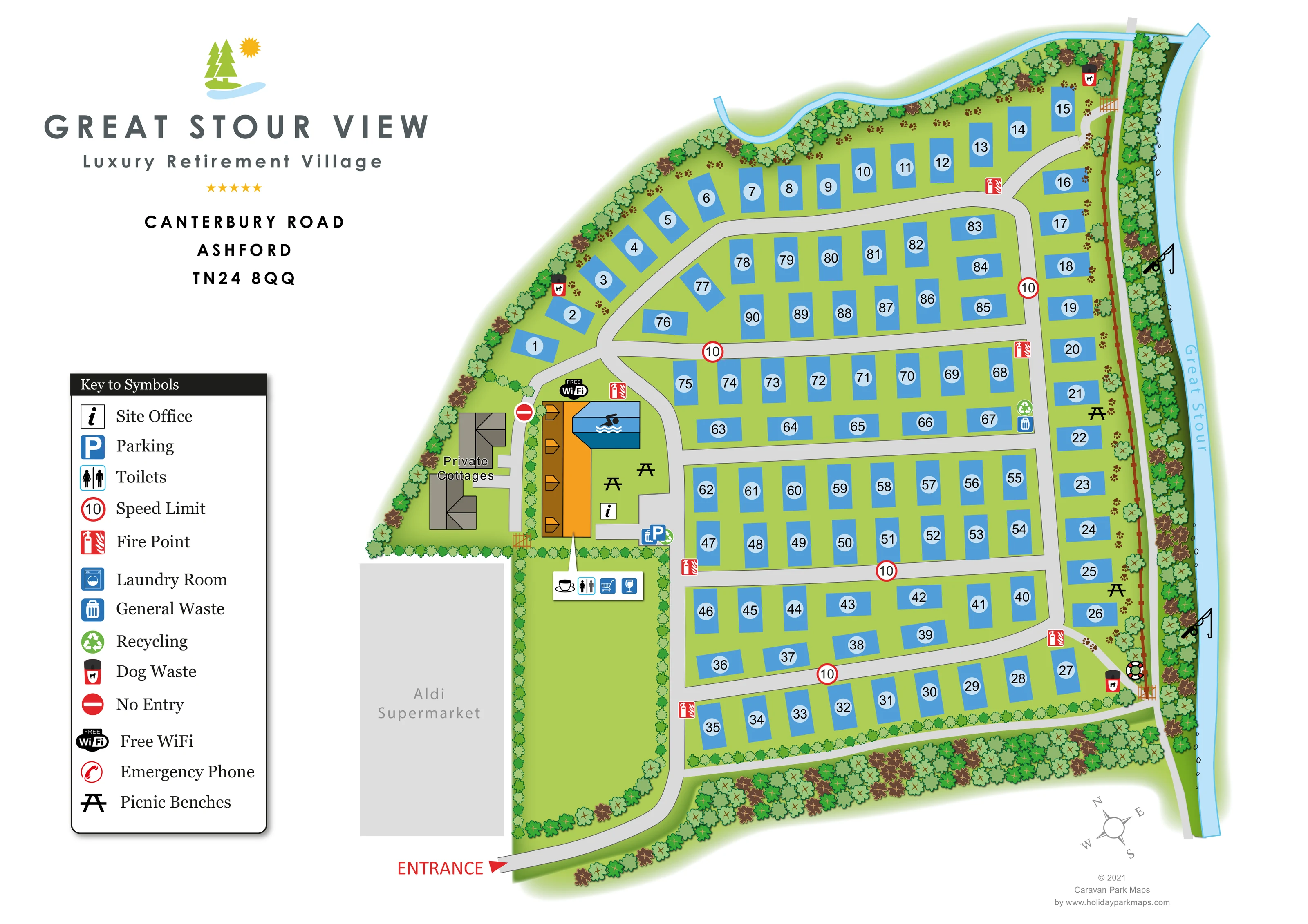
The Great Stour View map depicts a retirement village beside the Great Stour in Ashford. Canterbury Road provides the approach, with the river forming a prominent boundary to the site.
The artwork shows residential plots, internal roads, parking and shared facilities, with nearby landmarks helping to place the development in its wider setting. This is a residential map example rather than a touring or holiday-booking listing.
LOOK CLOSER
Named blue watercourse forming the right-hand boundary, with a curving watercourse also following part of the upper edge.
Dense stylised trees and shrubs frame the site, screen the cottages and neighbouring supermarket, and line the riverside.
A substantial unnumbered green area lies inside the entrance approach, below the shared-facility building.
Red ENTRANCE lettering and an arrow mark the approach at the lower-left edge of the site.
Broad grey roads form a connected perimeter-and-cross-street arrangement, serving rows of residential plots and the shared facilities.
A narrow grey route runs alongside a brown fence on the river-facing edge, with gate-like details at its ends.
Repeated red-ringed 10 markers appear on internal roads, while a no-entry symbol marks the branch beside the private cottages.
The information symbol identified as Site Office in the key is placed beside the central shared-facility building.
Named blue watercourse forming the right-hand boundary, with a curving watercourse also following part of the upper edge.
Dense stylised trees and shrubs frame the site, screen the cottages and neighbouring supermarket, and line the riverside.
A substantial unnumbered green area lies inside the entrance approach, below the shared-facility building.
Red ENTRANCE lettering and an arrow mark the approach at the lower-left edge of the site.
Broad grey roads form a connected perimeter-and-cross-street arrangement, serving rows of residential plots and the shared facilities.
A narrow grey route runs alongside a brown fence on the river-facing edge, with gate-like details at its ends.
Repeated red-ringed 10 markers appear on internal roads, while a no-entry symbol marks the branch beside the private cottages.
The information symbol identified as Site Office in the key is placed beside the central shared-facility building.
A blue parking symbol identifies a small grey area beside the shared facilities.
A blue projection attached to the orange shared building carries a swimmer-and-waves pictogram.
A callout attached to the shared building contains a cup, shopping trolley and wine-glass symbol, suggesting refreshment, shopping and drinks functions without naming individual venues.
A toilet pictogram appears in the shared-building callout and is explained in the key.
A Free WiFi badge is positioned above the shared-facility building.
Black picnic-table symbols appear beside the shared building and at intervals along the river-facing residential edge.
Red fire-point symbols are distributed around road junctions and accommodation rows.
Blue general-waste and green recycling symbols identify grouped disposal points near the shared facilities and within the residential area.
Black-and-red dog-waste symbols appear around the outer residential boundary, including the riverside ends.
Two fishing-rod illustrations mark points beside the river. They provide a riverside activity cue, not information about permissions or access conditions.
A lifebuoy is illustrated near the lower end of the riverside boundary.
A large grey block labelled Aldi Supermarket sits outside the village planting on the entrance side, providing a neighbouring landmark.
A laundry-room symbol is included in the key, but a corresponding location is not clearly identifiable on the plan.
The key includes an emergency-phone symbol; no clear placement is visible in the mapped village.
READING THE MAP
This illustrated map presents Great Stour View Luxury Retirement Village beside the Great Stour in Ashford. Unlike a touring-park plan, it organises a residential development: around 90 numbered plots sit within a connected network of grey streets, with private cottages and a shared-facility building grouped near the entrance side. The river provides a strong visual boundary, reinforced by trees, fencing, a narrow riverside route and fishing illustrations.
The landscape-format artwork gives the village name and Canterbury Road address generous space on the left, alongside a substantial symbol key. On the right, blue plot blocks stand out against green lawns and layered boundary planting. An orange communal building, a neighbouring Aldi supermarket and a red entrance arrow offer recognisable points of reference beyond the plot numbers. Pool, picnic, parking, toilet and service symbols add practical detail without requiring long labels across the residential streets. The result is a useful sample for clients needing a clearly structured residential estate or retirement-village map with a distinctive waterside setting.
The plan follows an irregular site outline, with the Great Stour running down its right-hand side and a curving watercourse along part of the upper boundary. Dense trees and shrubs frame the development, while a brown fence and narrow grey route distinguish the riverside edge from the main residential roads. Picnic-table symbols, fishing-rod illustrations and a lifebuoy add specific detail to this boundary.
Arrival is marked by a red ENTRANCE arrow at the lower left. The approach curves around an open lawn before reaching the shared facilities and joining the linked street network. Broad grey roads divide the blue numbered plots into paired rows, with additional homes following the upper and river-facing edges. Pale circular badges keep the plot numbers legible where the rectangular blocks rotate to follow bends. The private cottages are drawn as grey roof plans in their own planted pocket beside the shared building.
The orange shared building is the map's principal architectural landmark. Its blue projection carries a swimming pictogram, while a nearby callout groups cup, toilet, shopping-trolley and wine-glass symbols. Office, parking, Free WiFi and picnic symbols identify further functions around this area. Fire points, waste and recycling markers, dog-waste bins and red-ringed speed signs are distributed through the plan.
A large left-hand key explains the service symbols, including laundry and emergency-phone entries whose positions are not clearly shown. The neighbouring Aldi block, vertical river label and rotated compass provide wider orientation. The artwork is a single complete plan, with its title, address, legend and illustration composed together rather than split into separate site sections.
KEEP EXPLORING
Chosen for shared landscapes, accommodation or facilities.
 Explore the map ↗
United Kingdom
Colour-coded campsite map with riverside pitches, bell tents, a swimming pool and fishing lake.
 Explore the map ↗
United Kingdom
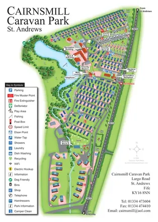
Portrait park map combining numbered caravan rows, touring and tent areas with a reservoir-side recreation hub.
 Explore the map ↗
France
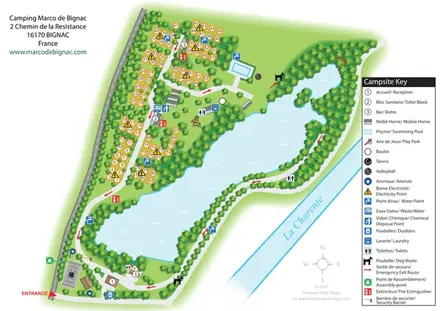
Bilingual lakeside campsite map with numbered pitches, recreation areas and colour-coded service points.
Features may come from the sample artwork, its key or published park information. Approximate numbers describe the drawing and may cover only part of a park. They are intended to help you compare map examples. Current facilities and booking information should be checked with the park.
TAKE A CLOSER LOOK
View the illustrated map in detail or choose a file to download. These are sample maps; contact the park for current visitor information.


LET’S MAP YOUR PARK
For a map quotation, find your park and draw a rough boundary around it. The area you select helps us work out the design time and price.
Draw your park for a quote ↗Or talk to our map designers
01751 473136