
Main fishing lake and Nursery Lake
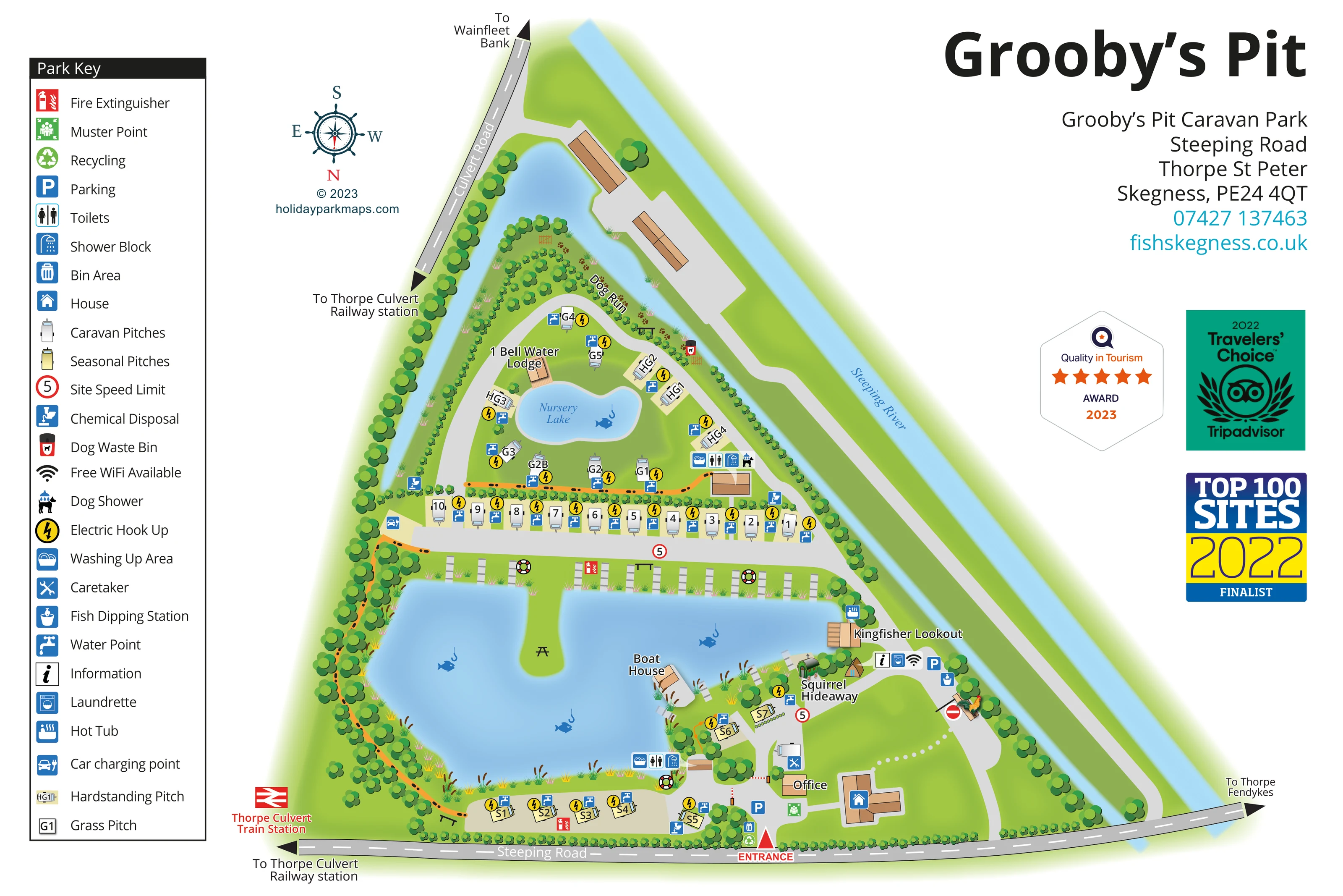
A large irregular lake dominates the lower park, with a smaller labelled Nursery Lake above it. Fish-and-hook illustrations identify their fishing role.
ILLUSTRATED PARK MAP · P145
Grooby’s Pit Caravan Park, Steeping Road, Thorpe St Peter, Skegness · United Kingdom
 Enlarge the map ↗
A SENSE OF THE PLACE
Grooby's Pit is an adults-only touring park at Thorpe St Peter near Skegness. Fishing lakes and the surrounding countryside define the setting.
Lakeside grass and hardstanding pitches have water and electric connections, supported by heated washrooms, washing-up space and a dog shower. The map shows the relationship between the touring areas, lakes and shared facilities; the adjacent Bellwater development has its own separate accommodation offering.
LOOK CLOSER
A large irregular lake dominates the lower park, with a smaller labelled Nursery Lake above it. Fish-and-hook illustrations identify their fishing role.
A broad blue river runs along the long diagonal edge of the triangular site.
A narrow blue channel follows the tree-lined Culvert Road boundary and curves around the upper end of the site.
Continuous tree belts frame the park, with internal hedges, shrubs, reeds and flower details separating pitches and softening the lake edges.
Repeated rectangular platforms line sections of the main lake; picnic tables appear on the grassy peninsula and beside the bank.
The main entrance is prominently marked on Steeping Road, beside the office and arrival-area symbols.
Blue parking symbols appear near the entrance and in the eastern lakeside service area.
Two amenity clusters are marked with toilet and shower symbols, serving the Nursery Lake pitches and the lower main-lake area.
A large irregular lake dominates the lower park, with a smaller labelled Nursery Lake above it. Fish-and-hook illustrations identify their fishing role.
Repeated rectangular platforms line sections of the main lake; picnic tables appear on the grassy peninsula and beside the bank.
A broad blue river runs along the long diagonal edge of the triangular site.
A narrow blue channel follows the tree-lined Culvert Road boundary and curves around the upper end of the site.
Continuous tree belts frame the park, with internal hedges, shrubs, reeds and flower details separating pitches and softening the lake edges.
The main entrance is prominently marked on Steeping Road, beside the office and arrival-area symbols.
Blue parking symbols appear near the entrance and in the eastern lakeside service area.
Two amenity clusters are marked with toilet and shower symbols, serving the Nursery Lake pitches and the lower main-lake area.
Washing-up symbols accompany both mapped washroom clusters.
A washing-machine symbol marks laundry provision in the eastern lakeside facilities cluster.
A labelled dog run follows the planted upper perimeter. A dog-shower symbol sits beside the upper amenities, and dog waste bins are marked at several points.
Yellow lightning symbols and blue tap symbols identify services alongside the touring and seasonal pitches.
Disposal symbols are positioned at several edges of the accommodation areas, including near the entrance-side seasonal pitches.
Bin and recycling symbols are grouped close to the entrance.
An electric-car symbol appears at the western end of the central pitch-access road.
Information and Wi-Fi symbols appear in the service cluster near Squirrel Hideaway. The key describes the Wi-Fi as free.
A fish dipping station symbol is marked near the eastern service and parking area.
A hot-tub symbol is placed beside Kingfisher Lookout.
A small timber-coloured building projects towards the main lake and is labelled Boat House.
The caretaker symbol appears near the office, while a separate building in the arrival area carries the house symbol.
Fire-extinguisher icons and lifebuoy illustrations appear around the main lake; a green muster-point symbol is marked near the entrance.
Grey roads connect the entrance, lakeside pitches and upper accommodation area. An orange route with dark dotted marks follows parts of the lake perimeter and links to the upper amenities.
Red-ringed 5 signs and a no-entry symbol are included on the internal road network.
Boundary roads carry arrows towards Thorpe Fendykes, Wainfleet Bank and Thorpe Culvert railway station. A red rail symbol identifies Thorpe Culvert Train Station beside the western road edge.
The catalogue identifies Grooby’s Pit as an adults-only touring park; this is contextual information rather than a mapped symbol.
READING THE MAP
Fishing lakes give this Grooby’s Pit map its shape and character. The illustrated plan shows a small touring park at Thorpe St Peter near Skegness, contained within a triangular arrangement of roads, tree belts and the Steeping River. A large lake fills much of the lower site, while Nursery Lake provides a second focus for grass and hardstanding pitches further up the plan.
Rather than presenting accommodation as one uniform block, the artwork distinguishes a straight touring row, more loosely arranged lakeside pitches and a separate seasonal group. Named buildings, including Kingfisher Lookout, Squirrel Hideaway and Bell Water Lodge, add recognisable landmarks. The entrance and office sit on Steeping Road, with internal drives linking accommodation to shared facilities.
A substantial pictorial key explains the practical details: washrooms, washing-up areas, electric hook-ups, water points, dog facilities and fishing-related services. Blue water, layered green planting and tan buildings keep the setting prominent, while bright service icons and clear pitch labels give the illustration a useful wayfinding role.
The single landscape-format artwork combines the complete park plan with a tall legend on the left and a large title, contact panel and dated award badges on the right. Its compass places south at the top, allowing the triangular site to fit naturally between Culvert Road, Steeping Road and the diagonal course of the Steeping River.
The main lake is the dominant feature. Fishing platforms line its upper bank, reeds soften the shoreline, and a narrow grassy peninsula carries a picnic table. The Boat House projects towards the water, while Kingfisher Lookout and Squirrel Hideaway sit among trees on the eastern side. An orange route with dark dotted marks follows sections of the lakeside and connects towards the upper facilities.
Accommodation is organised into distinct, readable groups. A straight row of touring caravans occupies the central access road. Grass and hardstanding pitches curve around Nursery Lake, beside Bell Water Lodge and the labelled dog run. Yellow seasonal caravan symbols follow the lower lakeshore. Blue taps and yellow electric-hook-up icons make pitch services visible without requiring a separate text list.
The entrance is marked in red on Steeping Road beside the office, parking, recycling and muster-point symbols. Toilet, shower and washing-up icons identify two amenity clusters. Other mapped details include a dog shower, laundrette, car charging point, chemical disposal points, fish dipping station, information point and Wi-Fi symbol. A hot-tub icon appears beside Kingfisher Lookout.
External arrows point towards Thorpe Fendykes, Wainfleet Bank and Thorpe Culvert railway station. The enlarged detail view repeats part of this same artwork, clarifying the key and upper pitch area rather than depicting another park section.
KEEP EXPLORING
Chosen for shared landscapes, accommodation or facilities.
 Explore the map ↗
United Kingdom
Woodland park map with mixed pitches, bell tents, lodges and a fishing lake.
 Explore the map ↗
United Kingdom
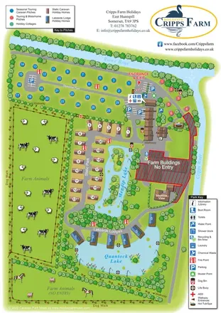
Illustrated farm holiday park plan combining riverside pitches, lakeside accommodation, animal fields and paw-print walking routes, with separate accommodation and facilities keys.
 Explore the map ↗
United Kingdom
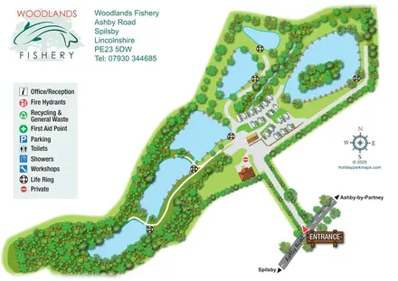
Illustrated fishery map with lakeside routes, wooded waters and a compact touring area.
Features may come from the sample artwork, its key or published park information. Approximate numbers describe the drawing and may cover only part of a park. They are intended to help you compare map examples. Current facilities and booking information should be checked with the park.
TAKE A CLOSER LOOK
View the illustrated map in detail or choose a file to download. These are sample maps; contact the park for current visitor information.


LET’S MAP YOUR PARK
For a map quotation, find your park and draw a rough boundary around it. The area you select helps us work out the design time and price.
Draw your park for a quote ↗Or talk to our map designers
01751 473136