
Pet Paddock
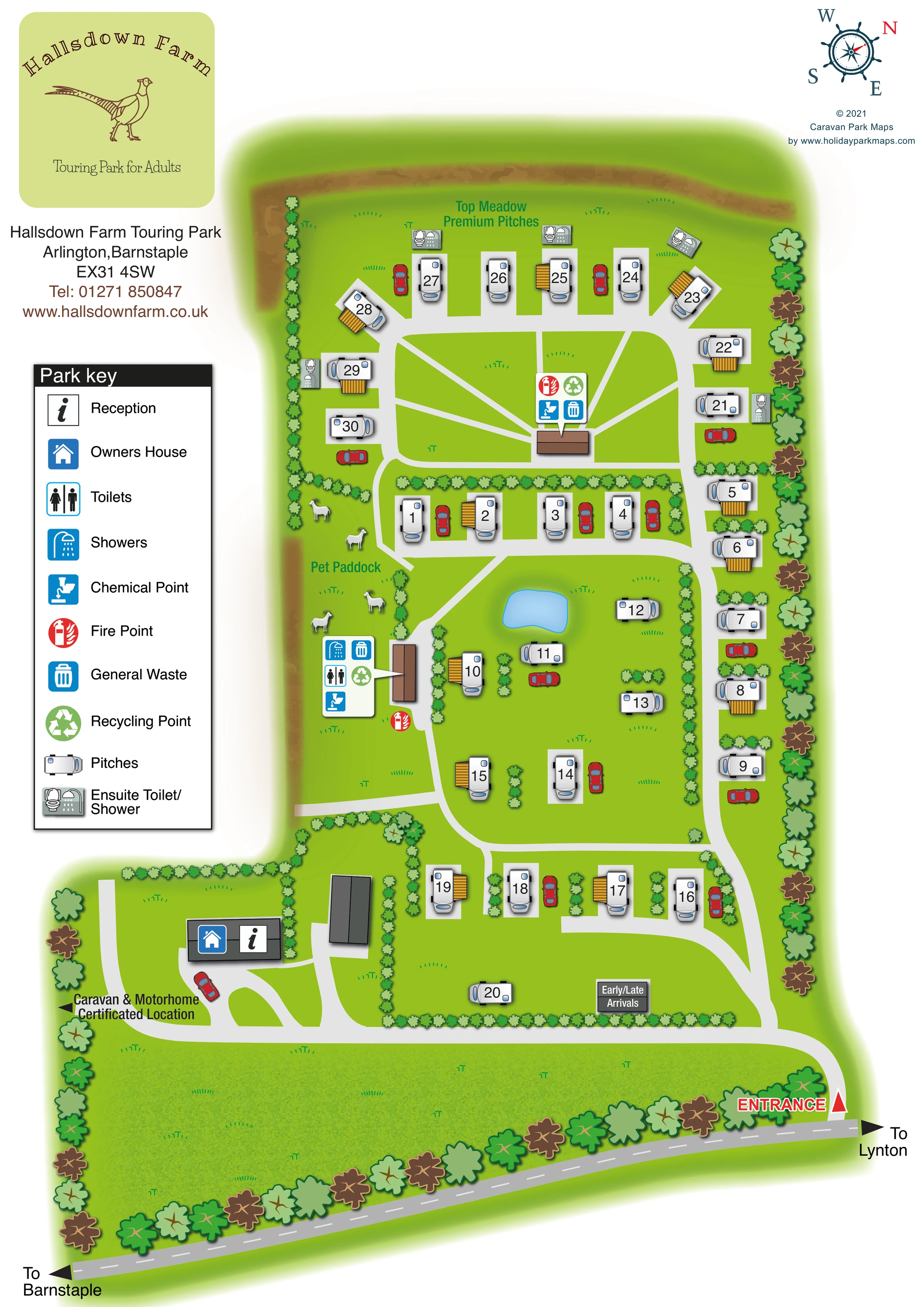
A narrow paddock on the left of the main touring area is labelled and illustrated with small white farm animals. It should not be described as a dog exercise area.
ILLUSTRATED PARK MAP · P487
Hallsdown Farm Touring Park, Arlington,Barnstaple · United Kingdom
 Enlarge the map ↗
A SENSE OF THE PLACE
Hallsdown Farm is an adults-only touring park at Arlington in North Devon. It offers a small countryside setting for caravans, motorhomes, campervans, trailer tents and folding caravans.
Grass, hardstanding and premium pitch settings provide different choices. The location suits trips towards Exmoor and the North Devon coast. Ordinary tents and dogs are not accepted under the park's published arrangements.
LOOK CLOSER
A narrow paddock on the left of the main touring area is labelled and illustrated with small white farm animals. It should not be described as a dog exercise area.
An irregular blue pond provides a clear landmark within the central touring area.
Small repeated shrubs divide pitch groups, while larger stylised trees line the outer boundary and roadside.
Bright green lawns fill the pitch enclosures, with a broader textured grass area between the touring layout and the public road.
An information symbol identifies reception on the building beside the lower-left arrival drive.
The blue house symbol shares the reception building near the arrival area.
Toilet and shower symbols identify the shared facilities in the brown building beside the Pet Paddock.
Small combined toilet-and-shower illustrations sit beside several pitches in Top Meadow.
An information symbol identifies reception on the building beside the lower-left arrival drive.
The blue house symbol shares the reception building near the arrival area.
Toilet and shower symbols identify the shared facilities in the brown building beside the Pet Paddock.
Small combined toilet-and-shower illustrations sit beside several pitches in Top Meadow.
Chemical point symbols appear at the shared washroom building and the central Top Meadow service building.
Waste and recycling symbols are grouped into the two service callouts rather than scattered as individual labels.
Red fire-point symbols mark the main washroom area and the Top Meadow service hub.
A named premium touring area occupies the upper enclosure, with pitches around its perimeter and routes meeting near a central service building.
A narrow paddock on the left of the main touring area is labelled and illustrated with small white farm animals. It should not be described as a dog exercise area.
An irregular blue pond provides a clear landmark within the central touring area.
Small repeated shrubs divide pitch groups, while larger stylised trees line the outer boundary and roadside.
Bright green lawns fill the pitch enclosures, with a broader textured grass area between the touring layout and the public road.
A prominent red entrance label and triangular marker identify the access from the public road at the lower right.
A dark sign labels an early/late arrivals area beside the lower internal drive.
Broad pale drives link the entrance, reception and touring groups. Narrower diagonal routes cross Top Meadow towards its central service building.
Black arrows label the two directions along the public road at the foot of the page.
A left-pointing arrow near reception indicates a separately named area beyond the detailed touring plan.
The phrase appears within the pheasant-branded panel at the top left.
READING THE MAP
This illustrated map of Hallsdown Farm Touring Park presents a small adults-only touring site at Arlington, near Barnstaple in North Devon. Its portrait layout follows the park from the roadside entrance and reception area to the upper enclosure labelled Top Meadow Premium Pitches. Roughly 30 touring pitches are shown in hedge-separated groups, with a small pond providing a memorable landmark in the middle of the plan.
The countryside setting is carried through the artwork rather than left to the branding alone. Tree-lined boundaries, bright grass, a labelled Pet Paddock with farm-animal illustrations and the pheasant logo all contribute to the site's character. Practical information remains prominent: numbered pitches, shared washrooms, chemical disposal, waste and recycling points, and selected en-suite facilities are identified through a clear pictorial key.
The map also makes arrival easy to understand visually, showing the entrance from the road, directions towards Barnstaple and Lynton, reception and an early/late arrivals area. It is a useful example of a compact touring-park map that combines an individual rural identity with detailed on-site wayfinding.
The main plan is arranged vertically, with the public road running diagonally across the foot of the page. A red entrance marker at the lower right leads into a pale internal drive. This crosses the arrival frontage towards the building marked with reception and owner's-house symbols, then connects with the touring routes. A separate arrow points towards a Caravan & Motorhome Certificated Location without depicting its pitch layout. The early/late arrivals label sits beside the lower touring enclosure.
Above the arrival area, numbered touring pitches occupy short rows and more open groups. Hedges separate the lower pitches from the central lawn, where an irregular blue pond helps visitors recognise their position. Another line of pitches follows the right-hand boundary. On the left, the Pet Paddock contains small farm-animal illustrations, with the shared toilet and shower building immediately beside it. A grouped callout identifies washrooms, chemical disposal, general waste and recycling, while a separate red symbol marks a fire point.
Top Meadow Premium Pitches forms a rounded enclosure at the top. Its pitches follow the perimeter, several accompanied by miniature en-suite toilet-and-shower symbols. Narrow pale routes fan out from a central service building, identified with chemical disposal, waste, recycling and fire-point symbols.
The left-hand information column contains the pheasant branding, park contact details and a tall pictorial key. A compass occupies the upper-right margin. Silver caravan forms, red cars, yellow striped pitch-side details and alternating tree colours provide visual variety without obscuring the routes or numbers. The accompanying enlarged view simply clarifies the key and neighbouring facilities; it is part of the same single-page artwork.
KEEP EXPLORING
Chosen for shared landscapes, accommodation or facilities.
 Explore the map ↗
United Kingdom
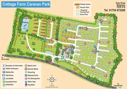
Illustrated touring and camping park map with numbered pitches, a fishing pond and a central farm courtyard.
 Explore the map ↗
United Kingdom
Woodland holiday-park map with named accommodation areas, touring loops and illustrated recreation facilities.
 Explore the map ↗
United Kingdom
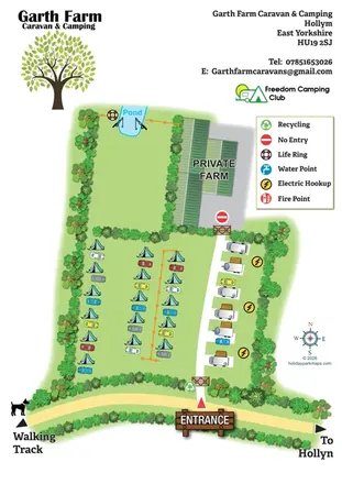
Illustrated farm campsite map with tent camping, electric touring bays, a pond and clearly marked private farm access.
Features may come from the sample artwork, its key or published park information. Approximate numbers describe the drawing and may cover only part of a park. They are intended to help you compare map examples. Current facilities and booking information should be checked with the park.
TAKE A CLOSER LOOK
View the illustrated map in detail or choose a file to download. These are sample maps; contact the park for current visitor information.


LET’S MAP YOUR PARK
For a map quotation, find your park and draw a rough boundary around it. The area you select helps us work out the design time and price.
Draw your park for a quote ↗Or talk to our map designers
01751 473136