
Yew Tree, Ash Tree, Blackthorn and Marsh lakes
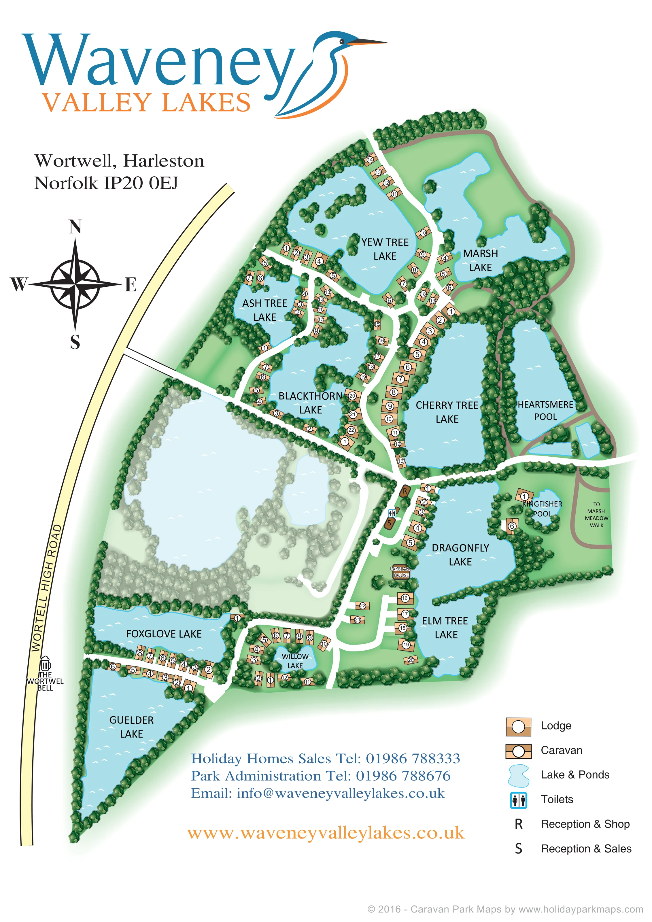
Named northern lakes with irregular shorelines, wooded edges and small tree-covered islands. Accommodation and branching roads occupy the strips of land between them.
ILLUSTRATED PARK MAP · P638
Wortwell, Harleston, Norfolk · United Kingdom
 Enlarge the map ↗
A SENSE OF THE PLACE
Waveney Valley Lakes is a holiday caravan and lodge ownership park at Wortwell on the Norfolk and Suffolk border. Fishing lakes, willow plantations, meadows and mature woodland define its landscape.
The grounds support a variety of birds and other wildlife, and paths offer opportunities for walking with dogs. The park focuses on a quieter rural retreat, with the map showing the relationship between holiday homes, lakes and woodland.
LOOK CLOSER
Named northern lakes with irregular shorelines, wooded edges and small tree-covered islands. Accommodation and branching roads occupy the strips of land between them.
Two elongated waters separated by a dense wooded strip. Cherry Tree Lake has a conspicuous accommodation row along its western bank; brown routes trace the surrounding landscape.
Named southern waters range from the large triangular Guelder Lake to the small Willow Lake, enclosed by a curved accommodation group.
Small, wooded pool east of Dragonfly Lake, with accommodation symbols nearby.
Small ponds appear near Heartsmere Pool, while a large lake and adjoining smaller water in the west-central area are drawn in a paler, subdued treatment.
Dense clusters of shaded tree symbols frame the lakes, screen accommodation groups and form much of the illustrated boundary.
A brown building marked R stands beside the central road junction, west of Dragonfly Lake; the legend identifies its reception and shop function.
A separate brown building marked S is shown just south of the R building, within the same central service area.
Named northern lakes with irregular shorelines, wooded edges and small tree-covered islands. Accommodation and branching roads occupy the strips of land between them.
Two elongated waters separated by a dense wooded strip. Cherry Tree Lake has a conspicuous accommodation row along its western bank; brown routes trace the surrounding landscape.
Named southern waters range from the large triangular Guelder Lake to the small Willow Lake, enclosed by a curved accommodation group.
Small, wooded pool east of Dragonfly Lake, with accommodation symbols nearby.
Small ponds appear near Heartsmere Pool, while a large lake and adjoining smaller water in the west-central area are drawn in a paler, subdued treatment.
Dense clusters of shaded tree symbols frame the lakes, screen accommodation groups and form much of the illustrated boundary.
A brown building marked R stands beside the central road junction, west of Dragonfly Lake; the legend identifies its reception and shop function.
A separate brown building marked S is shown just south of the R building, within the same central service area.
A blue-bordered male and female toilet symbol is positioned between the two reception buildings.
A named building appears beside the western shore of Dragonfly Lake. No specific visitor service or accommodation function is stated.
The pale-yellow public road runs along the western side. A white approach road leads east into the park and joins the internal lakeside road network.
Broad white roads curve between the lakes, divide into northern branches and form a southern loop with short accommodation access spurs.
The eastern side carries the directional label 'To Marsh Meadow Walk', beside brown routes around the waters and meadow-like open ground.
A beer-mug symbol and name identify the pub beside Wortwell High Road, outside the illustrated accommodation area.
Park information identifies fishing lakes as a defining part of the rural ownership-park setting; the artwork depicts the waters without marking individual fishing facilities.
READING THE MAP
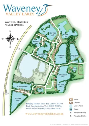
Water shapes the entire composition of this illustrated map for Waveney Valley Lakes at Wortwell, near Harleston in Norfolk. Rather than presenting the park as a grid of holiday homes, the design follows a chain of lakes, wooded banks and narrow strips of land, showing how caravans and lodges sit within their rural surroundings.
The portrait page combines a large blue-and-orange park logo with a detailed overhead plan. Pale blue water, shaded green trees and broad white roads establish the landscape, while tan accommodation symbols and white numbered circles make individual units easy to pick out. Named waters such as Yew Tree, Blackthorn, Cherry Tree and Dragonfly provide memorable reference points across the site.
Practical information is concentrated around the central reception area and in a compact legend at the foot of the page. The approach from Wortwell High Road, a nearby pub reference and the connection towards Marsh Meadow Walk add useful local context. This sample suits a lakeside ownership park where explaining the relationship between homes, access roads and natural features matters as much as locating facilities.
The single portrait plan shows an elongated park with Wortwell High Road along its western edge. A white approach road enters from the left and joins a branching internal network, taking visitors between the northern lakes or south towards the reception buildings and lower accommodation groups. A large compass rose establishes orientation without occupying the illustrated grounds.
In the north, Yew Tree, Ash Tree and Blackthorn lakes have irregular banks and wooded islands. Marsh Lake occupies the upper-right area, with a brown route curving around its outer edge. Farther south, Cherry Tree Lake and Heartsmere Pool sit side by side, separated by a dense band of trees. The west bank of Cherry Tree Lake carries a particularly clear row of numbered accommodation symbols.
The central service cluster lies west of Dragonfly Lake. Buildings marked R and S correspond to Reception & Shop and Reception & Sales, with toilets shown between them. Lakeland House is labelled farther down the same shore. Kingfisher Pool sits to the east, near the directional reference to Marsh Meadow Walk.
Elm Tree Lake extends below Dragonfly Lake. In the south-west, accommodation lines the road between Foxglove and Guelder lakes, while another curved group encloses the smaller Willow Lake. A large unnamed lake and nearby smaller water in the west-central area are drawn in much paler colours than the rest of the plan.
The lower-right legend distinguishes narrow caravan symbols from broader lodge symbols and explains the service markers. Contact information occupies the lower white margin, balancing the dominant landscape illustration. The roadside Wortwell Bell label supplies an additional external landmark.
KEEP EXPLORING
Chosen for shared landscapes, accommodation or facilities.
 Explore the map ↗
United Kingdom
Illustrated lakeside park plan with numbered holiday units, leisure buildings and a looping Woodland Walk.
 Explore the map ↗
United Kingdom
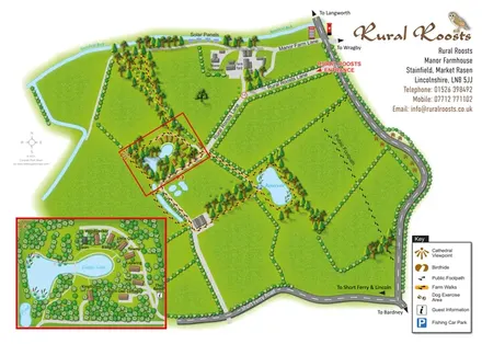
Rural Roosts farm overview with lakeside lodge inset, walking routes and countryside visitor features.
 Explore the map ↗
United Kingdom
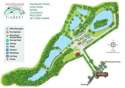
Illustrated fishery map with lakeside routes, wooded waters and a compact touring area.
Features may come from the sample artwork, its key or published park information. Approximate numbers describe the drawing and may cover only part of a park. They are intended to help you compare map examples. Current facilities and booking information should be checked with the park.
TAKE A CLOSER LOOK
View the illustrated map in detail or choose a file to download. These are sample maps; contact the park for current visitor information.


LET’S MAP YOUR PARK
For a map quotation, find your park and draw a rough boundary around it. The area you select helps us work out the design time and price.
Draw your park for a quote ↗Or talk to our map designers
01751 473136
 waveneyvalleylakes_large.png