
Fishing Lake 1 and Fishing Lake 2
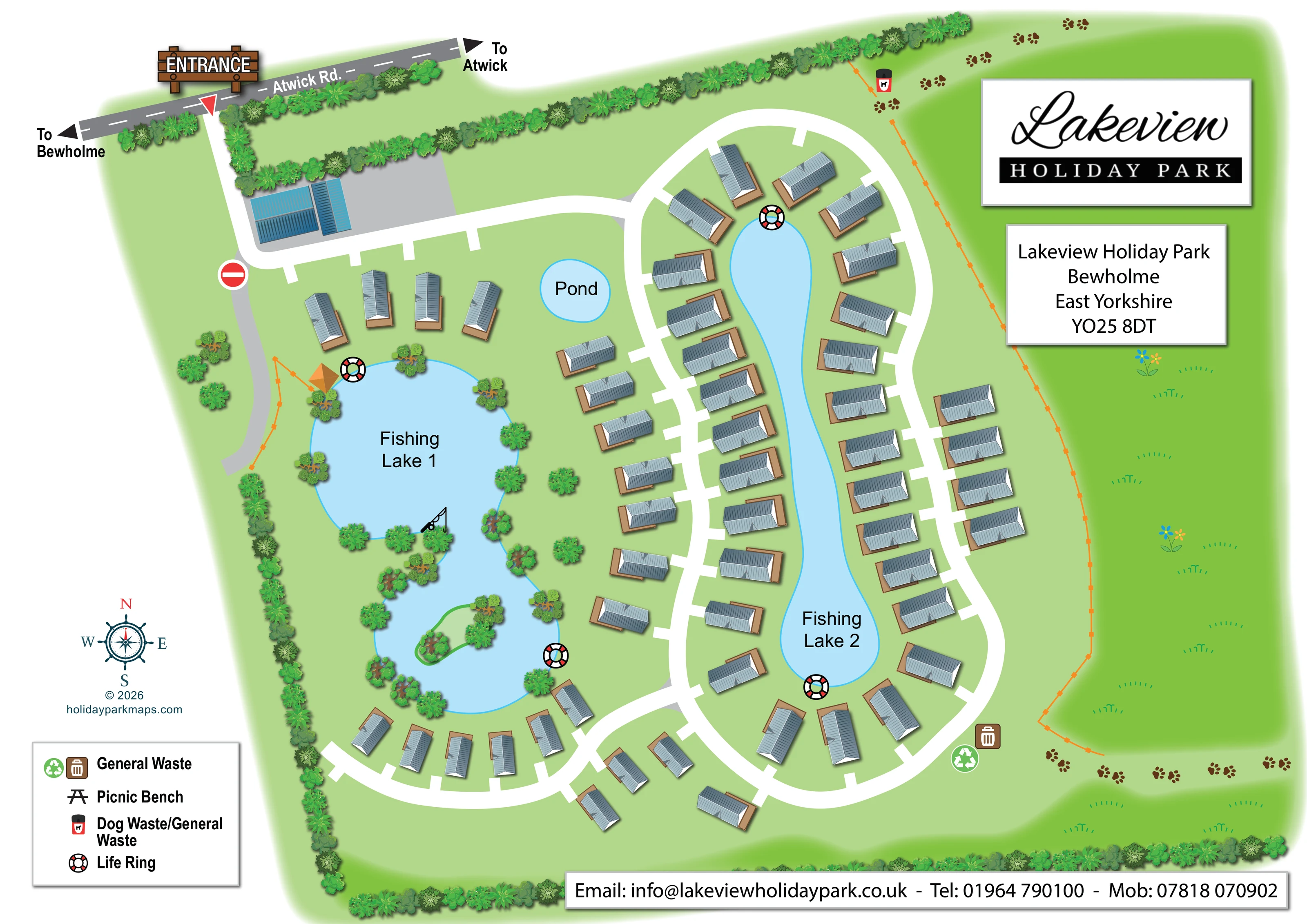
Two named fishing lakes dominate the plan: an irregular, two-lobed lake to the west and a long, narrow lake to the east. A fishing-rod illustration reinforces the use of Lake 1.
ILLUSTRATED PARK MAP · P185
Lakeview Holiday Park, Bewholme, East Yorkshire · United Kingdom
 Enlarge the map ↗
A SENSE OF THE PLACE
Lakeview Holiday Park is an owners-only site at Bewholme in East Yorkshire. Lodges and static holiday homes are set in countryside close to Hornsea and the coast.
The park welcomes pets and promotes a quieter setting for repeated breaks. Its map shows the holiday home plots and access routes, helping prospective owners understand the layout and relationship to the surrounding grounds.
LOOK CLOSER
Two named fishing lakes dominate the plan: an irregular, two-lobed lake to the west and a long, narrow lake to the east. A fishing-rod illustration reinforces the use of Lake 1.
A small elongated island with trees is illustrated within the southern lobe of Fishing Lake 1.
A separate small, rounded pond sits near the northern access road between the two main accommodation areas.
Dense illustrated planting follows much of the park boundary, with scattered trees and shrubs around Lake 1 and open grass beside the accommodation.
A prominent entrance sign marks the connection from Atwick Road at the upper left. Road-end arrows point towards Bewholme and Atwick.
Broad white roads link the entrance to the lakeside rows, forming connected curves and loops with short branches towards individual homes.
A red no-entry symbol appears at the northern end of a grey spur extending south beside Lake 1.
Brown paw prints trace the eastern and south-eastern margin beside an orange post-like boundary line. This suggests a dog-walking association, but the strip has no explicit route name or instructions.
Two named fishing lakes dominate the plan: an irregular, two-lobed lake to the west and a long, narrow lake to the east. A fishing-rod illustration reinforces the use of Lake 1.
A small elongated island with trees is illustrated within the southern lobe of Fishing Lake 1.
A separate small, rounded pond sits near the northern access road between the two main accommodation areas.
Dense illustrated planting follows much of the park boundary, with scattered trees and shrubs around Lake 1 and open grass beside the accommodation.
A prominent entrance sign marks the connection from Atwick Road at the upper left. Road-end arrows point towards Bewholme and Atwick.
Broad white roads link the entrance to the lakeside rows, forming connected curves and loops with short branches towards individual homes.
A red no-entry symbol appears at the northern end of a grey spur extending south beside Lake 1.
Brown paw prints trace the eastern and south-eastern margin beside an orange post-like boundary line. This suggests a dog-walking association, but the strip has no explicit route name or instructions.
Life-ring symbols are positioned around both fishing lakes and explained in the legend.
A bin icon and green recycling-style icon appear together beside the south-eastern road. The legend groups these symbols under General Waste.
A red-and-black dog-waste bin symbol is positioned near the northern end of the paw-marked perimeter strip.
A picnic-bench symbol is included in the key, but no clear corresponding position is visible on the plan.
Blue-roofed structures occupy a grey hardstanding area just inside the entrance. Their function is not labelled.
An unlabelled orange, pyramidal-roofed structure is illustrated near the north-western edge of Lake 1.
READING THE MAP
Two fishing lakes shape this illustrated map of Lakeview Holiday Park at Bewholme in East Yorkshire. Rather than presenting the accommodation as a rectangular grid, the artwork follows the curves of the water and the park’s access roads, showing roughly 50 holiday homes in a tree-lined setting. A smaller pond and a planted island add further landmarks within the grounds.
The entrance from Atwick Road is especially prominent, with a timber-style sign and arrows towards Bewholme and Atwick. From there, broad white roads lead into the lakeside rows, making the overall arrangement easy to understand at a glance. Blue-grey roofs, brown deck details and varied tree canopies give the plan depth without obscuring its structure.
The map also brings practical details into the illustration, including life rings, waste symbols and a paw-marked perimeter strip. Lakeview’s script logo and address sit in separate panels on the right, balanced by a compass and facility key on the left. This sample is particularly relevant to owners’ holiday parks where the relationship between homes, landscape and arrival routes matters more than a dense list of visitor attractions.
The single landscape-format plan shows the entrance in the upper-left corner, connecting Atwick Road to the park’s internal road network. Directional arrows identify Bewholme and Atwick, while a large illustrated entrance sign establishes the arrival point. Immediately inside, blue-roofed buildings sit on a grey hardstanding area; their purpose is not labelled. A separate grey spur beside the western lake carries a no-entry symbol.
The accommodation is organised around two contrasting water features. Fishing Lake 1 occupies the western half of the park and has an irregular, two-lobed outline, a small planted island and trees dotted along its banks. Holiday homes stand north of the lake, along its eastern side and around the southern road curve. Fishing Lake 2 is a long, narrow shape surrounded by closely arranged rows of homes and an elongated white road loop. Further homes line part of the outer eastern edge and the connecting roads to the south. A small pond sits near the northern link between these areas.
Life-ring symbols appear beside both lakes. A general-waste point is marked near the south-eastern road, and a dog waste/general waste bin appears towards the north-east. Brown paw prints follow the outer eastern and southern margin beside orange boundary details. The legend also includes a picnic bench, although its location is not clearly shown.
The artwork combines overhead roads and landscape shapes with shaded roof illustrations and detailed tree symbols. Its information panels remain distinct from the main plan: branding and address at upper right, compass and key at lower left, and a contact strip across the bottom. The holiday homes are unnumbered, so the map communicates the park’s overall arrangement through roads, lakes and recognisable landscape features.
KEEP EXPLORING
Chosen for shared landscapes, accommodation or facilities.
 Explore the map ↗
United Kingdom
Illustrated lakeside park plan with numbered holiday units, leisure buildings and a looping Woodland Walk.
 Explore the map ↗
United Kingdom
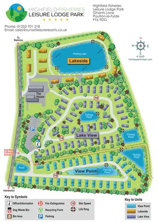
Colour-coded lodge-park plan with fishing lakes, looping roads and a clear entrance-side arrival area.
 Explore the map ↗
United Kingdom
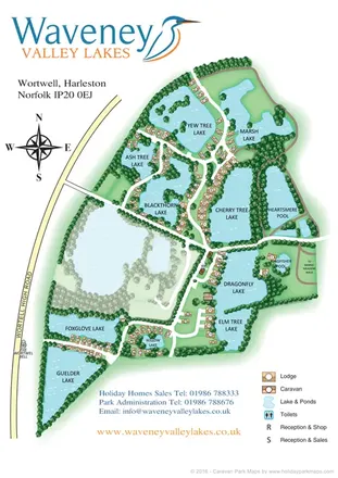
Illustrated lakeside caravan and lodge park map with numbered homes, wooded banks and a central reception cluster.
Features may come from the sample artwork, its key or published park information. Approximate numbers describe the drawing and may cover only part of a park. They are intended to help you compare map examples. Current facilities and booking information should be checked with the park.
LET’S MAP YOUR PARK
For a map quotation, find your park and draw a rough boundary around it. The area you select helps us work out the design time and price.
Draw your park for a quote ↗Or talk to our map designers
01751 473136