
Farm buildings and yards
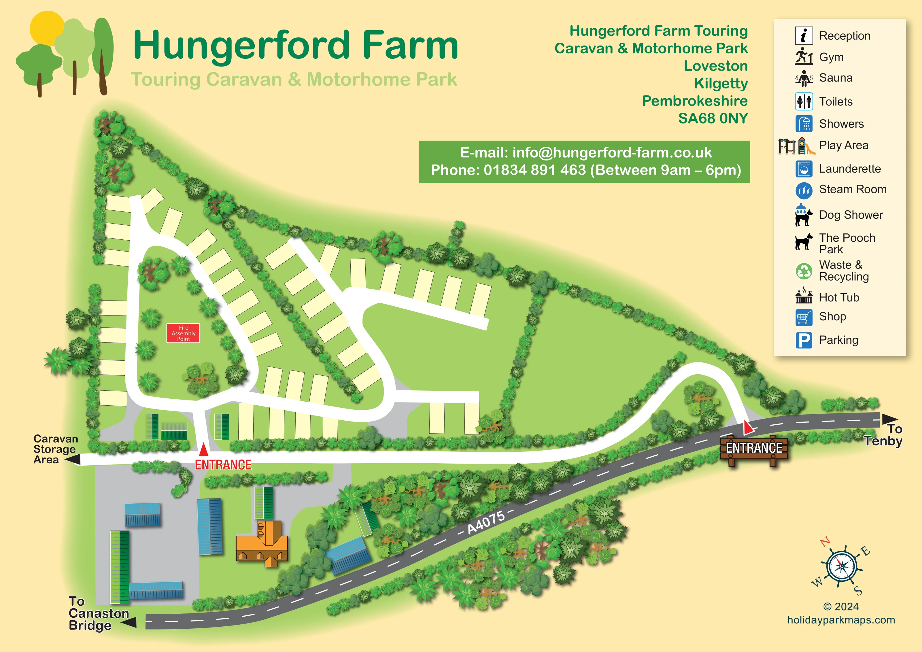
Blue- and green-roofed rectangular buildings, an orange-roofed house-like building and grey yards occupy the lower-left part of the illustration. Their individual uses are not labelled.
ILLUSTRATED PARK MAP · P171
Loveston, Kilgetty, Pembrokeshire · United Kingdom
 Enlarge the map ↗
A SENSE OF THE PLACE
Hungerford Farm Touring Caravan & Motorhome Park is based at Loveston, Kilgetty, Pembrokeshire. This is a family-run touring caravan and motorhome park.
Heated toilet block, private family shower rooms, accessible suite, laundry, Wi-Fi and an EV charging point are listed. Two enclosed dog-walking paddocks and a dog shower are provided.
LOOK CLOSER
Blue- and green-roofed rectangular buildings, an orange-roofed house-like building and grey yards occupy the lower-left part of the illustration. Their individual uses are not labelled.
Dense illustrated hedges define the perimeter and divide the pitch groups. Larger trees and ornamental planting fill road islands and screen the farmyard and roadside.
An unlabelled, hedge-bounded green area lies to the right of the touring pitches. No specific recreational or accommodation use is assigned to it.
The public road follows the lower edge of the site, with arrows towards Tenby on the right and Canaston Bridge on the left.
A red pointer and illustrated wooden entrance sign identify the turn from the A4075. A curving white drive leads left to a second entrance label at the touring area.
A left-pointing arrow at the end of the arrival drive directs visitors towards a caravan storage area beyond the depicted touring layout.
A red labelled panel marks the fire assembly point within the planted green island of the left-hand road circuit.
The public road follows the lower edge of the site, with arrows towards Tenby on the right and Canaston Bridge on the left.
A red pointer and illustrated wooden entrance sign identify the turn from the A4075. A curving white drive leads left to a second entrance label at the touring area.
A left-pointing arrow at the end of the arrival drive directs visitors towards a caravan storage area beyond the depicted touring layout.
A red labelled panel marks the fire assembly point within the planted green island of the left-hand road circuit.
Blue- and green-roofed rectangular buildings, an orange-roofed house-like building and grey yards occupy the lower-left part of the illustration. Their individual uses are not labelled.
Dense illustrated hedges define the perimeter and divide the pitch groups. Larger trees and ornamental planting fill road islands and screen the farmyard and roadside.
An unlabelled, hedge-bounded green area lies to the right of the touring pitches. No specific recreational or accommodation use is assigned to it.
Both appear in the right-hand key, but corresponding locations are not visibly marked on the plan.
The key includes separate toilet, shower and washing-machine symbols. Their positions are not visibly assigned to buildings.
These four amenities are named and illustrated in the key; the plan does not visibly locate them.
A colourful swing-and-slide illustration appears beside the play area entry in the key, without a corresponding mapped position.
Dog-related pictograms identify these amenities in the key. The unlabelled green enclosure cannot confidently be identified as The Pooch Park.
Recycling and parking symbols are included in the key, but no specific locations are visibly marked.
Operator information lists a heated toilet block, private family shower rooms, an accessible suite and laundry. These details are wider park context rather than located map features.
Operator information lists Wi-Fi and an EV charging point; neither is identified on the illustrated plan.
Operator information describes two enclosed dog-walking paddocks and a dog shower. The map key includes dog amenities but does not locate or distinguish the paddocks.
READING THE MAP
This illustrated map presents Hungerford Farm Touring Caravan & Motorhome Park at Loveston, near Kilgetty in Pembrokeshire. Its defining feature is the relationship between the touring pitches, the adjoining farm buildings and the A4075 approach. Rather than filling the plan with individual caravan drawings, the artwork uses pale rectangular pitches against green ground, making the arrangement of the small touring site easy to read.
Visitors can follow the roadside entrance into a curving arrival drive, then recognise the connected pitch circuits by their planted islands and hedge divisions. Directions towards Tenby and Canaston Bridge give the entrance a useful local context, while a separate arrow points towards caravan storage. The fire assembly point is clearly labelled within one of the green islands.
The page combines a large green park heading, a sun-and-trees emblem, an address and contact panel, and a tall facility key. Detailed tree canopies and coloured farm roofs add character without obscuring the principal routes. This sample is particularly relevant to compact touring parks that need to explain an approach road, internal circulation and neighbouring farm infrastructure within one illustrated sheet.
The single-sheet plan places the touring accommodation above a diagonal stretch of the A4075, with the farmyard below and an open, hedge-bounded green enclosure to the right. The public road is drawn in dark grey with a dashed white centre line, contrasting strongly with the broad white internal routes. Arrows at its ends identify the directions towards Tenby and Canaston Bridge.
At the right-hand roadside entrance, a red pointer and illustrated wooden sign mark the turn into the park. The drive curves around a planted island before running left along the lower edge of the touring area. A second red entrance label marks the connection into the pitch roads, while the drive continues towards an arrow for the caravan storage area.
Roughly 40 cream pitch rectangles sit beside two connected road circuits and their short branches. They are unnumbered and shown at varying angles to follow the road geometry. Hedges divide the pitch groups, and a large planted island in the left-hand circuit contains the labelled fire assembly point. Below the pitches, blue- and green-roofed farm buildings surround grey yards, alongside a more detailed orange-roofed building.
The right-hand key lists reception, a shop, toilets, showers, a launderette, parking, waste and recycling, a play area, gym, sauna, steam room, hot tub, dog shower and The Pooch Park. These entries explain the facility symbols, although their corresponding positions are not visibly marked within the plan. The green enclosure therefore remains an unassigned landscape area. Across the page, layered trees, soft boundary shading, a large branded heading and a decorative compass combine practical orientation with a distinctly illustrated presentation.
KEEP EXPLORING
Chosen for shared landscapes, accommodation or facilities.
 Explore the map ↗
United Kingdom
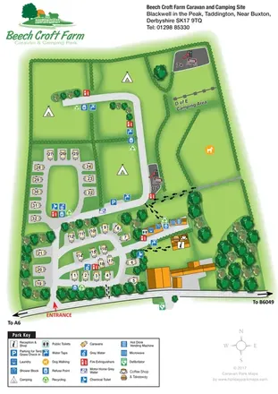
Illustrated touring and camping map with hedge-divided fields, age-labelled play areas and a detailed service key.
 Explore the map ↗
United Kingdom
A wooded, streamside park map with a linked farm, café, touring and cottage area.
 Explore the map ↗
United Kingdom
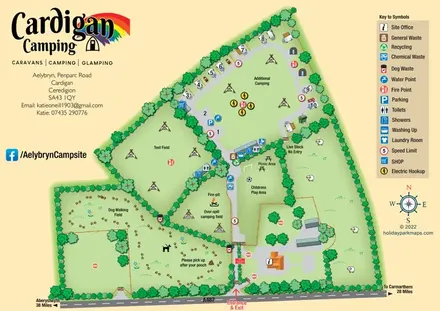
Illustrated farm-campsite map with mixed accommodation, named camping fields and a dedicated dog-walking area.
Features may come from the sample artwork, its key or published park information. Approximate numbers describe the drawing and may cover only part of a park. They are intended to help you compare map examples. Current facilities and booking information should be checked with the park.
LET’S MAP YOUR PARK
For a map quotation, find your park and draw a rough boundary around it. The area you select helps us work out the design time and price.
Draw your park for a quote ↗Or talk to our map designers
01751 473136